|
| Route 61 begins along Kailua Road at Maunawili Stream just beyond the signalized intersection with Kainehe Street north and Hamakua Drive south. 01/18/11 |
|
| The first reassurance shields for Route 61 stand beside the bridge crossing Maunawili Stream. 01/18/11 |
|
| Looking north at Kawai Nui Marsh and the Oneawa Hills from Route 61 (Kailua Road) southbound ahead of Pohakupu. 01/18/11 |
|
| Route 61 (Kailua Road) meets the north end of Route 72 (Kalanianaole Highway) at Pohakupu. 01/18/11 |
|
| Route 72 is Kalanianaole Highway southeast to Waimanalo and westward to Honolulu. Route 61 follows northernmost reaches of Kalanianaole Highway to Route 83 (Kamehameha Highway). 01/18/11 |
|
| Measuring 18.44 miles in length, Route 72 (Kalanianaole Highway) follows the southeastern coast of Oahu to Interstate H1 (Lunalilo Freeway) in Honolulu. Ulukahiki Street spurs north from Route 61 (Kailua Road) to Castle Medical Center. 01/18/11 |
|
| Confirming marker posted along Route 61 (Kalanianaole Highway) south between Route 72 and Uluhala Street (Route 6050). 01/18/11 |
|
| Auloa Road constitutes a loop south from Route 61 to Maunawili. The northernmost leg of Auloa Road is Route 6051, a 1.24 mile long spur to Maunawili Valley. 01/18/11 |
|
| Kapaa Quarry Road heads north from Route 61 to Route 65 (Mokapu Boulevard) between Mahinui and Kailua. 01/18/11 |
|
| Beyond Kapaa Quarry Road, Route 61 arcs southwest along the Oneawa Hills. 01/18/11 |
|
| Route 61 next meets the south end of Route 83 (Kamehameha Highway) and Auloa Road. 01/18/11 |
|
| Kalanianaole Highway ends where Kamehameha Highway begins along Route 83 north and Pali Highway along Route 61 south. 01/18/11 |
|
| Route 83 (Kamehameha Highway) straddles the north shore of Oahu between Kaneohe and Haleiwa along a 43.92 mile long course. 01/18/11 |
|
| A dynamic message sign advises motorists of any closures on the Trans Ko'olau Range tunnels for Route 61, Route 63 or I-H3 due to inclement weather, incident management or road work. 01/18/11 |
|
| Southbound Route 61 at the intersection with Pali Highway south to Honolulu, Auloa Road east to Maunawili and Kamehameha Highway north to Interstate H3 and Kaneohe MCBH. 01/18/11 |
|
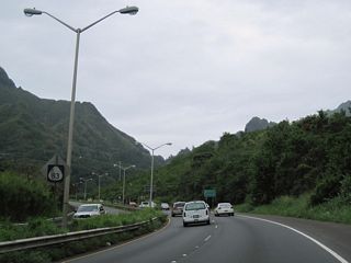
| Continuing into suburban areas in Nu'suanu Valley, Route 61 (Pali Highway) south intersects Pulelehua Way ahead of this reassurance shield. 07/29/10 |
|
| A trumpet interchange joins Route 61 (Pali Highway) with Wyliee Street west at Nuuanu Avenue south. 07/29/10 |
|
| Posted next to a scenic overlook along Route 61 (Pali Highway) south is a guide sign for Interstate H1 east to Waikiki. This sign was posted in July 2009 and replaced by June 2019. 07/29/10 |
|
| The unmarked south end of Route 61 (Pali Highway) at Route 98 (Vineyard Boulevard) in Downtown Honolulu. 08/16/19 |
Page Updated 01-23-2024.


