Hawaii Route 98 lines Vineyard Boulevard for 1.758 miles between Interstate H1 (Lunalilo Freeway) at Exit 22 and Exit 20 B. The six lane arterial runs alongside Foster Bontonical Garden and passes north of the Hawaii Capital Historic District and Chinatown.
Vineyard Boulevard was originally part of Route 72 northwest from the couplet of Lunalilo and Kinau Streets. Eventually replaced by the construction of Interstate H1, Vineyard Boulevard also extended north to the exchange with Route 63 (Kalihi Street).
|
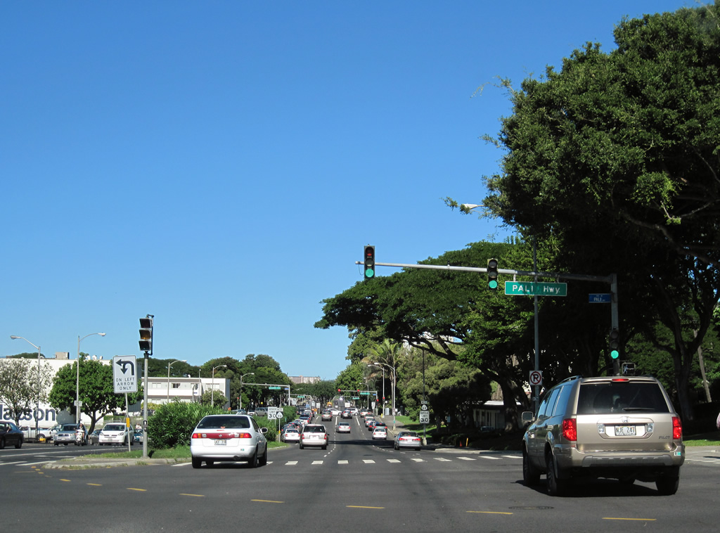
| Eastbound Route 98 (Vineyard Boulevard) at Pali Highway (Route 61). Route 61 follows Pali Highway northeast from Route 98 to Nu'uanu Valley and Kailua. 01/17/11 |
|
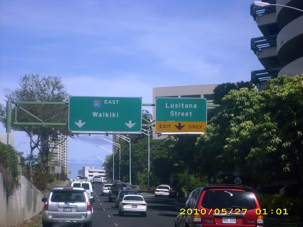
| Lusitana Street branches south from Vineyard Boulevard before Route 98 eastbound rejoins Interstate H1 (Lunalilo Freeway). 07/29/10 |
|
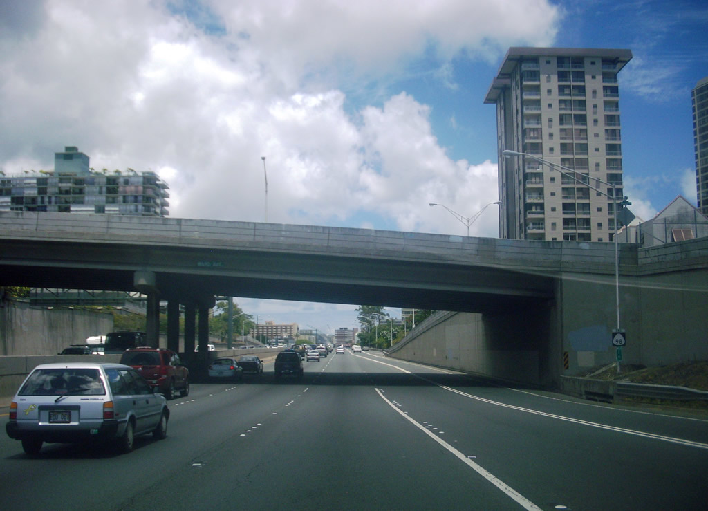
| An end shield follows at the wye interchange where Route 98 rejoins Interstate H1 (Lunalilo Freeway) . 07/29/10 |
|
| Route 98 (Vineyard Boulevard) separates from I-H1 (Lunalilo Freeway) westbound at a wye interchange just ahead of Punchbowl Street. Punchbowl Street leads north onto a c/d roadway connecting with I-H1 west and Route 61 (Pali Highway) north. Punchbowl Street south heads to the State Capitol. 01/19/11 |
|
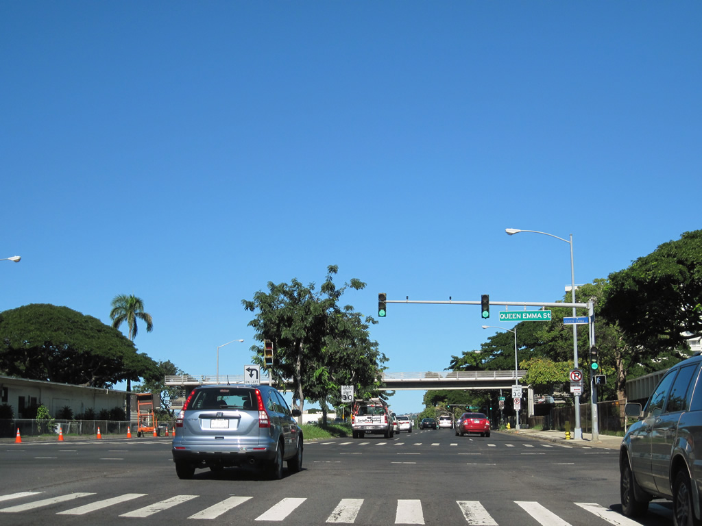
| Queen Emma Street crosses Route 98 (Vineyard Boulevard) at the succeeding traffic light. Queen Emma Street spans Interstate H1 east to the intersection of School Street, Lusitana Street and Iolani Avenue near Punchbowl Crater. 01/19/11 |
|
| Although not marked on Route 98, the intersection with Pali Highway represents the south end of Route 61. Route 61 follows Pali Highway northeast to Nu'uanu Valley and the Pali Tunnels, across the Ko'olau Range, on a 10.60 mile course to Kailua. 01/19/11 |
|
| A pair of shields for Route 98 stand beyond Pali Highway along Vineyard Boulevard west. 01/19/11 |
|
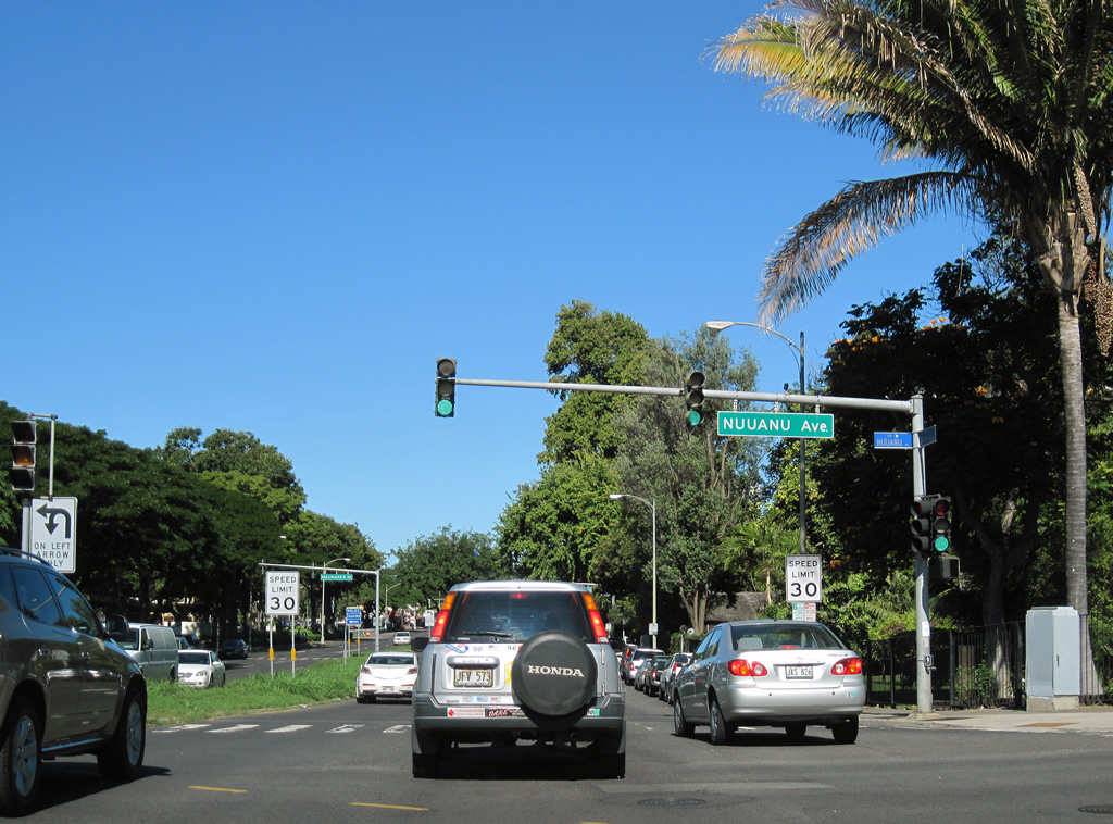
| Nuuanu Avenue branches southwest from the exchange along Route 61 (Pali Highway) at Wyllie Street to Route 98 (Vineyard Boulevard) at Foster Botanical Garden. 01/19/11 |
|
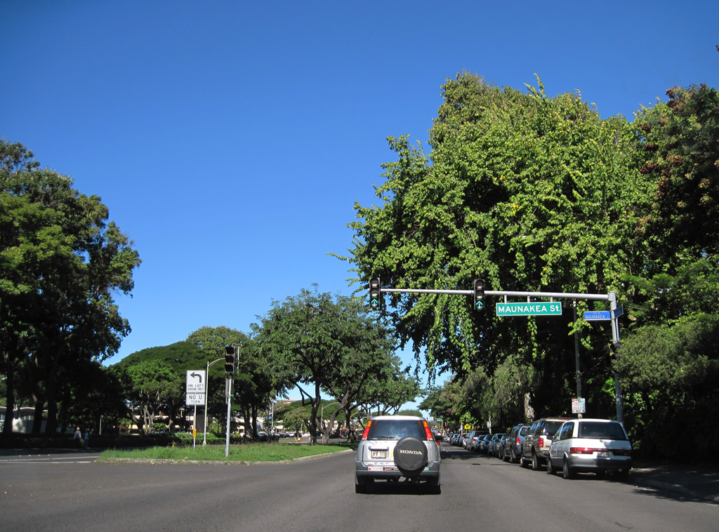
| Maunakea Street heads southwest from Vineyard Boulevard through Chinatown to Route 92 (Nimitz Highway) by Honolulu Harbor. 01/19/11 |
|
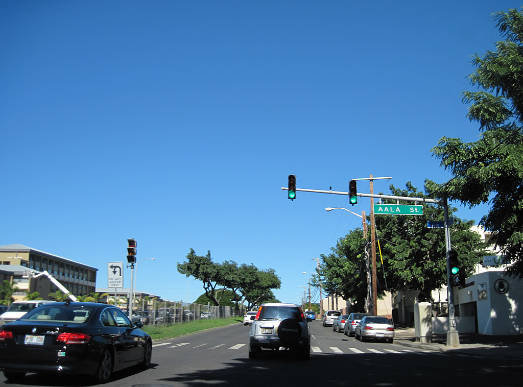
| Route 98 westbound spans Nuuanu Stream ahead of a signalized intersection with Aala Street. Aala Street travels two blocks southwest to Beretania Street at Aela Park and north to School Street by Interstate H1. 01/19/11 |
|
| Liliha street meets Vineyard Boulevard at the ensuing intersection between the Iwilei and Liliha neighborhoods. 01/19/11 |
|
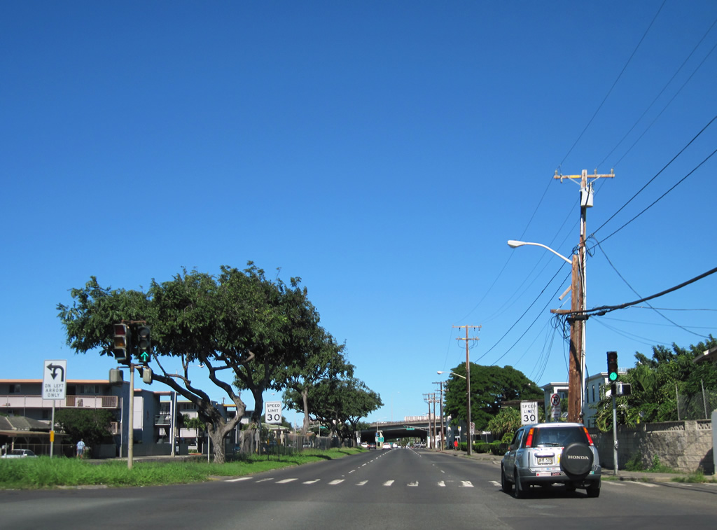
| Two reassurance markers for Route 98 west stand west of Liliha Street. 01/19/11 |
|
| A fenced median separates the roadways along Vineyard Boulevard from Aala Street west to Palama Street and Interstate H1. 01/19/11 |
|
| Pua Lane comprises a residential street between King Street and Interstate H1. 01/19/11 |
|
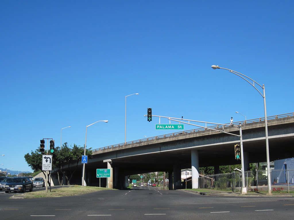
| Palama Street intersects Route 98 (Vineyard Boulevard) adjacent to the Lunalilo Freeway viaduct. Palama Street connects with King Street to the south and School and Alaneo Streets at Liliha beyond I-H1. 01/19/11 |
|
| Vineyard Boulevard westbound shifts onto Halona Street below Interstate H1. 01/19/11 |
|
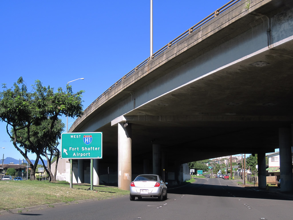
| Route 98 concludes at the entrance ramp joining Halona Street west with I-H1 to Kalihi and Interstate H-201 to Fort Shafter. 01/19/11 |
|
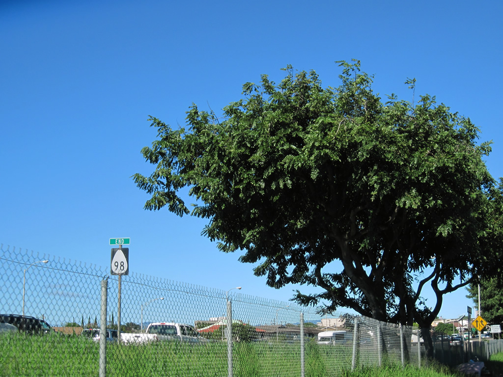
| An end sign for Route 98 stands along Interstate H1 (Lunalilo Freeway) between the Halona Street entrance ramp and Kapalama Drainage Canal. 01/19/11 |
Page Updated 12-15-2011.