

SR 14 travels east from Burrsville to SR 1 (Milford Bypass) through southern reaches of Kent County. Following Vernon Road from the Maryland state line, the state route travels across agricultural areas and forest land 8.41 miles to the west limits of Harrington. Commerce Street angles SR 14 northeast to Clark Street through Downtown, while Farmington Road south to Harrington Raceway and U.S. 13 doubles as SR 14 Truck.
Delaware State Route 14 Guides
Clark Street crosses paths with U.S. 13 at a split intersection with Dupont Highway by several traveler services and a shopping center. SR 14 (Milford Harrington Highway) continues east from Harrington through a mixture of farm land and large lot subdivisions to Marvels Crossroads and Church Hill Village. The route shifts southward ahead of SR 15 on the approach to Milford city limits.

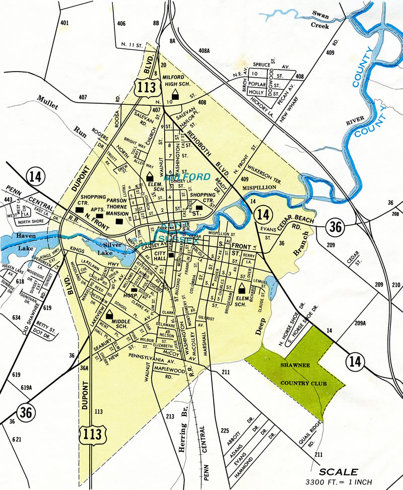
Through Milford, SR 14 follows NW Front Street by an number of industrial businesses to the commercialized intersection with U.S. 113 (Dupont Boulevard). Beyond U.S. 113, Front Street curves by Silver Lake and narrows across the Milford street grid. SR 14 intersects Walnut Street north of Downtown and follows NE Front Street for the remainder of its route to SR 1 Business (Rehoboth Boulevard) and the Milford Bypass. A grade separated intersection was constructed at the east end of SR 14 with SR 1 in 2018/19.
The 1936-37 Official Delaware Highway Map outlines SR 14 along the same alignment it takes today, from Burrsville east to Rehoboth Boulevard in Downtown Milford. The route extended south along Rehoboth Boulevard in Milford along the current alignment of SR 1 to Five Points, where it combined with SR 18 east to Wescoasts Road. Wescoasts Road turned the route back south to Lewes and Rehoboth Road to Midway. This alignment was later replaced with the dual Coastal Highway.
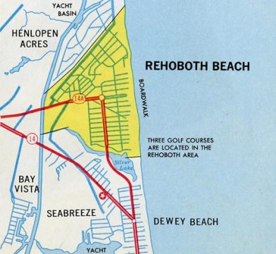
Lewes and Rehoboth Road took SR 14 southeast to Rehoboth Beach, where the route followed Rehoboth Avenue east and 2nd Street south to Silver Lake and Dewey Beach. This later became SR 14A and is now SR 1A. The Coastal Highway bypass of Rehoboth Beach was constructed by 1942.
Further south at Bethany Beach, SR 14 followed Pennsylvania Avenue to end at SR 26. The state route was extended south from Bethany Beach to Fenwick Island and the Maryland state line by 1942. The Bethany Beach bypass, a dual highway one block west of Pennsylvania Avenue, was completed by 1966.
Bids were accepted on the 4.4 mile Milford Bypass in March 1970.1 The expressway was constructed at a cost of $5.2 million and opened to traffic on May 9, 1972.2
The north-south alignment of SR 14 was renumbered as SR 1 in April 1974. The change was made in anticipation of a long range plan to extend the route north to the Delaware Turnpike.
Delaware State Route 14 - 2015 Annual Average Daily Traffic (AADT)
- 3,001 - Maryland state line to Knife Box Road
- 7,468 - Whitleysburg Road to west Harrington limits
- 10,481 - East Street to U.S. 13
- 8,817 - U.S. 13 to Broad Street (Road 37)
- 15,427 - west Milford limits to U.S. 113
- 2,235 - northeast Milford limits to SR 1
- "Bypass Bids Asked." The News Journal (Wilmington, DE), March 27, 1970.
- "Milford road bypass to open Tuesday." The News Journal (Wilmington, DE), May 5, 1972.
Connect with:
U.S. 13
U.S. 113
State Route 1
State Route 1 Business
State Route 15
Route 317
Page Updated 02-26-2021.