
California 84
California 84 is separated into two sections. The most well-known section is a major east-west route through the San Francisco Bay Area that uses the Dumbarton Bridge to provide the most southerly crossing of San Francisco Bay. California 84 starts its journey at the coast near San Gregorio, then crosses the Santa Cruz Mountains as a two-lane road on its way to Redwood City (Interstate 280) and Menlo Park (U.S. 101). The highway then crosses the bay via the multilane Dumbarton Bridge, adn it meets Interstate 880 in Newark. Reverting to a two-lane highway, California 84 passes through Sunol (Interstate 680) before terminating at Interstate 580 in Livermore. The eastern terminus may be shifted out of Livermore depending on a reconstruction project of the connection between Interstate 580 and California 84.
A second section of California 84 begins in obscurity along California 12 in Rio Vista in the California Delta region (formed by the Sacramento and San Joaquin Rivers entering the San Francisco Bay). California 84 resumes as a north-south route, this time heading north along the western banks of the Sacramento River (parallel to California 160) all the way to Sacramento. The state route ends at its interchange with Interstate 80 north of West Sacramento. Through Solano County, California 84 is signed and postmiled. In Yolo County, California 84 is only postmiled. The overhead signs on Interstate 80 and Business Loop I-80 & U.S. 50 do not mention California 84 (which is known as Jefferson Avenue in the metropolitan area).
California 84 Highway Guides
- East - San Gregorio to Redwood City
- East - Redwood City to Livermore
- North - Livermore to West Sacramento
- South - West Sacramento to Livermore
- West - Livermore to Redwood City
- West - Redwood City to San Gregorio
The two sections of California 84 are proposed to be joined, and plans are now being considered for upgrading the Vasco Road corridor. A connection may be constructed along Vasco Road based on actions taken in 2003 to connect the two sections by the California Transportation Commission. The defunct Mid-State Toll Road was an early 1990s proposal for the missing section of California 84.
In addition, a proposed realignment and straightening of California 84 through Fremont and Union City is proposed via Decoto Road, Paseo Padre Parkway, and a new "84 Parkway" that would connect to California 238 (Mission Boulevard) at the current Appian Way intersection in Union City. With this change, California 84 would no longer follow the maze of city streets through residential parts of Fremont.1 California 84 would no longer share alignment with Interstate 880, be consistently six lanes betwee Interstate 880 and Paseo Padre Parkway, and link with California 238 as a four-lane parkway. The route would have at-grade intersections and expressway characteristics.
| California 84 scenes | |
|---|---|
 |
These California 84 trailblazers are found along California 220 in the Sacramento River-San Joaquin River Delta Region near the Ryer Island Ferry. |
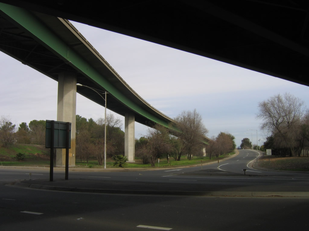 |
View of the ramp from California 84 to the Tower Bridge Gateway (Old California 275) looking east from the southbound sidewalk. Photo taken 01/16/06. |
Sources:
- Route 84 Fremont and Union City: Gap Closure, Local Congestion Relief by the California Department of Transportation (Caltrans) District 4 - page accessed 09/23/07

Page Updated January 13, 2008.
|
About Contact Glossary |
In The News Testimonials Interstate Guide |
Social Media:
 |
|
© 2000-23 AARoads.com | All Rights Reserved | Privacy Policy / Terms of Use
|
||