| California 78 east |
|
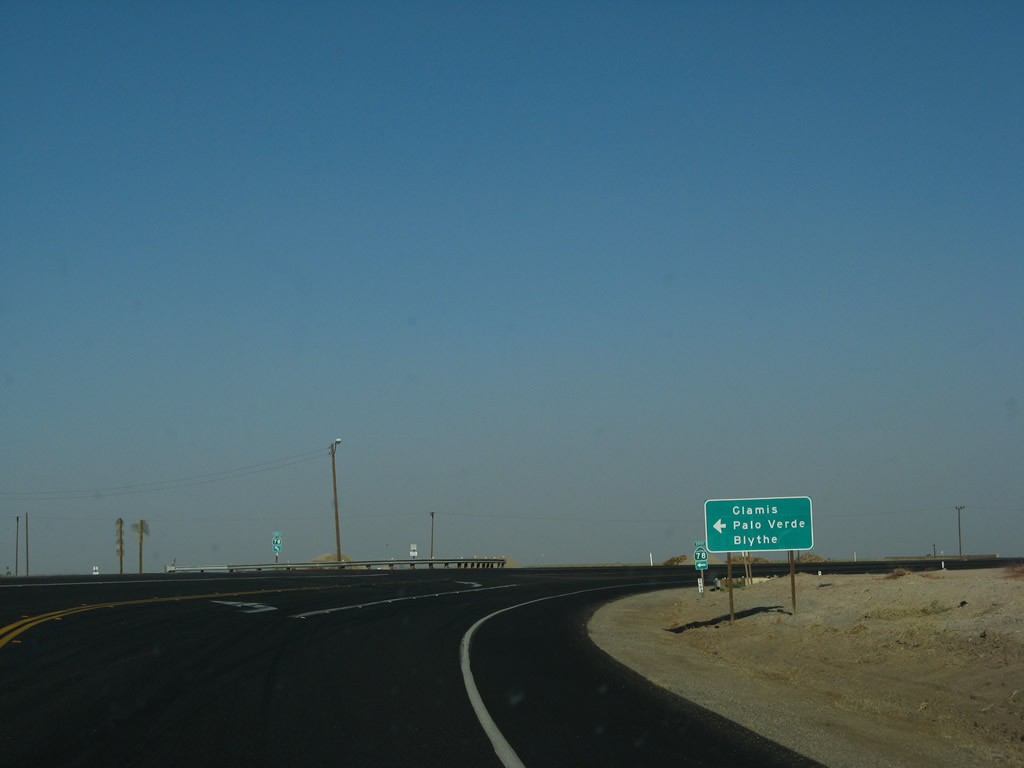
Leaving the Brawley Bypass along California 78 east toward Glamis, Palo Verde and Blythe. Photo taken 04/01/06. |
|
An Imperial Irrigation District (IID) 230kV single-circuit power line crosses over California 78. Photo taken 04/01/06. |
|
Eastbound California 78 prepares to cross over the Alamo River, which carries agricultural and industrial runoff from Mexicali and the Imperial Valley north to the Salton Sea. Due to the nature of runoff fueling this river, it carries a fair amount of pollution into the troubled Salton Sea. Photo taken 04/01/06. |
|
Continuing east, California 78 approaches its next major intersection, this time with California 115 north to Calipatria. Ahead, California 78 east and California 115 south will share pavement for several miles, then separate again. Photo taken 04/01/06. |
|
A set of California 78 and California 115 route markers is posted shortly thereafter. While through traffic on California 78 does not stop, southbound traffic on California 115 must stop. Photo taken 04/01/06. |
| California 78 east & 115 south |
|
California 78 east and California 115 south share pavement for a short distance, as marked by this reassurance shield east of Brawley. California 115 stays well to the east of Brawley and thus avoids any developed areas until reaching Holtville. Photo taken 06/07/08. |
|
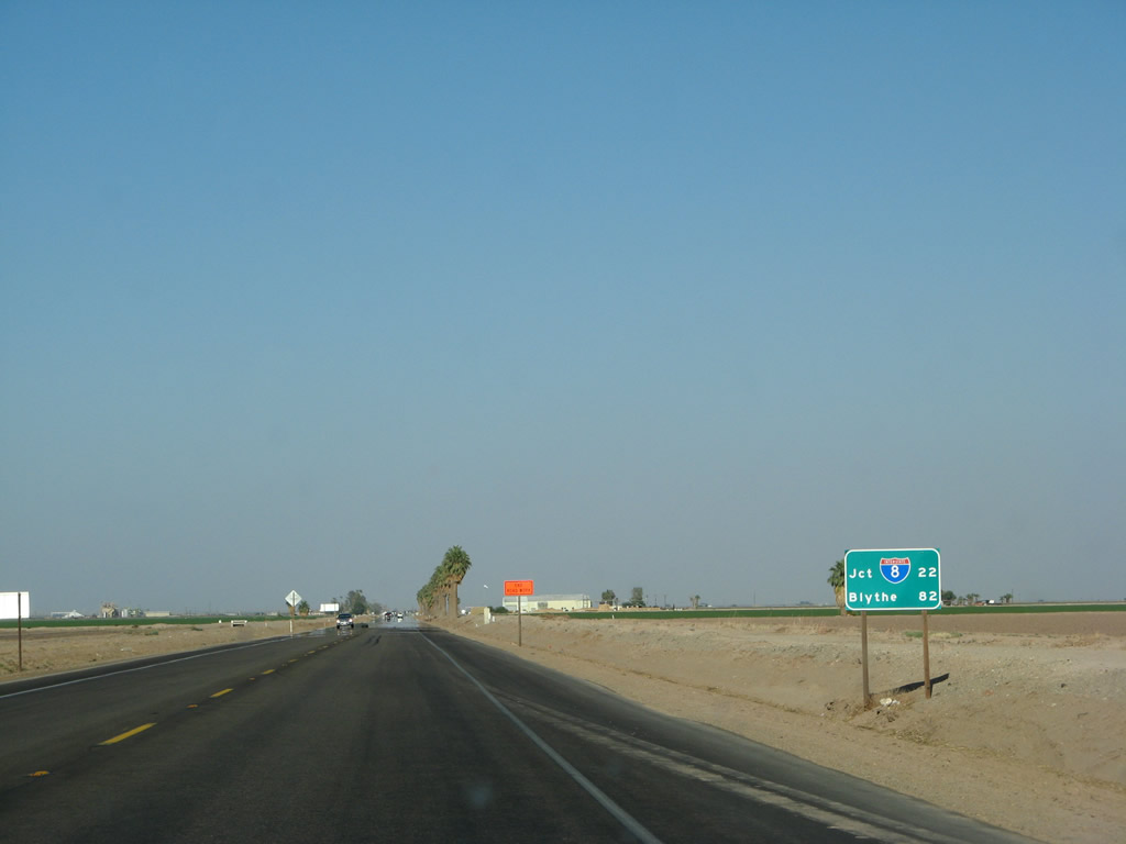
This mileage sign along California 78 east and California 115 south provides the distance to Interstate 8 (22 miles south via California 115) and Blythe (82 miles via California 78 east). Photo taken 06/07/08. |
|
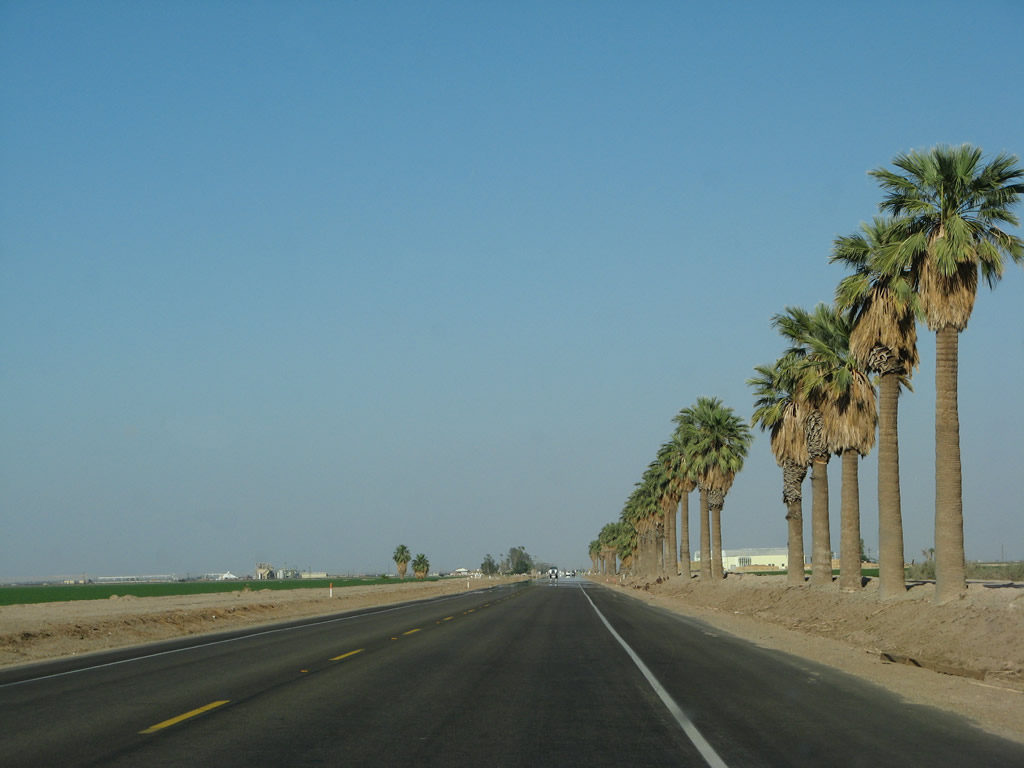
A row of palms line the south side of California 78 east and California 115 south. Photo taken 06/07/08. |
|
Eastbound California 78 and southbound California 115 approach their intersection with Casey Road. Photo taken 06/07/08. |
|
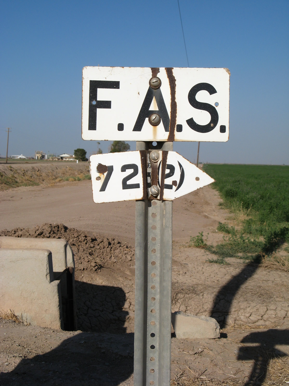
A porcelain-enamel F.A.S. (Federal Aid Secondary) marker is posted at the intersection of California 78-115 and Casey Road. Photo taken 06/07/08. |
|
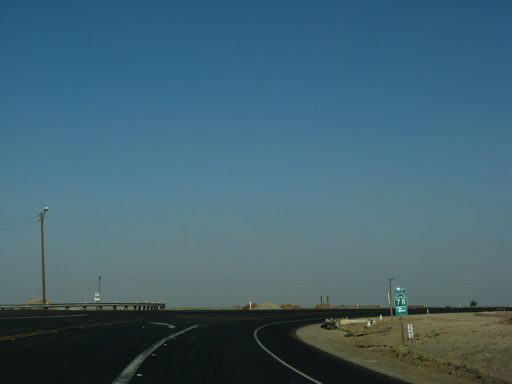
California 78 and California 115 split soon thereafter. California 78 will turn left (east) toward Glamis and Blythe. Prior its designation as a state route, California 78 was briefly known as Imperial County S-78. Bear right here for California 115 south to Holtville. Photo taken 06/07/08. |
|
A pair of trailblazers for California 78 and California 115 are posted soon thereafter. Photo taken 06/07/08. |
|
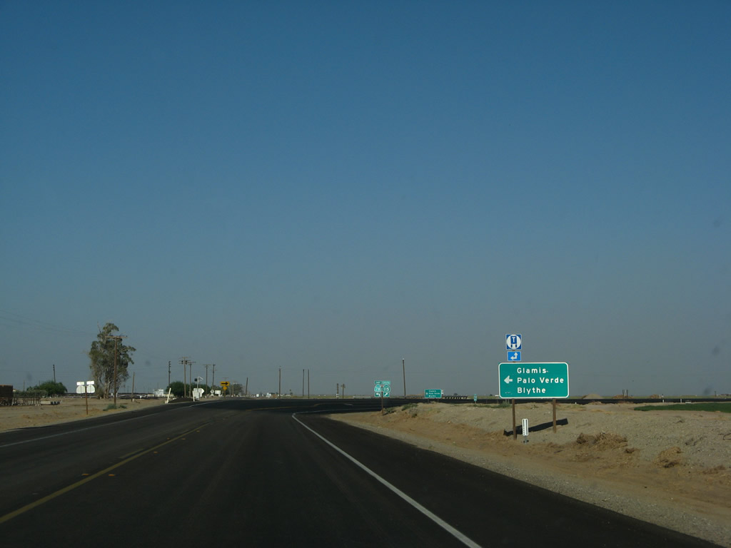
A second sign points the way to California 78 east to Glamis, Palo Verde, and Blythe. Photo taken 06/07/08. |
|
California 78 departs to the east, while California 115 proceeds south to Holtville. Photo taken 06/07/08. |
| California 78 east |
|
This mileage sign along California 78 east provides the distance to Glamis (21 miles), Palo Verde (62 miles), and Blythe (79 miles). Photo taken 06/07/08. |
|
Eastbound California 78 approaches Imperial County S-32 (Butters Road) south to Holtville and California 7. Photo taken 06/07/08. |
|
Southbound California 78 approaches Imperial County S-33 (Green Road). Photo taken 06/07/08. |
|
An Imperial County S-33 trailblazer is posted just before the intersection with Green Road. CR S-33 heads south to follow the Highline Canal to California 115 and Old U.S. 80 southeast of Holtville. Photo taken 06/07/08. |
|
|
|
A Southern California Edison 220kV power line passes over California 78. This particular line originates near a geothermal power plant off Historic U.S. 80 southeast of Holtville and extends north along the eastern edge of the Imperial Valley, following the Highline Canal and picking up renewable and other power generating sources as it connects to the Southern California Edison grid in the Coachella Valley. Photos taken 06/07/08. |
|
A California 78 east reassurance shield is posted soon thereafter. For a fair amount of time, a highway to head east of California 115 toward Palo Verde was planned but remained unconstructed until the early 1960s, when the final section through the sand dunes near Glamis was built. This section of California 78 was signed briefly as Imperial County S-78 before it was formally accepted into the state highway system sometime in the mid-1960s. Building California 78 east from California 115 through the Algodones Sand Dunes had its challenges, especially when building a permanent road on a constantly moving surface (sand). Engineering marvel as it is, California 78 (and Interstate 8 and Old U.S. 80 south of here), crosses the sand dunes and allows travel through an area that was once deemed impenetrable. Photo taken 06/07/08. |
|
|
|
|
|
| After passing the Highline Canal, the landscape changes dramatically. As we gain elevation to leave the lowest points of the Imperial Valley, California 78 reenters rugged desert lands. Agriculture becomes a distant memory as the sweeping hills of sagebrush and rolling desert eventually give way to large sand dunes, known alternately as the Algondones Sand Dunes, Imperial Sand Dunes, the Sand Hills, or in the case of the California 78 crossing over the dunes, Glamis. This series of pictures follows California 78 east as it travels through the sagebrush as it gives way to the dramatic sand hills. Building California 78 across the sand dunes was not possible given early highway building techniques, and advanced highway techniques required a bit of engineering and construction expertise. This delayed construction of the highway. Ben Hulse, a former state senator, predicted and supported the eventual construction of this seemingly impossible-to-build highway, and this section of California 78 is named in honor of his efforts to see it constructed. Photos taken 04/01/06. |
|
|
|
|
|
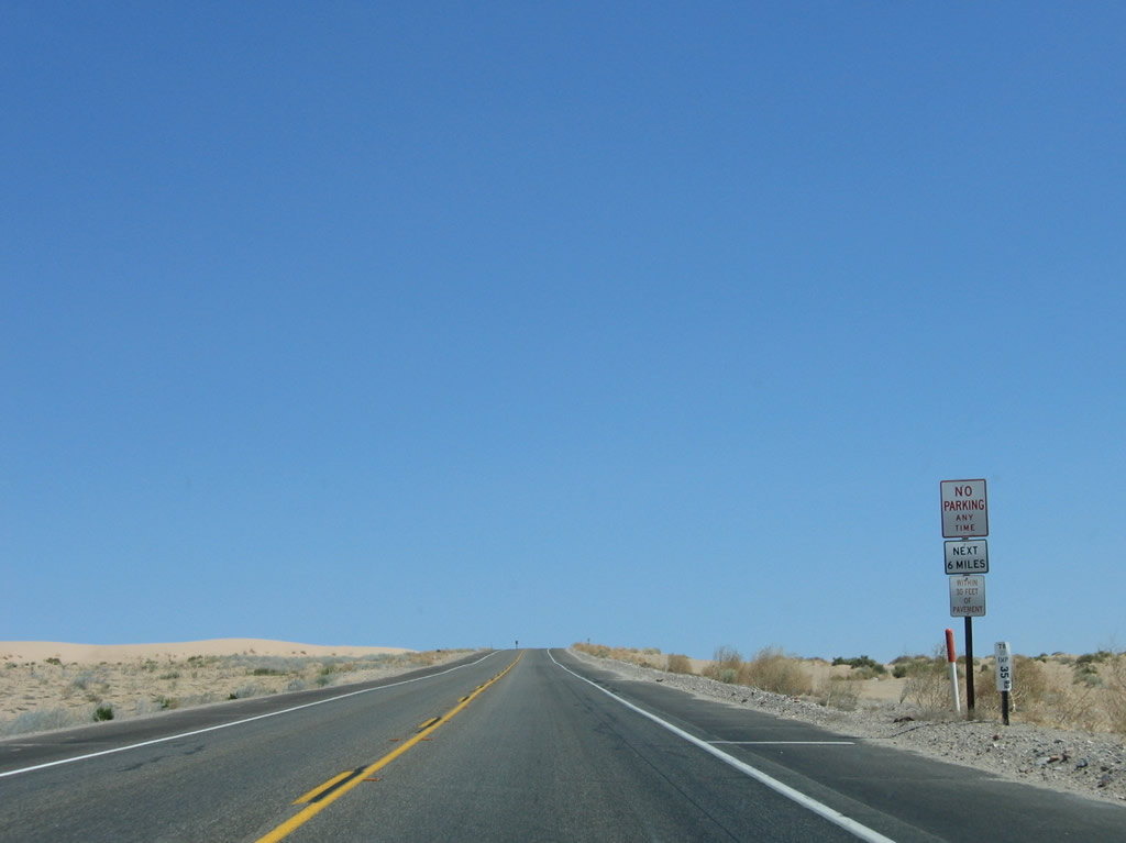
| Known as a wintertime destination across Southern California, Glamis is a very popular off-roading area and winter long-term visitation area. An entire community springs up in the winter to accommodate the visitors, but many leave by time the hot summer arrives. Some residents remain in Glamis year-round, too. A warning sign advises of the potential of wind and blowing sand for the seven-mile sand dune stretch. A right turn connects to Gecko Road, which offers recreational access to the sand dunes for off-road vehicles. Turn right (south) on Gecko Road to the Imperial Sand Dunes Cahuilla Ranger Station, which provides information on the recreational and conservation activities of the sand dune area. Photos taken 04/01/06. |
|
|
|
|
|
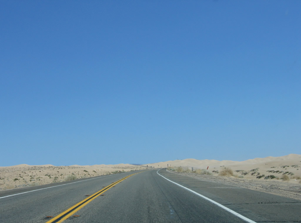
| California 78 proceeds east through the Algodones (Imperial) Sand Dunes. On this day, winds blew sand across the road and created some minor dust storms. Watch for four-wheel off-road vehicles on the sand; they may come close to or cross the highway. Photos taken 04/01/06. |
|
|
|
|
|
| More traffic is seen in this area during the winter and early spring as compared to the summer and early fall when it can be very hot in the sand dunes. At the highest point of the sand dunes, look for the Osborne Overlook (turn right onto Osborne Park Road to a parking lot) for a view of the sand dunes in all directions. East of Osborne Overlook, California 78 will begin to descend out of the sand hills and toward the unincorporated community of Glamis. Photos taken 04/01/06. |
|
|
|
|
|
| California 78 descends from Osborne Overlook in the Algodones Sand Dunes (Imperial Sand Dunes) and proceeds toward the unincorporated community of Glamis. Gusty winds blew sand across the highway on this early spring day. Photos taken 04/01/06. |
|
|
|
|
|
| Only California 78 and Interstate 8 make their way across the Algodones Sand Dunes in eastern Imperial County. This leaves miles of unexploited wilderness along the spine of the sand hills between Glamis and Buttercup Valley, which is where Interstate 8 (and its predecessor, U.S. 80), the Southwest Powerlink, and All-America Canal cross the dunes. Off-road vehicles travel through the ever-shifting dunes to explore the sand hills, launching either from Glamis or Buttercup Valley. Photos taken 04/01/06. |
|
|
|
|
|
| Reaching the bottom of the sand hills, California 78 approaches Glamis Flats Road. Quite a few off-road vehicles were in use on the flat sandy area adjacent to the parking area when we passed through the area. Beyond that, several recreation vehicles took up residence alongside the south side of the highway as we approach the community of Glamis. While a plank road helped carry automobiles across the dunes as early as 1912 along what is now the Interstate 8 corridor, it was not a permanent solution. today's method of road building requires a major base to prevent the asphalt roadway from moving along with the continually shifting sands. Photos taken 04/01/06. |
|
|
|
|
|
| Eastbound California 78 enters the unincorporated community of Glamis. Some motorist services may be available here, such as food and gas, especially in the busy winter months when visitors bring their off-road vehicles to Glamis to recreate in the sand. Leaving Glamis, the Union Pacific Railroad crosses California 78. The railroad travels northwest along the edge of the sand dunes until it joins the California 111 corridor at Niland. To the southeast, the railroad travels to Yuma, Arizona, joining the Interstate 8 corridor near Felicity (just west of Winterhaven). Beyond the railroad crossing, California 78 proceeds east toward Palo Verde. Photos taken 04/01/06. |
|
Leaving the sand dunes and Glamis behind, eastbound California 78 approaches the turnoff to GFOC Road. Turn left here for the Western Mesquite Mines, which produces gold. The mine was reactivated for gold production in 2008 with the intent for a 13-year life cycle. As of 2013, the mine is operated by New Gold. "GFOC" seems to refer to Goldfields Operating Company, which may have operated the Western Mesquite Mines complex in the past. Photo taken 04/01/06. |
|
California 78 curves northeast to skirt the eastern edge of the Western Mesquite Mines complex. Photo taken 04/01/06. |
|
Eastbound California 78 approaches Vista Mine Road. Photo taken 04/01/06. |
|
California 78 curves north to pass alongside the eastern edge of the Western Mesquite Mines complex. Photo taken 04/01/06. |
|
Traveling north, a fence separates California 78 from the adjacent gold mine. The Chocolate Mountains come into view in the distance. Photo taken 04/01/06. |
|
California 78 continues north alongside the mine for several miles. Photo taken 04/01/06. |
|
Nearing the foot of the Chocolate Mountains, California 78 again veers east. Photo taken 04/01/06. |
|
California 78 again turns east to follow the foot of the Chocolate Mountains. The highway will gradually turn northeast toward Palo Verde. Photo taken 04/01/06. |
|
California 78 threads its way through the Chocolate Mountains as it continues toward the Colorado River Valley. Photo taken 04/01/06. |
|
|
|
Due to the presence of multiple dips and washes along California 78, those driving at high rates of speed must be careful to avoid risking vehicle damage as evidenced in this dip. Photos taken 04/01/06. |
|
|
|
Eastbound California 78 next approaches Imperial County S-34 (Ogilby Road). CR S-34 links with Interstate 8 at a point east of Buttercup Valley and west of Felicity. CR S-34 is a good, two-lane highway that offers a link from California 78 to Yuma. Photos taken 04/01/06. |
|
A California 78 reassurance shield is posted along eastbound after the S-34 intersection as we enter the Chocolate Mountains. Note the "flash flood area" sign, which advises of the potential for the various washes and ditches to become flooded with water, especially during the summer monsoon season when drenching thunderstorms occur. Photo taken 04/01/06. |
|
This mileage sign advises of the distance to Palo Verde (28 miles) and Blythe (49 miles) along California 78 east. Photo taken 04/01/06. |
Page Updated March 10, 2013.