
California 70 East & 89 South - Central Plumas County
| California 70 east & 89 south | ||||
|---|---|---|---|---|
 |
After joining with California 89 south near Paxton, eastbound California 70 proceeds toward the Indian Creek bridge. These route markers are posted immediately after the two routes merge together onto their shared alignment. From here, we will travel generally southeast toward Quincy. Photo taken 09/04/10. | |||
 |
California 70 east and California 89 south cross over Indian Creek, which flows along with Spanish Creek into the East Branch of the North Fork of the Feather River. Photo taken 09/04/10. | |||
 |
The Indian Creek bridge was built in 1954. Photo taken 09/04/10. | |||
 |
This mileage sign provides the distance to Quincy (ten miles), Truckee (84 miles via California 89 south), and Reno (92 miles via California 70 east and U.S. 395 south). Photo taken 09/04/10. | |||
 |
California 70 (Feather River Highway) and California 89 proceed through more rugged landscape for the final distance into Keddie and Quincy. Photo taken 09/04/10. | |||
 |
The railroad comes into view as California 70-89 curves above Spanish Creek, which now parallels the state route. Photo taken 09/04/10. | |||
 |
California 70-89 crosses Spanish Creek on this deck truss 1932 bridge. It is slated for demolition after its replacement, a concrete arch bridge, it built adjacent to it. The replacement bridge opened to traffic on July 16, 2012, a little less than two years after this picture was taken. Photo taken 09/04/10. |
 |
A project was underway in 2010 to replace the Spanish Creek bridge to eliminate some structural deficiencies. The new bridge can support much greater loads (360,000-pound weight limit rather than 80,000-pound weight limit); meet current standards such as seismic stability, permit truckloads, and eight-foot shoulders; and would be an open-spandrel, concrete arch box girder bridge with a design lifespan of approximately 75 years. The overall bridge is 627 feet long, with an arch span of 354 feet. The bridge would rise 160 feet above the creek. This bridge would create a statement with a sweeping arch over the canyon below. Completion of this bridge occurred with an opening on July 16, 2012, at a cost of $29 million.1 The Spanish Creek Bridge was funded in part by the American Recovery and Reinvestment Act of 2009 in the amount of $28.3 million. Photo taken 09/04/10. |
 |
Soon after leaving the vicinity of the Spanish Creek Bridge, California 70 and California 89 crest next to an old wall that dates to the original Feather River Highway construction. On the left is the Keddie Wye, which is not visible from the travel lanes but can be viewed from the shoulder. Park at one of the wide turnouts to see the Keddie Wye. Photo taken 09/04/10. |
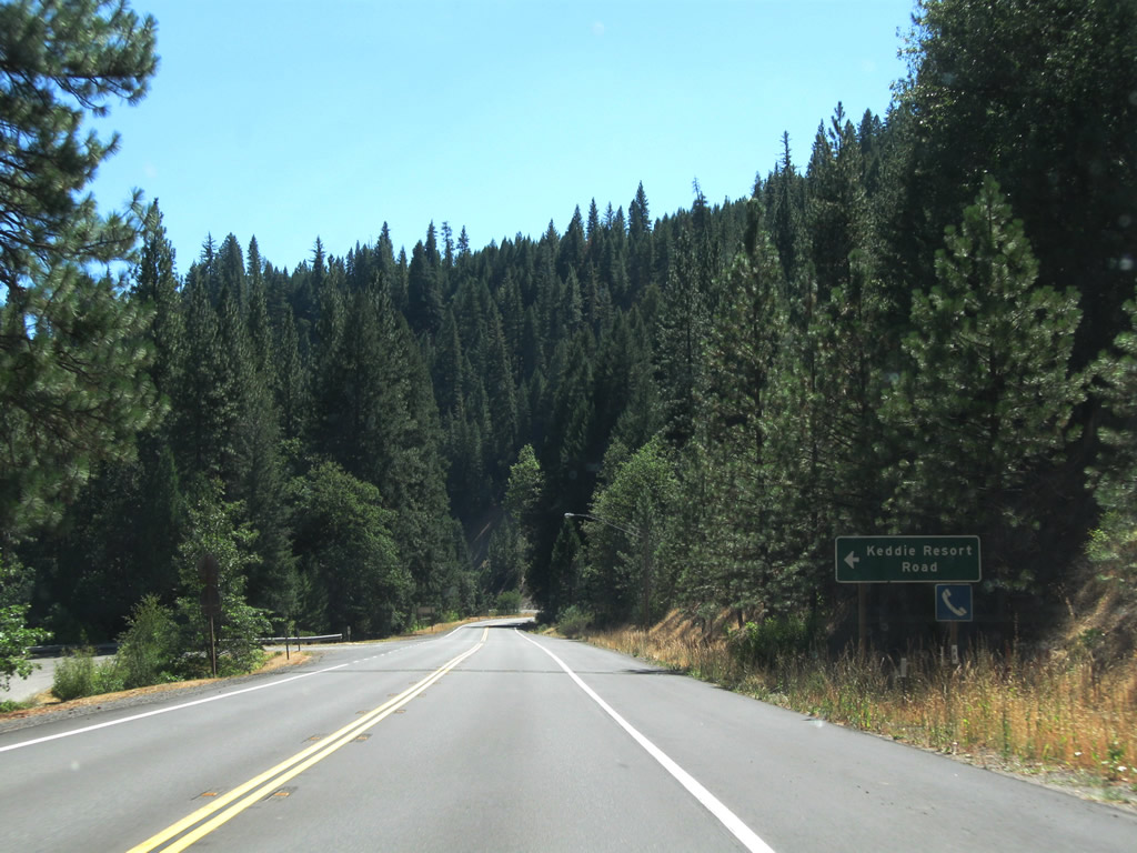 |
Eastbound California 70 and southbound California 89 approach Keddie Resort Road. Photo taken 09/04/10. |
 |
Eastbound California 70 and southbound California 89 next approach Chandler Road to Oak Camp (four miles). Chandler Road travels southeast, skipping past Quincy to rejoin 70-89 at the other end of the community. Photo taken 09/04/10. |
 |
California 70 and California 89 see a brief passing lane after the Chandler Road turnoff. Photo taken 09/04/10. |
 |
A rest area is nine miles ahead along California 70 east and California 89 south. Photo taken 09/04/10. |
 |
The next major intersection along California 70 east and California 89 south is with Golden Eagle Avenue, which travels west to Feather River College. Photo taken 09/04/10. |
 |
California 70 east and California 89 south again cross over Spanish Creek. Photo taken 09/04/10. |
 |
The next major intersection along California 70 east and California 89 south is with Spanish Creek Road, which travels east to Gansner Field and the Plumas County Visitors Bureau. Photo taken 09/04/10. |
 |
Soon thereafter, California 70 east and California 89 south enter the unincorporated community of Quincy, which is the seat of Plumas County. Quincy had a population of 1,728 as of the 2010 Census and sits at an elevation of 3,432 feet. California 70-89 becomes known as Crescent Street. Photo taken 09/04/10. |
 |
This sign advises of the pending junction with Bucks Lake Road, about a quarter mile east of here via California 70 east and California 89 south. Photo taken 09/04/10. |
 |
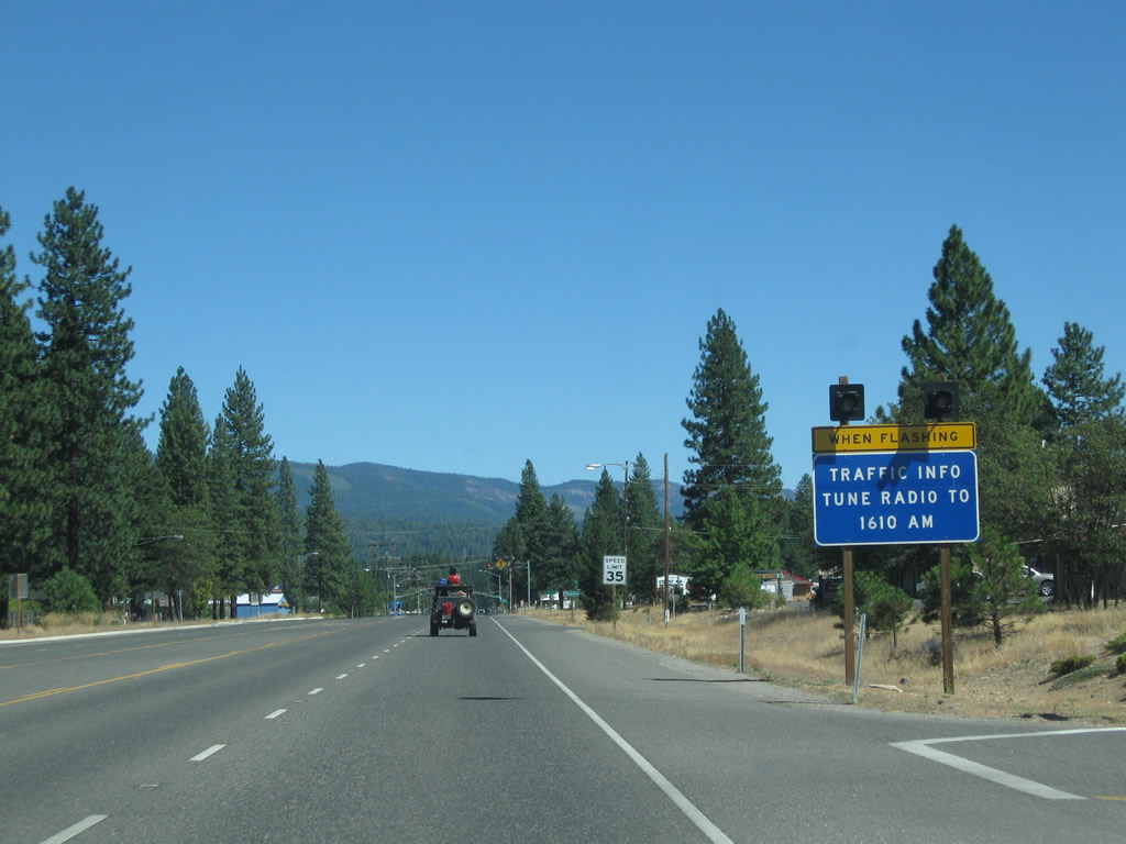
Motorist services such as gas, food, and lodging are available in Quincy. Photo taken 09/04/10. |
 |
California 70 and California 89 split into two one-way streets. Lawrence Street, splitting left here, carries northbound California 89 and westbound California 80, while Crescent Street and Main Street will carry California 89 south and California 70 east. Photo taken 09/04/10. |
 |
Sure enough, one block ahead, California 70 and California 89 turn from Crescent Street onto eastbound Main Street. Turn right here for Bucks Lake Road, which travels west to Bucks Lake and follows the Middle Fork of the Feather River southwest back to Oroville. This could have been the route for today's California 70 had the preferred alignment for the route been built on the Middle Fork rather than the North Fork. Photo taken 09/04/10. |
 |
California 70 and California 89 proceed east through downtown Quincy along Main Street. Businesses line both sides of the street, with the Plumas County Courthouse on the right (south) side of California 70-89/Main Street. Photo taken 09/04/10. |
 |
 |
 |
 |
 |
| California 70 and California 89 continue due east through downtown Quincy along Main Street. The one-way couplet reconnects with Lawrence Street at the east end of downtown, and the two state routes continue together east as Main Street toward the intersection with Quincy Junction Road, which is the location of the local high school. Beyond this signalized intersection, California 70-89 proceed east as a four-lane highway en route to a second business district located east of downtown. Photos taken 09/04/10. | ||||
 |
 |
 |
 |
 |
 |
 |
 |
 |
 |
 |
 |
 |
 |
 |
| Entering the eastern commercial area in Quincy, California 70 and California 89 proceed east past the Plumas County Fairgrounds, Jail, and Plumas County Road Department Yard (note older, button-copy sign posted here). A traffic signal governs the flow of traffic at the intersection with Mill Creek Road. Photos taken 09/04/10. | ||||
 |
 |
 |
 |
 |
 |
 |
 |
 |
 |
| California 70 and California 89 leave Quincy and reenter rural lands, some of which is protected as national forest. A mileage sign provides the distance to Portola (29 miles) and Reno (76 miles). Photos taken 09/04/10. | ||||
 |
 |
 |
 |
 |
| After meeting Chandler Road, California 70 and California 89 approach the Massack Safety Rest Area (about 6.5 miles east of Quincy). This rest area features restrooms, water, picnic tables, phone, disabled access, and a pet exercise area. Look for the turnoff to the rest area on the left. Photos taken 09/04/10. | ||||
 |
 |
 |
 |
 |
| After leaving the Massack Rest Area, California 70 and California 89 proceed southeast to cross over the Spring Garden Overhead. The Union Pacific Railroad passes below the state highway, continuing its path from Sacramento to Salt Lake City via the Feather River Canyon and its lower Sierra Nevada pass (Beckwourth Pass). Just south of here, the railroad makes a nearly perfect circular loop to achieve a higher elevation at a grade that can be handled by locomotives, with a grade separation where the railroad tracks cross over each other. This rail spiral is known as the Williams Loop and is comparable to the more famous Tehachapi Loop located off California 58 (former U.S. 466) near Tehachapi in Kern County. The grade is kept at or below one percent. Photos taken 09/04/10. | ||||
 |
 |
 |
 |
 |
| California 70 and California 89 continue east from the vicinity of Williams Loop toward Lee Summit via the small community of Spring Garden. A mileage sign provides the distance to Blairsden (13 miles; this is where California 89 south and California 70 east split), Portola (23 miles), and Reno (70 miles). A passing lane helps bring the highway up to Lee Summit. Photos taken 09/04/10. | ||||
 |
 |
 |
 |
 |
| California 70 and California 89 reach Lee Summit, elevation 4,439 feet. Descending from the summit, the state highway sees sweeping views of the surrounding Sierra Nevada. A turnoff via Gill Ranch Road connects to Sloat, which is located about midway between Quincy and Graeagle and has a historical town hall. Photos taken 09/04/10. | ||||
 |
 |
 |
 |
 |
| Shortly after the Gill Ranch Road turnoff, California 70 and California 89 enter the unincorporated community of Cromberg. Major intersections here include Old Cromberg Road, Mount Tomba Road, and Old Mill Pond Road. Photos taken 09/04/10. | ||||
 |
 |
 |
 |
 |
| California 70 and California 89 proceed east to meet Camp Layman Road, then gains a passing lane. Two Rivers Road offers river access from the highway. Photos taken 09/04/10. | ||||
 |
 |
 |
 |
 |
| The next marked intersections along California 70 and California 89 include Little Bear Road, Feather River Inn Road, and Mohawk Highway Road (south to Mohawk and Johnsville via a connection with Plumas County A-14 (Johnsville Road) west). Photos taken 09/04/10. | ||||
 |
 |
 |
 |
| Soon thereafter, the two state routes prepare to divide. Turn right ahead for California 89 south to Truckee or continue straight ahead for California 70 east to Portola. Historically, Old California 24 and Old U.S. 40 Alternate turned south along with California 89 at this intersection and stayed merged southeast to Clio, until the current realigned California 70 was built. The old alignment today is known as Clio State 40A Road. Turn south on California 89 to Blairsden, Graeagle, Mohawk, Johnsville, and Truckee. Photos taken 09/04/10. | |||
Sources:
- "Quake-resistant canyon bridge to open today near Quincy." Sacramento Bee, July 16, 2012.


Page Updated July 20, 2012.
|
About Contact Glossary |
In The News Testimonials Interstate Guide |
Social Media:
 |
|
© 2000-23 AARoads.com | All Rights Reserved | Privacy Policy / Terms of Use
|
||