| California 58 east |
|
Prior to reaching the summit, eastbound California 58 (Carrisa Highway) leaves San Luis Obispo County and enters Kern County. Note the pavement changes at the county line. Photo taken 07/05/06. |
|
California 58 (Carrisa Highway) continues to climb up the Temblor Range. Trees and scrub appear along California 58 for the first time since leaving the La Panza Range on the other side of Carrizo Plain. Photo taken 07/05/06. |
|
|
Reaching the 3,250-foot summit, California 58 (Carrisa Highway) continues east toward McKittrick. Photos taken 07/05/06. |
|
|
|
Almost without warning, California 58 (Carrisa Highway) starts to travel downhill ... fast. Several switchbacks, coupled with limited signing of the curves and a downhill grade make this an exercise in keeping the brakes working. This suite of photos follows California 58 as it winds its way down the backside of the Temblor Range. Watch for rockslides, especially during winter months. Photos taken 07/05/06. |
|
|
|
|
|
|
|
|
|
After the initial steep downhill descent and sweeping switchbacks, California 58 (Carrisa Highway) passes under the two main 500-kV power transmission lines leading from Pacific Gas and Electric's Diablo Canyon Nuclear Power Generating Station northeast to the massive Midway Substation near Buttonwillow. (Another 500 kV power line leads from Diablo Canyon north to the Gates Substation near the junction of Interstate 5 and California 198.) Photos taken 07/05/06. |
|
After passing under the massive power lines, California 58 (Carrisa Highway) continues to descend the Temblor Range, but now at a much more gradual pace. The winding switchbacks are done for the most part, and the road takes its time descending into McKittrick. Photo taken 07/05/06. |
|
Even on the east side of the Temblor Range, very little traffic uses California 58 until after McKittrick. Photo taken 07/05/06. |
|
Eastbound California 58 (Carrisa Highway) approaches Reward Road, which travels east to McKittrick on an alternate alignment parallel to California 58 (Carrisa Highway). Photo taken 07/05/06. |
|
For the next five miles, eastbound California 58 (Carrisa Highway) takes a few curves, but none as sharp as the ones we saw while descending Temblor Range. Photo taken 07/05/06. |
|
Prior to meeting California 33, eastbound California 58 (Carrisa Highway) approaches a fork in the road. Turn right to connect to California 33 south, or keep left to follow California 58 east to California 33 north. Too bad no guide sign announces this fact. Photo taken 07/05/06. |
|
The back of the signage for westbound California 58 comes into view before the roadway splits. Photo taken 07/05/06. |
|
Both branches of the fork are part of Carrisa Highway. At California 33, Carrisa Highway ends, but California 58 will continue with a shared alignment north on California 33 and then continue east again via McKittrick Highway. Photo taken 07/05/06. |
|
Although there is no junction sign to announce this fact, eastbound California 58 approaches California 33. Turn right on California 33 south to Taft (16 miles); turn left to follow California 33 north and California 58 east to McKittrick (one mile). The control city of Bakersfield is provided for eastbound California 58 (40 miles). Photo taken 07/05/06. |
|
A set of shields for California 33 and California 58 is posted at the end of Carrisa Highway. Turn left (north) to follow California 58 east to McKittrick, Buttonwillow, Rosedale, Green Acres, Fruitvale, and Bakersfield. Photo taken 07/05/06. |
| California 33 north & 58 east |
|
Northbound California 33 and eastbound California 58 enters the unincorporated community of McKittrick, with a population of 160 as of the 2000 Census. Photo taken 07/05/06. |
|
Limited services are available in McKittrick, including a motel and small market. Continue east on California 58 to Buttonwillow or north on California 33 to Avenal for gas. Photo taken 07/05/06. |
|
The routes divide shortly after leaving downtown McKittrick. Northbound California 33 will aim northwest toward Avenal and Coalinga, while eastbound California 58 turns northwest toward Buttonwillow and Interstate 5 at Exit 257. Photo taken 07/05/06. |
|
A mileage sign for the destinations is provided shortly thereafter, including Coalinga (74 miles north via California 33), Buttonwillow (12 miles via California 58), and Bakersfield (39 miles via California 58). Photo taken 07/05/06. |
| California 58/McKittrick Highway east |
|
After splitting from California 33, eastbound California 58 turns to the northeast for the journey to Buttonwillow and Bakersfield. Photo taken 07/05/06. |
|
Cruising over a hill, the Central Valley comes into view in all its grandeur. From here, California 58 keeps heading northeast until it meets Lokern Road. All along this road are various oil and gas exploration facilities, and a variety of pipes, tanks, and power lines in support of these operations can be seen from the state route. Even more of these facilities are located along California 33, especially south of McKittrick toward Taft and north toward Avenal. Photo taken 07/05/06. |
|
Towers for one of the 500-kV power lines can be seen in the distance, along with an oil derrick and a truck route. Photo taken 07/05/06. |
|
|
|
|
Continuing northeast, California 58 crosses under first of the two 500-kV power lines that earlier crossed the state highway on the descent from the Temblor Range. Note the other power lines that serve the oil and natural gas industries. Photo taken 07/05/06. |
|
California 58 transitions a bit more toward the east, but still travels northeasterly through here. Photo taken 07/05/06. |
|
Due to the lack of rainfall in this part of the Central Valley, the land is not irrigated in the foothills east of McKittrick. Mining and mineral extraction is a more commonly found activity in this corner of the state. California 58 continues east toward Buttonwillow, where farming plays a much larger role. Photo taken 07/05/06. |
|
Eastbound California 58 crosses the California Aqueduct, which carries water from the Sacramento River-San Joaquin River delta region. To ascend the Tehachapi Mountains south to Los Angeles, the aqueduct is pumped over the mountains at Wheeler Ridge. The aqueduct generally follows Interstate 5 from the Delta south to Wheeler Ridge and generally stays on the west side of the Central Valley. Photo taken 07/05/06. |
|
|
California 58 passes under the second 500-kV power line, which also connects Diablo Canyon Nuclear Power Generating Station with the Midway Substation. the 230-kV power line has paralleled California 58 since the downslope of La Panza Range west of Carrizo Plain, and it follows the 500-kV power line east to Midway. Photo taken 07/05/06. |
|
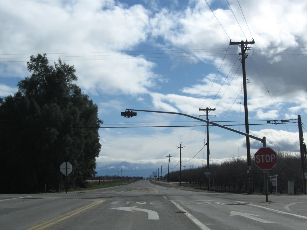
Eastbound California 58 approaches Lokern Road. At this point, California 58 transitions onto eastbound Lokern Road. To the west, Lokern Road connects with California 33 north of the Cymeric Oil Field and south of the Belridge Oil Fields. Photo taken 07/05/06. |
| California 58 east |
|
An eastbound California 58 reassurance shield is posted shortly after the Lokern Road intersection. Note that California 58 is an established truck route now, as it serves the trucks working the oil and gas fields in this part of the valley and takes them east to Interstate 5. From here, California 58 turns due east toward Buttonwillow. Photo taken 07/05/06. |
|
Shortly thereafter, a mileage sign provides the distance to Buttonwillow (four miles) and Bakersfield (30 miles). Photo taken 07/05/06. |
|
Having crossed the California Aqueduct, water becomes more plentiful. Agriculture becomes more common as SR 58 approaches Buttonwillow ("The Heart of Cotton Country") and enters the heart of the southern Central Valley. Photo taken 07/05/06. |
|
Eastbound California 58 / Lokern Road (McKittrick Highway) approaches Corn Camp Road north to Main Drain Road. Photo taken 07/05/06. |
|
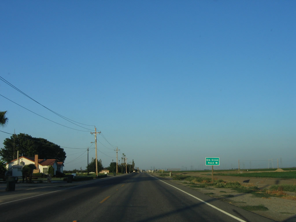
Shortly thereafter, eastbound California 58 approaches Elk Grove Road south. Photo taken 07/05/06. |
|
Residential areas appear on the north side of California 58 as we enter the outskirts of Buttonwillow. The next major intersection is with Palomas Avenue. Photo taken 07/05/06. |
|
Unincorporated Buttonwillow was home to 1,266 people as of the 2000 Census. The community is named for the "Buttonwillow Tree," which is a buttonbush. Because of their similarity to a willow tree, the buttonbush was called a "buttonwillow." Settlers used the Buttonwillow Tree to help with directions in this part of the valley. Through town, California 58 briefly becomes Front Street in addition to being McKittrick Highway and Lokern Road. Photo taken 07/05/06. |
|
Entering downtown Buttonwillow, eastbound California 58 approaches Buttonwillow Road, which travels north to Interstate 5 Exit 263. Note the use of a dreaded neutered Interstate 5 trailblazer. Continue straight ahead on California 58/McKittrick Highway east for motorist services and Interstate 5 south. Photo taken 07/05/06. |
|
After the Buttonwillow Road intersection, California 58 has a reassurance shield on eastbound Front Street/McKittrick Highway. Photo taken 07/05/06. |
|
For the first time, California 58 becomes four lanes as it continues through the industrial section of Buttonwillow. Photo taken 07/05/06. |
|
The next major intersection on eastbound California 58 (Front Street) is with Mirasol Avenue, which travels south to Taft (19 miles). Photo taken 07/05/06. |
|
Leaving Buttonwillow, California 58 passes by several stores (including car repair shops) and approaches the huge Midway Substation. Photo taken 07/05/06. |
|
|
California 58 passes on the south side of the Midway Substation, which is shown on some maps as "Kilowatt." Several lines intersect here: Path 15 brings two 500-kV power lines from the north (Gates Substation near Harris Ranch); two additional 500-kV power lines that have paralleled California 58 come into this substation from Diablo Canyon Nuclear Power Generating Station. Two more 500-kV power lines (Southern California Edison) continue south toward greater Los Angeles. A seventh 500-kV power line also travels south to greater Los Angeles via Palmdale, but it begins as a Pacific Gas and Electric power line, then changes into a Southern California Edison power line at a point near Horsethief Mountain on sprawling Tejon Ranch. Photo taken 07/05/06. |
|
|
|
Leaving the Midway Substation ("Kilowatt"), eastbound California 58/McKittrick Highway approaches Wasco Way south to Tupman (13 miles) and the Tule Elk Reserve. Connecting to Tupman Road, the highway eventually finds its way to California 119 (former U.S. 399). Photo taken 07/05/06. |
|
Eastbound California 58 passes under the 500-kV power line that travels southeast toward Palmdale and thence south toward La Ca-ada-Flintridge. A set of 230-kV power lines accompany the 500-kV power line to serve areas in the vicinity of Bakersfield. Photo taken 07/05/06. |
|
Passing by a few more farms and ranches, California 58 will soon approach its junction with Interstate 5. Photo taken 07/05/06. |
|
At Interstate 5 (Westside Highway), most motorist services are finally available after the long stretch without services in Carrizo Plain and McKittrick. Some services are in downtown Buttonwillow, but an even broader array can be found at the Interstate 5 interchange. The next left is the first traffic signal to be found on eastbound California 58; it connects California 58 with Interstate 5 south to Los Angeles. Photo taken 07/05/06. |
|
Eastbound California 58 meets Interstate 5 south at this traffic signal. Continue straight ahead under the Interstate 5 bridges for the ramp to Interstate 5 north to Sacramento. Photo taken 07/05/06. |
|
California 58 passes under Interstate 5. The next left connects California 58 east with Interstate 5 north to Sacramento. Photo taken 02/13/09. |
|
Eastbound California 58 approaches Tracy Avenue, which connects with Interstate 5 north. A few gas stations and restaurants are located along Tracy Avenue between California 58 and the Interstate 5 north on-ramp. Photo taken 02/13/09. |
|
Leaving the Interstate 5 interchange, this mileage sign provides the distance to Bakersfield (22 miles), Mojave (83 miles), and Barstow (151 miles) via California 58 east. Photo taken 02/13/09. |
|
A series of Pacific Gas & Electric power lines roughly parallel California 58 as the state highway leaves the vicinity of Buttonwillow and continues east toward Rosedale and Bakersfield. This view looks south over farms and orchards, with the Tehachapi Mountains framing the winter clouds. Photo taken 02/13/09. |
|
California 58 remains a two-lane highway between Buttonwillow and the outskirts of Bakersfield. It will shift onto a freeway alignment east of California 99. Photo taken 02/13/09. |
|
Passing through the southern reaches of the Central (San Joaquin) Valley, California 58 passes through a variety of ranches, farms, and corporate interests. The highway will see more development as it proceeds east toward the California 43 intersection. Photo taken 02/13/09. |
|
Eastbound California 58 approaches Mayer Avenue. Photo taken 02/13/09. |
|
A mile or so east, California 58 approaches Martin Avenue. Photo taken 02/13/09. |
|
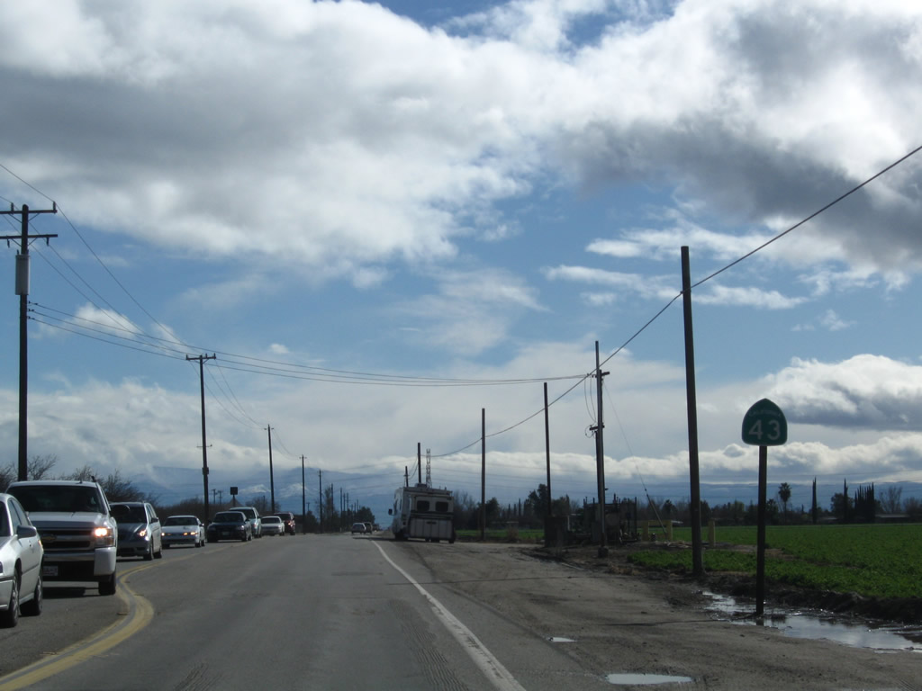
Eastbound California 58 approaches California 43. At this intersection, California 58 will turn south onto California 43, then turn east again along Rosedale Highway toward Rosedale, Fruitvale, and Bakersfield. Due to extensive residential and commercial development along California 58 between California 43 and California 99, traffic is advised of an alternate route via California 43 north and then east along 7th Standard Road to California 99. Seventh Standard Road effectively bypasses much of the development to the north, although it too can carry significant traffic. Photo taken 02/13/09. |
|
At the upcoming "T" intersection, California 58 east will turn right onto California 43 south. Photo taken 02/13/09. |
|
Slow down for the upcoming stop sign with California 43. Photo taken 02/13/09. |
|
California 43, also known as the Central Valley Highway for much of its journey, extends from California 119 near Buena Vista Recreation Area north via Shafter, Wasco, Corcoran, and Hanford to California 99 at Selma. Photo taken 02/13/09. |
|
Eastbound California 58 turns right (south) onto California 43/Enos Lane. The two routes will overlap briefly, then split again at Rosedale Highway. Photo taken 02/13/09. |
|
Reaching the T intersection, turn right for California 43 south and California 58 east to Taft and Bakersfield or left for California 43 north to Shafter and Wasco. Photo taken 02/13/09. |
| California 43 south & 58 east |
|
For about a mile, California 43 south and California 58 east share alignment along Enos Lane west of Bakersfield. Leaving the north intersection, only a California 43 south reassurance shield is posted even though California 58 is also sharing alignment on this segment. Photo taken 02/13/09. |
|
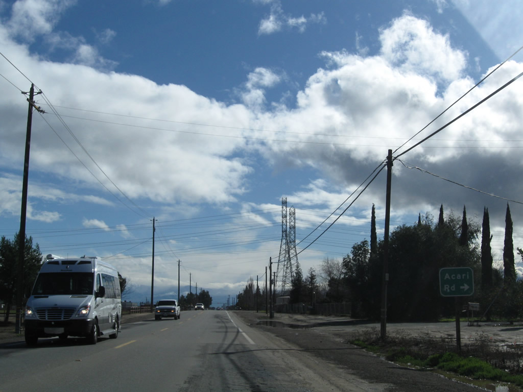
Southbound California 43 and eastbound California 58 approach Acari Road (next right). Photo taken 02/13/09. |
|
|
California 43 and California 58 pass under a set of Pacific Gas & Electric power lines, which travel from the Midway substation in Buttonwillow west to a power generation facility in Bakersfield. Photos taken 02/13/09. |
|
Southbound California 43 and eastbound California 58 split just a short distance south of the power line crossing. California 58 turns east toward Rosedale and Bakersfield, while California 43 proceeds south toward its junction with California 119 en route to Taft. Photo taken 02/13/09. |
|
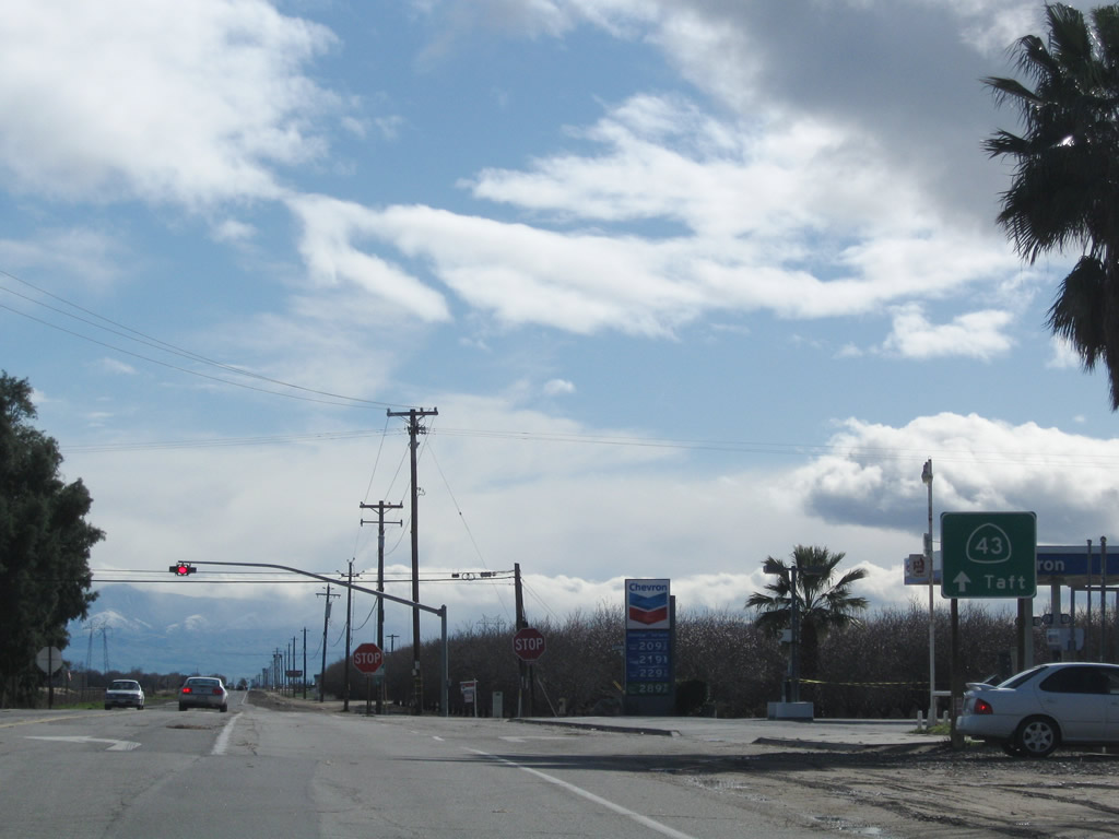
A second sign points the way for California 43 traffic to continue south toward Interstate 5 and Taft. Photo taken 02/13/09. |
|
An all-way stop governs the flow of traffic between California 43 south and California 58 east. Turn left here to continue west to Bakersfield. Photo taken 02/13/09. |
| California 58 east |
|
Leaving California 43 behind, eastbound California 58 joins Rosedale Highway for the remaining distance east to Bakersfield. Plans call for possible realignment of California 58 onto a proposed freeway connector between Interstate 5 and California 99 west of Bakersfield, but such construction is not imminent. Photo taken 02/13/09. |
|
California 58 travels along the Rosedale Highway, initially passing through farms, ranches and orchards before residential and commercial development takes over leading into metropolitan Bakersfield. Photo taken 02/13/09. |
|
Eastbound California 58 (Rosedale Highway) approaches Superior Road. Photo taken 02/13/09. |
|
Pink-white cherry blossoms on otherwise barren trees are the first signs of the upcoming spring season, while several other trees remain dormant during winter. Photo taken 02/13/09. |
|
Eastbound California 58 (Rosedale Highway) approaches Greeley Road. Photo taken 02/13/09. |
|
|
|
|
Seeing more development admist the agricultural lands west of Bakersfield, eastbound California 58 (Rosedale Highway) enters unincorporated Rosedale (population 8,445 as of the 2000 Census) and approaches several streets along its way: Stagecoach Street, Carriage Street, Nord Road, Wegis Avenue, Heath Road, Renfro Road, Jenkins Road, and Allen Road. Suburban development, including master planned housing tracts and retail areas, become more noticeable as the state route advances east. At Allen Road, California 58 widens to four lanes. Provisions are in place west of there for eventual roadway expansion. Photos taken 02/13/09. |
|
|
|
|
|
|
|
|
Continuing east, California 58 passes by Maher Way, Old Farm Road, Jewetta Avenue/Lone Oak Drive, Jewetta Avenue/Enger Street, La Crescenta Drive, and Verdugo Lane. A reassurance shield is posted on the bridge over the railroad. Photos taken 02/13/09. |
|
|
|
|
|
A bit further east (after the intersection with Calloway Drive), eastbound California 58 (Rosedale Highway) enters the city of Bakersfield. Located at the southern end of the San Joaquin (Central) Valley, Bakersfield is the seat of sprawling Kern County. Home to 247,057 people (as of the 2000 Census), Bakersfield sits at an elevation of 408 feet. Population grew substantially during the 2000s, and it is likely that the 2010 Census will reveal a substantially larger population. Like most communities in the San Joaquin Valley, Bakersfield receives much of its rain in winter, while summers are typically dry and hot. Total precipitation only amounts to around six and one-half inches, making the area semi-arid and only slightly wetter than the extensive Mojave Desert to the east. Anchoring an oil and agriculture foundation, the economy has also seen a boom due to housing construction in the early 2000s. California 58 will pass through the city, entering as a four-lane arterial (Rosedale Highway) and leaving as a freeway as it winds its way into the Tehachapi Mountains. Photo taken 02/13/09. |
|
|
|
|
A set of Pacific Gas & Electric power lines, which have paralleled California 58 to the north through Rosedale, turns south toward a power generation station on the south side of the state route. Photos taken 02/13/09. |
|
Eastbound California 58 meets Coffee Road at this traffic signal admist significant residential and commercial development. This area is also known as Fruitvale and is within the corporate limits of Bakersfield. Photo taken 02/13/09. |
|
Traffic cleared to offer this nice view of California 58 after the Jet Way traffic signal and intersection. Photo taken 02/13/09. |
|
Eastbound California 58 approaches Patton Way as storm clouds continue to dominate the skyline. Photo taken 02/13/09. |
|
The next traffic signal along California 58 east is with Fruitvale Avenue in the community of Fruitvale. The state route will cross over the Calloway Canal prior to meeting Fruitvale Avenue at the signal. Photo taken 02/13/09. |
|
|
|
California 58 east approaches Mohawk Street, Parker Lane, an at-grade railroad crossing, Landco Drive, Fairhaven Drive, and Gibson Street in western Bakersfield. In the distance ahead, after multiple traffic signals and much development, is the interchange with California 99. Photo taken 02/13/09. |
|
|
|
|
Eastbound California 58 approaches California 99. At this interchange, California 58 east will turn onto southbound California 99. This interchange also marks the western terminus of California 178, which travels through downtown Bakersfield into the Kern River Canyon en route to Lake Isabella. The next traffic signal (ahead) connects to Camino del Rio Court. Photo taken 02/13/09. |
|
The left three lanes continue east onto California 178/Rosedale Highway to downtown Bakersfield. This interchange also used to be the beginning of a business route for California 58 through Bakersfield leading to Edison Highway; signs for that route are no longer in place. The right two lanes connect to California 58 east and California 99 south. To California 99, turn left onto Buck Owens Parkway at the first traffic signal after the California 99 overpass. Photo taken 02/13/09. |
|
California 58 east departs Rosedale Highway and prepares to merge onto the California 99 freeway. Photo taken 02/13/09. |
Page Updated August 21, 2010.


 >
> 


