| California 58 east |
|
The interchange between U.S. 101 (El Camino Real) and California 58 is a trumpet interchange (Exit 211). Prior to the construction of the U.S. 101 freeway bypass of Santa Margarita between 1956-1962, U.S. 101 used to follow Old El Camino Real through downtown Santa Margarita, then continue north to Atascadero. This view shows the connection from southbound U.S. 101 to eastbound California 58. Note the old style guardrail on the connection ramp. Photo taken 07/05/06. |
|
Eastbound California 58 crosses over U.S. 101. The interchange is high-speed, even though the state highway is generally two lanes and lightly traveled for much of the distance from Santa Margarita east to McKittrick in the Central Valley in Kern County. Built in 1956, this overpass features concrete bridge rail common to bridges of that era. Photo taken 07/05/06. |
|
Still on the bridge, the curbing features divoted concrete and concrete paving. From here east to Santa Margarita, California 58 traces the route of original U.S. 101 (El Camino Real). Photo taken 07/05/06. |
|
Traffic from northbound U.S. 101 (El Camino Real) merges onto eastbound California 58. The state route remains two lanes. Photo taken 07/05/06. |
|
An end shield is posted for the westbound direction of California 58, and it can easily be seen while traveling eastbound California 58. Photo taken 07/05/06. |
|
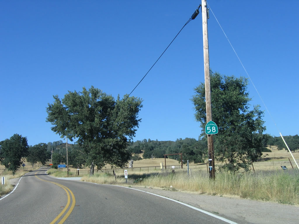
Although signed as if it were an exit, California 58 travels directly into downtown Santa Margarita, which is one mile east of this point. Note that California 58 parallels the Union Pacific Railroad corridor, but the state highway and railroad will part ways in Santa Margarita. The railroad will continue north toward the San Francisco Bay Area. Photo taken 07/05/06. |
|
Entering Santa Margarita, the speed limit on eastbound California 58 reduces to 45 miles per hour. The unincorporated community of Santa Margarita is located at the north end of Cuesta Pass along old U.S. 101. California 58 enters the community from the southwest, then leaves to the east. The estimated population of Santa Margarita is 1,340 people. Photo taken 07/05/06. |
|
Santa Margarita retains that small town charm. Some services are available ... and for those crossing La Panza Range, Carrizo Plain National Monument/California Valley, and Temblor Range, a visit to the gas station would be well-advised before leaving this area. It is a long way to McKittrick. Photo taken 07/05/06. |
|
Leaving downtown Santa Margarita, the state highway prepares to turn east. California 58 will enter some of the most sparsely populated areas of the Central Coast upon making this right turn onto Estrada Avenue. California 58 travels east to Santa Margarita Lake (eight miles), California Valley (50 miles), and McKittrick (72 miles). Continue straight ahead to follow Old U.S. 101 (El Camino Real) north to Atascadero and back to U.S. 101 north. Photo taken 07/05/06. |
|
As noted by the sign, trucks are not advised on California 58 east, mostly for the winding course the state highway takes over the La Panza Range and Temblor Range. Limited services are available on this section of state route, so be prepared while crossing on this lonely stretch of rural highway. From this point east to Bakersfield, California 58 follows old California 178, which had its designation changed in 1964 along with the other numbering changes. At that time, U.S. 466 (which follows portions of California 41, California 46, California 99, and California 58) was eliminated. Note however that California 58 from U.S. 101 to California 99 was never designated as U.S. 466. Only east of California 99 was California 58 aligned with old U.S. 466. Photo taken 07/05/06. |
| California 58 east |
|
After turning from El Camino Real, eastbound California 58 (Estrada Avenue) crosses the Union Pacific Railroad. On the right side of the highway is Santa Margarita Community Park. Photo taken 07/05/06. |
|
Through trucks are advised not to use California 58. Both California 46 and California 166 are better options since they are straighter and have fewer mountainous sections. Photo taken 07/05/06. |
|
After only four blocks, California 58 makes a sharp left turn from Estrada Avenue onto J Street/Calf Canyon Highway. Photo taken 07/05/06. |
|
A second mileage sign reaffirms the distance to Santa Margarita Lake and McKittrick as California 58 follows the Calf Canyon Highway east. Photo taken 07/05/06. |
|
Passing by a ranch house and barn, California 58 (Calf Canyon Highway) travels northeast until the intersection with California 229. A recreation sign advises that off-road activities are permitted in Los Padres National Forest. Photo taken 07/05/06. |
|
Eastbound California 58 crosses the Trout Creek bridge (1941) and prepares to split with Pozo Road. Follow Pozo Road southeast to Santa Margarita Lake County Park and Pozo Creek recreation areas. Continue east on California 58 to California Valley and McKittrick. Photo taken 07/05/06. |
|
A California 58 reassurance shield is posted shortly after the Pozo Road intersection. Photo taken 07/05/06. |
|
The next motorist services are not until Buttonwillow and the interchange with Interstate 5, which is some 82 miles east of here. Be sure to leave with a full gas tank. Photo taken 07/05/06. |
|
California 58 is a narrow highway, with limited shoulders and limited sight distance. Photo taken 07/05/06. |
|
Most of the traffic on California 58 is for ranch-to-market traffic. Here, California 58 east passes by a large ranch just before the Salinas River crossing. Photo taken 07/05/06. |
|
California 58 crosses the Salinas River on this 1996 bridge, which replaced an earlier bridge. The Salinas River flows north from its headwaters near Garcia Mountain and Machesna Mountain into Santa Margarita Lake, then follows a path parallel to U.S. 101 northwest through Atascadero, Paso Robles, King City, Soledad, and Salinas before emptying into the Pacific Ocean between Marina and Castroville. As the river flows further north, it spreads a wide and fertile valley that has been used for farming for generations. Photo taken 07/05/06. |
|
Eastbound California 58 approaches Park Hill Road, which travels southeast to Pozo as an alternate to Pozo Road. Photo taken 07/05/06. |
|
The road again narrows after Park Hill Road. California 58 passes through miles of undeveloped grasslands and brush as it combs its way east. Photo taken 07/05/06. |
|
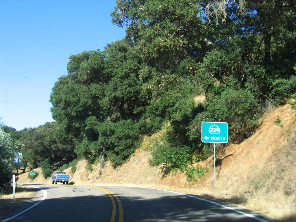
Eastbound California 58 approaches California 229 north to Creston. This short state route connects California 58 with California 41 near Creston. The state route is notable for its one and a half lane configuration. Motorists must be cautious of oncoming traffic as a result. Photo taken 07/05/06. |
|
A second advance guide sign for California 229 north is posted shortly thereafter. Photo taken 07/05/06. |
|
At the split between California 58 and California 229, aim left to Creston (eight miles) and Shandon (23 miles). California 229 north ends at California 41, which in turn travels northeast to Shandon. To California Valley and McKittrick, follow California 58 east by turning right ahead. Note that there is a stop sign governing westbound California 58 traffic, which may suggest that one-and-a half-lane California 229 may get more traffic than California 58? Or perhaps it is due to the limited sight distance at this interchange? Either way, it is rather unexpected to see this configuration! Photo taken 07/05/06. |
|
After the California 229 intersection, a California 58 east reassurance shield is posted. From here, California 58 continues its lonely journey along the Calf Canyon Highway east over the La Panza Range and into California Valley. Photo taken 07/05/06. |
|
Small stone walls line both sides of California 58 after the California 229 intersection, perhaps in lieu of metal guardrails. Photo taken 07/05/06. |
|
|
|
California 58 (Calf Canyon Highway) traverses some of the most isolated terrain in the Central Coast as the highway proceeds over the La Panza Range. These photos follow eastbound California 58 between the junction with California 229 and the Middle Branch of Huer Huero Creek, a distance of about three miles. Photos taken 07/05/06. |
|
|
|
|
Eastbound California 58 (Calf Canyon Highway) crosses the Middle Branch of the Huer Huero Creek on this 1951 bridge. Date stamps are imprinted into the curb of the bridge. Photo taken 07/05/06. |
|
|
|
This suite of photos shows eastbound California 58 (Calf Canyon Highway) between the Middle Branch of Huer Huero Creek and the intersection with La Panza Road. A single reassurance shield for the state highway is posted along the way. Photos taken 07/05/06. |
|
|
|
|
Eastbound California 58 (Calf Canyon Highway) passes by the Calf Canyon Winery. A few wineries are located along California 58, but not nearly as many as can be found on California 46 east of Paso Robles. Photo taken 07/05/06. |
|
Continuing east, California 58 (Calf Canyon Highway) meets La Panza Road, which travels northwest to Huer Huero and California 41 near Creston. Photo taken 07/05/06. |
|
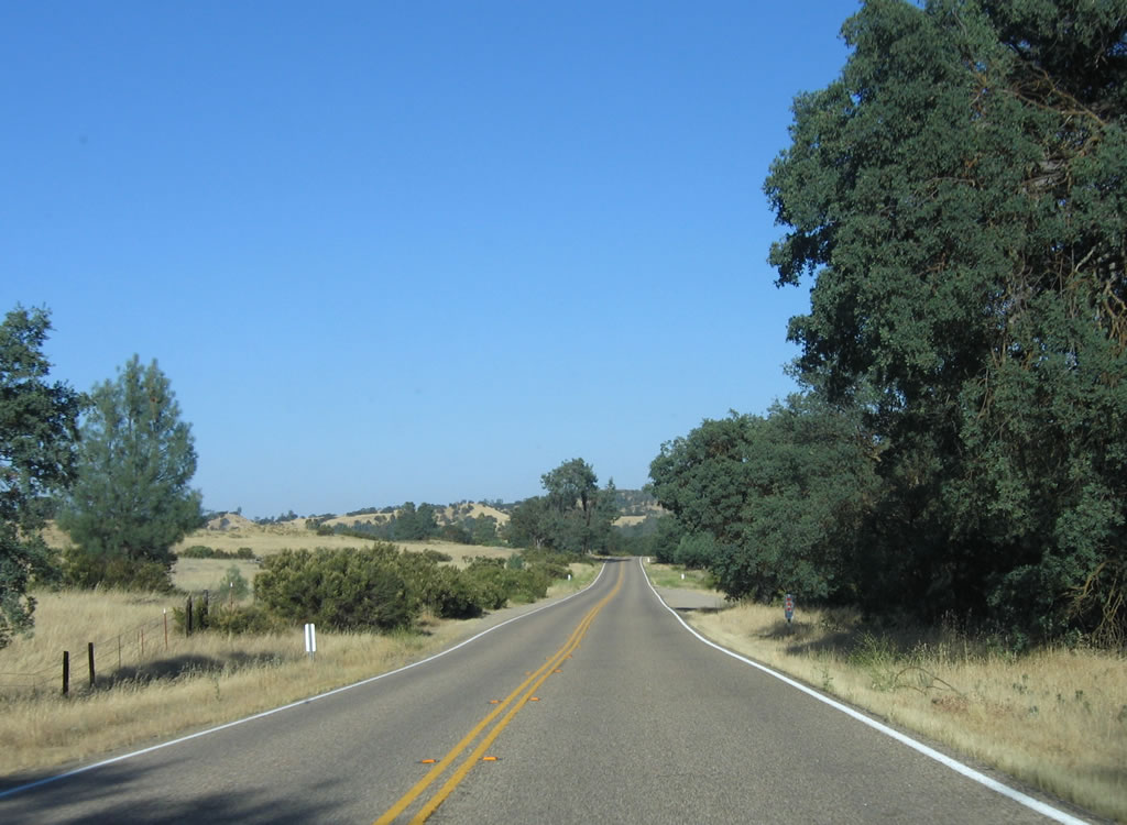
Very limited traffic uses California 58 through Calf Canyon to California Valley. Photo taken 07/05/06. |
|
Sweeping vistas such as this one are common along California 58 ... and the views are remarkably free of development and traffic. Photo taken 07/05/06. |
|
Eastbound California 58 (Calf Canyon Highway) approaches Shell Creek Road, which travels north through Camatta Canyon to meet California 41 and California 46 in Shandon. To all points north via California 41 (Fresno) and east via California 46 (former U.S. 466), turn left here. Photo taken 07/05/06. |
|
At the Shell Creek Road intersection, California 58 changes names from Calf Canyon Highway to Carrisa Highway. It will retain this name east to McKittrick and California 33. Photo taken 07/05/06. |
|
Eastbound California 58 (Carrisa Highway) enters the vicinity of Camatta Ranch. Photo taken 07/05/06. |
|
Near Bethel Ranch and southeast of Camatta Ranch, eastbound California 58 (Carrisa Highway) meets Red Hill Road, a ranch-to-market road. Photo taken 07/05/06. |
|
Oak trees line California 58 (Carrisa Highway) as the rural highway continues east. Photo taken 07/05/06. |
|
A California 58 reassurance shield is posted on eastbound Carrisa Highway. Photo taken 07/05/06. |
|
|
|
Eastbound California 58 (Carrisa Highway) closely follows and crosses Navajo Creek, then turns southeast toward La Panza Ranch. Photos taken 07/05/06. |
|
Now approaching the La Panza Ranch, California 58 (Carrisa Highway) continues to pass through some of the most scenic and isolated territory in Central California. Photo taken 07/05/06. |
|
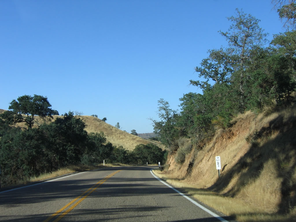
Only grasses and no oak trees line this stretch of California 58 (Carrisa Highway). Photo taken 07/05/06. |
|
A vineyard sits on the south side of California 58 (Carrisa Highway) as a power transmission line crosses overhead. The vineyard and orchards are part of La Panza Ranch. Photo taken 07/05/06. |
|
Eastbound California 58 (Carrisa Highway) approaches Pozo Road and the turn off from La Panza Ranch. No motorist services are available here. A reassurance shield is visible in the distance, after the Pozo Road intersection. Pozo Road travels west to the community of Pozo and and Santa Margarita Lake via La Panza Summit and Pozo Summit via a partially unpaved roadway. Ultimately, westbound Pozo Road rejoins California 58 just east of Santa Margarita. Photo taken 07/05/06. |
|
The aforementioned power line will follow California 58 (Carrisa Highway) briefly from La Panza Ranch east to near the Bitterwater Road in Carrizo Plain National Monument. Photo taken 07/05/06. |
|
|
Approaching San Juan Creek, eastbound California 58 (Carrisa Highway) twists a bit before crossing on a 1985 bridge. Photos taken 07/05/06. |
|
California 58 climbs over the final foothills of the La Panza Range before entering Carrizo Plain and approaching the communities of California Valley and Simmler. Photo taken 07/05/06. |
|
A Pacific Gas and Electric (PG&E) 230-kV power transmission line crosses over California 58. This line crosses the Carrizo Plain, transmitting power between the Central Coast generation facilities at Morro Bay and the Diablo Canyon Nuclear Generating Facility with the Central Valley. Photo taken 07/05/06. |
|
Both sets of power lines briefly follow California 58 as we enter Carrizo Plain and approach the community of California Valley. Photo taken 07/05/06. |
|
The vast California Valley and Carrizo Plain National Monument spreads out in front of us as California 58 (Carrisa Highway) leaves La Panza Range behind. Photo taken 07/05/06. |
|
Another California 58 reassurance shield is posted under some trees as the Carrisa Highway straightens out. Photo taken 07/05/06. |
|
Some ranches, homes, and other development are found along California 58 as the state highway crosses Carrizo Plain. The Temblor Range, which separates California Valley from the vast Central Valley, comes into view in the distance. Photo taken 07/05/06. |
|
Don't go too fast ... there are a couple of very sharp turns on California 58, including this one located near the site of the Carrizo Solar Power Plant (not in operation). California 58 briefly turns south here, then will turn east again at Carrizo Plains School. Photo taken 07/05/06. |
|
Now traveling due south, Hubbard Hill and Freeborn Mountain come into view. Formed by the San Andreas Fault, Carrizo Plain is only one hundred miles north of Los Angeles ... but there is no direct road from there to here. Soda Dry Lake, a glistening bed of white salt, can be seen by taking a brief detour south on Soda Lake Road near California Valley. From the air, certain portions of the San Andreas Fault itself can be seen, as it created valleys and ridges through this corridor that parallel the faultline as it traverses the state of California northwest toward the San Francisco Bay Area. Photo taken 07/05/06. |
|
California 58 again makes a sharp turn, this time curving to the east toward California Valley. The Carrizo Plains School is located to the north of the state route. Photo taken 07/05/06. |
|
Still no traffic! Eastbound California 58 (Carrisa Highway) continues east through the Carrizo Plain National Monument and approaches the turn off to California Valley. Photo taken 07/05/06. |
|
Eastbound California 58 (Carrisa Highway) approaches Soda Lake Road. Turn south on Soda Lake Road to California Valley (no services), Soda Dry Lake, and Carrizo Plain National Monument. President William Jefferson Clinton established the national monument on January 17, 2001, and most of the visitor facilities (such as camping) are located south of California 58 on Soda Lake Road. This national monument is managed by the federal Bureau of Land Management, not the National Park Service. Photo taken 07/05/06. |
|
A mileage sign on eastbound California 58 provides the distance to California Valley and Soda Dry Lake via southbound Soda Lake Road. No services are available in California Valley; continue east on California 58 to McKittrick. Photo taken 07/05/06. |
|
After the Soda Lake Road intersection, a few ranches line either side of California 58 (hence the trees in the distance) at the small community of Simmler (which consists of a few homes/ranches). However, no services are available. Photo taken 07/05/06. |
|
Eastbound California 58 (Carrisa Highway) crosses the rest of the Carrizo Plain. There is still no traffic on this road; the Temblor Range looms closer in view. Photo taken 07/05/06. |
|
The state route rolls with the landscape as it continues east toward the Temblor Range. Photo taken 07/05/06. |
|
|
Views such as these are common along eastbound California 58 (Carrisa Highway) as we approach the Temblor Range. For all these miles of road, not a car can be seen in any direction. This is truly California's Loneliest Road. Photos taken 07/05/06. |
|
|
Curving a bit to the southeast and then to the east, California 58 finds the best route to ascend the Temblor Range. Photos taken 07/05/06. |
|
|
California 58 east approaches the foothills of Temblor Range. The highway will leave an elevation of 1,970 feet at California Valley to the summit at 3,250 feet, then descend slowly into the Central Valley to McKittrick at elevation 1,051 feet. Upon reaching Buttonwillow and Interstate 5, California 58 will be at 269 feet. Photos taken 07/05/06. |
|
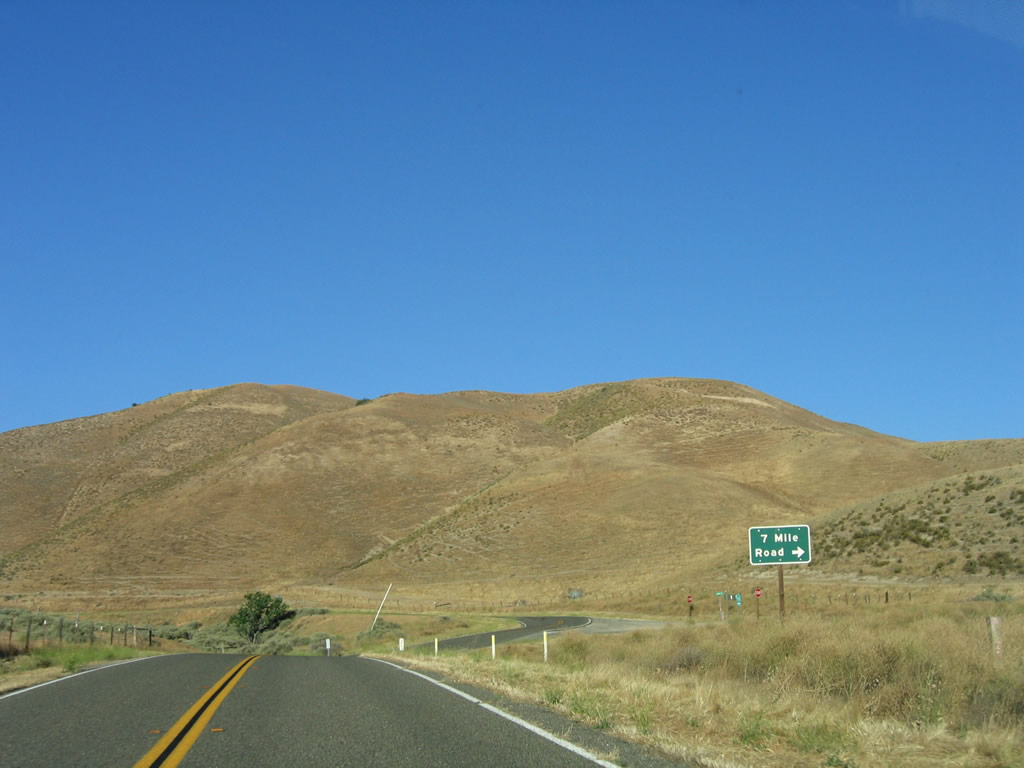
Eastbound California 58 (Carrisa Highway) meets Seven Mile Road, which travels southwest to Carrizo Plain National Monument, California Valley, and Soda Dry Lake via a connection with Soda Lake Road. Turn south here to follow Seven Mile Road to Elkhorn Road and Simmler Road south. Photo taken 07/05/06. |
|
|
|
|
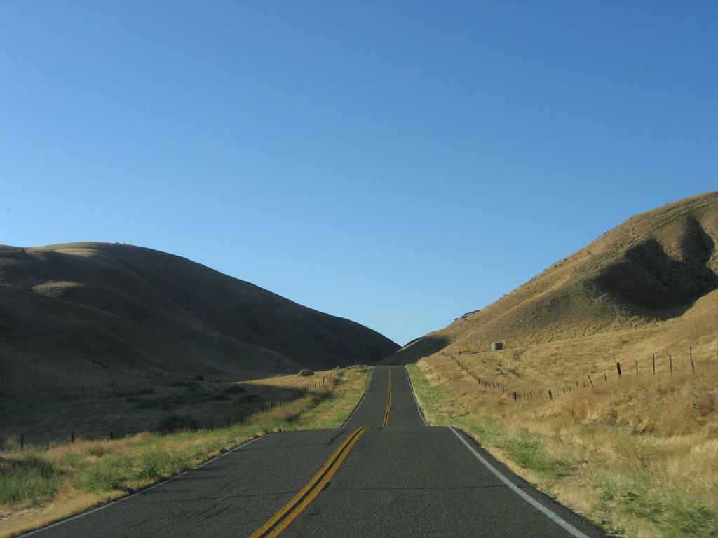
Ascending the Temblor Range, California 58 snakes its way through a fairly narrow canyon as it approaches the summit. Photo taken 07/05/06. |
|
Prior to reaching the summit, eastbound California 58 (Carrisa Highway) leaves San Luis Obispo County and enters Kern County. The most harrowing stretch of this journey across this section of isolated Central California -- the reason why trucks are not advised on this route -- is still to come. Note the pavement changes at the county line. Photo taken 07/05/06. |
Page Updated October 25, 2007.