
When I saw that Computer Cartography was my next class in the UWF GIS Certificate Program, I got pretty excited. Cartography has been an interest of mine going well back to childhood. When my siblings got a sketch pad to draw art, mine instead was used to draw maps. This passion stayed with me into high school and then college, where I would often doodle a small map in the margin of my notes. When I took AutoCAD at Delaware Technical & Community College, one of my first drawings was a fictional road map. You get the idea!
I first learned of Geographic Information Systems (GIS) in 1997, and with some encouragement, enrolled in the University of Delaware’s GIS class (GEOG 372) when I transferred to UD from DelTech that Fall semester. The following Spring semester, I took Advanced Geographic Information Systems (GEOG 472), where we used both ArcMap and ArcInfo in lab. I posted two examples of our GIS work from back then on a previous blog post. My professor Tracy DeLiberty encouraged me to further pursue GIS, but my career aspirations at the time were meteorology, and I eventually transferred to the University of South Alabama (USA) to pursue that and did not work with GIS again until 2006.
I landed my first job in mapping at Mapsource, Inc. out of St. Petersburg, Florida, where I eventually was promoted to Assistant Chief Cartographer. The boss/owner was Gene Ingle, an old school cartographer who originally worked in the newspaper industry. I learned quite a lot from Gene, and one of the things he instilled in me were standards in cartography.
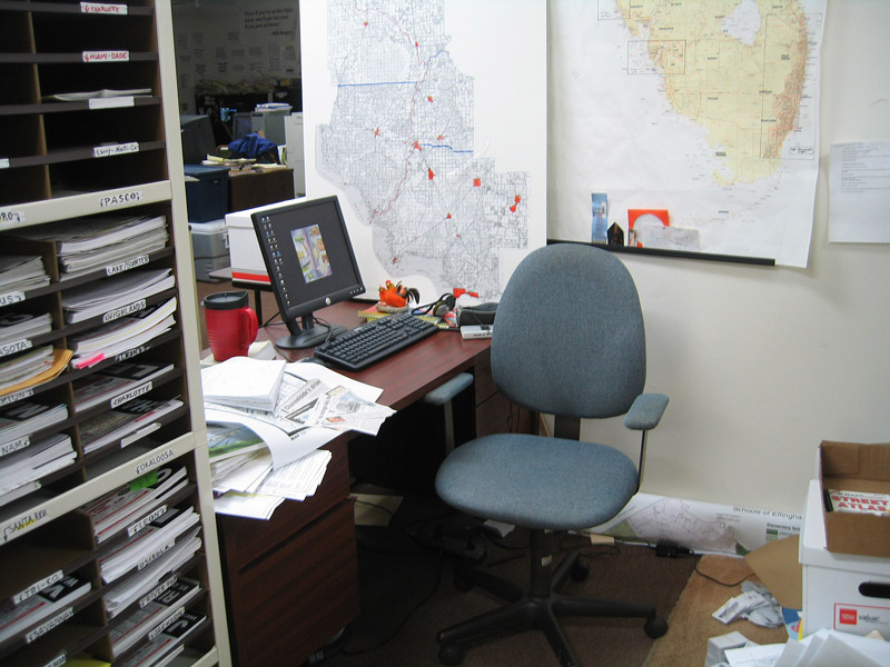
Justin’s station at Mapsource
Gene had an ironclad set of rules for the creation of our maps, which were all based in AutoCAD. Having this rule set took out some of the guesswork on how or where to place map elements, text orientation along features, acceptable abbreviations, what font type to use, appropriate text sizes, etc. To this day, I still incorporate many of these principles.
Sadly, I learned of Gene Ingle’s passing in 2018. He was 76 when I worked for him.
My career in cartography continued beyond Mapsource with a job as a map researcher for Universal Map Group out of DeLand, Florida. There I was tasked with updating existing map products with the use of GIS (ArcMap). I created Geodatabases with a variety of map updates from changes or additions to streets, city limits, points of interests and parks among other map elements.
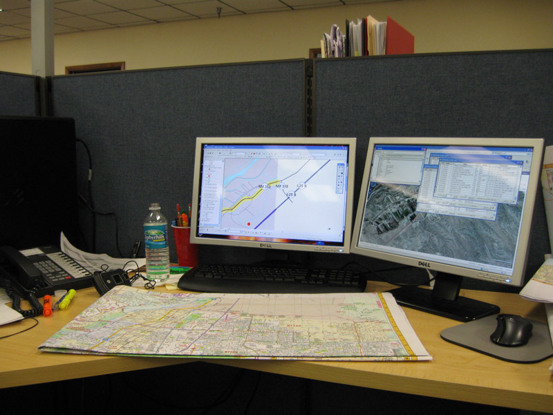
My station at Universal Map
First learned of the University of West Florida’s GIS Certificate program back when I started working for Geographic Information Systems Cartography & Publishing Services (GISCAP) as a mapping specialist. Last year when I was considering my future career goals, I had an epiphany and recalled the UWF GIS program.
Having been removed from regularly working with GIS for several years, I sought to both renew my skillset and also broaden it. As I’ve seen through my wife’s GIS work with the Florida Department of Transportation (FDOT), there is a lot more to GIS than just the creation of maps. Thus far the Introduction to GIS class and Remote Sensing and Photo Interpretation class have shown me just that.
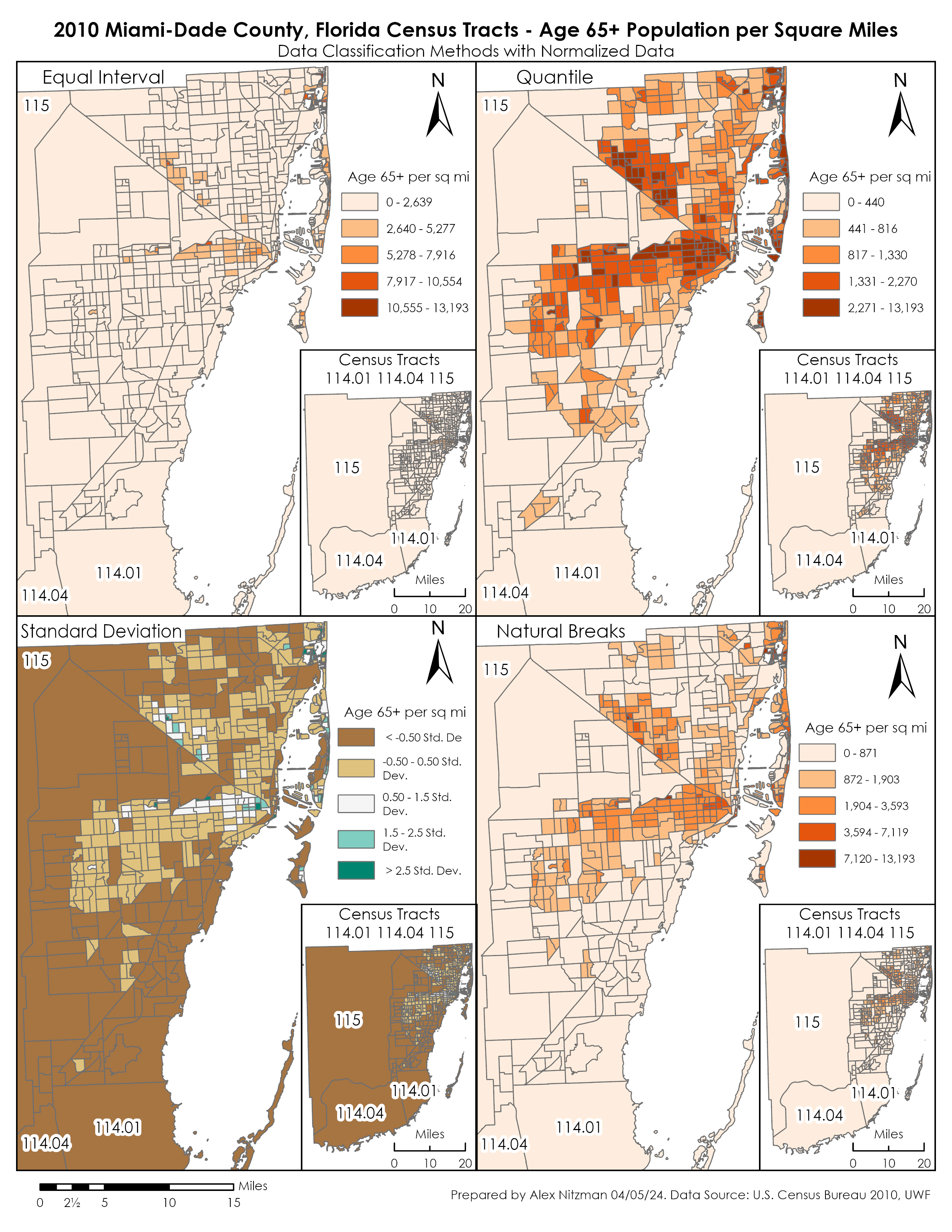
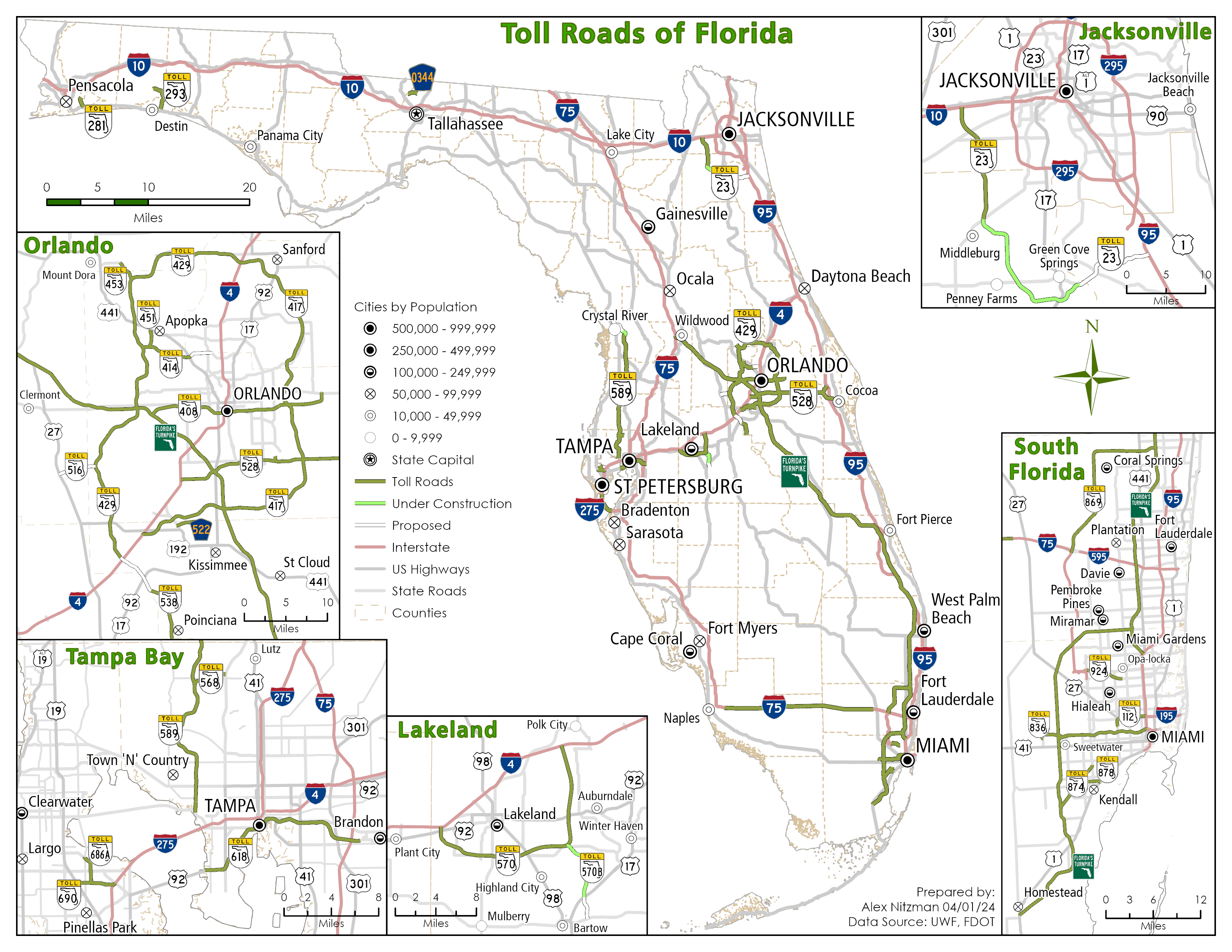
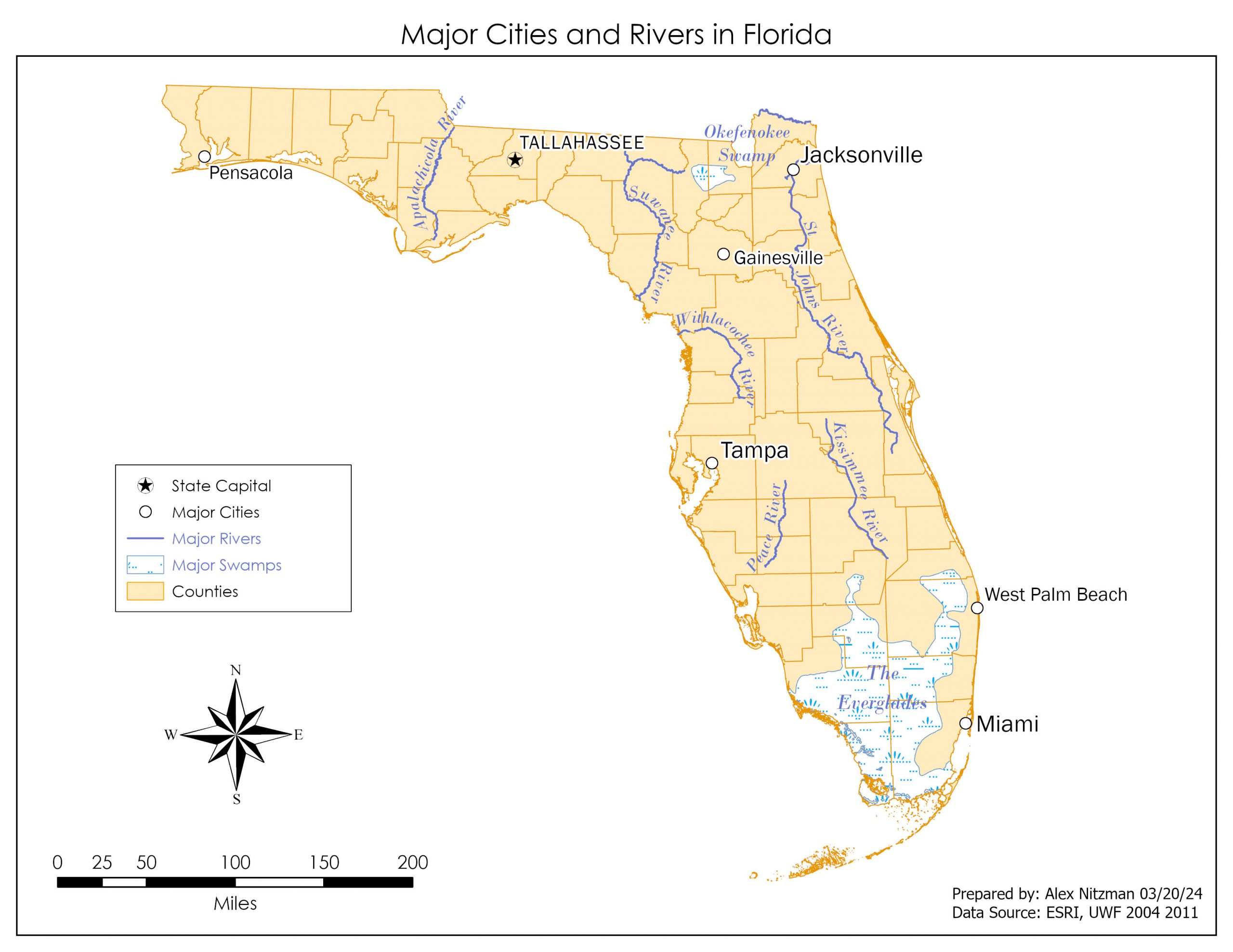
Our first assignment for Computer Cartography was to create a StoryMap. I have some familiarity with the concept of StoryMaps thanks to my wife, but prior to this past week, I had never attempted to create one myself.
Creating the StoryMap is very similar to compiling a blog post with a content management system (CMS) such as WordPress. There are widgets, style options, several ways to embed media, and of course multiple map tour options. For my first first StoryMap, I opted to create a short photo tour of the Interstate Highway System using photos I shot and posted on AARoads.com as the media. It can be viewed at https://storymaps.arcgis.com/stories/863cdd9091cc4d2d830d5ff4b7d520bb
Going forward, I am hoping to land a position as a GIS Analyst, ideally in something transportation related. Working with others and being part of a team are things I’ve missed with running a business solo for so long. I’ve received a lot of encouragement from folks I know at FDOT, and perhaps I can join them on a professional level in the future.
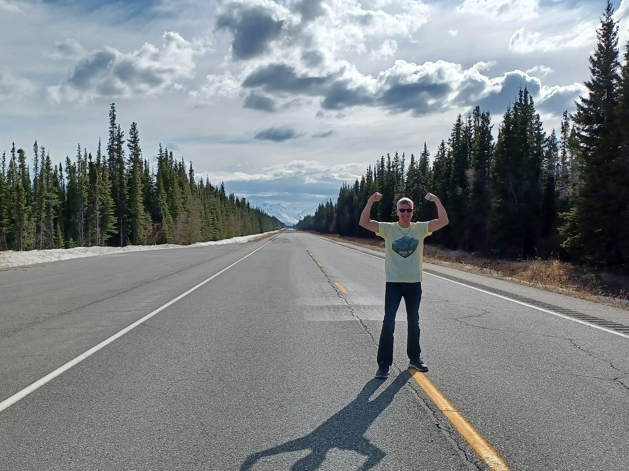
Celebrating my 50th State at Tok, Alaska!
Besides taking GIS classes, I enjoy traveling, working out at the gym, riding coasters at theme parks, playing video games and binging Anime with my wife.
Leave A Comment