
Utah State Route 9
Utah 9 is an east-west state route that connects Interstate 15 near St. George and Washington with U.S. 89 at Mount Carmel via Zion National Park. It is one of Utah's most scenic drives.
| Utah 9 west | |
|---|---|
 |
It costs $20 to enter Zion National Park (per vehicle), so this sign advises motorists that they will have to pay to enter the park. It is a very expensive through route to St. George from Mount Carmel. Photo taken 10/25/03. |
 |
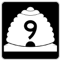
This is the first shield along westbound Utah 9 as it leaves Mount Carmel. Photo taken 10/25/03. |
 |
Mileage sign along westbound for Springdale and St. George. The east entrance, main visitors center, and various attractions in Zion National Park are omitted. Photo taken 10/25/03. |
 |
This is the last shield along westbound Utah 9 before entering Zion National Park. Photo taken 10/25/03. |
 |
Utah 9 comes to its route break here, as the highway enters Zion National Park. This is the last chance to turn around before paying the $20 park entry fee per vehicle. Photo taken 10/25/03. |
 |
 |
 |
 |
| Upon entering Zion National Park, Utah 9 changes into the Zion-Mount Carmel Highway. Since the Utah Department of Transportation does not maintain the section of highway within the park, Utah 9 technically has a route break through the park. However, for continuity we'll continue to refer to the route as Utah 9. At least here the routing is the same at both ends of the park; it is much more complicated in Yellowstone National Park, with seven U.S. routes coming from various directions, and three of them not resuming on the other side. Utah 9, meanwhile, passes through a few sandstone rock formations before it reaches Zion Valley. Photos taken 10/25/03. | |||
 |
Utah 9 retains its narrow sense as it passes by this cliff in Zion. Photo taken 10/25/03. |
 |
The first tunnel in Zion along westbound is a teaser compared to the main tunnel that passes under Bridge Mountain. At least with this tunnel, motorists can see end to end without difficulty. The same cannot be said for the curving Zion-Mount Carmel Tunnel. Photo taken 10/25/03. |
 |
The Zion-Mount Carmel Highway (Utah 9) approaches Bridge Mountain, under which the highway will pass to reach the Zion Narrows. Photo taken 10/25/03. |
 |
The warning sign on this guard station should be heeded. The tunnel interior is very dark, and it is over a mile in length. A bright sunny day contrasts poorly with the dark interior. Photo taken 10/25/03. |
 |
The Zion-Mount Carmel Tunnel, which passes under Bridge Mountain, was constructed in the 1920s, and it was designed with no interior lights, occasional glimpses to the valley below through open vents, and a small size since it was designed to accommodate small vehicles from another era. Vehicles sized 7'10" in width or 11'4" in height, or larger, must have an escort through the Zion-Mount Carmel Tunnel. Photo taken 10/25/03. |
 |
 |
 |
 |
 |
After exiting the Zion-Mount Carmel Tunnel, Utah 9 winds its way to the floor of the valley, passing by some magnificent vistas of the rock formations that line the surrounding mountains. At the bottom of the multiple switchbacks that carry Utah 9 down from the tunnel, the highway straightens out as it reaches the primary visitors center. The visitors center provides the primary parking area to explore the main attraction of Zion National Park, which is walking the Virgin River Narrows. Tour buses depart on a regular schedule during the tourist season (usually April through October) to mitigate traffic through the Narrows. Plenty of hiking opportunities are available at the various stops along the route of the tour buses. Photos taken 10/25/03. | ||
 |
 |
 |
 |
 |
 |
The last tour bus stop (and the point furthest away from the visitors center) is the hiking trail leading into the Zion Narrows from the Temple of Sinawawa. This path shows the narrow canyon that contains just enough room to squeeze a footpath alongside the river. During floods, this entire canyon can flood. Photo taken 10/25/03. |
Page Updated May 28, 2012.
|
About Contact FAQ |
Spotlights Testimonials Interstate Guide |
Social Media:
 |
|
© 2000-23 AARoads.com | All Rights Reserved | Privacy Policy / Terms of Use
|
||