| Interstate 80 west |
|---|
|
After the central Wendover interchange (Exit 1, Aria Boulevard), Interstate 80 crosses the Utah-Nevada State Line and enters Elko County and the city of West Wendover (population was 4,721 as of the 2000 Census; incorporated on July 1, 1991; and has an approximate elevation of 4,462 feet above sea level). Photo taken 05/16/12 by Steve Hanudel and Erik Slotboom. |
|
Sprawling Elko County, which includes the northeastern corner of the Silver State of Nevada, was founded on March 5, 1869, and represents the fourth largest county in the United States. The first exit along Interstate 80 in Nevada will be Exit 410, U.S. 93 Alternate south to Ely and Business Loop I-80/Wendover Boulevard east to West Wendover. Photo taken 09/08/05. |
|
|
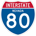
A neutered Interstate 80 westbound reassurance shield (with no state name) is the first of many found within the Silver State. About half of the route markers along Interstate 80 will have the state name, while the others will not. Photos taken 05/16/12 by Steve Hanudel and Erik Slotboom and 09/08/05 by AARoads. |
|
Use Exit 410 into Wendover for the Nevada tourist information center and rest area. The services (gas, food, lodging) found along Wendover Boulevard (Business Loop I-80 and former Nevada 224) are among the last encountered along Interstate 80 until the freeway connects to Wells, a distance of 58 miles. Photo taken 09/08/05. |
|
|
Westbound Interstate 80 reaches Exit 410, U.S. 93 Alternate south to Ely and Business Loop I-80 east to West Wendover. U.S. 93 Alternate departs the freeway together with Business Loop I-80 east into West Wendover, then immediately separate, with the business route turning onto Old U.S. 40/Wendover Boulevard into West Wendover and eventually into Wendover, Utah. Meanwhile, U.S. 93 Alternate (Former U.S. 50 Alternate) avoids downtown West Wendover and instead heads southward 118 miles toward Ely. Photos taken 05/16/12 by Steve Hanudel and Erik Slotboom and 09/08/05 by AARoads. |
|
Descending from Interstate 80 west onto the Exit 410 off-ramp, a Business Loop I-80 east and U.S. 93 Alternate south shield assembly directs motorists onto the connector between the Interstate 80 diamond interchange and Wendover Boulevard. Photo taken 09/08/05. |
| Interstate 80 west and U.S. 93 Alternate north |
|---|
|
Continuing west of Wendover along the Interstate 80 and U.S. 93 Alternate overlap, the two routes will share pavement from West Wendover all the way to Wells (Exit 352). Photo taken 09/08/05. |
|
An Interstate 80 westbound mileage sign and another sign to remind motorists of the lack of services ahead are both posted after the Exit 410 interchange. Motorists may double back to West Wendover via Exit 407 to return to West Wendover for gas, food, and lodging. Photo taken 09/08/05. |
|
|
Interstate 80 draws closer to the Toana Range west of Wendover. To the south is the western extant of the Bonneville Salt Flats and the northern reaches of the Goshute Mountains. Photos taken 09/08/05. |
|
Old U.S. 40 (Wendover Boulevard) ties into Interstate 80 and U.S. 93 Alternate three miles west of West Wendover at Ola (Exit 407). Photo taken 09/08/05. |
|
Westbound Interstate 80 and northbound U.S. 93 Alternate meets Exit 407, Wendover Boulevard to Ola. This diamond interchange is located well west of the outskirts of West Wendover. A pair of frontage roads travel alongside Interstate 80 within the vicinity of this interchange. Photo taken 09/08/05. |
|
|
Interstate 80 west and U.S. 93 Alternate north progress toward the Toano Range between Wendover and Oasis. The freeway enters Pacific Time Zone outside of West Wendover. The time zone originally skirted the Utah and Nevada state line. However, this was changed to allow Wendover and West Wendover to be in the same time zone, officials successfully petitioned to have the time zone relocated west into Nevada in October 1999. Photos taken 09/08/05. |
|
|
|
Pilot Peak (elevation 10,716 feet above sea level) dominates the northern horizon along Interstate 80 and U.S. 93 Alternate between West Wendover and the Toano Range. Photo taken 09/08/05. |
|
Pilot Road travels 15 miles northward from Interstate 80 and U.S. 93 Alternate at Exit 398 to Pilot Peak Mountain. Photo taken 09/08/05. |
|
A "Bridges may be icy" sign is posted on Interstate 80 west and U.S. 93 Alternate north. These types of signs are common in Northern Nevada and are used in place of the standard "Bridges Ice Before Roadway" signs found throughout the rest of the United States. The Nevada style signs list a stretch of road with at least two or more bridges. Photo taken 09/08/05. |
|
Westbound Interstate 80 and northbound U.S. 93 Alternate meet Exit 398, Pilot Road (a diamond interchange). Pilot Road begins at the interchange and travels 30 miles north to connect with Nevada 233 near Montello. Photo taken 09/08/05. |
|
|
Here we see northward facing views of Pilot Peak again and a salt flat nestled in between mountains of the Toano Range. Photos taken 09/08/05. |
|
|
|
Interstate 80 and U.S. 93 Alternate rise to an elevation of 5,940 feet above sea level through Silver Zone Pass. The climb across the Toano Range may require snow chains in inclement winter weather. A small advisory sign indicates whether or not chains are needed for the pass after Exit 398. Note that a neutered shield was changed to a state-named shield after the Pilot Road interchange. Photos taken 05/16/12 by Steve Hanudel and Erik Slotboom and 09/08/05 by AARoads. |
|
|
|
|
|
|
Interstate 80 and U.S. 93 Alternate leave Silver Zone Pass and approach the settlement of Shafter (Exit 387). The freeway leaves the Toano Range behind for the Goshute Valley. Photos taken 05/16/12 by Steve Hanudel and Erik Slotboom and 09/08/05 by AARoads. |
|
Westbound Interstate 80 and northbound U.S. 93 Alternate meet Exit 387, Shafter Road at this diamond interchange. Shafter itself lies 8.4 miles to the southwest at the crossroads of the Union Pacific and Nevada Northern Railroad lines. Photo taken 09/08/05. |
|
|
The wide open Goshute Valley brings great views for travelers along Interstate 80 west and U.S. 93 Alternate north. The Pequop Mountains rise along the western frontier. Photos taken 09/08/05. |
|
|
|
SR 233 begins toward Montello from the diamond interchange (Exit 378) with Interstate 80 and U.S. 93 Alternate at Oasis. The state route ends at the Nevada-Utah State Line, where it directly transitions onto eastbound Utah 30 en route to Interstate 84. The entire distance of Nevada 233 is 34.145 miles. Photo taken 09/08/05. |
|
|
Westbound Interstate 80 meets Exit 378, Nevada 233/Montello Road (former Nevada 30) on Interstate 80 and U.S. 93 Alternate. Nevada 233 connects to Montello, which is located 19 miles northeast of here. Local roads, including an eastbound side frontage road, tie into Exit 378 from the south. Photos taken 05/16/12 by Steve Hanudel and Erik Slotboom and 09/08/05 by AARoads. |
|
|
Leaving the community of Oasis on Interstate 80 west and U.S. 93 Alternate, the freeway begins another climb toward Pequop Summit (elevation 6,967 feet above sea level). Photos taken 05/16/12 by Steve Hanudel and Erik Slotboom and 09/08/05 by AARoads. |
|
|
The next exit along Interstate 80 and U.S. 93 Alternate west is Exit 376, Pequop Road. The aforementioned frontage road from Oasis also travels westward to Pequop nearby. Photos taken 09/08/05. |
|
Westbound Interstate 80 and northbound U.S. 93 Alternate meet Exit 376, Pequop Road in Pequop at this partial cloverleaf interchange. Photo taken 09/08/05. |
|
|
Continuing the ascent across the Pequop Mountains between Pequop and Summit (Exit 373). Photos taken 09/08/05. |
|
|
Westbound Interstate 80 and northbound U.S. 93 Alternate meet Exit 373, Rest Area at the Summit of the Pequop Mountains. The next such facility lies 114 miles away between Exits 271 and 261. Photos taken 09/08/05. |
|
|
|
|
|
| Interstate 80 and U.S. 93 Alternate westbound travelers encounter several twists and turns on the descent from Pequop Summit into Independence Valley. The Wood Hills rise to the southwest of the freeway. Note that triple trailer trucks, such as the one depicted in this series of pictures, are legal in Nevada if within appropriate weight ranges. Photos taken 05/16/12 by Steve Hanudel and Erik Slotboom and 09/08/05 by AARoads. |
|
|
|
|
|
|
The next interchange along Interstate 80 west and U.S. 93 Alternate north is Exit 365, Independence Valley. This exit of Interstate 80 and U.S. 93 Alternate serves a local prison. Adjacent frontage roads (including old U.S. 40) meet the freeway at Exit 365. Photo taken 09/08/05. |
|
Westbound Interstate 80 and northbound U.S. 93 Alternate meet Exit 365, Independence Valley. A frontage road continues along Interstate 80 westward to Exit 360. Photo taken 09/08/05. |
|
As of 2005, the first westbound Interstate 80 Nevada shield resided just beyond the Exit 365 on-ramp at Independence Valley. Note the omission of U.S. 93 Alternate; this route designation generally disappears from most shield assemblies on Interstate 80 west as the freeway draws closer to Wells. Photo taken 09/08/05. |
|
Exit 360 serves ranch areas near the vicinity of Moor Summit on Interstate 80 and U.S. 93 Alternate. Photo taken 09/08/05. |
|
Westbound Interstate 80 and northbound U.S. 93 Alternate meet Exit 360, Moor Road. This exit connects to several local and frontage roads that fan outward from the junction within the Wood Hills. None of these are recommended for through travelers. Photo taken 09/08/05. |
|
Looking northward from Moor Summit at more of the Wood Hills. The Union Pacific Railroad line parallels Interstate 80 closely from Moor westward to Winnemucca and Lovelock. Photo taken 09/08/05. |
|
Westbound Interstate 80 and northbound U.S. 93 Alternate approach the town of Wells, which began its life as an outpost along the Central Pacific Railroad in 1869. The town name is derived from the Humboldt Wells, small ponds of water and wetlands used to replenish 1800s travelers and wagon trains. Photo taken 09/08/05. |
|
At the next interchange (Exit 352B), U.S. 93 will reclaim U.S. 93 Alternate at Exit 352A of Interstate 80 westbound. U.S. 93 (Great Basin Highway) enters the scene from Lages Station 78 miles to the southeast. The U.S. highway skirts along the eastern outskirts of Wells. Photo taken 09/08/05. |
|
One mile east of the Exit 352B off-ramp for Business Loop I-80/Sixth Street west to U.S. 93/Great Basin Highway north on Interstate 80 west and U.S. 93 Alternate north. U.S. 93 serves Harriet Field to the northeast. Photo taken 09/08/05. |
|
The one-half mile guide sign for the Exit 352B off-ramp to Business Loop I-80 westbound. Exit 352B consists of a westbound only ramp onto the adjacent 6th Street (old U.S. 40). Sixth Street (Business Loop I-80) proceeds westward to the intersection with U.S. 93 and Nevada 223. Nevada 223 follows 6th Street for 1.989 miles between the Great Basin Highway to the West Wells interchange of Interstate 80 (Exit 351). Photo taken 09/08/05. |
|
Exit 352 recreation and Business Loop I-80 signs are posted next before Interstate 80 west meets Exit 352B. Use U.S. 93 south to U.S. 6-50 east for Baker and Great Basin National Park. The park entrance via Nevada 488 lies 199 miles to the southeast. The Emigrant Trail Center takes a look at life along during the 1800s along the California Trail in Wells. Photo taken 09/08/05. |
|
Westbound Interstate 80 and northbound U.S. 93 Alternate meet Exit 352B, Junction Business Loop I-80/Sixth Street west, U.S. 93/Great Basin Highway north, and east Wells. Old U.S. 40 follows Sixth Street through Wells to Beverly Hills (Exit 348). Photo taken 09/08/05. |
|
U.S. 93 (Great Basin Highway) meets Interstate 80 and U.S. 93 Alternate directly at the Exit 352A diamond interchange. U.S. 93 provides the main route between Wells and Ely 137 miles to the south. Photo taken 09/08/05. |
|
A small guide sign touts the connections of U.S. 93 to Ely, Twin Falls, Idaho and Great Basin National Park. The U.S. highway continues north 69 miles to the Gem State line at Jackpot. From there U.S. 93 continues another 46 miles to Twin Falls alongside U.S. 30. Photo taken 09/08/05. |
|
Westbound Interstate 80 reaches Exit 352A for U.S. 93/Great Basin Highway (Central Wells Interchange). U.S. 93 Alternate ends at the off-ramp (Exit 352A) to U.S. 93 (Great Basin Highway) from Interstate 80 west. The alternate route is completely unsigned at the diamond interchange however. Photo taken 09/08/05. |
Page Updated July 8, 2012.