| Interstate 80/Purple Heart Trail east |
|---|
|
|
|
Interstate 80 leaves California and enters the Silver State of Nevada and Washoe County. From here it's 411 miles to Wendover on the east end of the state. As we shift from one state to the next, note the change in pavement and the white California and Nevada postmiles near the welcome sign. The Truckee River, which hugs Interstate 80 between Truckee and Reno, cuts through this canyon. Note the differences in season (between summer and winter). Photos taken 07/18/09, 01/14/00, and 10/98. |
|
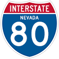
This is the first reassurance shield along Interstate 80 east in Nevada. Most Interstate shields in Nevada seem to have the state name, but there are plenty of neutered shields. Like California, Nevada uses white mile markers and freeway entrance shield assemblies. However, Nevada also uses common green mileposts in addition to white mile markers (comparable to California's postmiles). Photo taken 07/18/09. |
|
Interstate 80 follows the Truckee River out of California. This river, which originates at Lake Tahoe and extends north to Truckee and then east along Interstate 80, will pass through Verdi, Reno, and Sparks, then turn north at Wadsworth to empty into Pyramid Lake. There is no outlet from Pyramid Lake. The river is in the canyon to the right (east) of the freeway -- right now, Interstate 80 is traveling northeast and will soon turn due north as it enters Verdi. Photo taken 07/18/09. |
|
This mileage sign along Interstate 80 east provides the distance to Verdi (four miles) and Reno (12 miles). A tire chain installation area is located on the side of the road; in Nevada, flashing lights and warning signs will indicate when the chain law is in effect during times of inclement, snowy weather. Photo taken 07/18/09. |
|
As the freeway bends to the north, eastbound Interstate 80 approaches its first Nevada interchange: Exit 2, Junction Business Loop I-80 and Nevada 425/Third Street north to Verdi (one mile). There is no direct access to Exit 1, which serves Terrible's Gold Ranch Casino, so use Exit 2 instead. Photo taken 07/18/09. |
|
Business Loop I-80 and Nevada 425 pass through Verdi via Third Street, which is the old alignment of Historic U.S. 40. Verdi is an unincorporated community of Washoe County; combined with neighboring Mogul, the U.S. Census Bureau shows a population of 2,949 as of the 2000 Census. One of the old highway features in Verdi is the 1928 Crystal Peak Toll Bridge, an arch bridge over the Truckee River that can be seen from Crystal Peak Park. The business loop returns to Interstate 80 at Exit 5. Photo taken 07/18/09. |
|
Eastbound Interstate 80 reaches Exit 2 for Business Loop I-80 and Nevada 425/Third Street (Historic U.S. 40) north to Verdi. Photo taken 07/18/09. |
|
Upon departing the freeway at Exit 2, the business route initially follows a frontage road along the east side of the freeway. At the end of a long offramp, the frontage road connects to Orange Post Road (right turn, local access only), followed by a ramp back onto Interstate 80 east (left turn). Photo taken 07/18/09. |
|
Eastbound Business Loop I-80 approaches the left turn back to Interstate 80 east. Continue straight to pass under the freeway and join the west frontage road to become Third Street north into downtown Verdi. Turn left on the west frontage road to Terrible's Gold Ranch Casino. Photo taken 07/18/09. |
|
Returning to the mainline, this Interstate 80 east reassurance shield is posted prior to the Truckee River crossing. Photo taken 07/18/09. |
|
This mileage sign along Interstate 80 east provides the distance to Reno (ten miles) and Sparks (13 miles). Photo taken 07/18/09. |
|
The next exit along Interstate 80 east is Exit 4, Boomtown-Garson Road (one mile). This interchange serves the Boomtown Casino in Verdi. Photo taken 07/18/09. |
|
An Interstate 80 east reassurance shield assembly appears as traffic merges onto the freeway from South Verdi Road. Photo taken 07/18/09. |
|
The next offramp from Interstate 80 east connects to a truck scale and weigh station, which is called a "check station" in Nevada. Photo taken 07/18/09. |
|
Eastbound Interstate 80 reaches Exit 4, Boomtown-Garson Road to Boomtown Casino and Verdi. This is the second and last exit to serve Verdi. Photo taken 07/18/09. |
|
Continuing east, Interstate 80 sees afternoon thunderstorms booming in the mountains and deserts ahead. The Great Basin is known for its summer thunderstorms, some of which can produce heavy rain, hail, lightning, and strong winds. Occasionally these storms will develop in the Eastern Sierra Nevada as well as the Great Basin. Photo taken 07/18/09. |
|
Interstate 80 again crosses the Truckee River. Through Verdi, the river has a bend into town, and the freeway cuts off that bend by staying south of town. Photo taken 07/18/09. |
|
A variable message sign warns of pending maintenance work along the freeway. Photo taken 07/18/09. |
|
An onramp brings traffic from Business Loop I-80 and Nevada 425 onto eastbound Interstate 80. (There is no local road connection between Verdi and Mogul; all traffic must use Interstate 80 between Exit 6 and Exit 7.) A reassurance shield with state name is posted thereafter. Photo taken 07/18/09. |
|
Eastbound Interstate 80 approaches a scenic view that looks toward the Truckee River. Photo taken 07/23/09. |
|
The scenic view exit is shown as "Truck Parking" at the gore point. Photo taken 07/23/09. |
|
The next exit along Interstate 80 east is Exit 7, Mogul Road and Historic U.S. 40/West Fourth Street (0.50 mile). This interchange serves Mogul, a residential area located east of Verdi and west of Reno. Photo taken 07/18/09. |
|
Eastbound Interstate 80 reaches Exit 7, Mogul Road and Historic U.S. 40/West Fourth Street. Photo taken 07/18/09. |
|
The next exit along Interstate 80 east is Exit 8, Nevada 647 (Historic U.S. 40)/West Fourth Street (0.50 mile). Nevada 647, which also includes part of Business Loop I-80 through Reno and Sparks, travels east-west through the Reno-Sparks metropolitan area along the old alignment of U.S. 40. Officially, the business route joins Nevada 647 at Keystone Avenue, but some maps show the loop beginning as far west as Exit 8. Photo taken 07/18/09. |
|
This Interstate 80 east reassurance shield is posted after Exit 7. Photo taken 07/18/09. |
|
The next three exits along Interstate 80 east are Exit 8, Nevada 647 (Historic U.S. 40)/West Fourth Street; Exit 9, Robb Drive; and Exit 10, Nevada 659/McCarran Boulevard West. Photo taken 07/18/09. |
|
Eastbound Interstate 80 reaches Exit 8, Nevada 647 (Historic U.S. 40)/West Fourth Street to Business Loop I-80. This exit connects to Business Loop I-80, which is not defined to begin officially until Exit 12/Keystone Avenue. Photo taken 07/18/09. |
|
The next exit along Interstate 80 east is Exit 9, Robb Drive. This trumpet interchange was constructed in the late 1990s or early 2000s to serve a new community of western Reno. Neither the interchange nor the development along the freeway in place in 1994. Photo taken 07/18/09. |
|
Eastbound Interstate 80 reaches Exit 9, Robb Drive north. Photo taken 07/18/09. |
|
High mast lighting and a four-lane section of eastbound Interstate 80 indicate the relatively recent construction of this section of Interstate 80. However, the freeway will again narrow to two eastbound lanes shortly. Even through parts of downtown Reno and Sparks, Interstate 80 is limited in width due to nearby development along the freeway corridor. Reconstruction of the Reno Spaghetti Bowl Interchange (Interstate 80, Interstate 580, and U.S. 395) may address aspects of the limited capacity of Interstate 80 through the cities, but additional widening of the corridor would be very expensive. Photo taken 07/18/09. |
|
A smaller Interstate 80 east reassurance shield is posted thereafter as the eastbound lanes again narrow to two through lanes. Photo taken 07/18/09. |
|
The next three exits along Interstate 80 east are Exit 10, Nevada 659/McCarran Boulevard West; Exit 12, Keystone Avenue and Junction Business Loop I-80/Fourth Street east; and Exit 13, Sierra Street, U.S. 395 Business (Nevada 430)/Virginia Street, and Center Street. Photo taken 07/18/09. |
|
The right lane of Interstate 80 east becomes exit only for Exit 10, Nevada 659/McCarran Boulevard West. The gore point for the offramp is at the top of the hill. Formerly, Nevada 651 formed the western half of an at-grade boulevard (McCarran Boulevard) that loops around the cities of Reno and Sparks. The eastern half of McCarran Boulevard was previously designated as Nevada 650, with the numerical designation changing at the U.S. 395 and Interstate 580 interchanges. Most of the southern half of the loop was locally maintained, while the northern half was state maintained as part of Nevada 650 and Nevada 651. Photo taken 07/18/09. |
|
An Interstate 80 east reassurance shield is posted after Exit 10. After passing through the rolling hills, Interstate 80 will soon enter Truckee Meadows, which includes Reno and Sparks in a tight valley. The Truckee River stays south of the freeway through the urban area. Photo taken 07/18/09. |
|
Turning around a bend, the skyline of downtown Reno and Sparks comes into view along eastbound Interstate 80. The next exit along Interstate 80 east is Exit 12, Keystone Avenue and Junction Business Loop I-80/Fourth Street east. Use Keystone Avenue south to Fourth Street, which is mostly designated as Nevada 647 and previously U.S. 40. Photo taken 07/18/09. |
|
Interstate 80 enters the city of Reno upon crossing Stoker Avenue prior to the Keystone Avenue interchange. Reno, the "Biggest Little City in the World," had a population of 180,480 as of the 2000 Census and sits at an elevation of 4,505 feet above sea level. Reno is the seat of Washoe County. According to the city of Reno's webpage, the city of Reno was officially established on May 13, 1868. Reno was named after named after Civil War General Jesse Reno. Due to its position east of the Sierra Nevada and within the rainshadow, Reno only sees an average annual precipitation (rain and snow) of 7.48 inches, which is quite a bit less than seen in California's Central Valley on the west side of the same mountain chain. The downtown cityscape includes towering hotels and casinos. With tourism a huge part of the local economy, many travelers from Northern California visit Reno for the nightlife, entertainment, gambling, and fine dining. Photo taken 07/18/09. |
|
Eastbound Interstate 80 approaches Exit 12, Keystone Avenue and Business Loop I-80 east. This interchange is the first to serve the city of Reno and thus also serves as the west end of Business Loop I-80 through Reno and Sparks. The business route generally follows Fourth Street through Reno and Victorian Avenue through Sparks along the former U.S. 40 alignment; the business route crosses Interstate 80 at Exit 16 (from the south to north side of the freeway) and ends at Exit 19, East McCarran Boulevard interchange. For business loop routes in Nevada, usually only one advance guide sign has the business loop shield. This sign is located just before the actual exit, and its usefulness would be increased if the business loop were signed with an exit number. Of course, the best option would be to include the business loop shield on each advance sign. Photo taken 07/18/09. |
|
The interchange between Interstate 80 and Exit 12, Keystone Avenue is a single-point urban interchange (SPUI). An older porcelain enamel shield (no button copy) is posted at the exit ramp; this sign likely dates to when this freeway was first built in the 1960s. Photo taken 07/18/09. |
|
Departing the freeway at Exit 12, the single-lane offramp widens to three lanes. The left two lanes will turn onto Keystone Avenue north, and the right lane connects to Keystone Avenue south. This configuration is common for a SPUI, with left-turning traffic meeting at a single point underneath the freeway. Although not signed, one must turn right to take Keystone Avenue south two blocks to connect with Business Loop I-80/West Fourth Street east to downtown Reno. Photo taken 09/05/10. |
|
Back on the mainline and passing over Keystone Avenue, the next exit along Interstate 80 east is Exit 13, Junction Former Nevada 660/Sierra Street and U.S. 395 Business (Former Nevada 430)/Virginia Street north/south. To downtown Reno, follow U.S. 395 Business and Nevada 430/Virginia Street south. The famous "World's Biggest Little City" arch is found on Virginia Street just a few blocks south of the freeway. Photo taken 07/18/09. |
|
Interstate 80 shifts to a below-grade alignment prior to the offramp to Exit 13, Junction Former Nevada 660/Sierra Street and U.S. 395 Business (Former Nevada 430)/Virginia Street north/south. Two lanes join the freeway from Keystone Avenue on the right. Use Exit 13 to the University of Nevada at Reno (founded 1886). In sequence, the next three overpasses carry Vine Street, Washington Street, and Ralston Street over the freeway. Photo taken 07/18/09. |
|
The next three exits along Interstate 80 east are Exit 13, Junction Former Nevada 660/Sierra Street and U.S. 395 Business (Former Nevada 430)/Virginia Street north/south; Exit 14, Wells Avenue; and Exit 15, Interstate 580 and U.S. 395/North-South Freeway (Spaghetti Bowl Interchange). Nevada 660 follows Sierra Street from Interstate 80 north to U.S. 395 Business/Virginia Street, but only the initial fraction of a mile on Sierra Street is currently actively maintained by the state. The rest of Sierra Street is a city street maintained by the city of Reno. Photo taken 07/18/09. |
|
The right two lanes of Interstate 80 east connect to Exit 13, Junction Former Nevada 660/Sierra Street and U.S. 395 Business (Former Nevada 430)/Virginia Street. Prior to the completion of the North-South Freeway, U.S. 395 followed Virginia Street through downtown Reno, with an alternate route designated along Sierra Street (which also travels north-south one block west of Virginia Street). Today, Virginia Street is a business route for U.S. 395, and the mainline has been shifted onto the freeway (which is also designated as Interstate 580). Photo taken 07/18/09. |
|
Eastbound Interstate 80 reaches Exit 13, Junction Former Nevada 660/Sierra Street (former U.S. 395 Alternate), U.S. 395 Business (Former Nevada 430)/Virginia Street, and Center Street. In the mid-1990s, this overhead exit sign was a non-reflective sign without button copy, and it actually had a U.S. 395 Business shield posted above Virginia Street. The business route designation was removed from this signs presumably to alleviate motorist confusion with Exit 15, which is the U.S. 395 and Interstate 580 interchange. The older pull-through sign shows Interstate 80 east to Salt Lake City, about 500 miles from here. The eastbound control city should be Elko. Photo taken 07/18/09. |
|
The next three exits along Interstate 80 east are Exit 14, Wells Avenue; Exit 15, Interstate 580 and U.S. 395/North-South Freeway (Spaghetti Bowl Interchange); and Exit 16, Junction Business Loop I-80 (Historic U.S. 40) and Nevada 647/Victorian Avenue. In addition to using the federal standard green mileposts on Interstates, Nevada also uses a county-based milepost system similar to the one used by California. The mileposts indicate the route number (Interstate 80, abbreviated IR 80), the county name (such as Washoe, abbreviated WA), and the mileage from the western or southern terminus or county line (given to 100ths of a mile). Photo taken 07/18/09. |
|
Eastbound Interstate 80 reaches Exit 14, Wells Avenue. The next exit along eastbound is Exit 15, Interstate 580 and U.S. 395/North-South Freeway (Spaghetti Bowl Interchange). Photo taken 07/18/09. |
|
The next three exits along Interstate 80 east are: Exit 15, U.S. 395 and Interstate 580; Exit 16, Junction Business Loop I-80/Victorian Avenue (first Sparks interchange); and Exit 17, Nevada 668/Rock Boulevard. Photo taken 07/18/09. |
|
U.S. 395 is a major north-south highway in the Eastern Sierra. While it is a freeway through Reno, significant segments of the route are at-grade expressway or even just two lanes in California. U.S. 395 travels south to Carson City, Carson Valley (Minden and Gardnerville), Bridgeport, Bishop, Independence, Ridgecrest, and San Bernardino. Between Reno and Carson City, U.S. 395 is codesignated as Interstate 580. The North-South Freeway, when built in the 1980s, originally was signed for both U.S. 395 and Interstate 580. However, the Interstate 580 route markers were taken down since the route was not complete. However, with the freeway extension south to Carson City underway, the freeway will become signed for both Interstate 580 and U.S. 395. AASHTO shows Interstate 580 extending from Interstate 80 south to Nevada 667/Del Monte Lane. Photo taken 07/18/09. |
|
Eastbound Interstate 80 reaches Exit 15, U.S. 395 and Interstate 580. Upon exiting, stay left for U.S. 395 north to Susanville and points north; stay right for Interstate 580 and U.S. 395 south to Carson City and Carson Valley. This pull-through sign correctly indicates Elko as the control city. A major reconstruction of this interchange (known as the Reno Spaghetti Bowl) is also underway to increase capacity. Photo taken 07/18/09. |
|
Looking at the transition ramp for Exit 15, space is allocated on the U.S. 395 south sign for eventual inclusion of an Interstate 580 route marker in addition to the existing U.S. 395 shield. Photo taken 07/18/09. |
|
The next six exits along Interstate 80 east all serve the city of Sparks, the "City of Promise" (elevation 4,410 feet above sea level and incorporated on March 15, 1905). The second city along Interstate 80 east in Washoe County, Sparks had a population of 66,346 as of the 2000 Census. Like Reno, Sparks saw growth due to the explosion in the gambling industry through the 20th century as well as its position along the Union Pacific Railroad. Sparks's lone high-rise casino is the Nugget (built 1984), located on the south side of the elevated Interstate 80 freeway in downtown Sparks. The Union Pacific Railroad switchyard sits on the south side of the freeway near the Nevada 445/Pyramid Way interchange. The city was named in 1904 for former Governor John Sparks at the turn of the 20th century; incorporation ensued in the following year. Photo taken 07/18/09. |
|
An Interstate 80 east reassurance shield is posted as traffic merges onto eastbound from U.S. 395. After this shield and merge point, Interstate 80 officially leaves Reno and enters Sparks. Photo taken 07/18/09. |
|
Eastbound Interstate 80 reaches Exit 16, Junction Business Loop I-80 and U.S. 40 east to Sparks and west to Reno. The historic route is known as Fourth Street in Reno and as Victorian Avenue in Sparks. Photo taken 07/18/09. |
|
Now on elevated viaduct, the next exit along eastbound Interstate 80 is Exit 17, Nevada 668/Rock Boulevard and Nugget Avenue east (frontage road). Photo taken 07/18/09. |
|
Eastbound Interstate 80 reaches Exit 17, Nevada 668/Rock Boulevard and Nugget Avenue. The Nugget Hotel and Casino comes into view ahead; this is (for now) the only skyscraper in Sparks and opened in 1984. Nevada 668 is a short north-south secondary state route that links Nevada 648/Glendale Avenue with Nevada 663/Oddie Boulevard via an interchange with Interstate 80. Only the section of Rock Boulevard immediately adjacent to Interstate 80 is maintained by NDOT. Photo taken 07/18/09. |
|
The next exit along Interstate 80 east is Exit 18, Nevada 445/Pyramid Way north to Pyramid Lake. Photo taken 07/18/09. |
|
Perhaps because the Nugget hotel is so close to the freeway that it is more memorable than Reno's downtown for those breezing through on Interstate 80. Reno's downtown is much more impressive, but it is not as easily visible from the freeway due to the fact Interstate 80 is below grade in Reno. Photo taken 07/18/09. |
|
The right two lanes of Interstate 80 east connect to Exit 18, Nevada 445/Pyramid Way north to Pyramid Lake. Photo taken 07/18/09. |
|
Eastbound Interstate 80 reaches Exit 18, Nevada 445/Pyramid Way north to Pyramid Lake and Nugget Avenue (south frontage road). Photo taken 07/18/09. |
|
This view looks at the signage from Interstate 80 east to Exit 18, Nevada 445/Pyramid Way in Sparks. Nevada 445 is a state route that extends from Interstate 80 Exit 18 north to Pyramid Lake via Sutcliffe. The connection to Gerlach and the Black Rock Desert is afforded via Nevada 445 north, Nevada 446 east, and Nevada 447 north. Photo taken 07/18/09. |
|
An Interstate 80 east reassurance shield is posted as traffic joins eastbound from Nevada 445/Pyramid Way. Photo taken 07/18/09. |
|
Eastbound Interstate 80 reaches Exit 19, Nevada 659/McCarran Boulevard East to Business Loop I-80 and Nevada 647/Victorian Avenue west. This interchange marks the eastern terminus of Business Loop I-80 and Nevada 647. The next exit along eastbound is Exit 20, Sparks Boulevard (plans call for extension of Sparks Boulevard southwest toward U.S. 395 near Mt. Rose Junction). Photo taken 07/18/09. |
|
Upon exiting from Interstate 80 east at Exit 19, the left three lanes connect to Nevada 659/McCarran Boulevard East north; the right lane connects to Nevada 659/McCarran Boulevard East south. To Business Loop I-80/Victorian Avenue (Nevada 647) west, follow Nevada 659 north and turn left at Victorian Avenue. Photo taken 07/18/09. |
Page Updated May 4, 2012.