Interstate 195 Maryland

Overview
Interstate 195 provides a high speed route to the passenger terminal of Thurgood Marshall Baltimore-Washington International Airport (BWI) from Interstate 95 at Arbutus. The freeway also comprises a commuter route with connections to Baltimore-Washington Parkway (MD 295), U.S. 1 and MD 170. The north end serves the University of Maryland – Baltimore County (UMBC) campus and a 483 space Park & Ride lot at Catonsville.
 History
The freeway for I-195 previously consisted of two independent sections. Designated as Maryland Route 46, the southern segment spurred south from a three-wye interchange at B/W Parkway to the newly opened Friendship International Airport in 1952. The northern route, posted as MD 166, connected I-95 south with U.S. 1 near Elkridge in August 1974 and north to the new campus of UMBC in 1975. Due to the cancellation of Interstate miles elsewhere in the state,1 the American Association of State Highway and Transportation Officials (AASHTO) approved the designation of Interstate 195 from I-95 and MD 166 southeast to BWI Airport on November 15, 1975.
Efforts to complete the 1.5 mile long section linking the two freeways were delayed by an extended environmental review process needed for the stretch through Patapsco Valley State Park and a focus on construction funds elsewhere in the state. The route was ultimately completed on June 20, 1990, as were upgrades to Interstate standards on the original MD 46 section.1
A $1 million project overhauled the Catonsville park and ride lot at the north end of Interstate 195 from June to Fall 2012. The work shifted the Rolling Road Park & Ride entrance to a shared intersection with the park and ride exit and left turn from I-195 to Rolling Road south. A traffic light was installed there as well. Additional work removed 25 spaces at the northern portion of the lot to accommodate new green space.2
A short section of Interstate 195 was withdrawn from the Interstate System by request of the Maryland Department of Transportation on September 1, 2015. This removed I-195 from south of MD 170 (Aviation Boulevard) to the Thurgood Marshall Baltimore-Washington International Airport (BWI) terminal area. The withdrawal was approved by the Federal Highway Administration (FHWA). An eastbound confirming marker was posted beyond MD 170 in 1993. Eastbound end signs were added beyond the interchange by 2010.
Route Information
East End – Linthicum, MD
West End – Arbutus, MD
Mileage – 4.35
Cities – none
Junctions –

Source: December 31, 2021 Interstate Route Log and Finders List
I-195 Annual Average Daily Traffic (AADT)
Source: 2019 AADT – Maryland Annual Average Daily Traffic – Annual Average Daily Traffic (SHA Statewide AADT Lines)
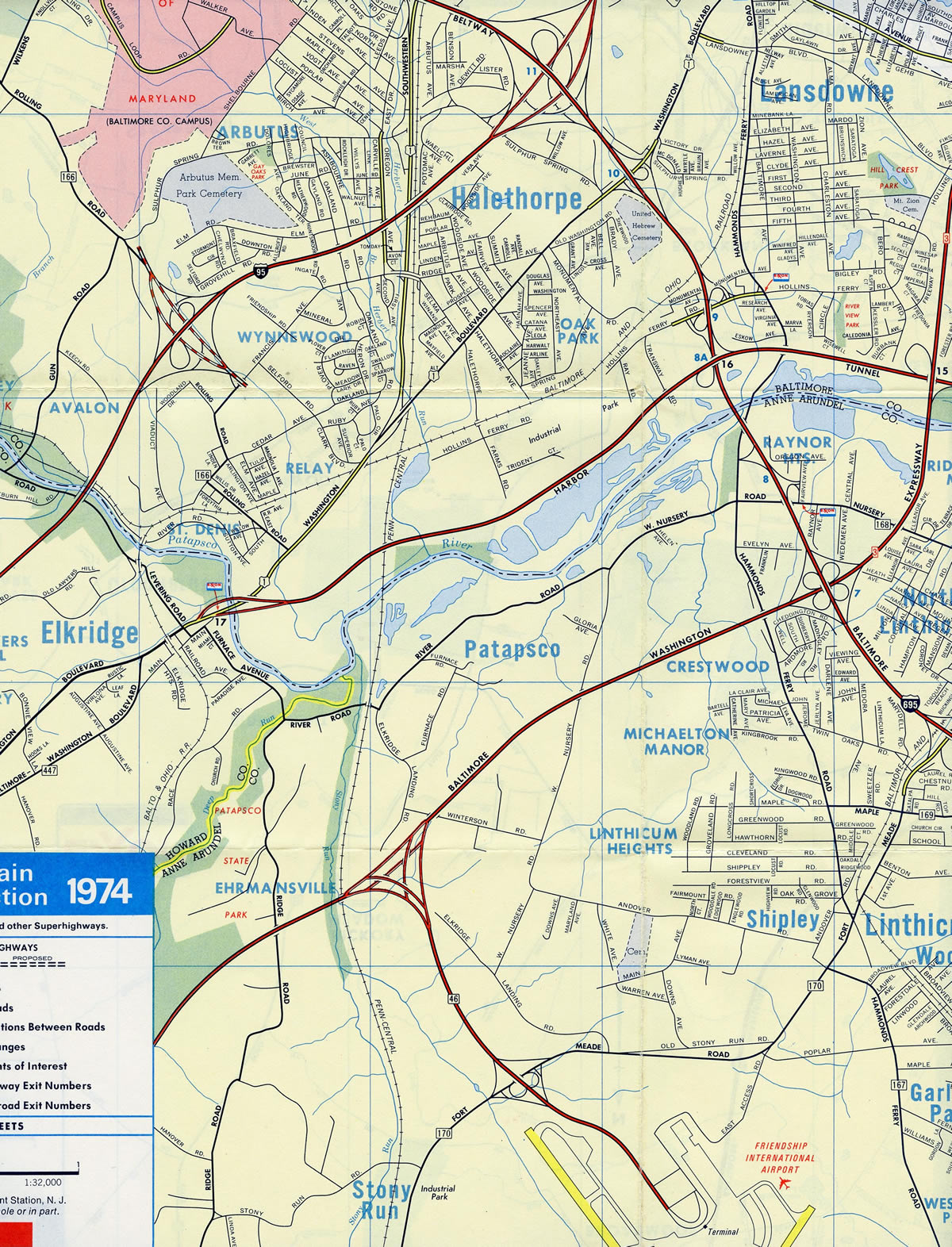
Prior to the freeway upgrade, MD 166 consisted of a surface route using Rolling Road south from Gun Road to U.S. 1 (Washington Boulevard) at Saint Denis.
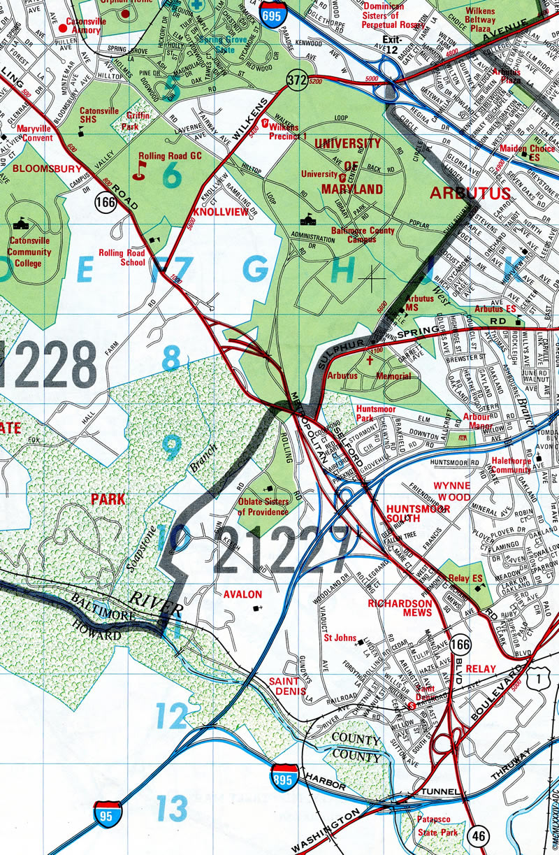
The 1.5 mile section between U.S. 1 (Washington Boulevard) and MD 295 (B/W Parkway) was proposed as a northern extension of MD 46 before the designation of Interstate 195.1
 Photo Guides
East End  – Linthicum, Maryland
![]() East at
East at ![]() / BWI Airport
/ BWI Airport
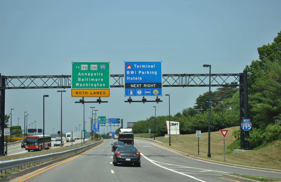
Ramps for MD 295 (B/W Parkway) merge onto I-195, one half mile ahead of the freeway end at MD 170 (Exits 1B/A). 06/06/12
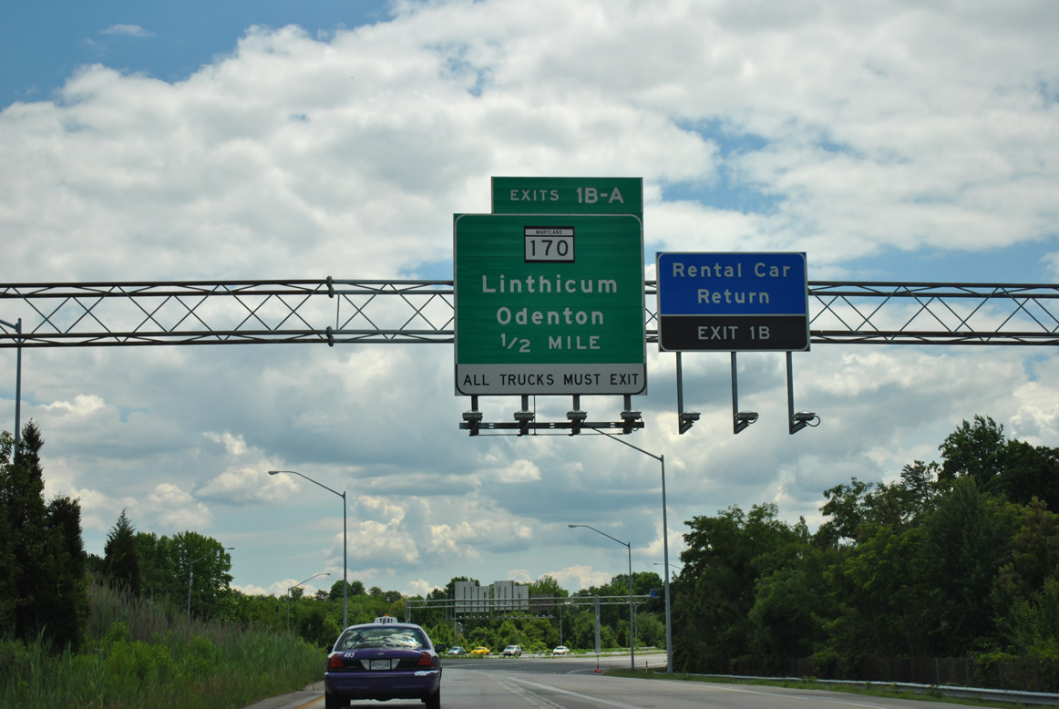
Interstate 195 eastbound at Exit 1B for MD 170 (Aviation Boulevard) south. MD 170 travels around the western periphery of the airport to MD 176 en route to the MD 100 freeway, Severn and Odenton. 06/06/12
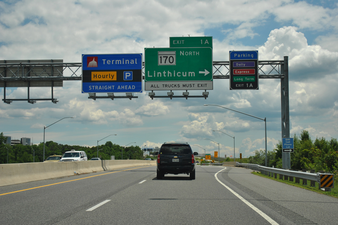
Exit 1A loops away from I-195 east to Linthicum as Metropolitan Boulevard enters BWI Airport. MD 170 comprises a 13 mile route from MD 175 at Odenton to MD 2 by Brooklyn Park. 06/06/12
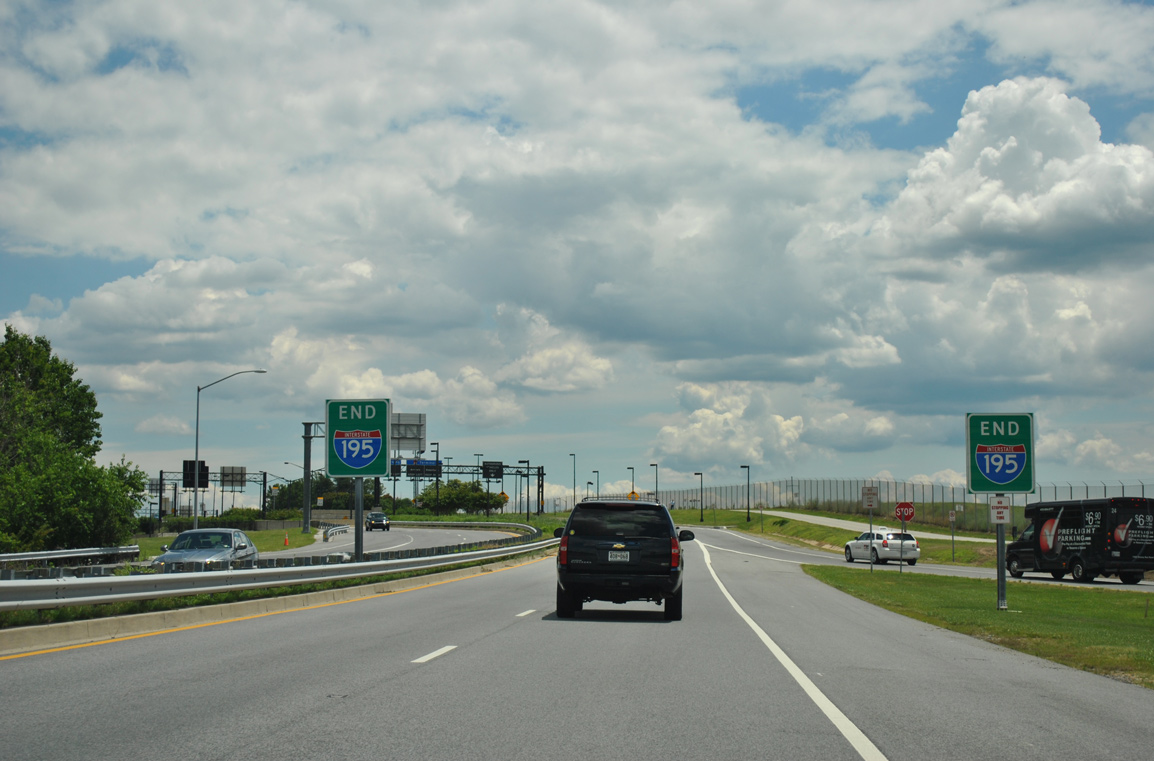
A pair of end signs for Interstate 195 stand ahead of the entrance ramp from MD 170 (Aviation Boulevard). The freeway transitions to Friendship Road, a loop serving the passenger terminal and other BWI Airport facilities. 06/06/12
Friendship Road – West at ![]()
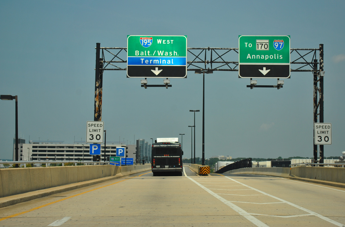
Exiting the passenger terminal, Friendship Road separates into ramps for I-195 (Metropolitan Boulevard) west and Elm Road north toward MD 170 (Aviation Boulevard). 06/06/12
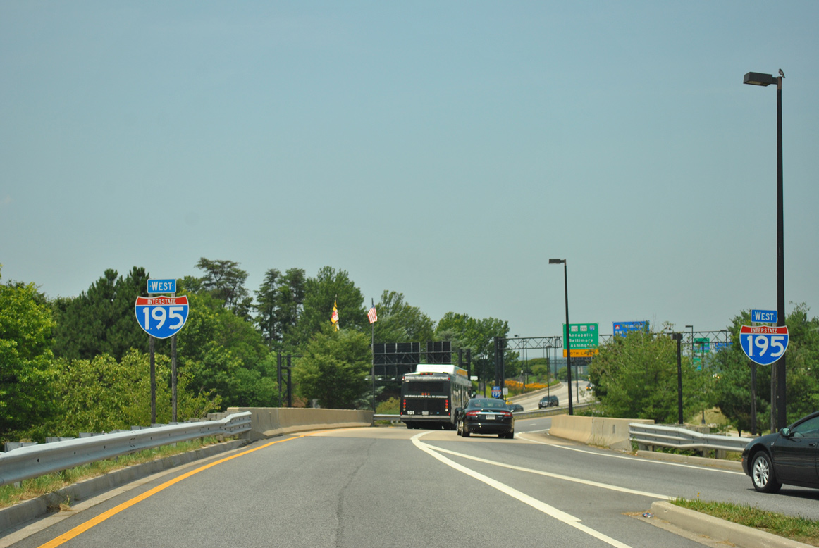
A pair of shields for I-195 appear as the lower level of Friendship Road merges with the upper level just ahead of the freeway beginning. 06/06/12
A second confirming marker for I-195 appears at the Elm Road on-ramp to Metropolitan Boulevard north. The adjacent exit provides return access to the terminal and additional parking. 06/06/12
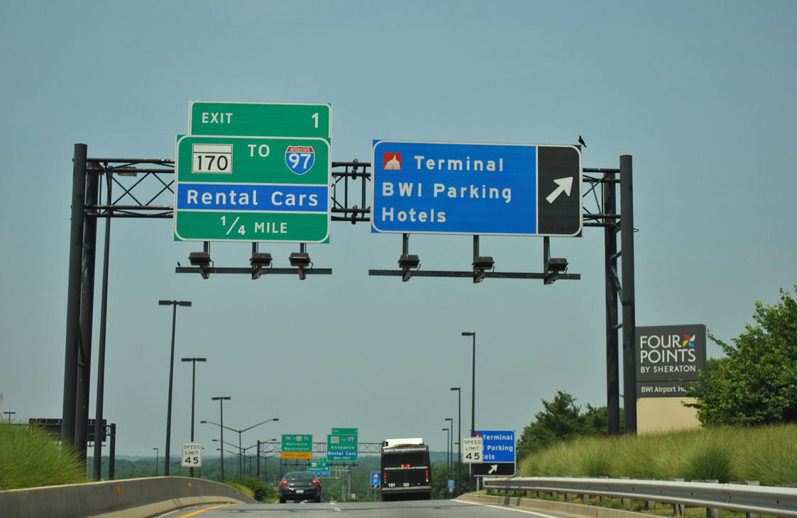
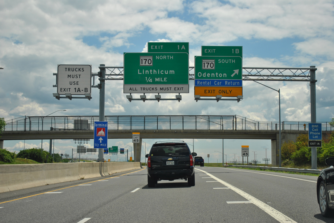
Exit 1 for MD 170 (Aviation Boulevard) departs in one quarter mile at the formal beginning of I-195. Signs for Interstate 97 direct motorists around BWI Airport using MD 170 and MD 162. 06/06/12
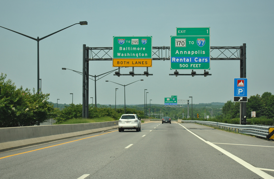
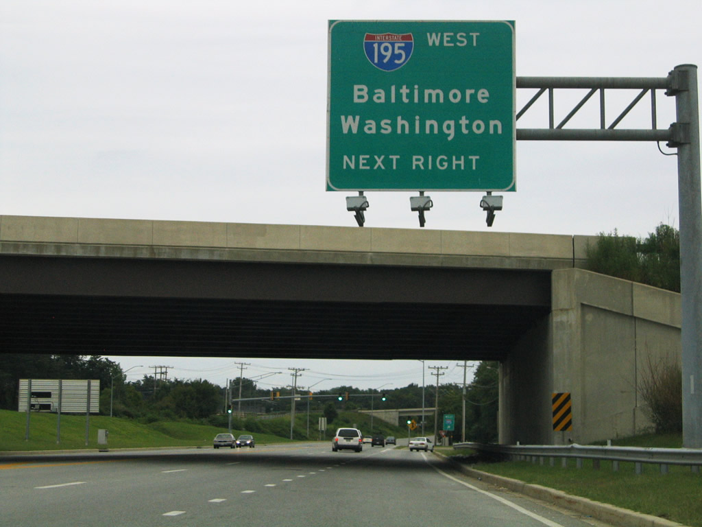
Although signed for westbound, Interstate 195 leads north from Exit 1 to MD 295 (B/W Parkway) and I-95 at Arbutus. Both freeways connect BWI Airport with Baltimore and Washington. 06/06/12

MD 170 (Aviation Boulevard) connects BWI Airport with rental car facilities and MARC commuter rail just to the west. The state route leads south to Severn and Odenton and north to Linthicum and Brooklyn Park. 06/06/12
![]() North at
North at ![]()
MD 170 (Aviation Boulevard) north at the six-ramp parclo interchange with I-195 west and Friendship Road east to Thurgood Marshall Baltimore-Washington International Airport (BWI). 08/27/05
West End  – Arbutus, Maryland
![]() South at
South at ![]()

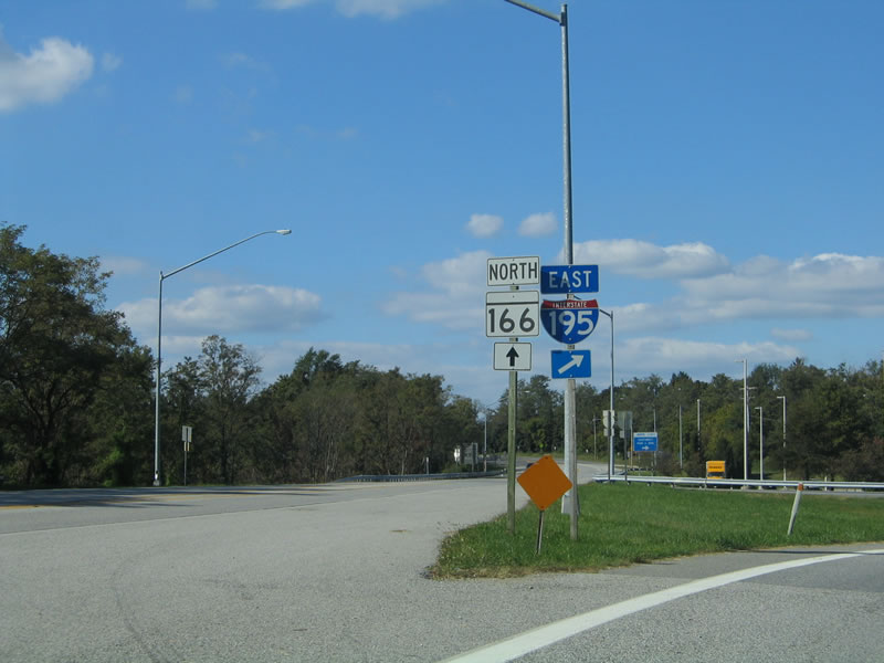
MD 166 (Rolling Road) south at the Catonsville park & ride lot, where Interstate 195 (Metropolitan Boulevard) begins. Rolling Road extends south from MD 166 to Selford Road. 06/17/00
Rolling Road north at ![]()
![]()
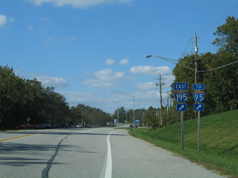
Rolling Road north at the right turn for Interstate 195 south to I-95 and BWI Airport. 10/10/04
MD 166 emerges from I-195 to overtake South Rolling Road north into Catonsville. The park & ride lot entrance is located between the freeway roadways to the right. 10/10/04
![]() West at
West at ![]()
![]()
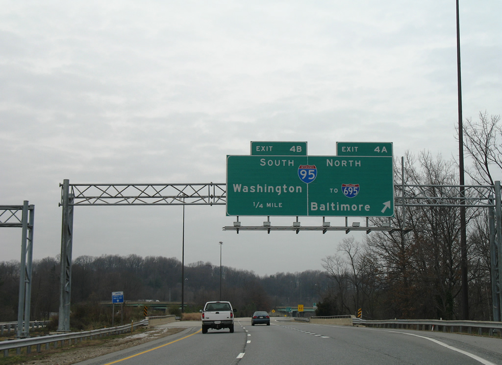
Passing over Francis Avenue, Interstate 195 west enters the directional interchange (Exits 4A/B) with I-95. I-95 north meets the Baltimore Beltway next. 12/28/07
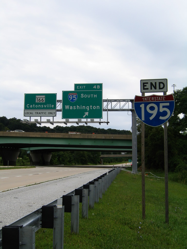
An end shield for Interstate 195 stands ahead of the loop ramp (Exit 4B) for I-95 south to Washington. Signs reference the remaining 1.1 miles of Metropolitan Boulevard as MD 166. 08/27/05
Sources:
- Metropolitan Boulevard (I-195), DCRoads.net.
- “SHA to give Southwest Park and Ride in Catonsville $1 million makeover.” The Baltimore Sun (MD), May 22, 2012.
Page updated December 11, 2020.