Interstate 184 Idaho

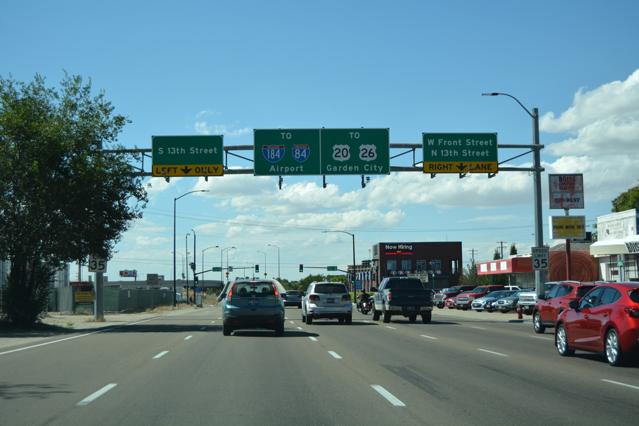
Three of the five westbound lanes along U.S. 20-26 (West Front Street) transitions onto the freeway viaduct leading out of Downtown Boise to Interstate 184 at Garden City. Photo by David Stybr (06/03/06).
Overview
Interstate 184 is the Boise Connector, a freeway spur east from I-84/U.S. 30 to the Boise city center. With as many as eight overall lanes, I-184 connects with a retail strip anchored by Boise Towne Square mall at Franklin Road and with U.S. 20/26 at the south end of Garden City. U.S. 20/26 extends the freeway 1.1 miles east from I-184 across the Boise River to the arterial couplet of Front and Myrtle Streets through Downtown Boise.
Route Information
East End – Boise, ID
West End – Boise, ID
Mileage – 3.62
Cities – Boise, Garden City
- Junctions –

Source: December 31, 2021 Interstate Route Log and Finders List
I-184 Annual Average Daily Traffic (AADT)
Source: 2018 AADT – Annual Average Daily Travel Application – Idaho Transportation Department (ITD)
 History
The Boise Connector appeared on planning maps since the 1960s. The freeway opened east from Interstate 80N in December 1968.1 It was approved as Interstate 180 by the American Association of State Highway Officials (AASHO) on June 30, 1970. Idaho Official Maps and various state maps printed in the 1970s showed I-180 as Interstate 180N in the 1970s, referencing Interstate 80N, the designation of I-84 prior to 1980. The American Association of State Highway and Transportation Officials (AASHTO) approved the renumbering of I-180 to Interstate 184 on October 13, 1979. The conversion of I-80N to I-84 was completed by July 1980. During this time period, Interstate 184 in Boise was also briefly signed as Business Loop I-84. Running along side U.S. 20 and U.S. 26 for a portion of its length, the business route was ultimately eliminated to reduce duplicative designations.
The viaduct system along the Boise Connector east from U.S. 20/26 (Chinden Boulevard) and the Boise River to Downtown was completed in August 1992. A $86 million project redesigned the interchange, “The Flying Wye” at the western end of I-184 between February 1999 and September 2004. Construction replaced a three-wye interchange with left side ramps with a multi level exchange. A three lane flyover was built from I-84 east to I-184 and separate ramps were added to and from Franklin Street to remove weaving traffic.1,2

1976 Idaho Official State Map showing Interstate 180N and previous alignments of U.S. 30 and State Highway 55.
 Photo Guides
East End  – Boise, Idaho
![]() East at
East at ![]()
![]()

Interstate 184 drops below grade ahead of Orchard Street and the half diamond interchange (Exit 3) with Fairview Avenue. Fairview Avenue parallels along the north side of the six lane freeway. 08/09/16
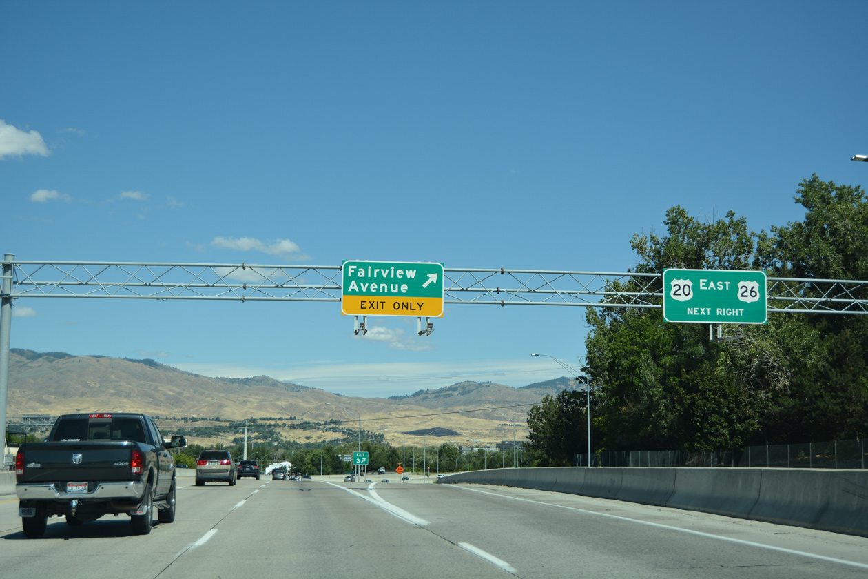
Fairview Avenue separates into one-way service roads between Orchard Street and U.S. 20/26 (Chinden Boulevard) at Garden City. Exit 3 constitutes a slip ramp onto Fairview Avenue east to West Downtown Boise. 08/09/16
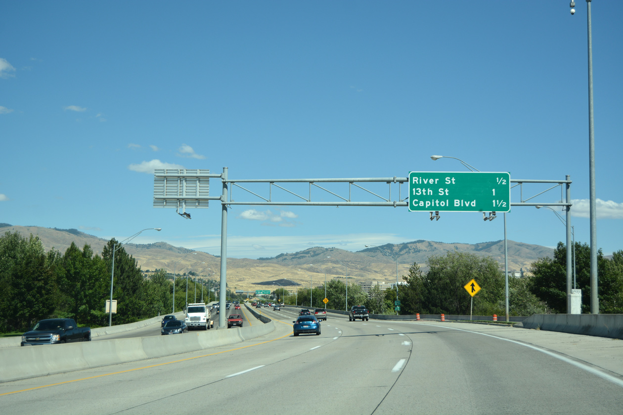
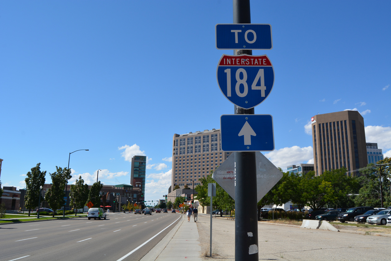
Interstate 184 ends at the wye interchange bringing U.S. 20/26 eastbound onto the freeway from Garden City. The elevated highway continues a half mile east to an unnumbered exit for River Street and one mile to the couplet of Myrtle/Front Streets at 13th Street. 08/09/16
![]()
![]() West at
West at ![]()
Overheads precede the U.S. 20/26 separation with Front Street at 13th Street and the freeway viaduct leading west to Interstate 184. 08/09/16
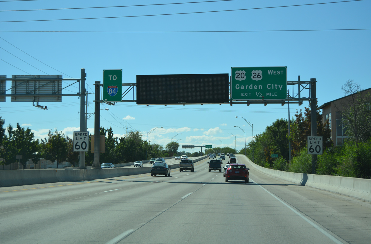
U.S. 20/26 elevate across 15th Street and Americana Boulevard from West Downtown Boise to Garden City. Interstate 184 begins at the wye interchange with Chinden Boulevard in a half mile. 08/09/16
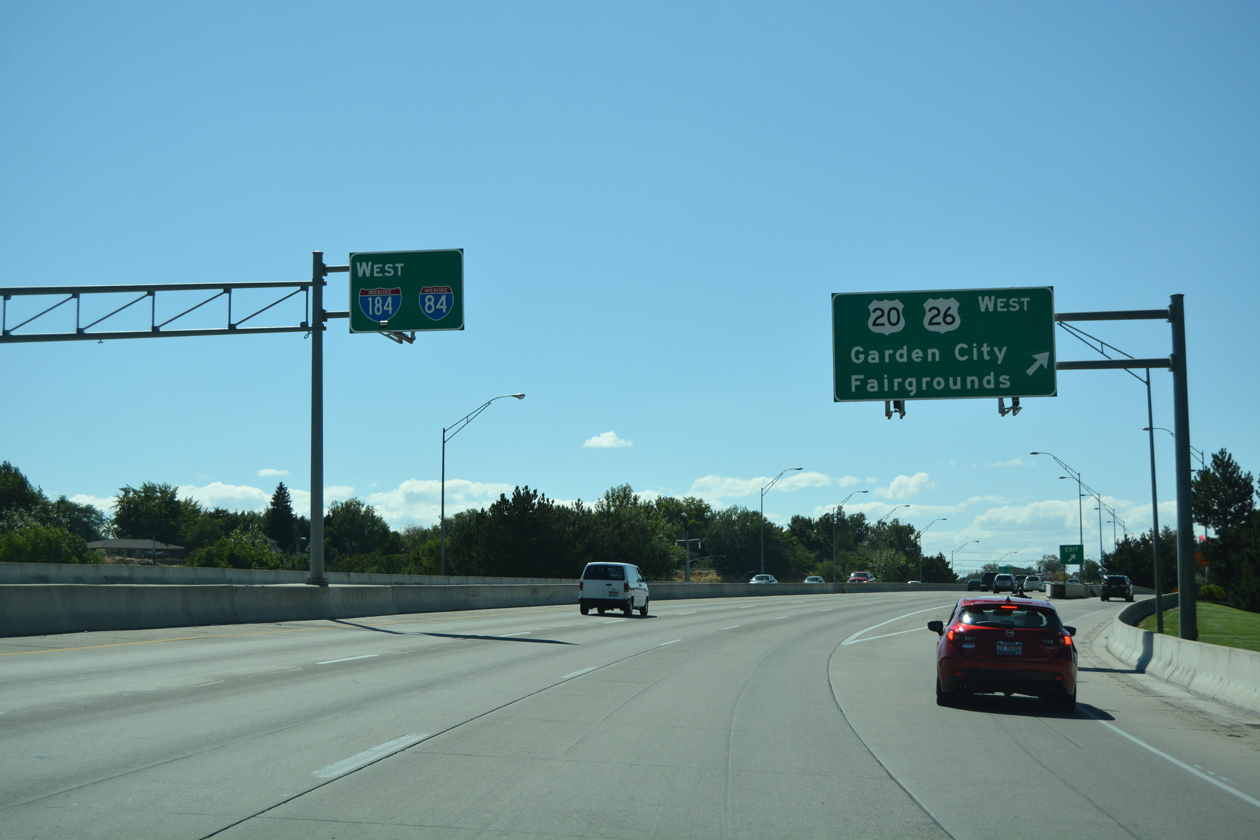
U.S. 20/26 angle northwest along Chinden Boulevard, a five lane commercial boulevard through Garden City. Interstate 184 takes over along the Boise Connector west 3.6 miles to I-84 east of Meridian. 08/09/16
West End – Boise, Idaho
![]() West at
West at ![]()
![]()
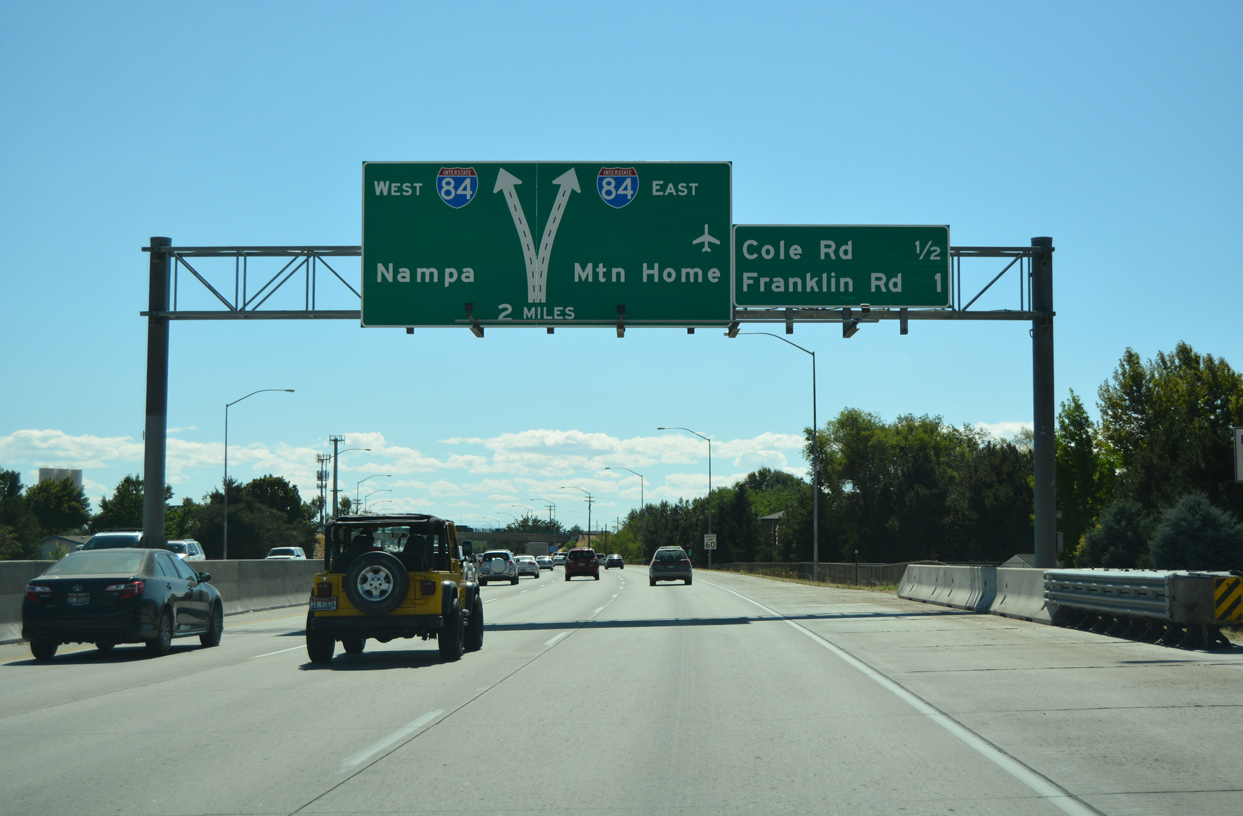
Two miles ahead of the directional T interchange (Exit 0) with I-84/U.S. 30 on I-184 westbound approaching Exit 1 B to Cole Road and Boise Town Square mall. 08/09/16
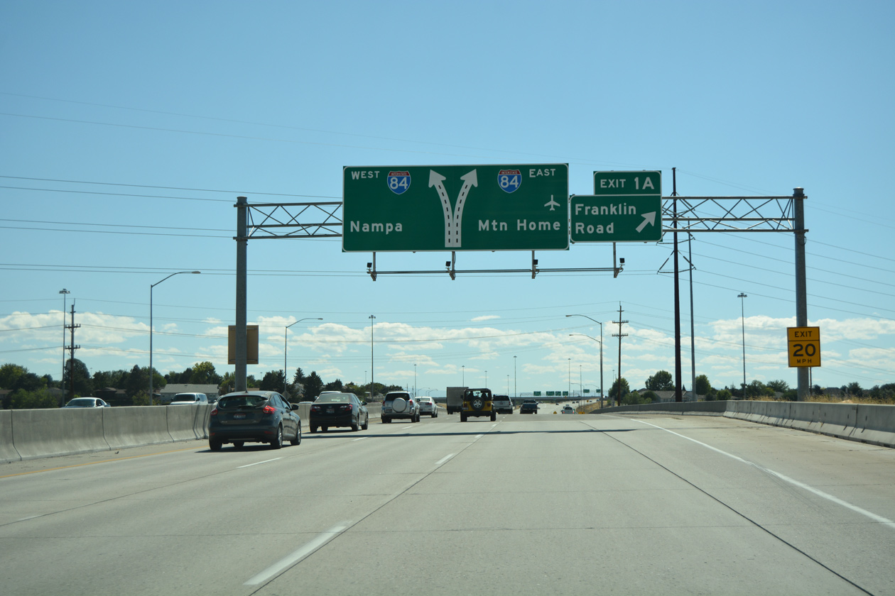
A folded diamond interchange (Exit 1 A) joins Interstate 184 with Franklin Street a half mile north of the ramp split for I-84/U.S. 30. 08/09/16
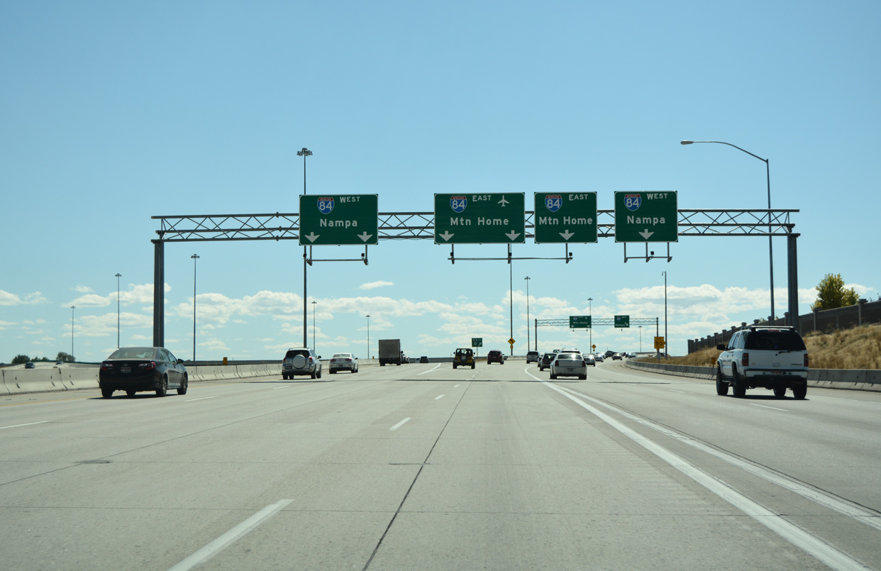
The left two lanes of Interstate 184 connect with I-84/U.S. 30 west to Meridian, Nampa and Caldwell. The two lane entrance ramp from Franklin Street joins the eastbound ramp (Exit 0) for I-84/U.S. 30 to Boise Airport (BOI) and Mountain Home. 08/09/16
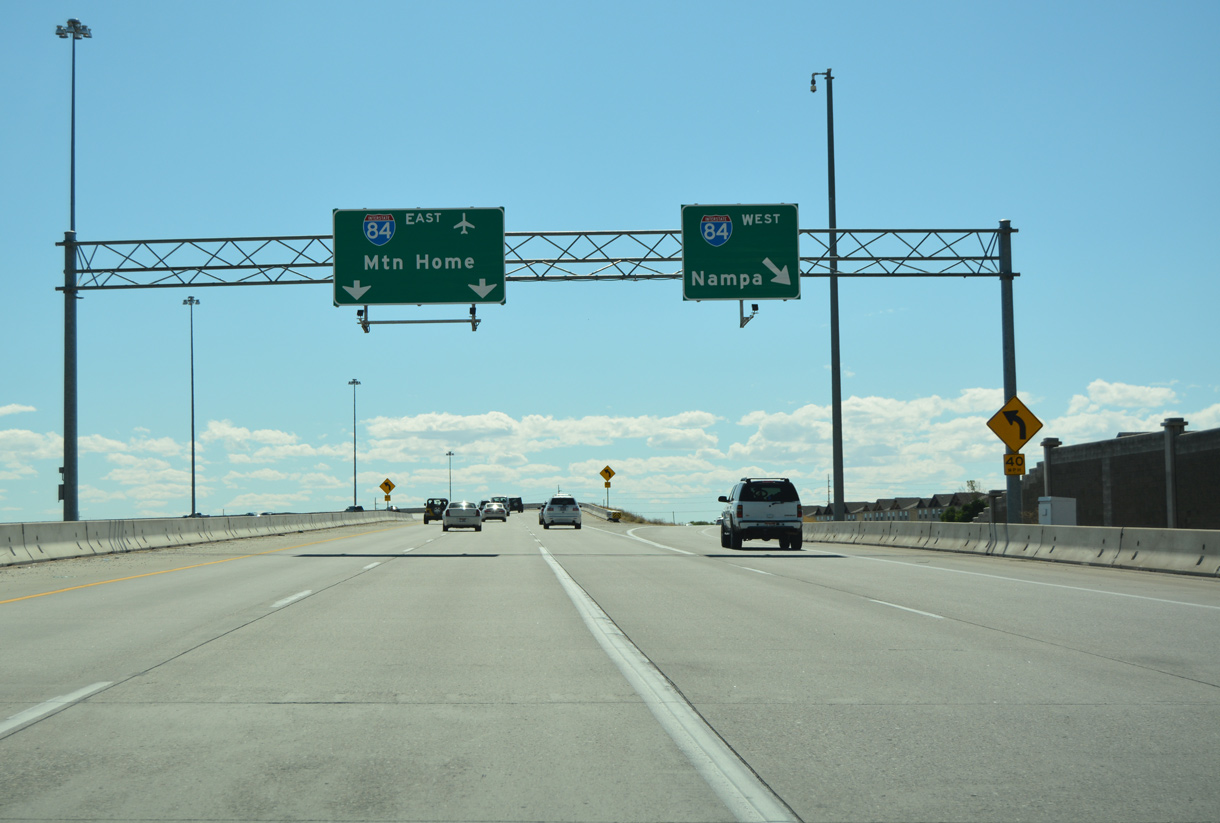
The westbound entrance ramp from Franklin Street partitions ahead of the three lane flyover for Interstate 84 east to Twin Falls, Pocatello and Salt Lake City, Utah. 08/09/16
![]()
![]() East at
East at ![]()
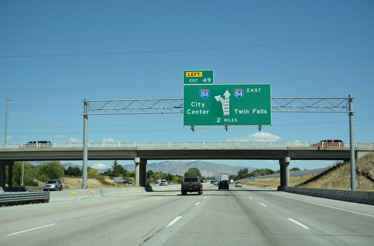
I-84/U.S. 30 enter the city of Boise from Merdian two miles ahead of Exit 49 / Interstate 184. 08/09/16
Four lanes advance east below the Five Mile Road overpass, one mile from the directional T interchange (Exit 49) with the Boise Connector. 08/09/16
1999-2004 reconstruction of “the Flying Wye” interchange added a three lane flyover for Interstate 184 east to the Boise city center. I-84/U.S. 30 east maintain three lanes as the freeway turns southeast to Boise Airport (BOI). 08/09/16
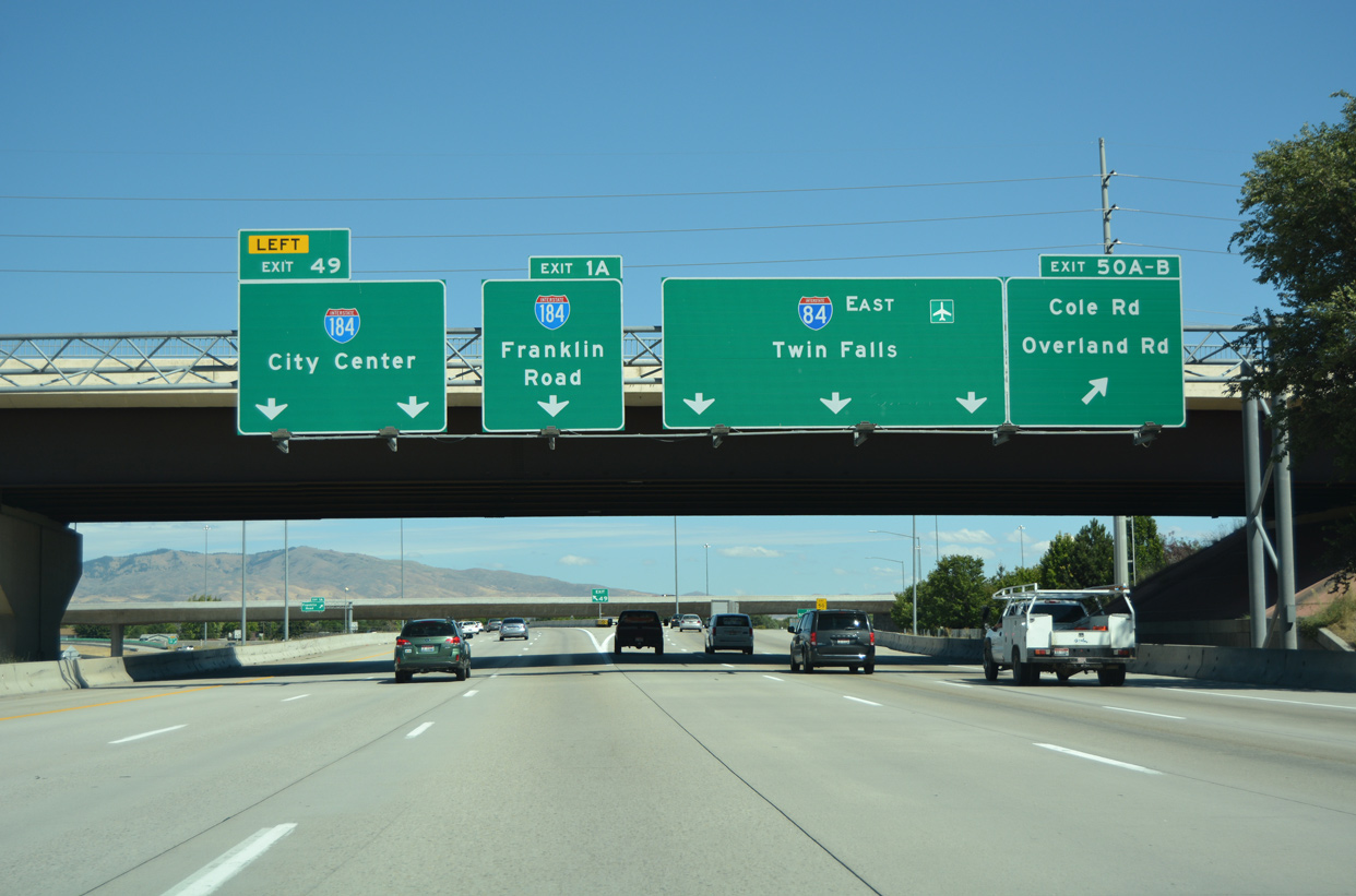
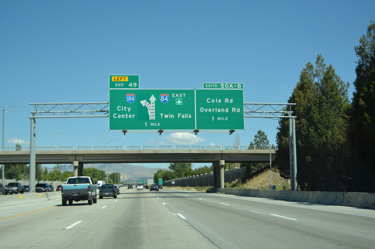
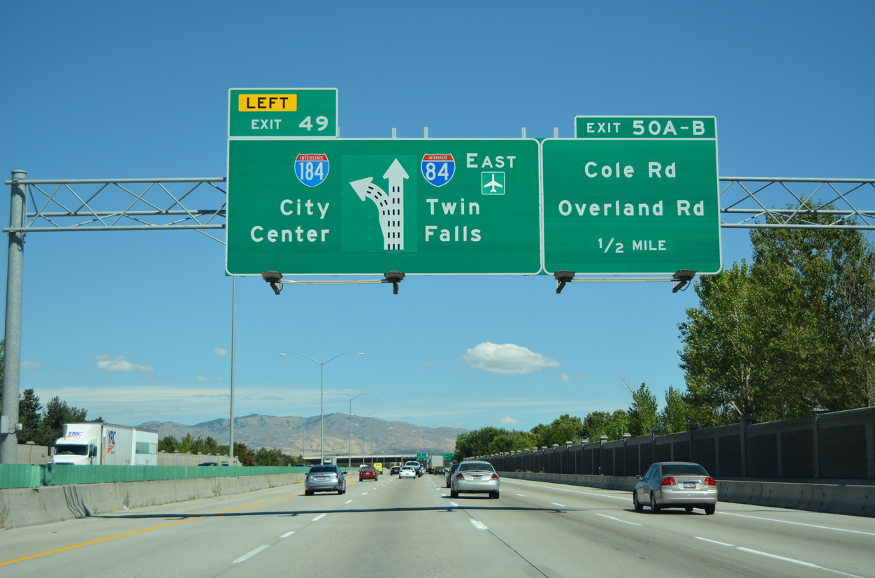
Left Exit 49 departs from I-84/U.S. 30 east. Exit 1 A follows from I-184 to Franklin Road while Exit 50 circumvents oncoming traffic to I-84 east from the Boise Connector to Cole and Overland Roads. 08/09/16
![]()
![]() West at
West at ![]()
I-84/U.S. 30 bee line northwest from Boise Airport (BOI) toward Interstate 184 east to Downtown. ITD recorded 89,500 vehicles per day (vpd) on this stretch of eight lane freeway in 2017. 08/09/16
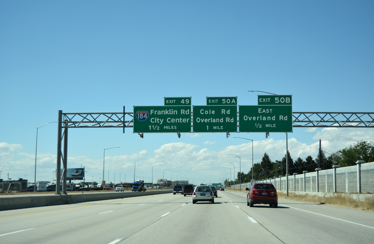
Cole and Overland Roads intersect directly above Interstate 84 ahead of the Boise Connector (Exit 49). I-84 was reconstructed here in 1996. 08/09/16
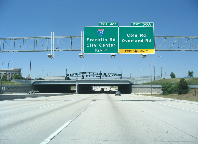
Replaced guide signs preceding Interstate 184 at the six-ramp parclo interchange (Exits 50 B/A) with Cole and Overland Road. Photo by Steve Hanudel (05/17/06).
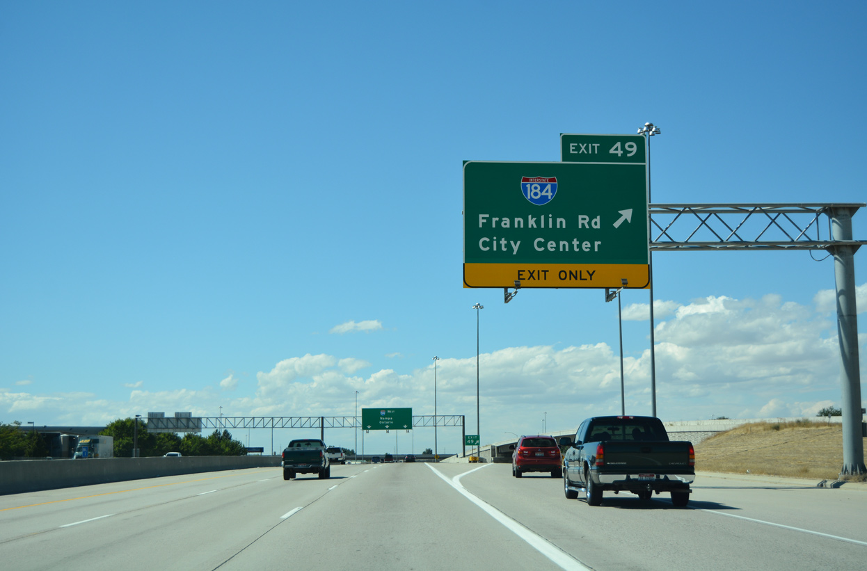
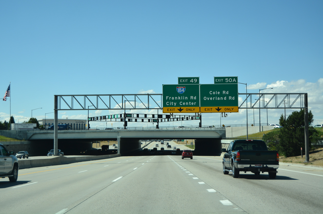
Exit 49 separates from I-84/U.S. 30 west for Interstate 184 east below the entrance ramp from Cole Road. A slip ramp to Franklin Road follows. 08/09/16
 West End Throwback


Previous guide signs at the west end of I-184 used Ontario and Twin Falls for Interstate 84. 08/31/06
Sources:
- “Rebuilding the WYE interchange.” Idaho Statesman (Boise), February 7, 1999.
- “Speeds will return to normal near Wye.” Idaho Statesman(Boise), September 5, 2004.
Page updated August 28, 2019.