Interstate 74
Overview
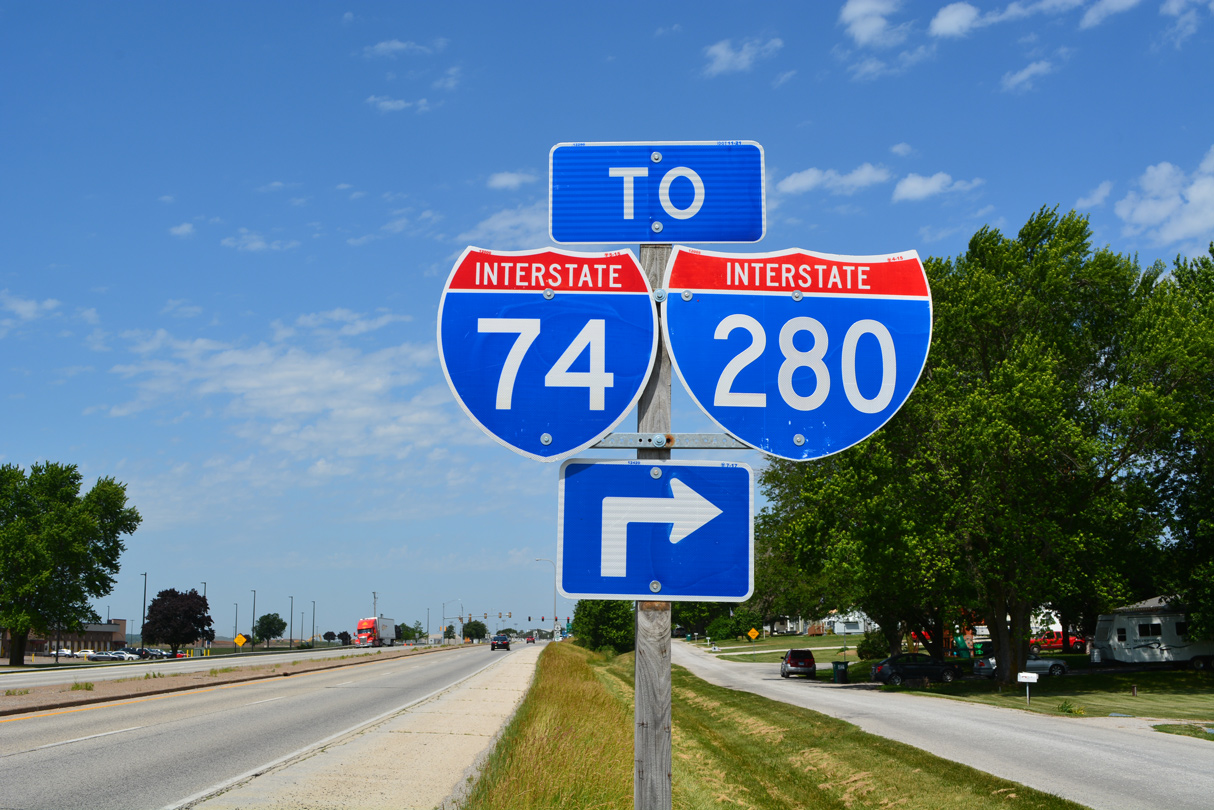
Interstate 74 joins the Upper Midwest, Southern Great Lakes and Ohio River Valley area along a northwest to southeast alignment. Beginning in Iowa at a trumpet interchange with I-80 in the Quad Cities, I-74 leads southward between Davenport and Bettendorf to cross the Mississippi River into Moline, Illinois. Turning east alongside Interstate 280 at Quad City International Airport (MLI), I-74 meets Interstate 80 again at the Big X, a cloverleaf interchange near Colona. Both routes make TOTSO (turn off to stay on) movements at the exchange, with Interstate 74 leading south toward Galesburg.
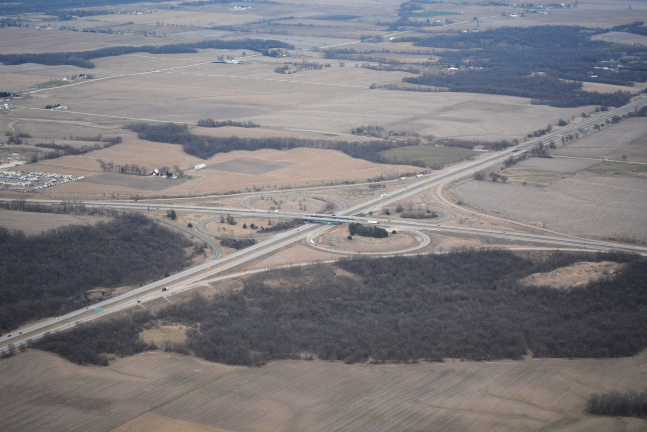
The Big X interchange, where I-74, I-80 and I-280 and IL 110 (Chicago Kansas City Expressway) converge outside the Quad Cities. 03/11/17
Once at Galesburg, Interstate 74 turns southeast toward Peoria, where it crosses the Murray Baker Bridge over the Illinois River. Interstate 474 provides a bypass to the south while I-74 serves Downtown Peoria and East Peoria. Just east of the city is the north end of I-155 and the village of Morton. Interstate 155 constitutes a cut off south to I-55 for Springfield and St. Louis while I-74 remains eastward to Normal and Bloomington.
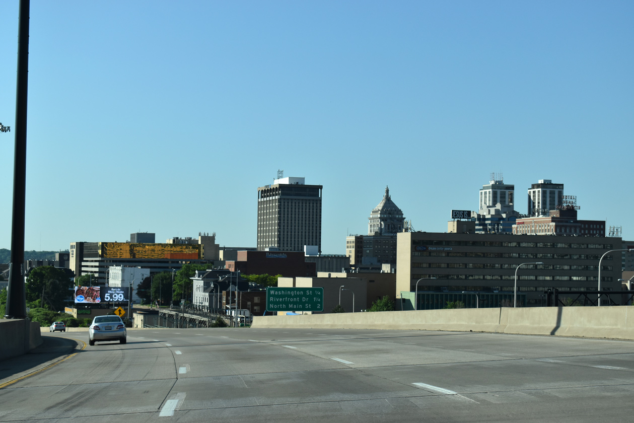
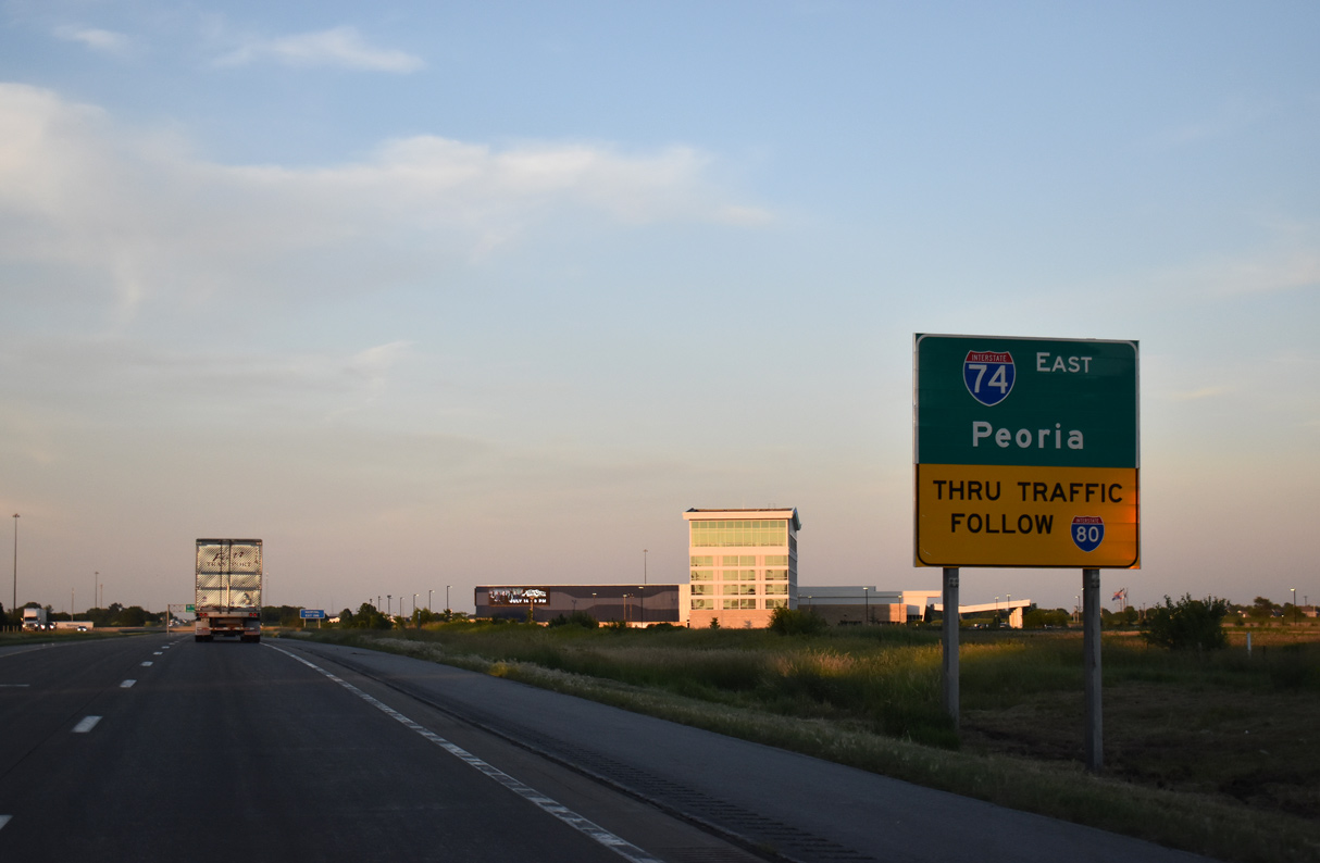
Interstate 74 eastbound at Downtown Peoria. 05/24/18
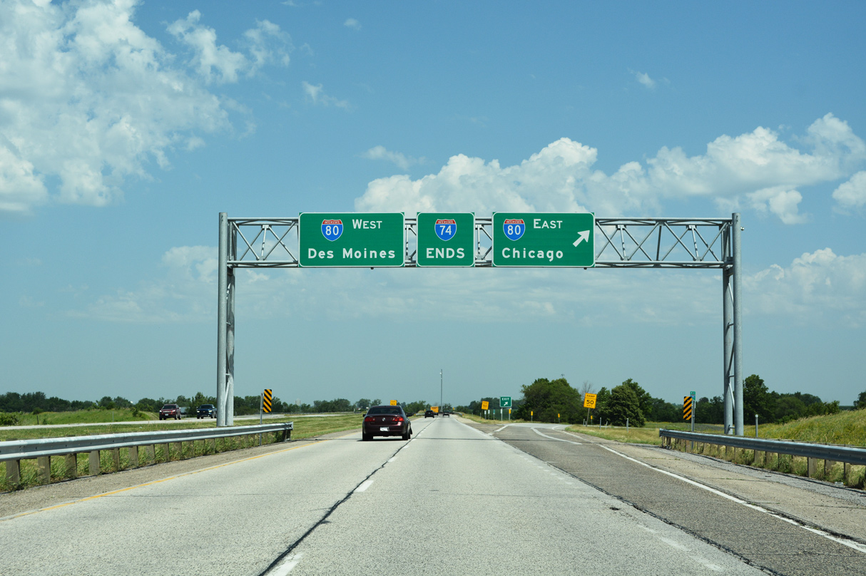
A nearly six mile overlap takes Interstate 74 south along side I-55 around the Bloomington-Normal area. Interstate 39 ties into the area just east of the overlap while Business Loop I-55 lines an old alignment of Historic U.S. 66 through the cities. I-74 branches southeast to Champaign and Urbana while I-55 turns southwest to Lincoln.
I-57 and I-74 come together on the northwest side of Champaign at a cloverleaf interchange being rebuilt into a partial turbine. I-57 follows a mostly rural route north toward Kankakee and Chicago and south to Effingham and Mt. Vernon. The route connects I-74 with adjacent Interstate 72, as it leads west from Champaign to Decatur and Springfield. East from I-57, Interstate 74 runs across northern reaches of the Champaign-Urbana area and then to Danville and the Indiana state line.
U.S. 136 parallels Interstate 74 east from Danville to Crawfordsville and its eastern end in Indianapolis. Within the Hoosier State, I-74 has long exit less stretches and mostly traverses agricultural areas outside of the Crossroads of America, the nickname of the capital city.
Within Indianapolis and Marion County, a Unigov system formed in 1970, I-74 joins Interstate 465 to travel across the city. Freeway spurs at both connections with the beltway alluded to a continuation, but any plans to take I-74 through the city were dropped early during the Interstate system development. Additionally the west spur joining I-74 with Crawfordsville Road was removed during Accelerate 465 construction between 2007 and 2012.
Beyond Interstate 465, I-74 resumes in a southeasterly heading to Shelbyville, Greensbury, where U.S. 421 leaves the corridor for Versailles, and Morris. The rural freeway reaches a hilly area at the state line where U.S. 52 overlaps into Harrison, Ohio.
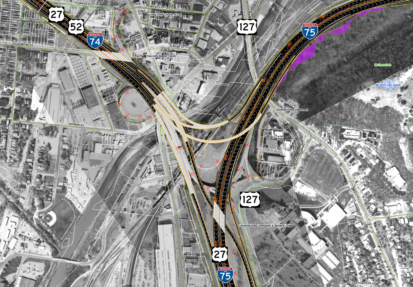
The stretch of Interstate 74 through the Buckeye State is punctuated by forested hills and suburban tracts as the freeway winds eastward toward Cincinnati. A short overlap takes the route along the I-275 beltway by Miamitown and across the Great Miami River ahead of the final push into Cincinnati at Mt. Airy Forest. I-74 concludes at the mix of U.S. 27, U.S. 52, U.S. 127 and Interstate 75 by the South Cumminsville neighborhood and Mill Creek in the city.
Three extant sections of Interstate 74 also exist in North Carolina, but they do not connect directly with the existing I-74 from the Quad Cities to Cincinnati. They are from the Virginia state line along I-77 to Mt. Airy, from I-40 in Winston-Salem south to Rockingham along I-73 and from east of Laurinburg to south of Lumberton along U.S. 74. Three other segments are signed as Future Interstate 74. They are from Mt. Airy south to Winston-Salem along U.S. 52, the Rockingham bypass and the Laurinburg bypass east to Maxton, both along U.S. 74.
High Priority Corridor
North Carolina’s section of Interstate 74 is part of High Priority Corridor 5: I-73/74 North-South Corridor. Its designation in North Carolina is written into law.
 Parallel U.S. Routes
Starting in the Quad Cities area, Interstate 74 follows U.S. 150 southeast to Danville, then follows U.S. 136 the rest of the way into Indianapolis. Southeast of Indianapolis, Interstate 74 at first follows U.S. 421, then U.S. 52 the final distance into Cincinnati.
New Mississippi River Bridge
Illinois and Iowa collaborated on the I-74 Corridor Study in the Quad Cities area. Improvements included work to expand I-74 throughout the Quad Cities, modifications of interchanges, and the construction of a new Mississippi River bridge. Significant funds for the study were included in the SAFETEA-LU bill, signed into law in August 2005.
Following years of delays, partially due to funding, construction on the new basket-handle, true-arch twin bridge for I-74 across the Mississippi River kicked off in July 2017. Approach work included the reconstruction of River Drive in Moline (completed in June 2015) and relocation of streets in Bettendorf (work started in April 2015 and ran through the end of 2016). Construction along U.S. 67 relocated the northbound route to run in tandem with southbound on Grant Street as the State Street alignment was severed by new bridge construction. Kimberly Road, the former alignment of U.S. 6, was also redesigned in 2016 to accommodate a new interchange for the span. Total cost for the project is $1.2 billion.3,4
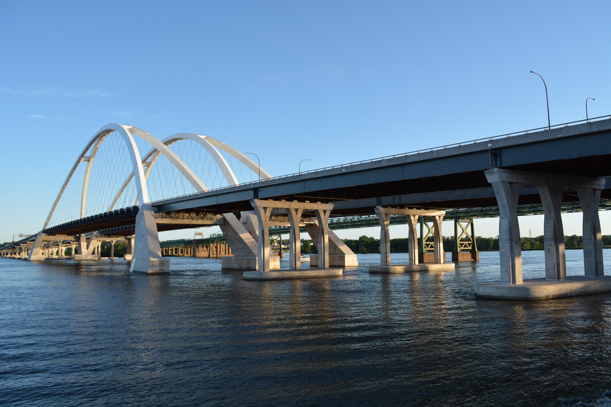
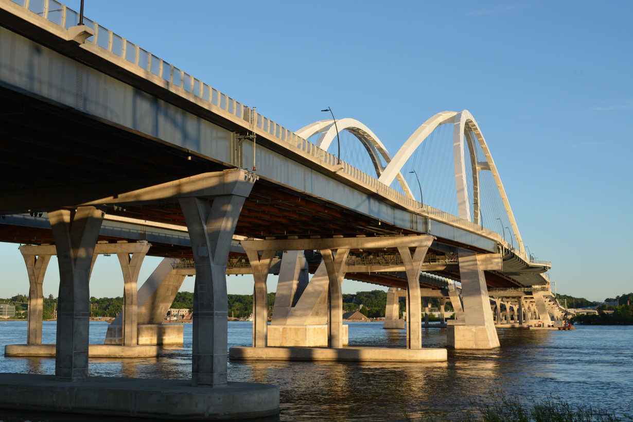
The I-74 Mississippi River Bridge rises to a height of 245 feet, 85 feet higher than the Iowa-Illinois Memorial Bridge. The span accommodates six overall lanes with the option to add an additional lane per direction. A multi use path accompanies the Illinois bound bridge with an observation area at mid span. 06/18/22
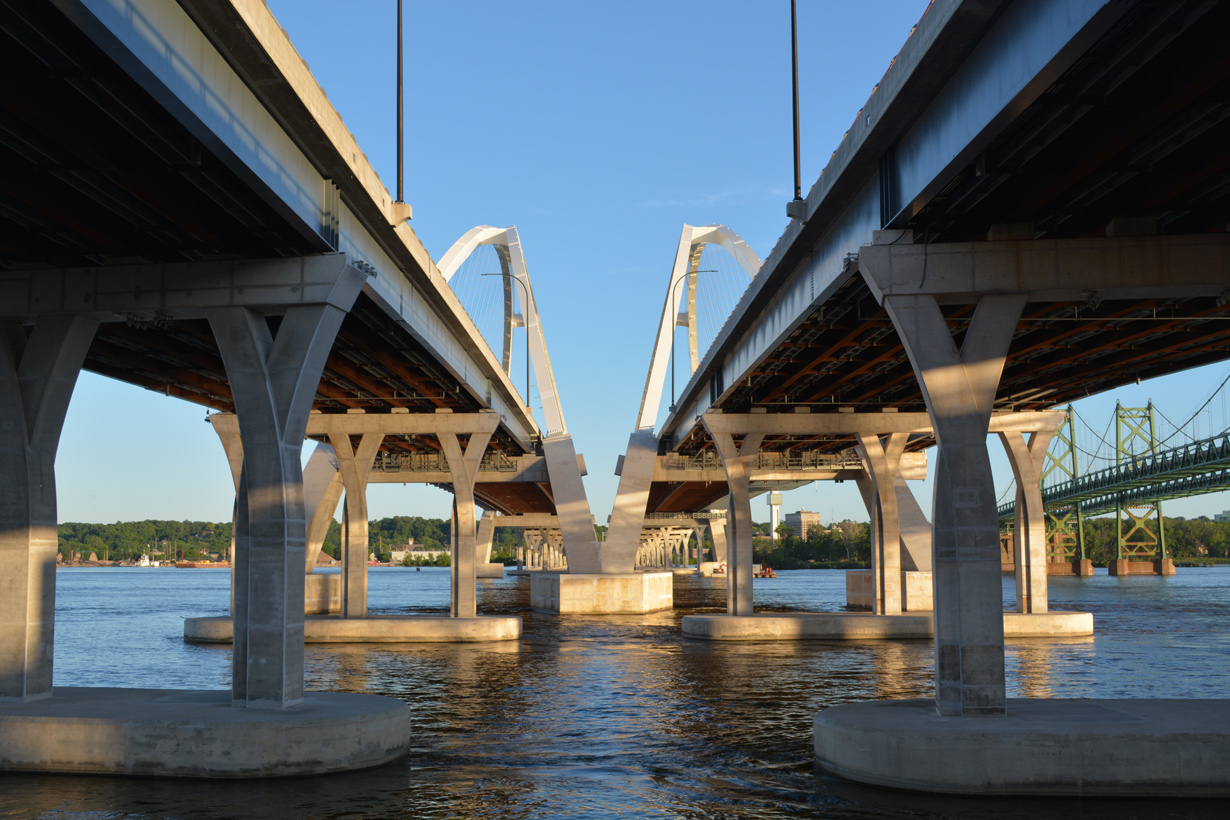
The new Mississippi River bridge lies just east of the Iowa-Illinois Memorial Bridge. Consisting of two four lane spans with full shoulders, the crossing includes a multi use path and scenic overlook at mid span. Preliminary construction on the project started in 2016, with work involving the bridge framework commencing in Summer 2017. Partial closures of Interstate 74 west took place in 2019 to accommodate work on the approaches for the replacement span. The new Iowa bound or westbound span was slated to open by November or December of 2019.4 Work however continued through 2020 with the goal of opening the bridge to two way traffic by the end of the year.13 The new Iowa bound bridge finally opened to traffic on November 13, 2020. Eastbound traffic shifted onto the new span on December 18, 2020.
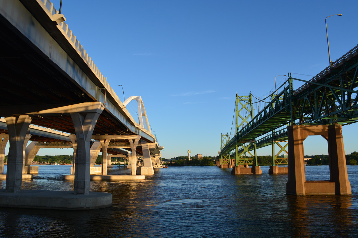
Work on the new Illinois bound bridge continued to December 2, 2021, when the new I-74 River Bridge fully opened to traffic. The old I-74 bridge remained in service for local traffic headed to Downtown Moline until that time, when it permanently closed. Work in 2022 demolishes the suspension bridge.
The American Association of State Highway and Transportation Officials (AASHTO) conditionally approved the 1.4 mile relocation of I-74/U.S. 6 from 7th Avenue in Moline, Illinois to U.S. 67 (Grant Street) in Bettendorf, Iowa at the Spring 2021 Meeting.
Major Projects
Interstate 74 through southwestern Ohio was completed in 1974. The easternmost stretch is undergoing redesign as part of the I-75 Mill Creek Expressway mega project. $13.3 million in construction was completed at the Colerain Avenue and Beekman Street (U.S. 27) interchange from May to September 2012. Additional work, including building a new westbound ramp from I-75 north, started in March 2015.
New flyovers will be built on the north side of the exchange with I-75 as well and the Interstate 74 mainline will be rebuilt from Beekman Street east to the viaduct over Mill Creek and the adjacent railroad lines. Three years of construction for the $91 million project (Mill Creek Expressway: Phase 5B) begins in Spring 2021 2022.
Route Information
Iowa – 5.36
Cities – Davenport, Bettendorf
- Junctions –

Illinois – 220.34*
Cities – Moline, Galesburg, Peoria, Bloomington, Champaign, Urbana, Danville
Junctions –

Indiana – 171.54**
Cities – Crawfordsville, Indianapolis, Shelbyville, Greensburg
- Junctions –
Ohio – 19.47***
Cities – Cincinnati
- Junctions –
North Carolina – 75.03#
Cities – Mt. Airy, Winston-Salem, High Point, Randleman, Asheboro, Ulah, Candor, Ellerbe, Rockingham, Laurinburg, Lumberton
Junctions –
Future
Source: December 31, 2021 Interstate Route Log and Finders List
* – 5.89 miles on I-55, 9.39 miles on I-280
** – 3.45 miles on I-275
*** – 20.60 miles on I-465
# – 19.17 miles on I-73
Interstate 74 through Peoria was reconstructed to modern standards between 2002 and Fall 2007. The $500 million project affected 11 miles of roads. 05/27/08
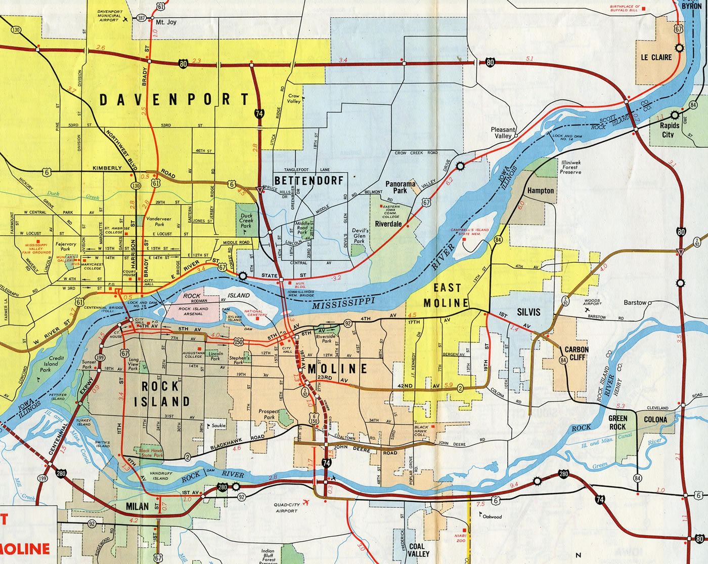
Construction of Interstate 74 from I-280 to the Iowa-Illinois Memorial Bridge replaced the route of U.S. 6/150 along 19th-27th Streets north to Downtown Moline. U.S. 6 later shifted onto the freeway northward to Kimberly Road while U.S. 150 was truncated southward from Moline to an intersection with U.S. 6 east of Quad City International Airport (MLI) in 1977.
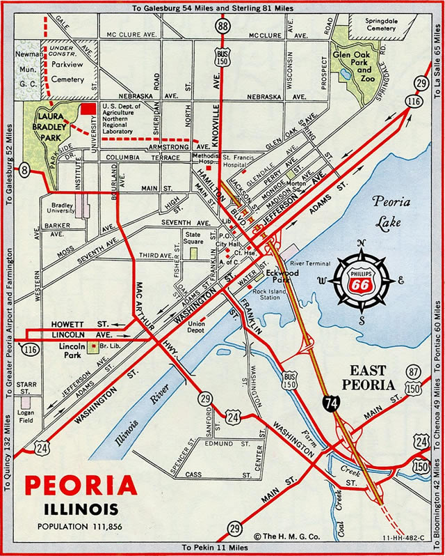
Costing $15.5 million, the Illini Expressway opened in conjunction with the Murray Baker Bridge on December 12, 1958. The freeway from Glendale Avenue in Peoria to Main Street in East Peoria was considered a local crosstown route when it opened. A six month closure of Knoxville Avenue followed in 1959, with I-74 extended east to Washington Street in East Peoria in 1961 and west to University Street in Peoria in 1963.12
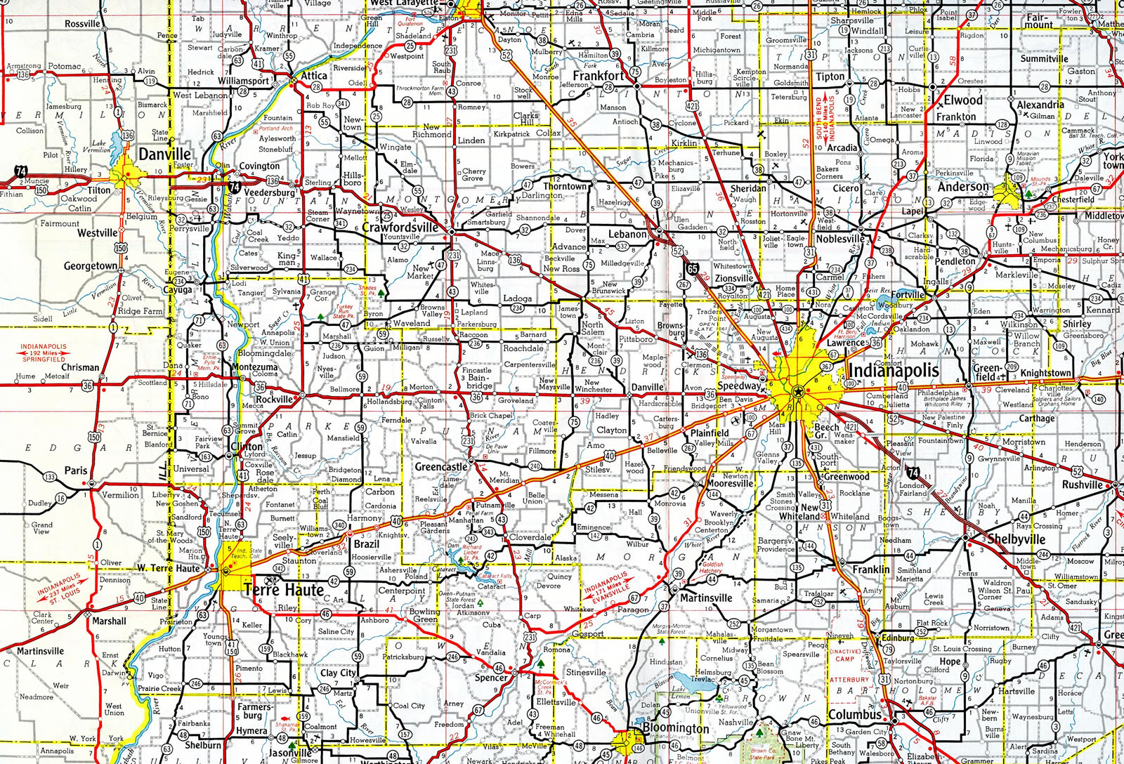
The earliest sections of Interstate 74 opened to traffic across the Hoosier State included a bypass of U.S. 136 south of Covington and upgrades to U.S. 421 from southeast of Indianapolis to Shelbyville.
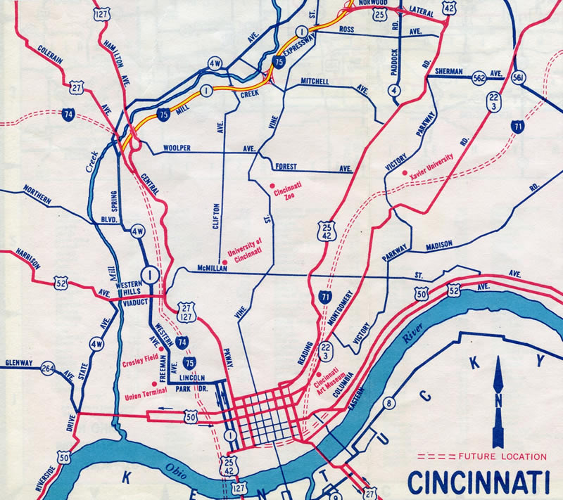
The Mill Creek Expressway for Interstate 75 was already open to traffic from U.S. 27 and the future east end of I-74 northward in 1961. Maps showed I-74 and I-75 overlapped south into Downtown. This may have been planned, as maps for Cleveland also showed I-71/77 concurrent to the Lake Erie waterfront.
History
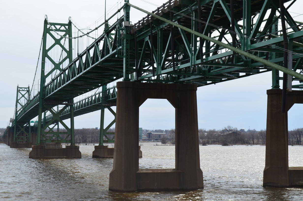
The Iowa-Illinois Memorial Bridge carried Interstate 74 across the Mississippi River until December 2021. The westbound span opened in 1935 with two-way traffic. The eastbound span was added by 1959.1 The suspension bridge carried U.S. 6 prior to the designation of I-74, which was added to the span once the freeway approaches were constructed in 1974.2 Tolls were collected at the crossing until January 1, 1970.
The Preliminary Interstate Route Numbering Plan for Illinois released by the American Association of State Highway Officials (AASHO) on August 14, 1957 routed I-74 and I-80 in tandem from Moline southeast to Colona. The Illinois Division of Highways submitted an Urban Numbering Plan to AASHO on July 24, 1958. It assigned Interstate 274 to the Quad Cities East Loop and Interstate 280 to the Quad Cities Southwest Loop. Adjustments were made by November 10, 1958 with the Interstate System Route Numbering approved by AASHO. I-80 replaced I-274 while I-74 and I-280 remained in place through the Quad Cities5
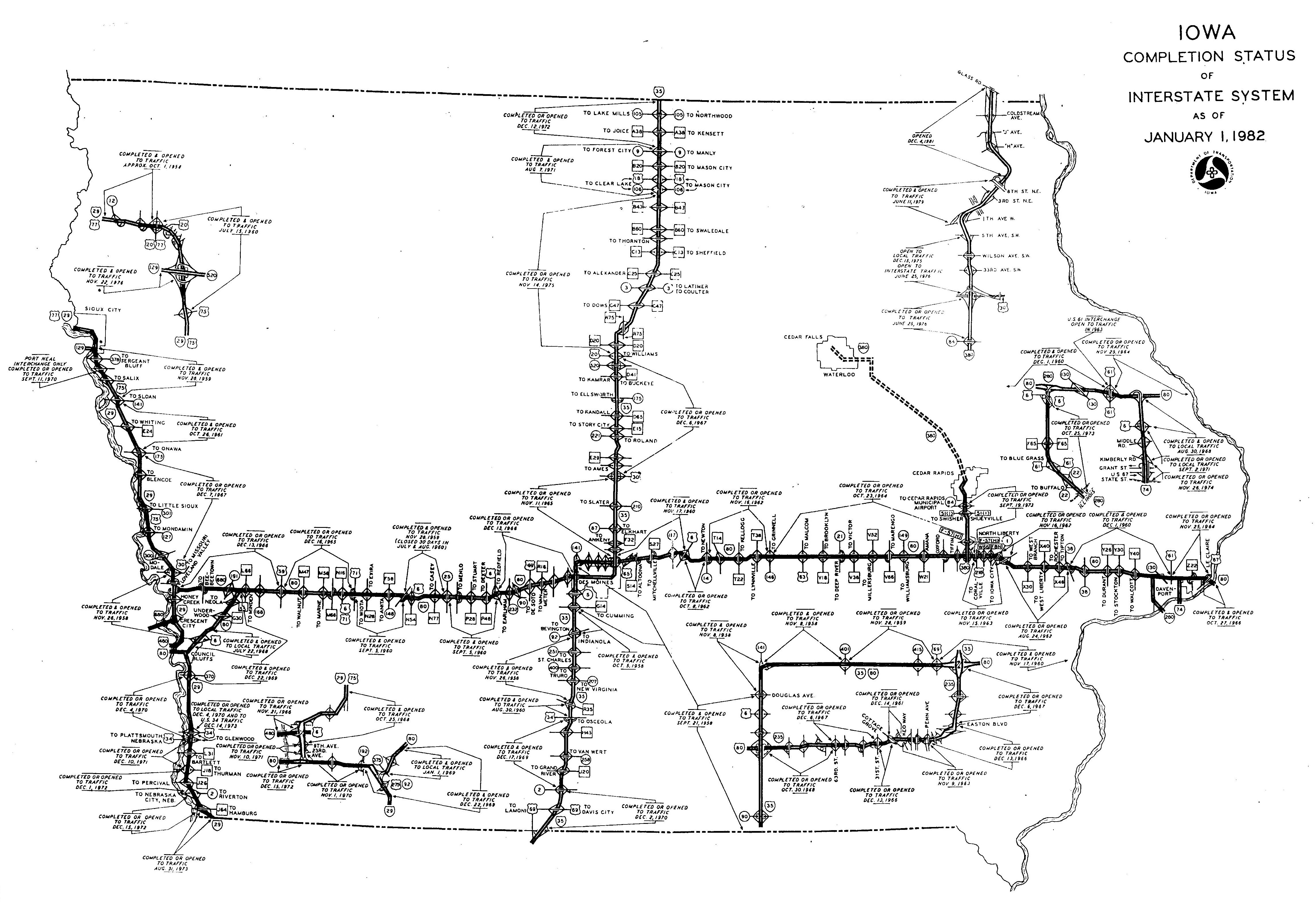
Within Iowa, Interstate 74 opened from north to south:2
- August 30, 1968 – from Interstate 80 south to U.S. 6
- September 2, 1971 – U.S. 6 south to Kimberly Road
- November 26, 1974 – Kimberly Road south to the Mississippi River bridges
Within Illinois, Interstate 74 was completed initially through Peoria along the Illini Expressway and Murray Baker Bridge in December 1958. The cross-state route was finished in 1971 with the opening of I-74 between Bloomington and Mahomet.6,7 See the AARoads guide for Interstate 74 Illinois for more details on the original construction of the freeway.
Representing the first portion of Interstate 74 open to traffic anywhere, the 3,114 foot long Murray Baker Bridge cost $5.5 million to construct when it opened on December 12, 1958. It was named after the businessman that lured Holt Caterpillar Company to East Peoria and R.G. LeTourneau Company to Peoria. The freeway from Glendale Avenue in Peoria to Caterpillar Trail in East Peoria was unofficially named the Illini Expressway. I-74 was finished across the Peoria area and west to Kickapoo in 1965. 1,6 million cubic yards of dirt were removed from Fondulac Hill in East Peoria while 300 homes, 20 apartment buildings and 70 businesses were demolished to make way for the freeway.8,9
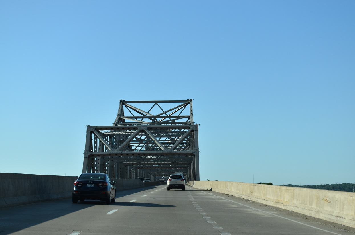
Crossing the Illinois River on the Murray Baker Bridge linking Peoria with East Peoria. 05/24/18
The Big X cloverleaf interchange where I-74 and I-80 bump one another utilizes a TOTSO (turn off to stay on) movement for both freeway mainlines. In an effort to correct this design issue, Illinois officials proposed renumbering the Quad Cities Interstate system in 1991 to reroute I-80 south over I-280 around Moline and Rock Island and I-74 north over current I-80 from East Moline to Le Claire and north Davenport. The existing I-74 between Moline and Bettendorf would be renumbered as Interstate 174. This action was not supported by Iowa officials and officially dropped in 1993.
Through Peoria and East Peoria, the Upgrade 74 project between October 2002 and December 2006 rebuilt the freeway to modern standards. The $490-million project10 expanded I-74 to six and eight lanes, improved all Peoria interchanges, and rebuilt the approaches to the Murray Baker Bridge. Upgrade 74 work included:7
- 2003 – Widening Sterling Avenue to six lanes
- 2003 – Reconstrucing overpasses for Sterling Avenue, Gale Avenue, University Street, Broadway Street, Sheridan Road and Ellis Street.
- 2003 – Construct a new intersection at Knoxville and Pennsylvania Avenues, reconstruct Downtown Streets and permanently remove the Bigelow Street, Columbia Terrace and Armstrong Street bridges.
- 2003 – Reconstruct Riverfront Drive and Camp Street ramps in East Peoria
- 2004 – Construct new ramp tunnels Downtown and ramps for Sterling, Knoxville and Glen Oak Avenues
- 2004 – Reconstruct over and underpasses for Nebraska Avenue, Perry Avenue, Monroe Street, Madison Street, Jefferson Avenue, Adams Street and Washington Street.
- 2004 – Reconstruct University Street ramps and eastbound Washington Street ramps in East Peoria.
- 2005 – Close Murray Maker Bridge and raise Adams Street over I-74 by another 15 feet.
- 2005 – Widen War Memorial Drive and replace ramps.
- 2005 – Widen Main Street in East Peoria, reconstruct Washington Street westbound ramps.
Work was to be completed by November 17, 2006, but delays pushed completion to early December 2006. Incidental work involving landscaping and cleanup continued through winter 2007.10
The I-74 and I-155 Improvement Project underway between Spring 2013 and October 2016 rebuilt the freeway and interchange at Morton, Illinois. I-74 was reconstructed and expanded to six lanes from just east of I-474 to Morton Avenue (Exit 102). I-155 was upgraded from I-74 south to IL 98 (Birchwood Avenue). The trumpet interchange joining the two freeways was expanded to improve ramp geometry. The single lane tunnels taking Jefferson Street under I-74 were replaced with a conventional overpass while the adjacent abandoned railroad underpass was removed. The exchange with Morton Avenue was also redesigned to eliminate the loop ramp (Exit 102B) on I-74 eastbound.
Construction on Interstate 74 west of Crawfordsville, Indiana started on January 28, 1964 and was finished on December 7, 1965. Work on the eastern portion in Montgomery County followed two months later, with completion on July 4, 1966. When I-74 was completed across the state in 1967, it was the first interstate within the Hoosier State fully opened.11
Accelerate 465 construction finished in December 2012 rebuilt an 11-mile corridor of the Indianapolis beltway along the west side of the city. The $423 million project included a redesign of the full cloverleaf interchange joining I-74 and I-465 with Crawfordsville Road (former U.S. 136). The direct connection from I-74 to Crawfordsville Road was removed and replaced with new ramps joining it and the beltway with U.S. 136 just to the south. This eliminated weaving traffic patterns and the TOTSO connection for the I-74 westbound mainline.
Future Plans
Long range plans called for Interstate 74 to continue east and south of Cincinnati through West Virginia and Virginia into North Carolina and South Carolina, with the freeway ending in Myrtle Beach. However, only North Carolina has shown interest or made progress with building I-74. Ohio and West Virginia are unlikely to ever build their proposed portions of the route.
To make the connection between Cincinnati and Huntington, West Virginia, Interstate 74 was proposed to pass through either Ohio or Kentucky. A feasibility study of routing Northern Kentucky Outer Loop Interstate 74 in Kentucky was completed in March 2003, and it revealed that constructing an east to west bypass around Cincinnati to the south via Kentucky might be needed someday, but it was not necessary at the time.14 Another study at the time considered routing Interstate 74 along the AA Highway rather than Ohio Route 32.
Within West Virginia, Interstate 74 was programmed to follow proposed I-73 along U.S. 52; the two routes would split before entering Virginia, with I-74 merging with I-77 south into North Carolina.
Interstate 74 shields were first erected along a stretch of U.S. 220 freeway south of Asheboro, North Carolina and in 2001 along a stretch between the Virginia State Line and Mt. Airy, North Carolina.
Main guide: Interstate 74 North Carolina
Within South Carolina, a failed state resolution previously attempted to designate Carolina Bays Parkway as part of I-74, Veterans Highway/Conway Bypass as part of I-73, and the North Myrtle Beach Connector from Main Street to the parkway as part of a new route designated Interstate 174.
The proposed route of I-74 was adjusted to hook southwest from Wilmington, North Carolina to reach the Grand Strand via Carolina Bays Parkway. I-73 may be built as a toll road but funding has continually remained an issue. The North Myrtle Beach Connector was completed as an at-grade expressway and opened in September 2009.
More information on I-74 in the Carolinas at Bob Malme’s Interstate 73/74 Progress web pages.
East End  – Cincinnati, Ohio
![]() North at
North at ![]()
![]()
![]()
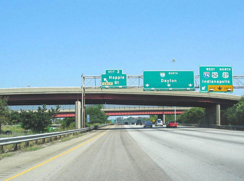
I-75 advances 2.25 miles north through the West End neighborhood of Cincinnati to Interstate 74 west. Phase 4 construction for the Mill Creek Expressway project through July 2017 rebuilt I-75 from the Western Hills Viaduct to Hopple Street. 11/08/09
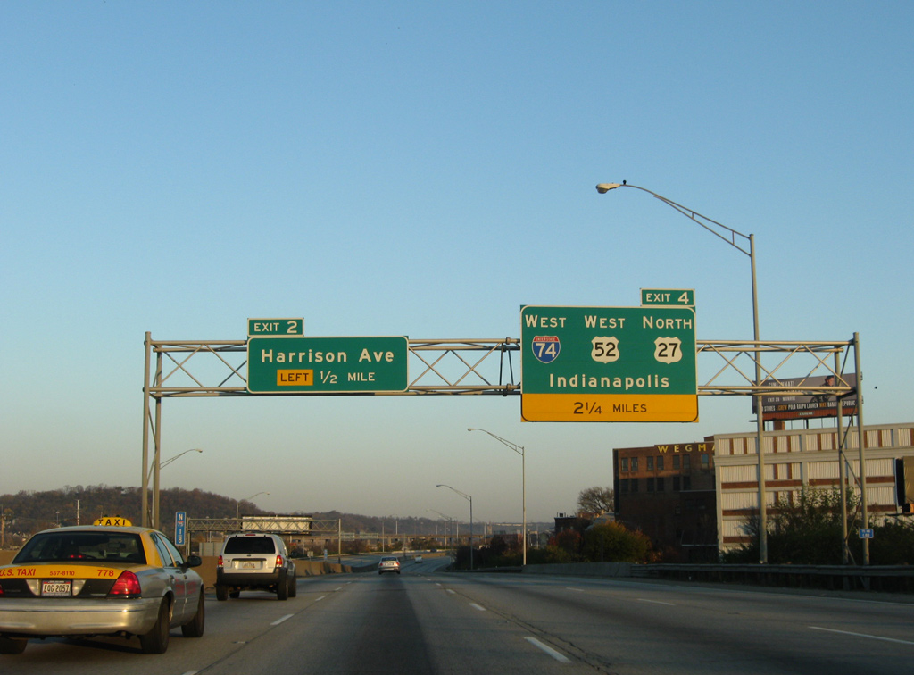
Left Exit 2 to Harrison Avenue departs 1.75 miles south of Interstate 74. The forthcoming exit for Hopple Street was relocated from the left to the right in 2015. 11/08/09
This sign for I-74 was still in use during construction in 2015. U.S. 27/52 west combine with I-75 north from Hopple Street to I-74 west and South Cumminsville. Succeeding signs for I-74 were taken down due to the shift of traffic onto temporary configurations along the east side of Interstate 75. 11/08/09
![]() South at
South at ![]()
![]()
![]()

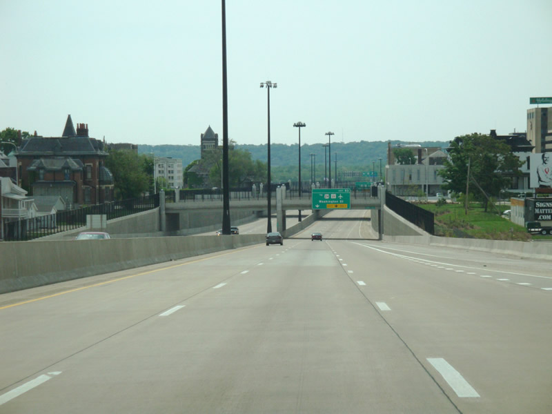
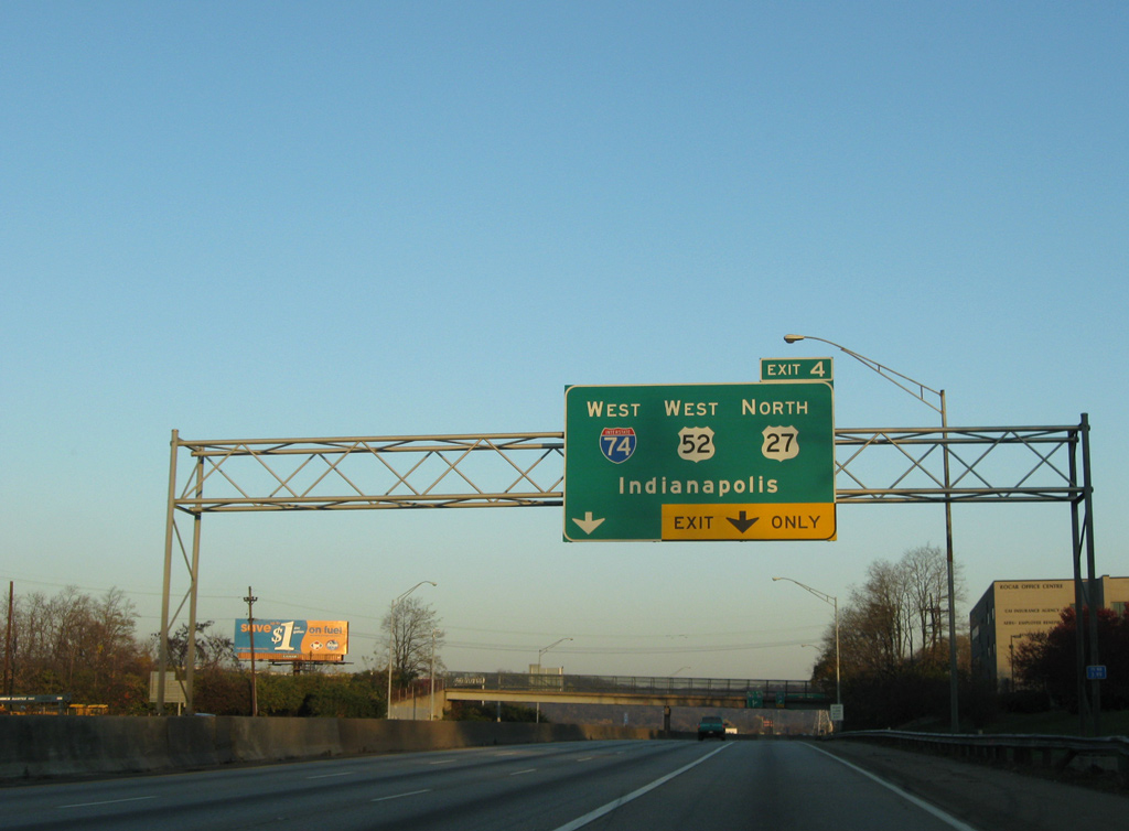
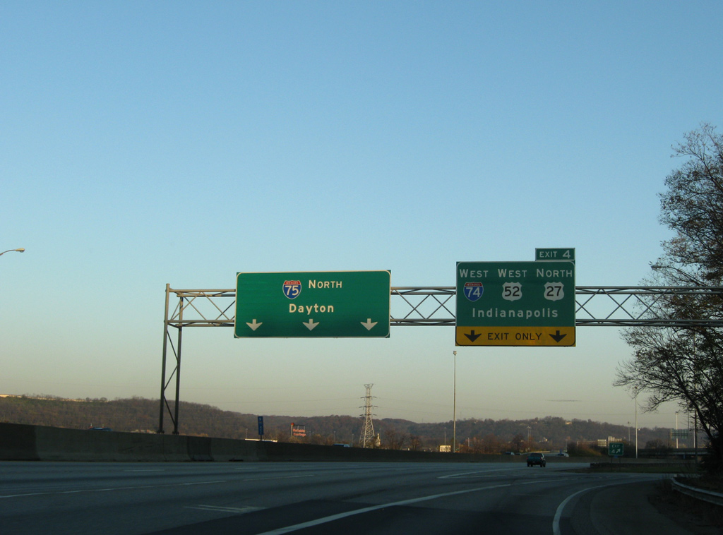
I-75 (Mill Creek Expressway) weaves southwest between Mill Creek and the Clifton neighborhood of Cincinnati to Exit 4 for I-74/U.S. 27-52 west. I-75 and U.S. 52 east overlap for a half mile to Camp Washington while U.S. 52 west accompanies I-74 to Exit 169 in Braysville, Indiana. 11/04/11
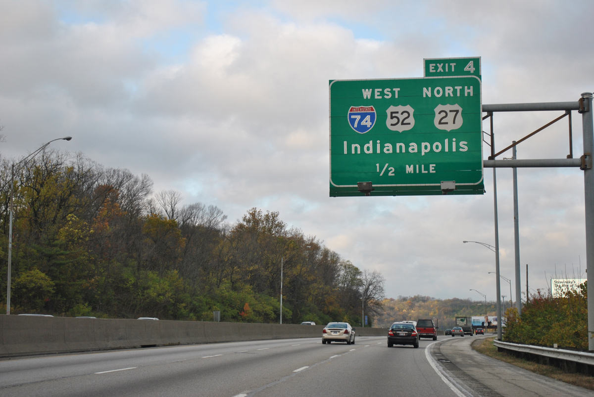
One half mile ahead of the directional T interchange (Exit 4) with Interstate 74 west on I-75 south. I-74 winds northwest from Cincinnati ten miles to combine with Interstate 275. 11/04/11
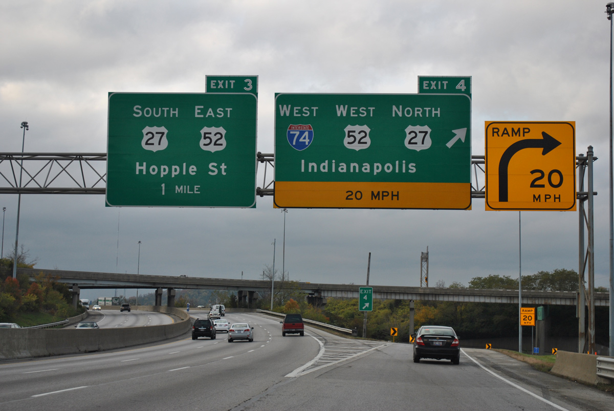
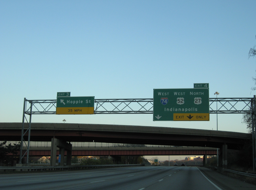
Exit 4 departs I-75 south along a sharp curve to join Interstate 74 west, which presently travels at grade below the adjacent railroad lines. Phase 5B of the Mill Creek Expressway projects for I-75 replaces this movement with a high speed flyovers serving both I-74 west and U.S. 27 (Beekman Street) north to Northside. 11/04/11
East End Throwback
![]() North at
North at ![]()
![]()
![]()

Button copy guide signs posted 2.25 miles south of the Interstate 74 on I-75 north. Photo by Steve Hanudel (08/20/05).
Passing under the Western Hills Viaduct along Interstate 75 north. A loop ramp joined the freeway north from Harrison Avenue east, 1.5 miles south of the directional T interchange (Exit 4) with I-74/U.S. 52 west. Photo by Steve Hanudel (08/20/05).
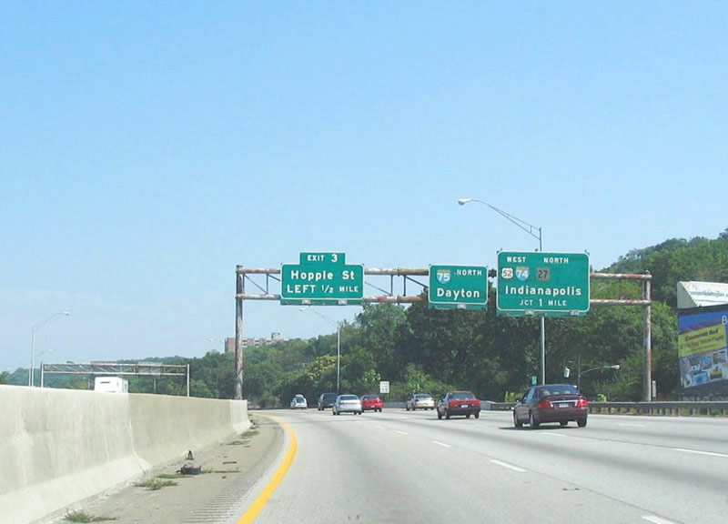
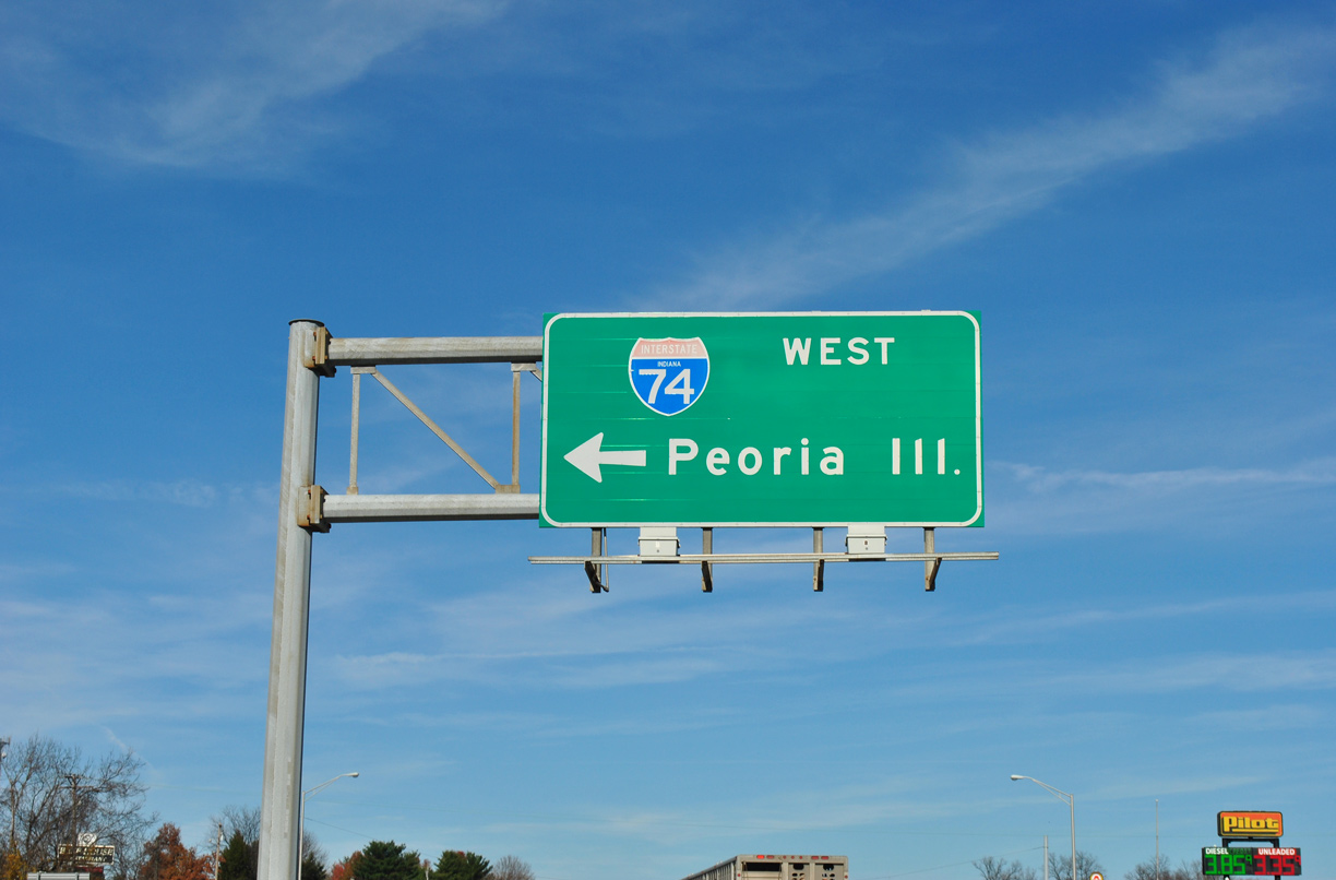
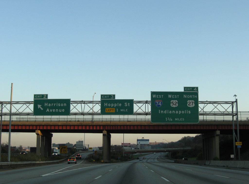
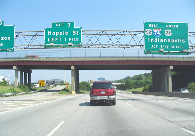
I-75 continues north with four lanes to Left Exit 3 for Hopple Street. Interstate 74 travels northwest to Indianapolis. I-74 west to I-65 north provides the most direct route to Chicago from Cincinnati. Photo by Steve Hanudel (08/20/05).
Directional ramps once connected Hopple Street east with I-75 north and from I-75 north to Hopple Street west. These were removed during the Mill Creek Expressway project. Button copy signs pictured here were replaced by 2007. Photo by Steve Hanudel (08/20/05).
This sign bridge was posted along I-75 north between the Monmouth Avenue overpass and a former pedestrian bridge at Colerain Avenue. I-75 northbound reduced to three lanes at Exit 4. 11/08/09
Two lanes partitioned from Interstate 75 north for I-74/U.S. 27-52 west to Northside, Harrison and Indianapolis, Indiana. I-75 proceeds north from the exchange with I-74, 47 miles to Dayton. 11/08/09
West End – Bettendorf, Iowa
![]() West at
West at ![]()
Interstate 74 runs between an apartment complex and the Lakehurst subdivision just north of 53rd Street. The final confirming shield for I-74 west stands along this stretch. 06/21/22
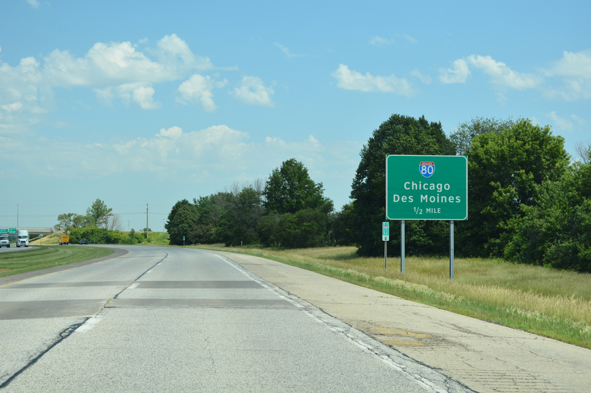
A half mile guide sign for Interstate 80 was added to I-74 west ahead of Veterans Memorial Parkway following construction to expand the interchange (Exit 1) at 53rd Street. The ramps for I-80 are unnumbered. 06/21/22
The original 67th Street overpass was replaced in 2015-16 as part of Bettendorf and Davenport city project to extend Veterans Memorial Parkway east to Utica Ridge Road. Overheads for the ramp separation to I-80 were replaced in kind. 06/21/22
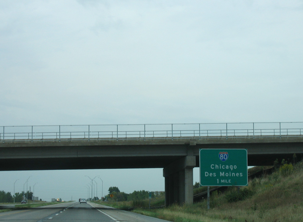
The mainline of I-74 defaults onto I-80 west ahead of the cloverleaf interchange with U.S. 61 north and U.S. 61 Business (Brady Street) south. U.S. 61 links the Quad Cities with Dubuque while I-80 constitutes a heavily traveled freight corridor across the Hawkeye State to Iowa City, Des Moines and Council Bluffs. 06/21/22
![]() East at
East at ![]()
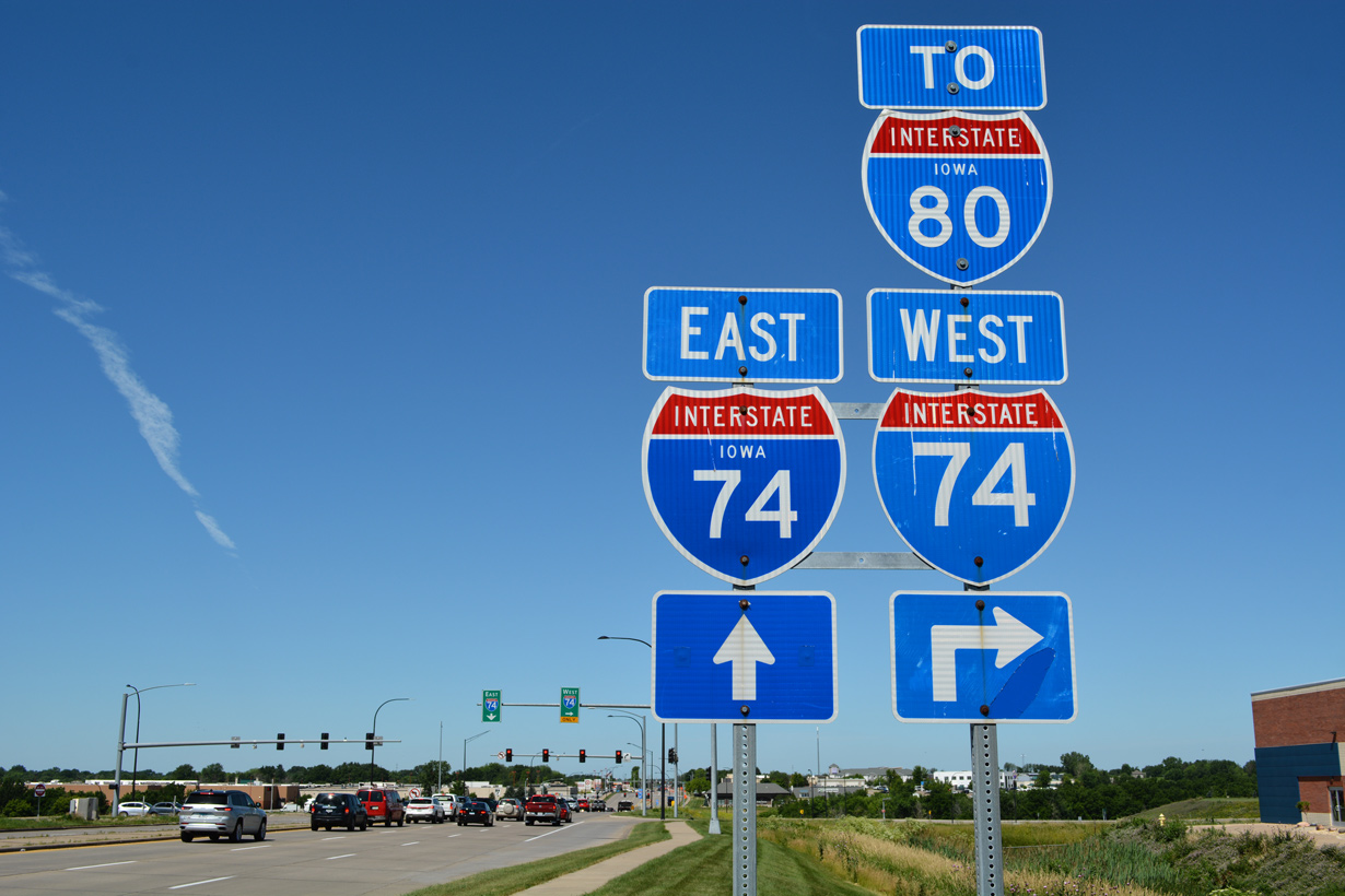
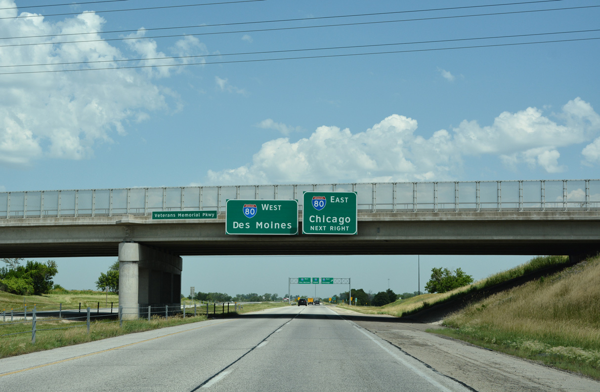
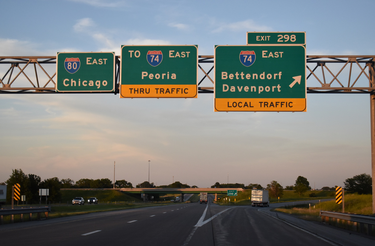
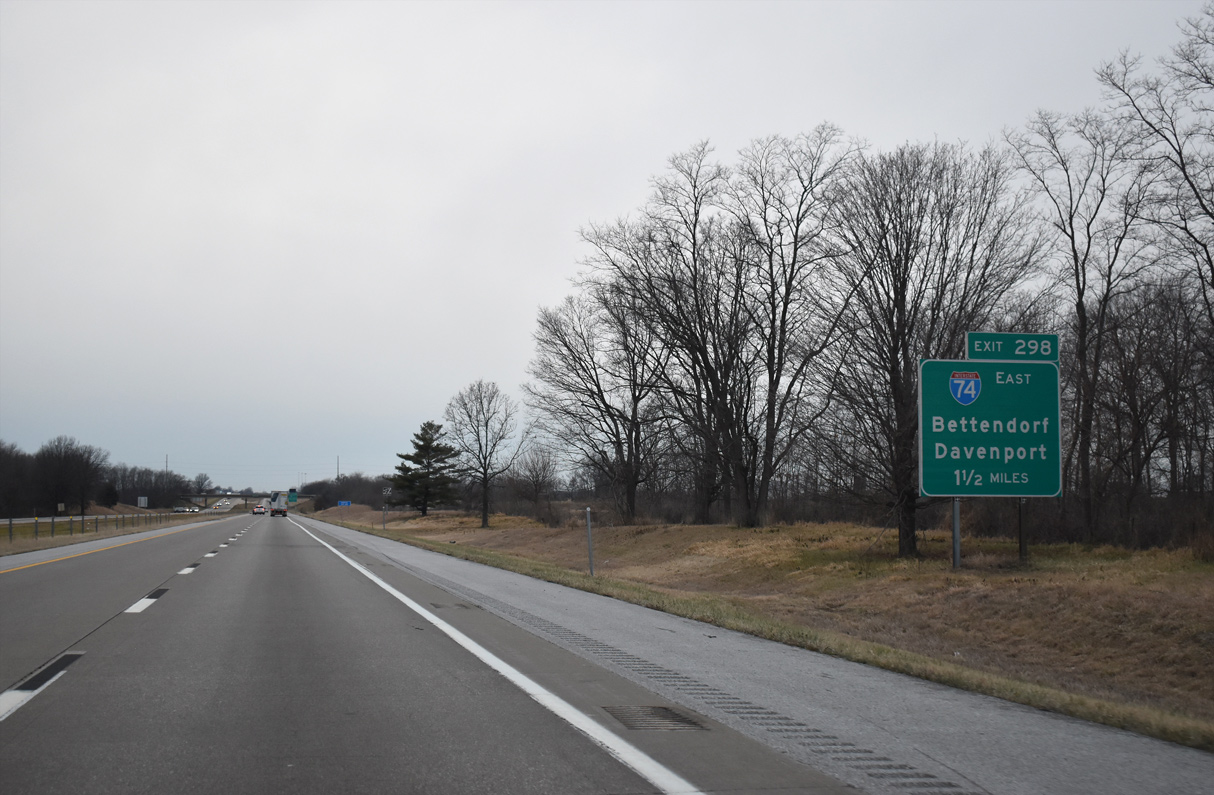
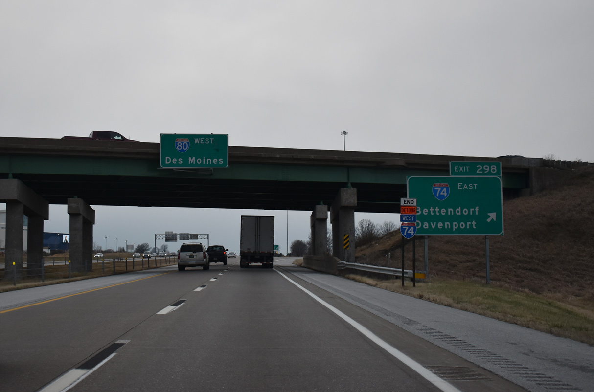
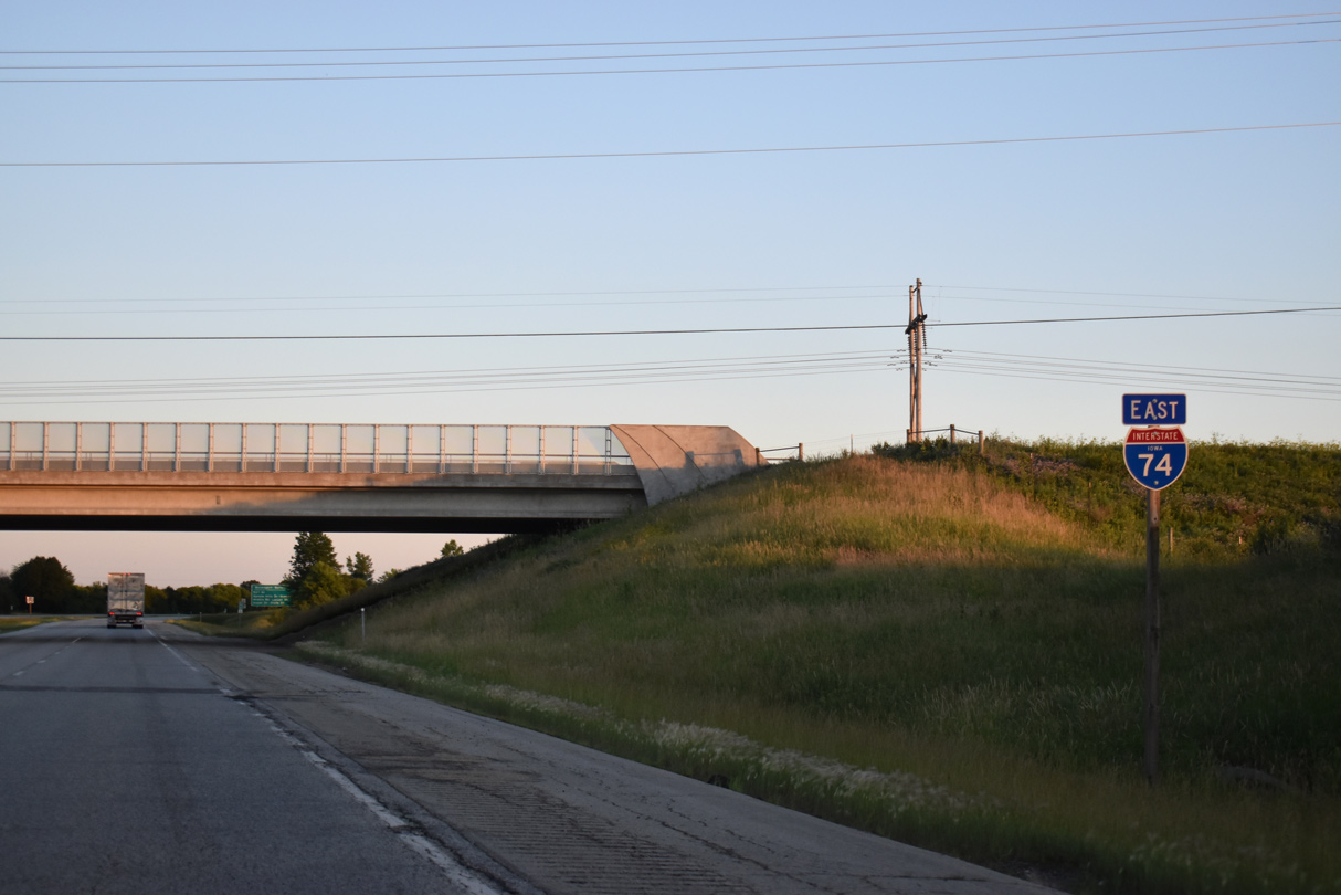
Interstate 80 continues two miles east from the separation with U.S. 61 north to meet I-74 at a trumpet interchange (Exit 298). I-74 leads south through eastern Davenport to the Bettendorf Riverfront while I-80 stays northward to Le Claire and Rapids City, Illinois. 06/19/21
Yellow placards referencing Local Traffic were added to signs at Exit 298 during the mid 2000s to redirect through traffic away from the Iowa Illinois Memorial Bridge along I-74. 06/19/21
The rural exchange at I-74/80 was targeted for area development, leading to construction of the Rhythm City Casino complex just to the southwest. Nearby I-74 connects with 53rd Street, which serves a busy retail corridor on parallel Elmore Avenue between the casino and U.S. 6 (Kimberly Road). 06/19/21
![]() West at
West at ![]()
Interstate 80 remains rural through northern reaches of Bettendorf west to the Davenport city line and Exit 298 for I-74 east. 12/27/23
Exit 298 loops onto I-74 east from I-80 west. There are four exits on the Iowa side of the Quad Cities south to the Mississippi River and Moline, Illinois. 12/27/23
Exit 298 loops onto I-74 east from I-80 west. There are four exits on the Iowa side of the Quad Cities south to the Mississippi River and Moline, Illinois. 12/27/23
![]() East
East
The first reassurance marker for I-74 precedes the Veterans Memorial Parkway overpass. Veterans Memorial Parkway constitutes an arterial built by the cities of Davenport and Bettendorf between 2013 and 2016 to open up additional areas for economic development. 06/21/22
West End Throwback
Construction from 2010 to November 2012 expanded the diamond interchange at 53rd Street with loop ramps to I-74. The new ramp joining I-74 westbound took the place of this guide sign for I-80. 09/04/05
The 67th Street overpass preceding the ramp separation for I-80 was replaced in 2015 with the extension of Veterans Memorial Parkway east from U.S. 61 Business (Brady Street) to Utica Ridge Road. 09/04/05
Sources:
- Interstate 74 Corridor Study in the Quad Cities area
- “Iowa Completion Status of Interstate System as of January 1, 1982.” Iowa Department of Transportation.
- “Seeing progress for new I-74 bridge project.” The Dispatch / Rock Island Argus (QCOnline.com), March 25, 2015.
- “Building a Bridge: I-74 project moves into home stretch.” KWQC March 14, 2016.
- Stephen Summers’s Interstate system route numbering page.
- “Cause for celebration – Festival will mark historic I-74 construction and reopening of Murray Baker Bridge.” The Peoria Journal Star, September 29, 2005.
- “THE BIG FIX — First year at-a-glance.” Peoria Journal Star, The (IL), June 22, 2003.
- “Road to Change > When Interstate 74 Cut Through Peoria in the Late ’50s, The Drive Toward Future Growth Began. The Interstate’s Impact on the City Has Been Significant During the Past Four Decades, But Officials Today are Still Looking Toward the Future.” Journal Star (Peoria, IL), June 30, 1996.
- “Bridge is Link That Altered Face of a City > Span That Carries I-74 Across River was Key in Shaping a Greater Peoria.” Journal Star (Peoria, IL), December 12, 1998.
- “I-74: Inching to the finish – Some barrels remain, work zone speed limits still in effect while crews chip away on minor work, cleanup, landscaping.” Peoria Journal Star, The (IL), November 29, 2006.
- “I-74 part of celebration.” Paper of Montgomery County, The (Crawfordsville, IN), June 30, 2006.
- “Original a work in progress — ‘Illini Expressway’ unified Tri-County Area, fueled growth of Downtown Peoria.” Peoria Journal Star, The (IL), June 22, 2003.
- “‘Major accomplishment’ on new I-74 bridge.” Quad Cities Times (Davenport, IA), September 16, 2020.
http://transportation.ky.gov/planning/projects/projects/I-74/I-74.shtm.
Page updated January 27, 2024.