
Virginia Route 199 encircles the independent city of Williamsburg in York County along Humelsine Parkway. Measuring 14.13 miles in length, the belt route is an overall controlled access expressway. Limited access sections for SR 199 extend west from I-64 at Exit 242 to the exchange with U.S. 60 (Pocahontas Trail) and SR 143 (Merrimac Trail) and north from the SPUI with SR 321 (Monticello Avenue) back to I-64 at Exit 234.
A regional transportation plan created by the Hampton Roads Planning District Commission in 1968 proposed a four lane beltway around Williamsburg to divert traffic from existing two lane roads. The plan recommended completion for the Williamsburg artery, the eventual Route 199, by 1985. Construction got underway in the mid-1970s on a 6.4 mile segment.1 Virginia Route 199 opened from SR 5/31 (Jamestown Road) in southwest Williamsburg east to I-64 and SR 641 (Penniman Road) by 1976.2
Original plans for the eight mile extension of SR 199 northward from SR 5 to U.S. 60 at Lightfoot and I-64 at Newman Road (SR 646) outlined a two lane at-grade highway constructed within a four lane right of way.3 Subsequent plans for Route 199 excluded any exits in York County and incorporated a signalized intersection with Longhill Road in James City County. Local officials protested, and James City helped convince the Virginia Department of Transportation (VDOT) to build a grade separation for Longhill Road. Plans to develop land around the intersection with International Parkway (SR 603 - Mooretown Road) fueled efforts by York County to get a $5 million exit ramp, which was completed in 1997.2
Remaining work on SR 199 was partitioned into four segments. The 1.6 mile long Lightfoot corridor linking I-64 with U.S. 60 (Richmond Road), was finished in Fall 1995. The grade separation at Mooretown Road was built later, and traffic along SR 199 utilized the eventual exit ramps until it was.4
The Long Hill Road corridor extended SR 199 south from U.S. 60 (Richmond Road) 2.8 miles to SR 612 (Longhill Road). Construction got underway here in October 1996 and was scheduled for completion in Spring 1997. Work on the Monticello Avenue corridor, 2.1 miles south from SR 612 to SR 321, commenced in September 1996 and was anticipated to open in Fall 1997. The overpass at the exchange with Monticello Avenue was added later.4
The Route 5 corridor extended SR 199 southeast from SR 321 (Monticello Avenue) 1.6 miles to SR 5 along Jamestown Road. Construction started in September 1995 with completion expected in Spring 1997.4
Numerous revisions with the $68 million project4 pushed back the scheduled completion to Fall 1998.1 These including redesigning the diamond interchange at Mooretown Road into a full cloverleaf.6 The final section of the Route 199 beltway officially opened to traffic following a ceremony attended by government leaders, transportation officials and area residents by the intersection of SR 5/199 on August 6, 1999. The overpass for Longhill Road was also dedicated as the Robert S. Hornsby Memorial Bridge at the event.5
Route 199 was renamed as Humelsine Parkway in a bill signed into law by Governor Mark R. Warner that became effective on July 1, 2004. A Williamsburg resident and longtime board member of the Colonial Williamsburg Foundation, Carlisle H. Humelsine was a leading advocate for construction of Route 199 in 1974.7
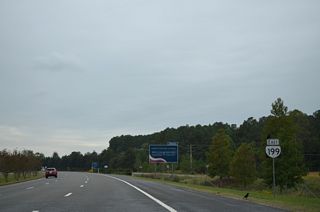
SR 199 (Humelsine Parkway) extends southwest from a parclo interchange joining I-64 with SR 646 (Newman Road).
10/12/14
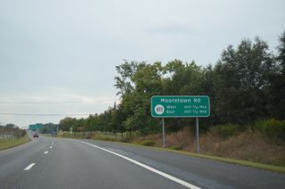
Forthcoming SR 603 (Mooretown Road) parallels U.S. 60 north from SR 713 (Waller Mill Road) at Greensprings in Williamsburg 4.81 miles to SR 646 (Lightfoot Road).
10/12/14
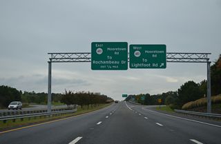
A cloverleaf interchange joins SR 199 with SR 603 (Mooretown Road) adjacent to the Shops at Cedar Valley and big box retail.
10/12/14
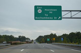
Rochambeau Drive arcs east from Mooretown Road to adjacent commercial development and as the frontage road for I-64 south to SR 143 (Capitol Landing Road).
10/12/14
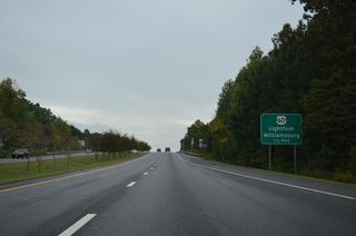
SR 199 crosses into James City County just ahead of the folded diamond interchange with U.S. 60 (Richmond Road).
10/12/14
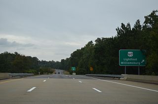
U.S. 60 (Richmond Road) leads south from SR 199 at Lightfoot into Williamsburg and north to Norge and Toano.
10/12/14
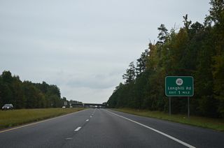
SR 612 (Longhill Road) meets SR 199 at a parclo interchange west of the Williamsburg city line.
10/12/14
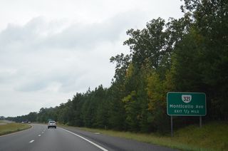
SR 321 lines Monticello Avenue 2.23 miles east to Compton Drive for William & Mary University and west to SR 613 (New Road) at SR 5000.
10/12/14
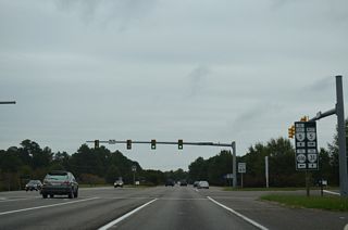
SR 5 parallels the James River west to SR 106/156 north of the Benjamin Harrison Memorial Bridge before turning north toward Richmond.
10/12/14
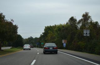
SR 31 (Jamestown Road) spurs 4.46 miles southwest to the Jamestown-Scotland Ferry crossing the James River.
10/12/14
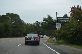
SR 5 overtakes Jamestown Road northeast from SR 31 to William & Mary University and Downtown Williamsburg.
10/12/14
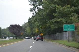
SR 199 straddles the Williamsburg / James City County line east from SR 5/31 (Jamestown Road) to the exchange with U.S. 60 (Pocahontas Trail).
10/12/14

Brookwood Drive (SR 700) links SR 199 with SR 617 (Lake Powell Road) south at Birchwood Park.
10/12/14
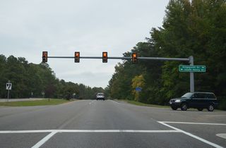
Unmarked along SR 199, S Henry Street north 1.85 miles to SR 5 at Francis and Boundary Streets in Downtown Williamsburg is SR 132. Kingspoint Drive south links SR 199 with Colonial Parkway south to Jamestown.
10/12/14
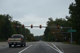
Continuing east from the grade separation with Colonial Parkway, SR 199 next intersects SR 637 along Quarter Path Road north and Mounts Bay Road south.
10/12/14
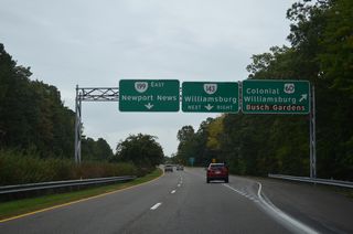
Succeeding folded diamond interchanges connect SR 199 with U.S. 60 (Pocahontas Trail) and SR 143 (Merrimac Trail) along the Williamsburg / York County line.
10/12/14
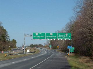
These overheads at the exit for U.S. 60 (Pocahontas Trail) east to Busch Gardens Williamsburg and northwest to Page Street in Williamsburg were replaced in kind.
03/25/06
- "Traffic Patterns: Project Has Miles to Go - Route 199's Completion to Cap Years of Planning, Require Vision for Future." Daily Press (Newport News, VA), November 18, 1996.
- VA 181 to 200. Virginia Highways Page.
- "Open Road: Route 199 Extension Ready for Traffic - Motorists, Merchants Glad for End to 20-Year Project." Daily Press (Newport News, VA), August 6, 1999.
- "Countdown to 199 - Lane Changes: Beltway Will Alter Landscape." Daily Press (Newport News, VA), May 17, 1995.
- "Ceremony Accompanies Opening of Route 199." Daily Press (Newport News, VA), August 7, 1999.
- "On the Roads to Growth - York Gears up for Development Along 2 Routes." Richmond Times-Dispatch (VA), August 1, 1999.
- "Whaddayaknow? - Regional Mysteries Solved, One Column at a Time." Daily Press (Newport News, VA), June 24, 2005.
Photo Credits:
- 03/25/06 by Pam Steckman. 10/12/14 by AARoads.
Connect with:
Interstate 64
U.S. 60
Page Updated 04-15-2021.


