 East
East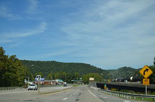
SR 648 (Elgood Mountain Road north / East River Mountain Road south) intersects U.S. 460 (Virginia Avenue) just east of the West Virginia state line in the town of Glen Lyn.
09/23/14
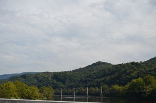
Pier supports south of the New River Bridge on U.S. 460 remain from a former Norfolk and Western Virginia Railroad bridge.
09/23/14
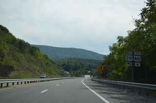
U.S. 219 extends just 1.73 miles south from Peterstown, West Virginia to U.S. 460 in Rich Creek.
09/23/14
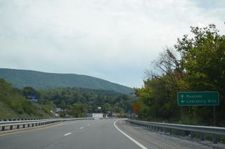
U.S. 219 travels northeast to Lewisburg and Elkins in West Virginia to the Maryland panhandle.
09/23/14

U.S. 219 south concludes at U.S. 460 along Island Street in Rich Creek. The north end of U.S. 219 is in Buffalo, New York with Interstate 90.
09/23/14
 East East |
| U.S. 460 meets U.S. 29 (Wards Road) south and U.S. 29 Business north at a cloverleaf interchange near Vista Acres in south Lynchburg. U.S. 29 Business follows Wards Road north 1.6 miles to U.S. 501 on the Lynchburg Expressway. Wards Road also connects with U.S. 460 Business (Fort Avenue). 05/30/05 |
 North North  East East |
| U.S. 29/460 combine north into the city limits of Lynchburg. Straddling Candlers Mountain, the freeway was originally designated SR 224. 05/30/05 |
| A loop ramp joins U.S. 29/460 with Candlers Mountain Road in one mile. South out of Lynchburg, Candlers Mountain Road (SR 670) connects with University Boulevard to adjacent Liberty University. 05/30/05 |
| This distance sign referenced U.S. 460 control cities as it predated the realignment of U.S. 29 onto the freeway. 05/30/05 |
| Candlers Mountain Road (SR 670) circumvents Candlers Mountain eastward from U.S. 29/460 (Liberty Mountain Drive) to SR 677 (Sunnymeade Road). 05/30/05 |
| U.S. 501 links U.S. 29/460 with the Lynchburg Expressway. The arterial route serves River Ridge Mall and a number of big box hotels and other businesses along Candlers Mountain Road. 05/30/05 |
| Joining Downtown Lynchburg with Madison Heights, U.S. 501 provides a direct connection to U.S. 29 Business (Lynchburg Expressway). 05/30/05 |
| U.S. 501 stems north from U.S. 29/460 to Candlers Mountain Road and the Lynchburg Expressway from a directional T interchange. U.S. 501 follows the expressway westward toward Boonsboro. The route travels 111.5 miles within Virginia between U.S. 60 at Buena Vista and the North Carolina state line near Cluster Springs. 05/30/05 |
 East East |
| Advancing east from U.S. 460 Business (Pamplin Road) outside Pamplin, U.S. 460 reaches Prospect in five miles. 12/21/08 |
| SR 658 (Five Forks Road south / Mountain View Road north) intersects U.S. 460 (Prince Edward Highway) at Shields. SR 658 travels east to Five Forks and Hampden-Sidney. 12/21/08 |
| SR 657 (Sulphur Spring Road) spurs east from U.S. 460 (Prince Edward Highway) near Elam. 12/21/08 |
| SR 627 (Hixburg Road) stems north from U.S. 460 at Elam to Hixburg. 12/21/08 |
| SR 751 (Hidden Lake Road) heads north from SR 657 to U.S. 460 west of Prospect. Old U.S. 460 follows Pineview Road east from Hidden Lake Road to the south. 12/21/08 |
| U.S. 460 widens with a tree lined median ahead of Prospect and SR 776 (Rhodes Road) north. 12/21/08 |
| SR 626 (Peaks Road) enters Prospect from Hurtsville to the north. SR 626 continues south on Prospect Road to Pine Oak Road and Allens Mill. 12/21/08 |
| Glen Carson Road connects U.S. 460 (Prince Edward Highway) with Catalpa Lane west as SR 763 in Prospect. 12/21/08 |
| SR 652 loops northeast from SR 626 along Brisentine Trail and Harris Creek Road to U.S. 460 east of Prospect. 12/21/08 |
| Prospect Road continues east from SR 626 (Pin Oak Road) as SR 608 to U.S. 460. 12/21/08 |
| SR 608 continues north from U.S. 460 at the next intersection onto First Rock Road. 12/21/08 |
| SR 649 (Oliver Road) meanders southeast from U.S. 460 (Prince Edward Highway) to SR 648. 12/21/08 |
| SR 695 is a former alignment of U.S. 460 along Tuggle Road east to Tuggle and W 3rd Street outside Farmville. 12/21/08 |
| U.S. 460 upgrades to a freeway to bypass the Prince Edward County seat of Farmville. The trumpet interchange with U.S. 15 north to Sheppards and Sprouses Corner is the first of two exits for the city. 12/21/08 |
| U.S. 15 overlaps with U.S. 460 Business east briefly to W 3rd Street and Sheppards Road, where U.S. 15 Business begins. U.S. 15 continues north into Buckingham County and eventually to Culpeper in northern Virginia. 12/21/08 |
| Doubling as a truck route for SR 45 north to Cumberland, U.S. 15/460 combine for five miles east along the Farmville bypass. 12/21/08 |
 East East |
| U.S. 460 joins Wagner Road east from I-95 south at Exit 48A. 01/04/19 |
| U.S. 460 (Wagner Road) continues 1.32 miles east from the cloverleaf interchange with I-95 to County Drive. 06/25/10 |
| SR F330 (Normandy Drive) arcs northwest to the east Frontage Road alongside I-95 from the succeeding traffic light on U.S. 460 (Wagner Road) east. 01/04/19 |
| Normandy Drive (SR F330) extends south into the Berkeley Manor development beyond parallel Old Wagner Road. 01/04/19 |
| Curving northward, U.S. 460 (Wagner Road) spans CSX and Norfolk Southern Railroad lines ahead of U.S. 460 Business (County Drive) west and SR 106 (Courthouse Road) north. 01/04/19 |
| U.S. 460 Business follows County Drive northwest 2.16 miles to SR 109 (Hickory Hill Drive) east to Fort Lee. U.S. 460 continues County Drive southeast to New Bohemia and the Sussex County line. 01/04/19 |
| SR 106 begins along Courthouse Road north from U.S. 460/460 Business (County Drive). SR 106 heads 2.91 miles northeast to Prince George. 01/04/19 |
| Part of a regional bypass route north around Richmond, forthcoming I-295 encircles the south and east side of Petersburg. 01/04/19 |
| Interstate 295 south concludes at I-95, 2.6 miles southwest of U.S. 460. 01/04/19 |
| U.S. 460 (County Drive) crosses into Prince George County at the cloverleaf interchange with Interstate 295. 01/04/19 |
 North
North 
 East
East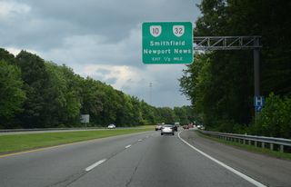
SR 10 begins 0.54 miles to the south of the parclo interchange with U.S. 13-58-460 (Suffolk Bypass) at the SR 32 (Godwin Boulevard) north split with U.S. 460 Business (Pruden Boulevard) west.
07/28/13

SR 10/32 (Godwin Boulevard) continue north through a commercialized stretch from U.S. 13-58-460 (Suffolk Bypass) en route to Smithfield. SR 32 eventually combines with U.S. 258 and U.S. 17 across the James River Bridge northeast to Newport News.
07/28/13
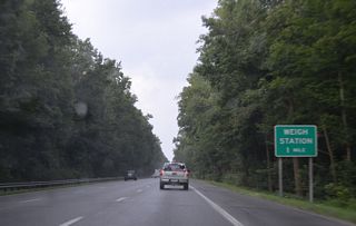
U.S. 13-58-460 Business (Portsmouth Boulevard) conclude along U.S. 13-58-460 east ahead of Bob Foeller Drive and a weigh station.
07/28/13
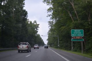
Weigh stations operate along both sides of U.S. 13-58-460 (W Military Highway) west of the Chesapeake city line.
07/28/13
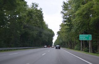
Traversing Great Dismal Swamp, U.S. 13-58-460 advance east into Chesapeake, nine miles from Downtown Portsmouth.
07/28/13
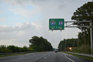
U.S. 13-58-460 (W Military Highway) enter a cloverleaf interchange with I-664 (Hampton Roads Beltway) west of I-64/264 in one mile.
07/28/13
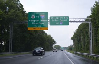
U.S. 58 continues east from U.S. 13/460 through the exchange with I-664 to SR 191 (Joliff Road) at Military Highway in Bowers Hill.
07/28/13

U.S. 13/460 split with the ramp for I-664 south for the continuation of Military Highway east from Bowers Hill. I-64 parallels Military Highway to the south from I-264/664 to SR 168 (Chesapeake Expressway) south to the Outer Banks.
12/14/17
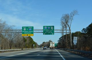
Interstate 664 south concludes at a three-wye interchange with I-264 east to Portsmouth and the I-64 to Virginia Beach.
12/14/17
 North
North  East
East
Military Highway separates from U.S. 13-58-460 along a frontage road south of the exchange with I-664. U.S. 13/460 join the arterial via this connecting ramp.
12/14/17
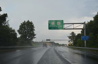
The entrance ramp for I-664 south from U.S. 13/460 east merges onto the Hampton Roads Beltway ahead of Exit 14 for Military Highway beyond Bowers Hill.
07/28/13

U.S. 13/460 (W Military Highway) parallel a CSX Railroad line to S Military Highway adjacent to I-664.
12/14/17
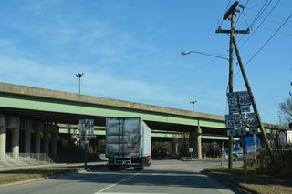
U.S. 13 north / U.S. 460 east follow W Military Highway north to U.S. 58/460 ALT (Airline Boulevard) at SR 191 (Joliff Road) north.
12/14/17
 East East |
| U.S. 460/SR 166-168 cross the Campostella Bridge over the Eastern Branch of the Elizabeth River north to Kimbell Terrace and a parclo interchange with I-264. 12/14/17 |
| A Chesapeake Bay Bridge-Tunnel trailblazer references I-264 east from U.S. 460 (Campostella Road) in Norfolk. I-264 east to I-64 (Hampton Roads Beltway) west links Downtown with U.S. 13 north to the crossing. 12/14/17 |
| Interstate 264 spurs east from Norfolk to the Virginia Beach Oceanfront. 12/14/17 |
| SR 166 branches northeast from U.S. 460/SR 168 (Brambleton Avenue) east just beyond the exchange with I-264. 12/14/17 |
| SR 166 follows Park Avenue north 0.59 miles to Princess Anne Road east ahead of the Broad Creek neighborhood. 12/14/17 |
| U.S. 460/SR 168 (Brambleton Avenue) lower into a subway below Ceclia Street and a Norfolk Southern Railroad line beyond Maltby Avenue eastbound. 12/14/17 |
| SR 168 splits with U.S. 460 (Brambleton Avenue) eastbound for Tidewater Drive north to Ocean View in Norfolk. 12/14/17 |
| U.S. 460 (Granby Street) east ties into the exchange joining I-64 with I-564 west to Naval Station Norfolk (NSN). 12/14/17 |
| Heading north from the exchange with I-564, U.S. 460 (Granby Street) runs between I-64 (Hampton Roads Beltway) and Forest Lawn Cemetery. 12/14/17 |
| Separate ramps connect U.S. 460 (Granby Street) with I-64 by Forest Lawn Cemetery in Norfolk. 12/14/17 |
| The eastbound entrance ramp for I-64 joins the Hampton Roads Beltway by Naval Station Norfolk (NSN) Gate 22. 12/14/17 |
| I-64 loops east from I-564 (Admiral Taussig Boulevard) to Virginia Beach and southwest into Chesapeake. 12/14/17 |
| The on-ramp for I-64 west precedes Masons Creek from U.S. 460 (Granby Street) eastbound. 12/14/17 |
| Interstate 64 turns west at Willoughby Bay to the Hampton Roads Bridge Tunnel (HRBT) linking Norfolk with Hampton. 12/14/17 |
| U.S. 460 (Granby Street) proceeds north across Masons Creek to Bayview Boulevard in the Commodore Park neighborhood. 12/14/17 |
| Granby Street north at Westmont Avenue and the Hampton Gardens neighborhood in Norfolk. 12/14/17 |
| Bay Avenue east and Ocean Avenue west form a one way couplet through the Lenox and Pamlico neighborhoods between I-64 and SR 168 (Tidewater Drive). 12/14/17 |
| Motorists headed to I-64 are directed north on Granby Street to SR 168 (Tidewater Drive). 12/14/17 |
| U.S. 460 (Granby Street) turns northeast to a grade separated intersection with SR 168 (Tidewater Drive). SR 168 leads north through Willoughby Terrace to U.S. 60 (Ocean Avenue) near I-64 at Exit 273. 12/14/17 |
| The northernmost mile of SR 168 is an urban expressway to U.S. 60 at West Ocean View. 12/14/17 |
| U.S. 460 (Granby Street) ends east at U.S. 60 (Ocean View Avenue) just off Chesapeake Bay in Norfolk. 12/14/17 |
| The previous end shield for U.S. 460 at U.S. 60 (Ocean View Avenue) was replaced after July 2016. 01/06/01 |
| A replacement end shield for U.S. 460 with Clearview font at Selby Place was installed by August 2017 and missing four months later. 12/14/17 |
| U.S. 60 (Ocean View Avenue) combines with I-64 west ahead of Willoughy Beach and the Hampton Roads Bridge Tunnel (HRBT). U.S. 60 east continues into Virginia Beach where it meets U.S. 13 south of the Chesapeake Bay Bridge Tunnel (CBBT). 12/14/17 |
Sources:
- Froehlig, Adam
Connect with:
Interstate 64
Interstate 81
Interstate 85
Interstate 95
Interstate 295
U.S. 1
U.S. 11
U.S. 13
U.S. 17
U.S. 29
U.S. 58
U.S. 220
U.S. 501
State Route 116
Page Updated 04-20-2021.


