U.S. 176 extends 219.10 miles southeast into the Palmetto State from Tryon, North Carolina. Paralleling Interstate 26, U.S. 176 connects Landrum, Campbobello and Inman along Asheville Highway in northern Spartanburg County. U.S. 176 shifts onto an expressway along N Pine Street at Southern Shops and is a part of Interstate 585 from Business Loop I-85 south into the city of Spartanburg.
U.S. 176 South Carolina Guides
- Interstate 585
- U.S. 21/176/321 East - Columbia
- U.S. 176 East - Sandy Run to Holly Hill
- U.S. 21/176/321 West - Columbia
S.C. 9 overlaps with U.S. 176 south from Boiling Springs Road at Spartanburg 10.52 miles to Pacolet. The two continue southeast to Jonesville in Union County before diverging to Lockhart and Union. U.S. 176 turns southward to Whitmire in Newberry County than southeast again along a rural course to Pomaria. Prior to 1950, the south end of U.S. 176 was located at U.S. 76 in the city of Newberry.
Approved by the American Association of State Highway Officials (AASHO) on September 16, 1950, U.S. 176 was extended southeast over what was S.C. 177 to U.S. 76 near Ballentine and over S.C. 31 from U.S. 21 in Calhoun County to U.S. 52 at Goose Creek. This brought the total length of U.S. 176 in the state to 217 miles. The South Carolina State Highway Department requested the extension to AASHO on April 28, 1950:
This route would provide a continuous United States numbered route from Hendersonville, North Carolina via Spartanburg, Union, Whitmire, Columbia, Holly Hill to Charleston - a route from the mountains of North Carolina to the seashore of South Carolina. This route has been selected and approved as a section of the National System of Interstate Highways, which route originates at Knoxville, Tennessee.
Recently we completed construction of a 30 mile section of this road to interstate standards; between points just south of Whitmore and north of Columbia. All other sections of this route are of first class construction.
Entering Richland County, U.S. 176 (Broad River Road) converges with the I-26 corridor again southeast at Spring Hill. U.S. 176 combines with U.S. 76 for 3.00 miles from east of Ballentine to I-26 at Exit 101. U.S. 76 shifts onto the freeway while U.S. 176 arcs east to Harbison State Forest, northern reaches of Columbia and St. Andrews.
Within the capital city, U.S. 176 crosses the Broad River east to Three Points and angles southeast along River Drive to U.S. 21/321 (Main Street). U.S. 21/321 combine south along Main Street, west along Elmwood Avenue with U.S. 76 to I-126 and south on Huger Street to U.S. 1/378 (Gervais Street). Spanning the Congaree River west from Blossom Street, U.S. 21/176/321 enter the city of Caycee along Knox Abbott Drive. The three routes shift onto Charleston Highway through a portion of West Columbia while turning southward toward Dixana.
U.S. 21/176/321 meet the south end of Interstate 77 before separating. U.S. 321 continues to Gaston while U.S. 21/321 cross I-26 again southeast into Calhoun County. The 19.74 mile long overlap with U.S. 21/176 U.S. 176 concludes near Sandy Run, where U.S. 21 advances south to Orangeburg and U.S. 176 southeast toward St. Matthews.
Progressing toward the Low Country of South Carolina, U.S. 176 remains east of I-26 through Cameron, Wells and Holly Hill. U.S. 176 concludes at U.S. 52 across from Red Bank Road (Road 37) in the city of Goose Creek.
 East
East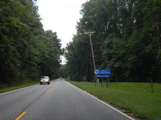
The welcome sign for South Carolina stands along U.S. 176 (Asheville Highway) eastbound between Ridge Road (Road 902) and the Spartanburg County line.
08/21/16
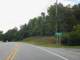
U.S. 176 crosses into Spartanburg County 0.87 miles from the North Carolina state line in Greenville County.
08/21/16

U.S. 176 (N Howard Avenue) runs alongside a Norfolk Southern Railroad line southeast into the city of Landrum.
08/21/16
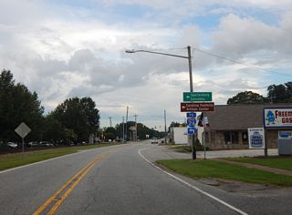
U.S. 176 (N Howard Avenue) meets S.C. 14 (Rutherford Street) in the Landrum business district.
08/21/16
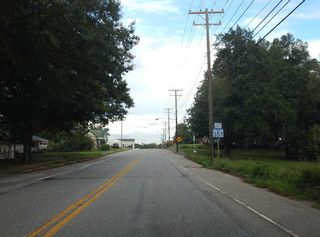
S.C. 357 constitutes a 15.04 mile long highway south from U.S. 176 at Campobello to S.C. 101/290 in Greer.
08/21/16
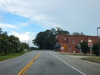
U.S. 176 (Asheville Highway) east at Gramling Mills Road (Road 75) at the community of Gramling.
08/21/16
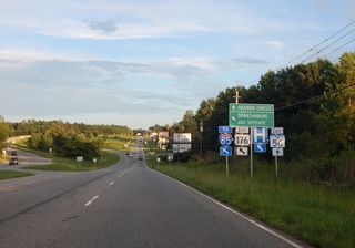
U.S. 176 shifts east from S.C. 56 (Asheville Highway) onto Pine Street at Southern Shops. Both routes lead to the city of Spartanburg. S.C. 56 runs along an arterial through Lone Oak to Hearon Circle at Business Loop I-85 while U.S. 176 serves the campus of USC Upstate via I-585.
08/21/16
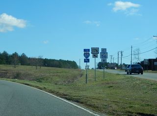
U.S. 176 (Pine Street) partitions with S.C. 56 (Asheville Highway) at a wye interchange. S.C. 56 runs 63.70 miles southward from Spartanburg to Clinton and S.C. 39 near Chappells.
01/16/16
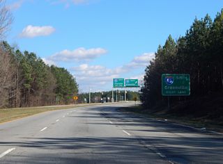
U.S. 176 (N Pine Street) enters a diamond interchange with Interstate 85 to the immediate east of S.C. 56 (Asheville Highway).
01/16/16

The southbound entrance ramp to I-85 from U.S. 176 (Pine Street) east leads to Duncan, Greer and Greenville.
01/16/16
 East
East  South
South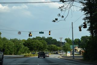
Isom Street (Road 44) parallels a CSX Railroad line east from U.S. 176/S.C. 9 (N Pine Street) to the Beaumont Village neighborhood.
05/25/21
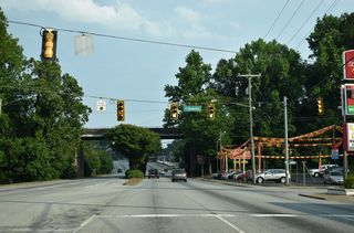
Cleveland Street (Road 70) intersects U.S. 176/S.C. 9 adjacent to a Norfolk Southern Railroad line east from Wofford College.
05/25/21
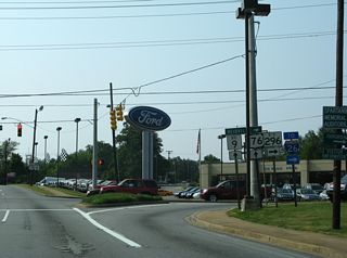
Pine Street proceeds south under the NS Railroad line to Daniel Morgan Avenue and Linder Street. Daniel Morgan Avenue was formerly apart of S.C. 296 east from John B. White, Sr. Boulevard to U.S. 176/S.C. 9.
06/01/07
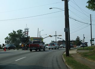
Business Spur I-585 previously extended south along U.S. 176/S.C. 9 (Pine Street) to U.S. 29 (St. John Street).
06/01/07
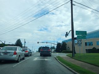
U.S. 29 shifts east onto Main Street at Converse College and leads west to the Spartanburg County Courthouse in Downtown.
08/20/16
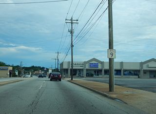
U.S. 176/S.C. 9 (S Pine Street) proceed south from E Main Street (Road 4) to E Kennedy Street.
08/20/16
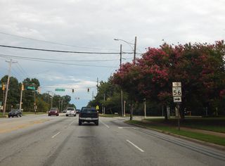
St. Andrews Street (Road 487) links U.S. 176/S.C. 9 (S Pine Street) with adjacent S.C. 56 (Union Street).
08/20/16
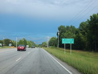
Whitestone Glendale Road (Road 30) crosses U.S. 176/S.C. 9 south from Glendale to S.C. 295 (Southport Road) near Whitestone.
08/20/16
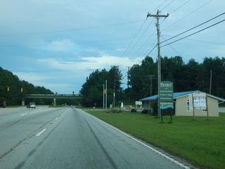
W Main Street (Road 227) parallels a Norfolk Southern Railroad line east into the town of Pacolet.
08/20/16
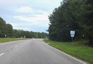
U.S. 176/S.C. 9 intersect the east end of S.C. 295 (Southport Road) beyond a Norfolk Southern Railroad overpass.
08/20/16
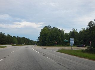
S.C. 295 constitutes a 16.70 mile long loop around Spartanburg to Business Loop I-85 at New Cut Road and Southern Shops.
08/20/16
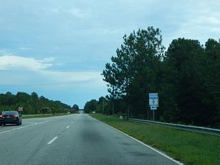
U.S. 176 turns south from S.C. 9 (S Pine Street) onto a bypass of Pacolet to Union and Whitmire.
08/20/16
 East
East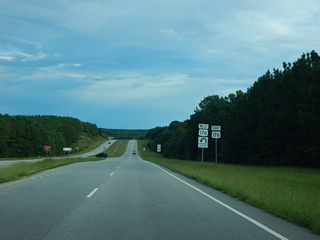
U.S. 176 meets New Hope Church Road (Road 407) at an RCUT (Restricted Crossing U-Turn Intersection).
08/20/16

U.S. 176 Connector links U.S. 176 (N Duncan Bypass) with parallel S.C. 18 (Thompson Boulevard) on the north side of Union.
08/20/16
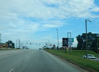
S.C. 215 (Buffalo West Springs Highway) south and S.C. 18 Connector (Harwood Heights) west come together at a signalized intersection with U.S. 176 (N Duncan Bypass) in Union.
08/20/16
 East
East  East
East 
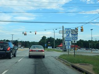
S.C. 49 bypasses Downtown Union to the north along Rice Avenue and Arthur Boulevard east from U.S. 176/S.C. 215.
08/20/16

S.C. 49 overlaps with U.S. 176/S.C. 215 (N Duncan Bypass) 0.75 miles south to W Main Street.
08/20/16
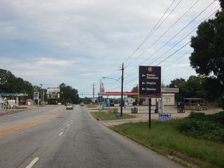
W Main Street (Road 7) runs 0.79 miles northeast to Downtown Union along the former route of S.C. 49.
08/20/16
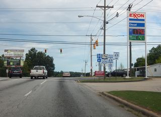
S.C. 49 turns onto W Main Street from U.S. 176/S.C. 215 to Cross Keys Highway and the community of Cross Keys.
08/20/16
 East
East 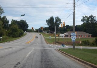
Industrial Park Road west to S.C. 49 and Union Boulevard east to S.C. 18 (S Pinckney Street) are part of S.C. 496, a 1.64 mile long route.
08/20/16
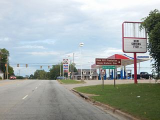
Sardis Road (Road 16) runs southwest from Union to Union County Airport / Troy Shelton Field (35A).
08/20/16
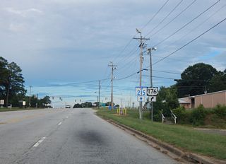
S.C. 215 (Beltline Road) splits with U.S. 176 east at the south end of S.C. 18 (Pinckney Street).
08/20/16
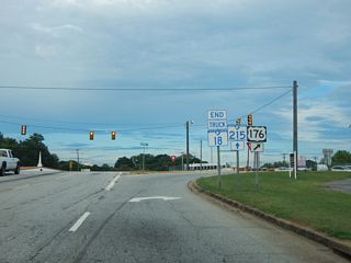
The truck route for S.C. 18 concludes as U.S. 176 overtakes Pinckney Street from S.C. 18 (old U.S. 176) south along Whitmire Highway.
08/20/16
 East
East West
West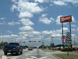
Red Bank Road (Road 37) ties into the south end of U.S. 176 (St. James Avenue) from the south at U.S. 52 in Goose Creek.
05/26/07
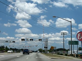
U.S. 176 travels 31.7 miles northwest from U.S. 52 (N Goose Creek Boulevard) and Red Bank Road to the town of Holly Hill.
05/26/07
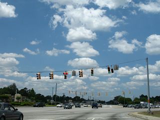
Red Bank Road (Road 37) and U.S. 176 (St. James Avenue) meet U.S. 52 (N Goose Creek Boulevard) at a sharp angle adjacent to an at-grade CSX Railroad crossing.
05/26/07
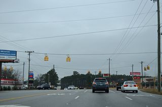
Kennerly Road (Road 129) south and Kinley Road (Road 670) north come together at U.S. 176 (Broad River Road).
01/02/14
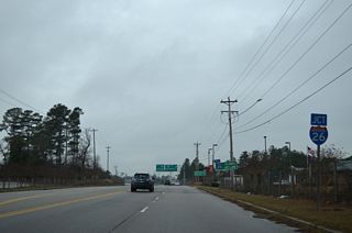
A six-ramp parclo interchange joins U.S. 176 (Broad River Road) with I-26 and U.S. 76 east in Irmo.
01/02/14
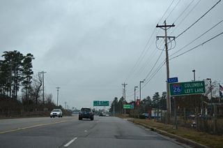
Although not acknowledged here, U.S. 76 overlaps with I-26 east to St. Andrews and I-126 into Columbia.
01/02/14
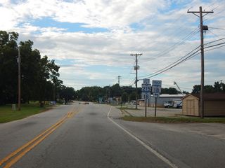
U.S. 176 (Whitmire Highway) west converges with the south end of S.C. 18 (Pinckney Street) and S.C. 215 at the city of Union.
08/20/16
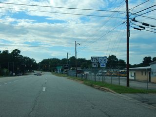
S.C. 215 (Beltline Road) runs 12.18 miles southeast from U.S. 176/S.C. 18 to S.C. 72/121 at Carlisle. S.C. 215 overlaps with U.S. 176 around Union.
08/20/16
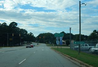
S.C. 18 (Pinckney Street) heads north into Downtown Union while a truck route accompanies U.S. 176/S.C. 215 (Duncan Bypass) to the west. S.C. 18 follows old U.S. 176 north to Jonesville.
08/20/16
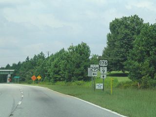
U.S. 176/S.C. 9 (S Pine Street) combine on the west side of Pacolet, just ahead of S.C. 295 (Southport Road) west to White Stone and Spartanburg.
09/04/04
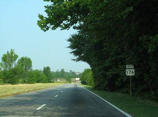
The speed limit lowers to 35 miles per hour along U.S. 176 west at the two-wye interchange with S.C. 56 (Asheville Highway).
06/01/07
 scenes
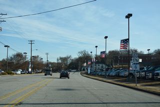
Daniel Morgan Avenue loops 1.04 miles around Downtown Spartanburg northeast from U.S. 29 (St. John Street) to U.S. 176/S.C. 9 (N Pine Street).
12/15/16

Daniel Morgan Avenue formerly represented the eastern extend of S.C. 296. S.C. 296 was truncated westward to John B. White, Sr. Boulevard at the intersection with U.S. 29 at W Main and St. John Streets.
12/15/16
Photo Credits:
12/15/16 by AARoads
Connect with:
Interstate 26
Interstate 85
Interstate 95
Interstate 126
Business Loop I-85
U.S. 1
U.S. 15
U.S. 21
U.S. 29
U.S. 76
U.S. 221
U.S. 321
U.S. 378
U.S. 601
Highway 6
Highway 33
Page Updated 12-31-2021.


