|
| Drivers enter unincorporated Wynn Haven Beach after crossing the county line. The community resides in a narrow swath between Eglin A.F.B lands and Santa Rosa Sound. 11/19/15 |
|
| U.S. 98 shield posted after the Santa Rosa County line. Okaloosa County, home to Eglin Air Force Base, Fort Walton Beach, and the resort town of Destin. The 2010 U.S. Census indicates that 180,822 call the county home. 08/23/11 |
|
| Entering the Florosa area along U.S. 98 east. 11/19/15 |
|
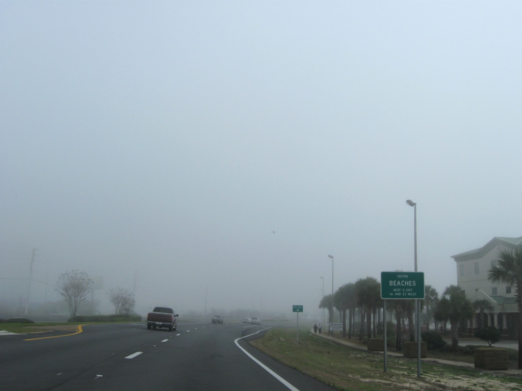
| A traffic light operates along U.S. 98 (Miracle Strip Parkway) at Parish Boulevard. Parish Boulevard spurs southwest to the Parrish Point neighborhood adjacent to The Narrows of Santa Rosa Sound. 11/19/15 |
|
| Eastbound reassurance shield posted between Parish Boulevard and Seashore Village on Miracle Strip Parkway east. 11/19/15 |
|
| Traffic lights at the U.S. 98 entrance to Florosa Elementary School commenced operations on August 18, 2008.1 These lights originally operated only during morning and afternoon hours, but changes in FDOT policy required the lights to remain operational throughout school hours. The switch took place on January 11, 2011.2 11/19/15 |
|
| U.S. 98 enters the Hurlburt Field area of Eglin A.F.B. after Falling Waters Drive. Commercial traffic headed is directed to use the entrance from Freedom Way to the northeast. 11/19/15 |
|
| A single point interchange joins U.S. 98 with Hurlburt Field to the north and the Soundside Area of the A.F.B to the south. 11/19/15 |
|
| A long off-ramp separates from U.S. 98 east ahead of Cody Avenue north and Champaign Street south. The commercial gate for Hurlburt lies further via Doolittle Boulevard and Hill Avenue north. 11/19/15 |
|
| Nondescript guide signs reference the off-ramp for Cody Avenue and Hurlburt Field in both directions of U.S. 98. The exchange opened initially to westbound traffic on July 18, 2015 and in the eastbound direction on July 28.3 11/19/15 |
|
| A two-year, $18 million project replaced the signalized intersection at Cody Avenue with a SPUI. Work continued to November 2, 2015, when a ceremony formally marked the end of construction.4 11/19/15 |
|
| U.S. 98 is designated Air Commando Boulevard on the stretch within Hurlburt Field. 11/19/15 |
|
| A pedestrian bridge spans U.S. 98 just ahead of Cody Avenue, joining Hurlburt Field with the Soundside Area The crossing was lowered and repositioned alongside U.S. 98 for repairs in 2012. 11/19/15 |
|
| Leaving the military area, U.S. 98 (Miracle Strip Parkway) enters the city of Mary Esther. Mary Esther was established in the mid-1850s by John Newton, a minister and teacher, who named the town after his daughters. The city incorporated in 1946. 11/19/15 |
|
| Doolittle Boulevard ties into U.S. 98 within the first mile of Mary Esther. The street links Miracle Strip Parkway with Hollywood Boulevard and adjacent Hill Avenue, a through street leading north to the East Gate of Hurlburt Field. 08/23/11 |
|
| Nearing SR 393 (Mary Esther Boulevard), a commercial arterial leading north to Santa Rosa Mall and western Ft. Walton Beach. 08/23/11 |
|
| SR 393 (Mary Esther Boulevard) travels 1.83 miles northward to SR 189 (Beal Parkway). Also known as Mary Esther Cutoff, the state road provides one of two connections to north Ft. Walton Beach across Cinco Bayou via connections with Beal Parkway. 08/23/11 |
|
| Eastbound distance sign and reassurance shield of U.S. 98 posted after SR 393, one mile west of Downtown Ft. Walton Beach. 08/23/11, 05/13/11 |
|
| Wright Parkway leads north from U.S. 98 (Miracle Strip Parkway) to Ft. Walton Beach High School and SR 393 (Mary Esther Cutoff) near its north end. 08/23/11 |
|
| The next traffic light is located at Miracle Strip Parkway and Memorial Parkway. Memorial Parkway travels south from SR 189 (Beal Parkway) and Beal Memorial Cemetery to U.S. 98 at the Fountainhead Condominiums. 08/23/11 |
|
| Approaching SR 189 (Beal Parkway) north, an alternate route to SR 85 (Eglin Parkway) via Walter Martin Road or the route's entirety north. 08/23/11 |
|
| Overhead posted ahead of the SR 189 northbound beginning on U.S. 98 east. SR 189 encircles Ft. Walton Beach on a 10.53 mile loop between Miracle Strip Parkway and the Eglin A.F.B. Air Armament Center. 08/23/11 |
|
| After two sets of guide signs, SR 189 appears on this junction shield assembly. 08/23/11 |
|
| SR 189 (Beal Parkway) constitutes a four lane arterial north and west around Cinco Bayou to Ocean City and north Ft. Walton Beach. 08/23/11 |
|
| U.S. 98 (Miracle Strip Parkway) next approaches the split wye intersection with SR 85 (Eglin Parkway) north. The state road connects Fort Walton Beach with the Eglin Air Force Base, Valparaiso and Niceville and doubles as one of two routes to Interstate 10 from coastal Okaloosa. 05/11/11 |
|
| The western wye (Eglin Parkway) of SR 85 is signed as a Truck Route despite being a part of the state road mainline. All interests to the 56.5 mile state road to Crestview and Laurel Hill must use the Eglin Parkway wye from U.S. 98 east. 12/18/08 |
|
| Eastbound U.S. 98 at the northbound beginning of SR 85 (Eglin Parkway) and Brooks Street east. Brooks Street represents the historic routing of U.S. 98 through the central business district. 05/11/11 |
|
| The east wye of SR 85 follows Florida Place from 1st Street to U.S. 98 (Miracle Strip Parkway). This branch serves interests from U.S. 98 west and to U.S. 98 east. 12/18/08 |
|
| Perry Avenue stems north from Brooks Street to become SR 145 from U.S. 98 to SR 85 (Eglin parkway) at 4th Street. The 0.51 mile state road provides a busy alternative to Eglin Parkway for movements between Eglin Parkway and Okaloosa Island via the Brooks Bridge. 05/11/11 |
|
| U.S. 98 curves southeastward and immediately rises onto the John T. Brooks Bridge over the Intracoastal Waterway. Interests to Santa Rosa Boulevard west are advised to move into the right lane for the next intersection. 04/19/09 |
|
| The John T. Brooks Bridge replaced a swing bridge when it opened in 1964. John T. Brooks was a Civil War soldier who founded the Brooks' Landing settlement that later would become Fort Walton Beach. 12/18/08 |
|
| Descending from the John T. Brooks Bridge of U.S. 98 across Santa Rosa Sound. Shimmering waters of the Gulf of Mexico lie along the horizon. 12/01/08 |
|
| Santa Rosa Boulevard and a set of frontage roads from underneath the Brooks Bridge tie into U.S. 98 (Miracle Strip Parkway) at the bridge east end. Santa Rosa Boulevard constitutes a four lane divided arterial west from Marler County Park to the Eglin A.F.B. boundary on Okaloosa Island. The island community is unincorporated, but used to be a part of Fort Walton Beach. 12/18/08 |
|
| U.S. 98 turns east along Okaloosa Island and next meets Destin in six miles. 12/18/08 |
|
| Eastbound reassurance shield posted after the Brooks Bridge. The Gulfarium marine show aquarium lies in the background. 12/01/08 |
|
| Pier Road and the entrance to the Emerald Coast Conference Center converge where U.S. 98 expands with a grassy median. Pier Road connects with the parking area for the Okaloosa Island Fishing Pier. 01/25/13 |
|
| The Okaloosa Area of Gulf Islands National Seashore provides Choctawhatchee Bayside access from U.S. 98 ahead of the Eglin Air Force Base lands. 12/01/08 |
|
| Traveling through the east section of Eglin A.F.B. on Okaloosa Island. 04/04/09, 12/18/08 |
|
| U.S. 98 shifts northward between Eglin Beach Park and USCG Station Destin into the city of Destin. 12/18/08 |
|
| The William T. Marler Bridge spans East Pass between Okaloosa Island and the city of Destin. William Marler was Destin's first postmaster and named the city after fishing boat Captain Leonard Destin, Sr. whom he worked for in the late 1800s. Leonard Destin, Sr. settled in the area in the 1850s and established the fishing village. 01/25/13 |
|
| East Pass dumps into the Gulf of Mexico from Choctawhatchee Bay. It is the only inlet to the Bay and adjacent Santa Rosa Sound in either Okaloosa or Santa Rosa Counties.
Old Pass Lagoon opens to the south of U.S. 98 (Harbor Boulevard), The protected waters are lined with numerous marinas and condominiums. 01/25/13, 12/18/09 |
|
| U.S. 98 lowers from the Marler Bridge onto Harbor Boulevard through a busy commercial district in central Destin. The eastbound span opened in 1979, joining the westbound bridge completed in 1971. 04/04/09 |
|
| Stahlman Avenue angles northeast from U.S. 98 (Harbor Boulevard) to Hickory Street near Marler Bayou. 01/25/13 |
|
| SR 293 trailblazer posted after Stahlman Avenue for the Mid-Bay Bridge, one of three connections from U.S. 98 in the Destin area to the mainland. An overhead sign assembly and beacon advise motorists of heavy pedestrian traffic over the next 2.5 miles. 01/25/13 |
|
| Benning Drive, former unsigned County Road 30B, stems north from U.S. 98 (Harbor Boulevard) to Sibert Avenue (former County Road 30A) and the U.S. Army Infantry Recreation Area on Choctawhatchee Bay. 05/13/11 |
|
| Beach Drive spurs north from U.S. 98 to Kelly Street and Joe's Bayou in central Destin. 12/18/08 |
|
| Main Street links U.S. 98 (Harbor Boulevard) with the Coleman's Lake area and Indian Trail near Cobbs Point in Destin. The north-south road was the eastern leg of Okaloosa County Road 30A. 01/25/13 |
|
| Approaching the westbound beginning of Gulf Shore Drive on U.S. 98 (Harbor Boulevard) east. 05/13/11 |
|
| Gulf Shore Drive stems west from U.S. 98 and The Shoppes At 98 Palms to the Destin peninsula south of Old Pass Lagoon and public beach access at East Pass. 01/25/13 |
|
| Airport Road (unsigned CR 30F for 1.64 miles) loops northwest from U.S. 98 (Emerald Coast Parkway) to Destin Airport (DTS) and Main Street at Legion Drive. 01/25/13 |
|
| Construction widens U.S. 98 (Emerald Coast Parkway) to six overall lanes from Airport Road (CR 30F) east 3.853 miles to Emerald Bay Drive, located just ahead of the Walton County line. The $33.3 million project started in July 2017 and runs through winter 2021. 01/25/13 |
|
| The western branch of County Road 2378 comprises a 0.24 mile segment of Scenic U.S. Highway 98 from Emerald Coast Parkway to June White Decker Park on the Gulf of Mexico. The spur provides public beach access. 01/25/13 |
|
| U.S. 98 shifts more inland from CR 2378 toward Destin City Hall. Project Number 414132-3 to six lane of U.S. 98 includes the addition of a traffic light at forthcoming Indian Bayou Trail north and Restaurant Row south. 01/25/13 |
|
| Two Trees Road connects U.S. 98 with parallel Commons Drive and the Indian Bayou community. Eastbound travelers otherwise are advised of the next two beach access roads. 12/18/08 |
|
| Henderson Beach Road leads south from Commons Drive into Henderson Beach State Park. Parkland lines the south side of Emerald Coast Parkway along this stretch. Big box retail and other shops and eateries front the north side of U.S. 98. 04/14/09 |
|
| Matthew Boulevard leads south from U.S. 98 at Pariso Boulevard to the eastern branch of Okaloosa County Road 2378 (Scenic U.S. Highway 98). CR 2378 provides the main route for coastal residents east from Henderson Beach State Park into Walton County. 05/13/11 |
|
| Nearing the northbound beginning of SR 293 (Danny Wuerffel Way) on U.S. 98 (Emerald Coast Parkway). SR 293 in conjunction with SR 285, SR 85, or U.S. 331 provides a route to Interstate 10. 05/13/11 |
|
| The Mid-Bay Bridge directly connects U.S. 98 with SR 20 at Bluewater Bay and Seminole east of Niceville. SR 20 ends in Niceville to the west and connects with Freeport and Tallahassee to the east. 05/13/11 |
|
| Connections with SR 293 to SR 20 west and SR 85 south lead motorists to Northwest Florida Regional Airport (VPS) and Ft. Walton Beach. 12/01/08 |
|
| Opened in June 1993, the Mid-Bay Bridge is one of two crossings over the Choctawhatchee Bay between U.S. 98 and SR 20 (U.S. 331 being the other). The two lane span links with the Mid-Bay Bridge Connector, a toll road encircling Niceville northwest to SR 85. The initial stretch of the two lane expressway opened to traffic to SR 20 on May 12, 2011. 04/14/09 |
|
| Retail plazas surround the intersection of U.S. 98 (Emerald Coast Parkway) and SR 293 (Danny Wuerffel Way) in all four quadrants 04/14/09 |
|
| Regatta Bay Boulevard crosses U.S. 98 between Dolphin Street to the south and the Regatta Bay Golf & Country Club neighborhood to the north. 01/25/13 |
|
| Tequesta Drive leads north to the Emerald Lakes subdivision from U.S. 98 at the succeeding eastbound signal opposite Trista Terrace Court.
04/04/09 |
|
| U.S. 98 enters Walton County just beyond Emerald Bay Drive. Further six lane widening of Emerald Coast Parkway extends 3.65 miles east from Emerald Coast Drive through Summer 2020. 12/18/08 |
12/01/08, 12/18/08, 04/04/09, 04/14/09, 04/19/09, 12/18/09, 05/11/11, 05/13/11, 08/23/11, 01/25/13, 11/19/15 by AARoads
Page Updated 10-08-2018.


 east
east