|
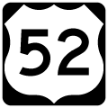
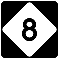
| Interstate 285 concludes along U.S. 52/NC 8 northbound within the cloverleaf interchange (Exit 107) at I-40. 01/17/19 |
|
| U.S. 52/NC 8 meet Sprague Street at a half diamond interchange (Exit 108A) just north of I-40 and I-285. Sprague Street heads east to Thomasville Road (old U.S. 311-NC 109) and west to Main Street (former U.S. 52/NC 8). 01/17/19 |
|
| U.S. 311 was relocated off of city streets through south Winston-Salem onto an overlap with U.S. 52/NC 8 in 1996.1 U.S. 311 was subsequently truncated northward in Winston-Salem in 2018. 01/17/19 |
|
| U.S. 52/NC 8 curves northwest on a viaduct over Waughtown Street (SR 4315) to a half diamond interchange (Exit 108B southbound). The freeway through Winston-Salem was completed by 1964.2 07/09/10 |
|
| 2014-17 reconstruction along U.S. 52 replaced the trumpet interchange linking the freeway with adjacent Vargrave Avenue with a DDI (Exit 108B) for Research Parkway. 01/17/19 |
|
| Vargrave Street runs along the east side of U.S. 52/NC 8 to Diggs Boulveard east to Bowman Gray Stadium, The street was demolished northward to make way for Research Parkway. 01/17/19 |
|
| U.S. 52/NC 8 drop below grade at Mock Street. Forthcoming Exit 108B leads to Old Salem and the UNC School of the Arts. 01/17/19 |
|
| Exit 108B leaves U.S. 52/NC 8 north below a CSX Railroad bridge. Research Parkway connects with Martin Luther King Jr, Drive (SR 4325) south of Winston Salem State University. 01/17/19 |
|
| A double arch spans the DDI joining U.S. 52/NC 8 with Research Parkway. Research Parkway parallels the freeway north through the Wake Forest Innovation Quarter. 01/17/19 |
|
| A parclo interchange (Exit 108C) at Rams Drive (Old Stadium Drive) and Vargrave Street south in Columbia Heights was removed from the ensuing stretch of U.S. 52/NC 8 north. 01/17/19 |
|
| An auxiliary lane opens northbound from the Rams Drive overpass to the cloverleaf interchange (Exit 109) with U.S. 421/158-NC 150 (Salem Parkway). 01/17/19 |
|
| Designated as Business 40 until February 2020, U.S. 421 follows Salem Parkway east across Winston-Salem to Guilford County outside Greensboro. U.S. 158 accompanies the freeway five miles to Reidsville and NC 150 for 11 miles to NC 66 at Kernersville. 01/17/19 |
|
| Closed entirely on November 17, 2018, U.S. 421 (Salem Parkway) was rebuilt from U.S. 52 west to Peters Creek Parkway (NC 150) south of Downtown. Exit 109B to U.S. 421/158-NC 150 west reopened on February 2, 2020. U.S. 158 overlaps with Salem Parkway west to Stratford Road. 01/17/19 |
|
| A $13.1 million improvement project along U.S. 52 between U.S. 421 (Salem Parkway) and U.S. 311 (Martin Luther King, Jr. Drive) removed a split diamond interchange (Exit 110A) between 3rd and 5th Streets.3 01/17/19 |
|
| U.S. 311 commences east from U.S. 52/NC 8 along Martin Luther King, Jr. Drive from Exit 110B. U.S. 311 follows MLK Drive a half mile to New Walkertown Road en route through northeastern Winston-Salem. 01/17/19 |
|
| Construction between June 8, 2011 and November 1, 2012 added a third northbound lane from U.S. 421 (Salem Parkway) to the parclo interchange (Exit 110B) with MLK Drive / U.S. 311 north.3 U.S. 311 runs northeast from Winston-Salem to Walkertown, Madison and Eden. 01/17/19 |
|
| Liberty Street (SR 2456) angles northeast from Downtown Winston-Salem to meet U.S. 52/NC 8 at parclo interchange (Exit 110C). Liberty Street, which previously extended south to Main Street, is the former alignment of NC 8. 01/17/19 |
|
| Advancing north below 16th Street, U.S. 52/NC 8 converges with 25th Street, 28th Street and Cleveland Avenue at Exit 111A. 01/17/19 |
|
| The entrance ramp from parallel Liberty Street forms an auxiliary lane north to Exit 111A. 25th and 28th Streets run through the North Winston and Bon Air communities. 01/17/19 |
|
| Exit 111A parts ways with U.S. 52/NC 8 north for separate ramps to 25th Street west and 28th Street at Cleveland Avenue. Adjacent Liberty Street extends north to Smith Reynolds Airport (INT). 01/17/19 |
|
| A $19 million construction project from March 2010 to 2013 replaced the 1964-built viaducts taking U.S. 52 over Liberty Street (SR 2456) and the adjacent Norfolk Southern Railroad Switching Yard. This work included ramp improvements at 28th Street and the removal of a direct ramp (Exit 111B) to Liberty Street north.4 01/17/19 |
|
| Akron Drive (SR 2264) meets U.S. 52/NC 8 at a diamond interchange (Exit 112) in one half mile. Akron Drive leads east to Liberty Street at Montview and INT Airport. 01/17/19 |
|
| Akron Drive leads west to Patterson Avenue, the pre-1964 alignment of U.S. 52,2 and Indiana Avenue, which was U.S. 52 before 1945.2 01/17/19 |
|
| Akron Drive connects with Reynolds Boulevard west to Truist Field and Lawrence Joel Veterans Memorial Coliseum, home of Wake Forest University football and basketball respectively. 01/17/19 |
|
| Shields posted for U.S. 52 and NC 8 beyond the Akron Drive (SR 2264) overpass. 01/17/19 |
|
| U.S. 52/NC 8 begins the northwesterly turn out of Winston-Salem ahead of the parclo interchange (Exit 113) with Patterson Avenue. 01/17/19 |
|
| Patterson Avenue, the former alignment of U.S. 52, shifts to the east side the freeway north from Exit 113 by a number of industrial parks. 01/17/19 |
|
| U.S. 52/NC 8 parallel Patterson Avenue and Leak Fork on the succeeding stretch. 01/17/19 |
|
| The 22 mile overlap with NC 8 concludes on U.S. 52 northbound at the parclo interchange (Exit 114) with Germantown Road (SR 1725). 01/17/19 |
|
| NC 8 travels north to Germanton, Danbury and Lawsonville. Virginia Route 8 continues the multi state highway to Christiansburg. 01/17/19 |
|
| U.S. 52 continues through an S-curve along side Patterson Avenue and an adjacent quarry. 01/17/19 |
|
| University Parkway (SR 4000) heads north from Wake Forest University to a commercialized parclo interchange (Exit 115) with U.S. 52 near Stanleyville. 01/17/19 |
|
| University Parkway overtakes the former route of U.S. 52 northward from Patterson Avenue to become NC 66 at Old Hollow Road. NC 66 continues University Parkway from Stanleyville to the town of Rural Hall. 01/17/19 |
|
| Exit 115B loops onto University Parkway (SR 4000) south to the campus of Wake Forest University. 01/17/19 |
|
| A folded diamond interchange (Exit 116) joins U.S. 52 with Hanes Mill Road (SR 1672) to the immediate north of University Parkway. 01/17/19 |
|
| Hanes Mill Road arcs west from NC 8 (Germanton Road) to a large retail area at University Parkway, the exchange with U.S. 52 and Bethania Station Road (SR 1672) south to Bethania Station. 01/17/19 |
|
| A systems interchange is under construction along U.S. 52 north of the Ziglar Road (SR 1669) overpass with the Winston-Salem Northern Beltway (Interstate 74). 01/17/19 |
|
| The Winston-Salem Northern Beltway replaces the wye interchange with the SR 66 connector (SR 1840) preceding Exit 118 for NC 65 (Bethania-Rural Hall Road). 01/17/19 |
|
| NC 65 takes Bethania Rural Hall Road north to Rural Hall before turning east to Germanton, Stokesdale and Reidsville. Bethania Rural Hall Road (SR 4002) angles southwest to Main Street at Bethania. 01/17/19 |
|
| Construction of Western Section 6 of the Winston-Salem Beltway (I-274/I-74) revised Exit 118 from a diamond into a parclo intercahnge. 01/17/19 |
|
| U.S. 52 leaves the city limits of Winston-Salem and next approaches a diamond interchange (Exit 120) with Westinghouse Road (SR 1632). 01/17/19 |
|
| Distance sign posted six miles southeast of the Stokes County town of King, 16 miles from Pilot Mountain and 26 miles from Mt. Airy. 01/17/19 |
|
| Westinghouse Road (SR 1632) becomes Shore Road south of Exit 120 at Griffin Road. Griffin Road leads west toward Tobaccoville while Westinghouse Road east becomes Tobaccoville Road en route to NC 65. 01/17/19 |
|
| Confirming marker posted northbound after Muddy Creek. 01/17/19 |
|
| A parclo interchange (Exit 122) links U.S. 52 with Moore-RJR Drive (SR 1634) east of the RJ Reynolds Tobaccoville Manufacturing Center in one mile. 01/17/19 |
|
| Moore RJR Drive ties into Moore Road (SR 1634) just east of Exit 122. Moore Road north to Mountiain View Road (SR 1122) connects with NC 66 to Hanging Rock State Park. 01/17/19 |
|
| The diamond interchange (Exit 123) with Doral Drive (SR 1611) south to Tobaccoville and Main Street (SR 1122) north to King straddles the Forsyth / Stokes County line. 01/17/19 |
|
| U.S. 52 angles across the southwestern corner of Stokes County for 6.58 miles. 01/17/19 |
Page Updated 08-10-2020.


 North
North


