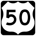
Traveling 140 miles across the Free State, U.S. 50 constitutes a commuter freeway east from Washington, D.C. to the suburbs of Prince Georges and Anne Arundel Counties, including the capital city of Annapolis. U.S. 301 combines with the U.S. 50 east from Exit 13 at Bowie east to Queenstown (Exit 46). Spanning Chesapeake Bay between Annapolis and Kent Island, U.S. 50 joins the D.C. area with Maryland's Eastern Shore via the William Preston Lane, Jr. Bridge. The suspension bridges represent only the second fixed auto route across the expansive body of water from Cecil County south to Hampton Roads, Virginia. South beyond the split with U.S. 301 northeast to Middletown, Delaware, U.S. 50 continues to Easton, Cambridge and Salisbury. U.S. 50 concludes just shy of the Atlantic Ocean in Ocean City.
U.S. 50 Maryland Guides
East
U.S. 50 departs the city of Washington from New York Avenue NE via a four-lane freeway (John Hanson Highway) at Baltimore-Washington Parkway. Beyond there, the freeway winds northeast to meet the Capital Beltway (I-95/495) where U.S. Interstate 595 begins. Designated in 1989, I-595 overlays John Hanson Highway between Exit 7 and Exit 24. The route was never signed due to the familiarity of motorists with preexisting U.S. 50. Modernization of the route from the mid 1980s to early 1990s expanded the freeway to six or eight overall lanes.
Prior to 1948, U.S. 50 traveled east only as far as Annapolis while the highway from Queenstown southeast to Easton, Cambridge, Salisbury and Ocean City was a part of U.S. 213. The Maryland State Roads Commission petitioned the American Association of State Highway Officials (AASHO) for the authority to extend U.S. 50 east to Ocean City. The extension coincided with planned improvements including an expressway from Washington, DC east to a bypass of Annapolis, the proposed Chesapeake Bay Bridge, and a planned divided highway from Kent Island to Queenstown and Wye Mills. State officials reasoned that the extension would carry the highest percentages of out of state travelers. A Maryland State Roads Commission letter to AASHO dated August 13, 1948 outlined the proposed route:
The extension of this route would follow State Route #2 to State Route #404, State Route #404 to Sandy Point, Maryland, then via the State-owned Ferry System across the Chesapeake Bay to Matapeake, Maryland, then Route #404 to U.S. Route #213 at Wye Mills and following that route to Ocean City. We would abandon the number of U.S. #213 from its junction with the proposed extension of U.S. #50 at Wye Mills to Ocean City.
AASHO approved the changes for both U.S. 50 and U.S. 213 on November 1, 1948. U.S. 50 was extended across Chesapeake Bay via the Sandy Point-Matapeake Ferry to Queen Anne County and along MD 404 to U.S. 213 at Wye Mills. The extension replaced U.S. 213 southward to Cambridge, Salisbury and Ocean City. The Chesapeake Bay Bridge replaced the ferry service when it opened in 1952.1
 scenes scenes |
| Separate ramps connect MD 704 (Martin Luther King, Jr. Highway) west with U.S. 50 (I-595) west to Washington and U.S. 50 c/d roadway to I-95/495 and Garden City Drive south. A loop ramp formerly joined MD 704 west with U.S. 50 east to Annapolis. It was replaced with a left turn onto the eastbound entrance ramp. 01/02/08 |
| MD 704 (Martin Luther King Jr. Highway) intersects Hargrove Road ahead of the ramps with U.S. 50 (I-595) westbound. The forthcoming ramp joins Exit 7B to the Capital Beltway northbound. 01/02/08 |
| The westbound on-ramp to U.S. 50/U.S. 301 from Winchester Creek Road at Exit 45B. Nesbit Road heads north from MD 18 (Old Stevensville Queenstown Road) to Winchester Creek Road and the Chester River at Exit 45B. 09/25/04 |
- Ends of U.S. Highway 50, 50-N, and 50-S, Dale Sanderson.
Photo Credits:
09/25/04, 01/02/08 by AARoads
Connect with:
Interstate 95
Interstate 97
Interstate 495 - Capital Beltway
Interstate 595
U.S. 13
U.S. 113
U.S. 301
Route 2
Route 213
Route 404
Page Updated 01-12-2023.


