|
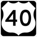
| This button copy sign was located along U.S. 40 east at the Baltimore Beltway southbound ramp (outer loop). A six-ramp parclo interchange comprises the junction between Baltimore National Pike and Interstate 695 at Westview. Loop ramps from U.S. 40 to the Beltway were removed. 06/17/00 |
|
| Leaving the junction with Interstate 695, U.S. 40 enters a busy commercialized stretch starting with Westview Shopping Center opposite Kent Avenue. 06/20/12 |
|
| Ingleside Avenue crosses paths with U.S. 40 (Baltimore National Pike) from Catonsville northeast to the east end of Interstate 70 and MD 122 (Security Boulevard). 06/20/12 |
|
| U.S. 40 transitions from Baltimore National Pike onto Edmondson Avenue ahead of the signalized intersection with Cooks Lane north and Old Orchard Road south. Old Orchard Road constitutes a residential street south to Ten Hills; Cooks Lane bisects the Hunting Ridge neighborhood to become MD 122 at the city line. 07/02/10 |
|
| Cooks Lane angles from the east end of Interstate 70 (Exit 94) to end at U.S. 40 (Edmondson Avenue). The residential through road becomes Security Boulevard (MD 122) west to the Social Security Administration. Pictured here is a reassurance shield for U.S. 40 posted at the Cooks Lane / Old Orchard Road traffic light. 07/02/10 |
|
| U.S. 40 expands from four to six lanes at the transition to Edmondson Avenue. Signals follow Cooks Lane at Nottingham Road, a residential road to Ten Hills. 07/02/10 |
|
| Uplands Parkway lines Uplands Park south from U.S. 40 (Edmondson Avenue) to Beechfield Avenue and MD 144 (Frederick Avenue). Winans Way winds northward to Rognel Heights and Gwynns Falls Park to the north.
Changes between 2010 and 2012 replace the span wire sign. Old Frederick Road is permanently closed due to the development of Uplands on the land southeast of U.S. 40 and Uplands Parkway. 06/20/12 |
|
| U.S. 40 passes by Uplands Park to meet Glen Allen Drive and the former Old Frederick Road. Old Frederick Road was severed from U.S. 40 due to development of Uplands. The street still runs southeast from Athol Avenue to MD 144 (Frederick Avenue) at Hilton Street. 07/02/10 |
|
| Swann Avenue ties the new Uplands development with U.S. 40 to the south and Rognel Heights to the north. 06/20/12 |
|
| Athol Avenue leads south from Woodridge Road and adjacent Edmondson Village Shopping Center to MD 144 (Frederick Avenue) at the Irvington neighborhood. 06/20/12 |
|
| Wildwood Parkway comprises a two lane divided tree-lined parkway northward from U.S. 40 to Rognel Heights and Stokes Drive at Gwynns Falls Park. 06/20/12 |
|
| Mt. Holly Street sees a staggered intersection with U.S. 40 by the Edmondson Village neighborhood. 06/20/12 |
|
| Another traffic light follows Mt. Holly Street one block to the east along U.S. 40 (Edmondson Avenue) at Allendale Street. 06/20/12 |
|
| Edgewood Street crosses U.S. 40 at the next traffic light within the street grid. 06/20/12 |
|
| U.S. 40 (Edmondson Avenue) lowers from Edmondson Village to the intersect Hilton Street ahead of Gwynns Falls. Hilton Street travels north-south from Caton Avenue and U.S. 1 (Wilkens Avenue) to MD 26 (Liberty Heights Avenue) and Wabash Avenue near the Arlington section of the city. Hilton Street is superseded by Hilton Parkway through Gwynns Falls Park from Edmondson Avenue to North Avenue. 06/20/12 |
|
| A compact three quarter cloverleaf interchange joins U.S. 40 (Edmondson Avenue) with Hilton Parkway adjacent to the Hilton Street intersection. Hilton Parkway carries U.S. 1 Truck & U.S. 40 Truck north between U.S. 40 and North Avenue. An old button copy overhead directs eastbound motorists onto the northbound parkway through Gwynns Falls Park from Edmondson Avenue. Hilton Parkway maintains four overall lanes between the interchange and the North Avenue & Hilton Street intersection. 06/20/12 |
|
| U.S. 40 parts ways with Edmondson Avenue for Franklin Street at the intersection with Poplar Grove Street. Edmondson Avenue continues as a local street east, one block north of U.S. 40.
Traffic lights posted here remain red for motorists bound for Edmondson Avenue east with green arrows for through traffic. This configuration is not conventional and not permitted via MUTCD standards. 06/20/12 |
|
| A second older style U.S. 40 shield directs drivers onto Franklin Street east. Poplar Grove Street flows north and south from U.S. 40 into the adjacent neighborhoods. 06/20/12 |
|
| Franklintown Road angles southeast from Gwynns Falls Park to end at MD 144 (Frederick Avenue). A traffic light governs the movements of its intersection with U.S. 40 (Franklin Street). 06/20/12 |
|
| Warwick Avenue joins U.S. 40 with the Rosemont community to the north from this traffic light. A span wire reassurance shield is posted here. 06/20/12 |
|
| U.S. 40 partitions into the one way street couplet of Mulberry Street (east) and Franklin Street (west) beyond Warwick Avenue. Pictured here is the curve onto Mulberry Street as U.S. 40 passes under AMTRAK / MARC tracks. Note the engraved keystone leftover from the Pennsylvania Railroad days. 06/20/12 |
|
| U.S. 40 approaches Pulaski Street and splits with Mulberry Street for the former Interstate 170 freeway. 06/20/12 |
|
| U.S. 40 utilizes the former Interstate 170 freeway below Franklin and Mulberry Streets between Pulaski and Greene Streets. This freeway was completed in 1979 and intended to link downtown Baltimore from unconstructed Interstate 70 at Gwynns Falls Park to the west. When plans to complete I-170 were dropped in 1983, U.S. 40 overtook the route. 06/20/12 |
|
| For several decades, a section of Interstate 170 from Pulaski Street eastward to the on-ramp of U.S. 40 sat unused. A mural was painted along the facade of the freeway abuttment adjacent to Pulaski Street.
A $2.5 million project commenced in September 2010 to demolish unused portions of the former Interstate 170 freeway between Pulaski and Monroe Streets. The removal makes way for two new parking lots for the nearby West Baltimore transit station of MARC. 08/27/05 |
|
| U.S. 40 departs Mulberry Street after the intersection with Pulaski Street and joins the former Interstate 170 freeway. The ramp traveled alongside remnants of the unconstructed off-ramp to U.S. 1 (Fulton Avenue & Mulberry Street) since removed during a 2010 demolition project. A grassy berm and two retaining walls were also leveled during that work. 08/27/05 |
|
| A sign bridge for U.S. 1 also remained in place over the ghost on-ramp. These were taken down with the removal of the ramp stub in late 2010. 06/27/10 |
|
| Guide signs loom above the abandoned freeway mainline at the Mulberry Street on-ramp from Pulaski Street. The left panel alludes to the freeway end at Greene Street (MD 295 north) near Downtown. An off-ramp departs the former Interstate 170 freeway for Martin Luther King, Jr. Boulevard within the next mile.
A security fence was added beyond the barrier to the left after 2010. 06/27/10 |
|
| U.S. 40 eastbound reassurance shield posted near the Stricker Street pedestrian bridge. For a brief time the freeway carried Interstate 170 markers, with U.S. 40 remaining along the parallel frontage streets. 06/20/12 |
|
| The former Interstate 170 freeway briefly carries six lanes between U.S. 1 and the Martin Luther King, Jr. Boulevard off-ramp. MLK Boulevard skims the western periphery of downtown Baltimore to the Mount Vernon, Seton Hill, Lexington Terrace, and Ridgelys Delight communities. 06/20/12 |
|
| Approaching the Arlington Avenue overpass on U.S. 40 eastbound. Speed limits on the former Interstate 170 freeway are set at 50 mph. 06/27/10 |
|
| The final button copy sign bridge displays the only two exit ramps in association with the former Interstate 170 freeway. The right side ramp descends to a signalized intersection with Martin Luther King, Jr. Boulevard. The U.S. 40 mainline continues over MLK Boulevard onto Mulberry Street west of its intersection with Greene Street. A grassy right-of-way remains from the unconstructed Baltimore Metro Line. The label scar on the left panel once displayed "Baltimore". 06/20/12 |
|
| Traffic partitions between U.S. 40 (Mulberry Street) east to Greene Street and north downtown and Martin Luther King, Jr. Boulevard. Interests to the Inner Harbor area of downtown or Camden Yards should use MLK Boulevard southbound. MLK Boulevard northbound leads to Maryland Avenue and Chase Street at the community of Mount Vernon. 08/27/05 |
|
| A freeway ends sign precedes the U.S. 40 eastbound merge onto Mulberry Street just beyond Martin Luther King, Jr. Boulevard. 08/27/05 |
|
| The former Interstate 170 freeway ends and U.S. 40 returns to its Mulberry and Franklin Street one way couplet through northern reaches of the Baltimore central business district. Mulberry Street passes underneath the Social Security Building ahead of the traffic light with Greene Street. Greene Street travels south through the University of Maryland at Baltimore Campus to Oriole Park at Camden Yards and M&T Bank Stadium. 08/27/05 |
|
| A reassurance marker for U.S. 40 east resides under the Social Security Building just beyond the freeway merge onto Mulberry Street. 06/20/12 |
|
| U.S. 40 quickly enters the intersection with Greene Street after the freeway departure. Greene Street doubles as MD 295 (vastly unsigned north of Oriole Park at Camden Yards) southbound from Franklin Street to Russell Street. The state route eventually becomes the Baltimore-Washington Expressway southwest out of Baltimore. 06/27/10 |
|
| Paca Street carries MD 295 northbound from the Russell Street split with Greene Street to end at U.S. 40 (Franklin Street) west. MD 129 begins one block to the north and continues Paca Street north to the one way street couplet of McCulloh Street (north) and Druid Hill Avenue (south). 06/27/10 |
|
| Eutaw Street crosses U.S. 40 (Mulberry Street) east at the next traffic light. The street leads south to Oriole Park at Camden Yards and north to the State Center and Madison Park. 06/20/12 |
|
| Howard Street stems north from the end of Interstate 395 at Conway Street to Lexington Street Mall and U.S. 40. North of Mulberry Street, Howard Street continues to Mount Vernon and eventually Johns Hopkins University.
A Baltimore Transit Company street car line follows Howard Street north from Camden Yards to the University of Baltimore. 06/20/12 |
|
| Park Avenue follows at the next block between the central business district and Mount Vernon. 06/20/12 |
|
| Cathedral Street travels just eight blocks between Saratoga Street and Chase Street near the north end of Martin Luther King, Jr. Boulevard. 06/20/12 |
|
| Charles Street provides a main route between downtown Baltimore, Mount Vernon and Johns Hopkins University. The street eventually becomes a part of MD 139 leading out of the city. 06/20/12 |
|
| The one way street couplet of U.S. 40 recombines at St. Paul Street, where Mulberry and Franklin Streets converge onto the Orleans Street Viaduct. Through traffic is advised to keep left ahead of St. Paul Street (MD 2). 06/20/12 |
|
| St. Paul Street doubles as MD 2 southbound from U.S. 1 (North Avenue) to Light Street along the Inner Harbor. Northbound follows Calvert Street below the Orleans Street Viaduct. 06/20/12 |
|
| Opened in 1936, the Orleans Street Viaduct spans Calvert Street, Guilford Avenue, Interstate 83 (Jones Falls Expressway), The Fallsway and Hillen Street between MD 2 (St. Paul Street) south and Gay Street. The six lane bridge links downtown Baltimore with Johns Hopkins Hospital to the east. 06/20/12 |
|
| Descending from the Orleans Street Viaduct into the signalized intersection with Gay Street. Gay Street between U.S. 40 (Orleans Street) and Broadway was completed removed, with a portion replaced with Old Town Mall. 06/20/12 |
|
| Gay Street flows northeast from the area near Baltimore City Hall to become Ensor Street at Old Town Mall. Old Town Mall was a 1970s pedestrian street mall built over what was Gay Street between Orleans and Aisquith Streets. The commercial strip today is a collection of derelict and abandoned businesses. 06/20/12 |
|
| Forrest Street once connected U.S. 40 (Orleans Street) with the heart of Old Town Mall. Now the street simply ends at McElderry Street nearby. North of Ensor Street, Forrest Street forms the beginning of Greenmount Avenue, the eventual MD 45 (historic U.S. 111) leading north from U.S. 1 (North Avenue). 06/20/12 |
|
| Aisquith Street heads north to Monument Street and south to Fayette and Baltimore Streets from U.S. 40 and this traffic light. 06/20/12 |
|
| Central Avenue joins Inner Harbor East and Little Italy with Harford Avenue to the north. 06/20/12 |
|
| Reassurance shields for U.S. 40 appear as Orleans Street nears Johns Hopkins Hospital. This assembly is posted after Central Avenue. 06/20/12 |
|
| Caroline Street lines the west side of the Johns Hopkins Hospital campus from U.S. 40 north to Monument Street. 06/20/12 |
|
| Broadway constitutes a multi-lane urban boulevard from Fells Point to the south and the confluence of U.S. 1 (North Avenue) and MD 147 (Harford Avenue) to the north. U.S. 40 bisects the Johns Hopkins University campus to Wolfe Street. 06/20/12 |
Page Updated 07-14-2012.

 East
East


 East
East


