|
| A pair of junction shields stand just west of the U.S. 19 Alternate northbound beginning at U.S. 92/SR 687 (4th Street N). 12/08/19, 11/12/16 |
|
| The first shield for U.S. 19 Alternate northbound precedes the ramp for I-375 at 6th Street N. 12/08/19 |
|
| Interstate 375 (North Bay Drive) splits with U.S. 19 Alternate (5th Avenue N) ahead of 8th Street N. The urban freeway spur provides a high speed route from the north side of Downtown St. Petersburg to I-275. 10/08/16, 08/31/19 |
|
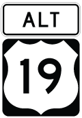
| U.S. 19 Alternate reassurance marker posted at 8th Street N by the Historic Uptown neighborhood. 12/08/19 |
|
| A pair of I-375 trailblazers precede Dr. Martin Luther King, Jr. St N and the subsequent freeway entrance ramp from 5th Avenue N. An additional ramp joins North Bay Drive from 8th Street N adjacent to these assemblies. 12/08/19 |
|
| U.S. 19 Alternate north at Dr. Martin Luther King, Jr. St (9th Street N), an urban boulevard leading from Downtown to Crescent Lake, Fossil Park and the Gateway area of north St. Petersburg. 12/08/19 |
|
| The second entrance ramp to Interstate 375 departs from U.S. 19 Alternate (5th Avenue N) beyond Dr. Martin Luther King, Jr. St N. I-375 elevates westward alongside U.S. 19 Alternate to a directional T interchange with I-275. 12/08/19, 01/16/14 |
|
| A reassurance marker stands along 5th Avenue N adjacent to St. Anthony's Hospital ahead of 14th Street N. 12/08/19 |
|
| 5th Avenue N west at 16th Street N. 12/08/19 |
|
| U.S. 19 Alternate leads two tenths of a mile west from 16th Street N to meet I-275 north directly. 12/08/19 |
|
| The one way couplet with 4th Avenue N concludes ahead of the half diamond interchange with Interstate 275 north. 12/08/19 |
|
| U.S. 19 Alternate (5th Avenue N) proceeds west from the exchange through the Historic Kenwood neighborhood. 01/13/17 |
|
| U.S. 19 Alternate travels 1.25 miles west from I-275 to U.S. 19 (34th Street N). 01/13/17 |
|
| 28th Street N runs north from the Central Avenue Business District and crosses U.S. 19 Alternate (5th Avenue N) en route to the North Kenwood and Ponce De Leon neighborhoods. 01/13/17 |
|
| Reassurance marker posted west of 28th Street N. 01/13/17 |
|
| Advancing west to U.S. 19 (34th Street N), U.S. 19 Alternate (5th Avenue N) reaches a commercial area at 31st Street N. 01/13/17 |
|
| U.S. 19 follows 34th Street south to I-275 at Pinellas Point, where it combines with the freeway across the Sunshine Skyway toward Bradenton. North from St. Petersburg, U.S. 19 continues along a commercial arterial to Lealman and Pinellas Park. 01/13/17 |
|
| Within St. Petersburg, U.S. 19 runs along the 34th Street Business District north to Disston Heights and North Kenwood and south to the Palmetto Park and Childs Park neighborhoods. 01/13/17 |
|
| 5th Avenue North leads U.S. 19 Alternate west from U.S. 19 into the Central Oak Park neighborhood. 01/13/17 |
|
| The city of Seminole lies nine miles northwest of U.S. 19 in St. Petersburg via U.S. 19 Alternate. Downtown Clearwater follows in 18 miles. 01/13/17 |
|
| U.S. 19 Alternate (5th Avenue N) north at 37th Street N. 01/13/17 |
|
| Reassurance marker posted west of 37th Street N in the Central Oak Park neighborhood. 01/16/14 |
|
| 49th Street N originates off Boca Ciega Bay in the city of Gulfport. The four lane boulevard doubles as County Road 611 northward into St. Petersburg, meeting U.S. 19 Alternate (5th Avenue N) at the Disston Heights neighborhood. CR 611 travels the height of Pinellas County, joining Pinellas Park with Clearwater and Safety Harbor via the Bayside Bridge. 01/13/17 |
|
| Advancing west from 49th Street N (CR 611), U.S. 19 Alternate (5th Avenue passes between the Disston Heights and Live Oak neighborhoods. 01/16/14 |
|
| 58th Street N intersects U.S. 19 Alternate (5th Avenue N) north from Gulfport and the Lake Pasdena neighborhood in St. Petersburg. 01/13/17 |
|
| U.S. 19 Alternate turns north from 5th Avenue N onto Tyrone Boulevard at the Eagle Crest neighborhood. 01/13/17 |
|
| Tyrone Boulevard initially leads north four blocks from 5th Avenue N before angling northwest toward Bay Pines. 01/13/17 |
|
| Entering a commercial strip anchored by Tyrone Square Mall, U.S. 19 Alternate (Tyrone Boulevard) approaches 22nd Avenue N and SR 693 (66th Street N). 22nd Avenue N provides a cut off to SR 693 south to South Pasadena. 01/13/17 |
|
| 22nd Avenue N comprises a four lane parkway or boulevard east from U.S. 19 Alternate and SR 693 at Tyrone Square Mall across St. Petersburg to I-275 and U.S. 92 (4th Street N). 01/16/14 |
|
| Connecting St. Petersburg with St. Pete Beach. State Road 694 measures 11.64 miles in length north from SR 699 (Gulf Boulevard) to Kenneth City, Pinellas Park and the U.S. 19 freeway at Largo. 01/13/17 |
|
| An east side service road opens from U.S. 19 Alternate by Tyrone Square Mall to 71st Street N at the Pinellas Trail underpass. 01/16/14, 01/13/17 |
|
| U.S. 19 Alternate (Tyrone Boulevard) north at 68th Street N to Tyrone Square Mall and the Jungle Terrace neighborhood. 01/16/14 |
|
| U.S. 19 Alternate elevates across Pinellas Trail and a ramp linking 71st St N / 30th Avenue N with Tyrone Boulevard southbound. The 544 foot long span here was built in 1957.1 06/23/07 |
|
| Intersecting U.S. 19 Alternate at the succeeding traffic light, 38th Avenue N (CR 138) runs east across the north side of St. Petersburg through the Jungle Terrace and Disston Heights community to I-275 and U.S. 92 at Northeast Park. 06/23/07 |
|
| U.S. 19 Alternate (Tyrone Boulevard) and Park Street (County Road 1) converge between the St. Petersburg and Seminole city limits alongside Pinellas Trail. CR 1 stems 2.35 miles north along Cross Bayou to CR 694 (Park Boulevard) and 6.14 miles to SR 688 (Ulmerton Road) in Largo. 06/23/07 |
|
| Several big box stores line the west side of Park Street beyond U.S. 19 Alternate and parallel Pinellas Trail. 06/23/07 |
|
| Turning more to the west, U.S. 19 Alternate crosses Long Bayou to Bay Pines. The 1,113 foot long span across the brackish waters here was built in 1967.2 06/23/07 |
|
| 95th Street N intersects U.S. 19 Alternate (Bay Pines Boulevard) south from an industrial park and the St. Petersburg/Madeira Beach KOA campground opposite Hoover Boulevard south to Bay Pines National Cemetery. 06/23/07 |
|
| 100th Way (unsigned CR 361) meets U.S. 19 Alternate (Bay Pines Boulevard) south from Lake Kersky in Seminole at the main entrance to the Bay Pines V.A. Medical Center. 06/23/07 |
|
| U.S. 19 Alternate curves northward onto Seminole Boulevard at the three wye interchange with SR 666 (Tom Stuart Causeway). This interchange was constructed in anticipation of the planned St. Petersburg-Clearwater Expressway looping west from I-275. The freeway was cancelled in 1978. 06/23/07 |
|
| State Road 666 (Tom Stuart Causeway) spans Boca Ciega Bay along a 1.40 course between U.S. 19 Alternate at Bay Pines and SR 699 (Gulf Boulevard) at Madeira Beach. 06/23/07 |
|
| Seminole Boulevard constitutes a six lane arterial through the city of Seminole north from SR 666. 08/15/15 |
|
| 54th Avenue N crosses U.S. 19 Alternate (Seminole Boulevard) between Duhme Road (CR 321) and the St. Petersburg/Madeira Beach KOA campground on Long Bayou. 08/15/15 |
|
| The Pinellas Trail spans U.S. 19 Alternate (Seminole Boulevard) at the intersection with 66th Avenue N in Seminole. The rail trail travels nearly the length of Pinellas County between St. Petersburg and Tarpon Springs. 08/15/15 |
|
| Northbound Seminole Boulevard at 70th Avenue N to Seminole Plaza shopping center and 113th Street N. 08/15/15 |
|
| The ensuing intersection along U.S. 19 Alternate (Seminole Boulevard) north is with County Road 694 (Park Boulevard). CR 694 leads west from Seminole to SR 699 (Gulf Boulevard) at Indian Shores. 08/15/15 |
|
| CR 694 (Park Boulevard) east crosses Lake Seminole en route to SR 693 (66th Street N) at Pinellas Park. State Road 694 takes over there and extends the arterial east to U.S. 19 and Interstate 275 in St. Petersburg. 08/15/15 |
|
| Continuing north along Seminole Boulevard from Park Boulevard, U.S. 19 Alternate parallels Lake Seminole northward to CR 296 (Bryan Dairy Road). 08/15/15 |
|
| Johnson Boulevard ties into U.S. 19 Alternate east from CR 694 (Park Boulevard) and the Seminole City Center retail complex. 08/15/15 |
|
| The city of Largo lies five miles north of CR 694 (Park Boulevard) on U.S. 19 Alternate. 08/15/15 |
|
| 86th Avenue N heads west from Lake Seminole to Oakhurst. Unsigned CR 264 follows the collector route 2.50 miles west to Oakhurst Road (CR 233). 08/15/15 |
|
| Removed in 2018, this I-275 trailblazer preceded the U.S. 19 Alternate (Seminole Boulevard) intersection with 102nd Avenue N (CR 296). CR 296 provides a direct connection to Interstate 275 through Pinellas Park. 06/23/07 |
|
| Unsigned here, Pinellas County Road 296 travels 8.37 miles between Hamlin Boulevard (CR 213) to the west and the U.S. 19 freeway at 118th Avenue N to the east. 08/15/15 |
|
| 110th Avenue N spurs east from U.S. 19 Alternate (Seminole Boulevard) to Lake Seminole and west to Ridge Road at Walsingham. 08/15/15 |
|
| Northbound U.S. 19 Alternate at Walsingham Road west. Walsingham Road provides a cut-off between Seminole Boulevard and SR 688 (Ulmerton Road) west to Indian Rocks Beach. 08/15/15 |
|
| U.S. 19 Alternate (Seminole Boulevard) enters the city of Largo just ahead of 126th Avenue N. 08/15/15 |
|
| U.S. 19 Alternate (Seminole Boulevard) converges with SR 688 (Ulmerton Road) by Largo Mall. 08/15/15 |
|
| State Road 688 (Ulmerton Road) represents one of two main east-west arterials across the city of Largo. Historically SR 688 was considered for a freeway corridor. Those plans were shelved in the mid-1970s due to high right of way acquisition costs. 08/15/15 |
|
| West from U.S. 19 Alternate, SR 688 turns southward onto Walsingham Road to Gulf Boulevard (SR 699 / CR 183) at Indian Rocks Beach.. Eastward, Ulmerton Road continues through south Largo to High Point, St. Pete-Clearwater International Airport (PIE), and I-275 north at the Howard Frankland Bridge. 08/15/15 |
|
| U.S. 19 Alternate continues north from SR 688 (Ulmerton Road) to Downtown Largo at SR 686 (East Bay Drive). 08/15/15 |
|
| Seminole Boulevard through Largo separates the SE and SW street suffixes. 8th Avenue travels east to Lake Alison and west to Taylor Lake and Indian Rocks Road. 08/15/15 |
|
| U.S. 19 Alternate shield posted north of 8th Avenue SE/SW in Largo. 08/15/15 |
|
| The intersection of U.S. 19 Alternate (Seminole Boulevard) separates the west and east sections of Bay Drive. West Bay Drive joins Largo with Belleair Bluffs, Belleair Beach, and Belleair Shore as Pinellas County Road 416. 08/15/15 |
|
| State Road 686 begins at U.S. 19 Alternate (Seminole Boulevard) and travels along East Bay Drive to U.S. 19 in east Largo. Roosevelt Boulevard carries the state road beyond the U.S. 19 freeway to the Bayside Bridge (CR 611) and St. Pete-Clearwater International Airport (PIE). 08/15/15 |
|
| Largo Central Park occupies the southeast corner of U.S. 19 Alternate and SR 686. SR 686 (East Bay Drive) constitutes a commercial arterial joining Downtown here with Largo city hall. CR 416 (West Bay Drive) spans Clearwater Harbor across Belleair Beach Causeway to Gulf Boulevard (CR 183). 08/15/15 |
|
| Seminole Boulevard becomes Missouri Avenue north of SR 686 (East Bay Drive). The state road counterpart of U.S. 19 Alternate shifts from SR 595 to SR 651, reflecting the realignment of the route east from Clearwater-Largo Road and Fort Harrison Road into Clearwater. 05/04/19 |
|
| Missouri Avenue north at 4th Avenue NW and the entrance to Largo High School. 05/04/19 |
|
| U.S. 19 Alternate (Missouri Avenue) meets Rosery Road at a commercialized intersection. Rosery Road extends east to Eagle Lake Park and west to Poinsetta Road into the town of Belleair. 05/04/19 |
|
| Passing by Central Park Plaza, U.S. 19 Alternate (Missouri Avenue) continues north to Jasper Street in Largo. 05/04/19 |
|
| Wyatt Street east and Ponce De Leon Boulevard north come together at U.S. 19 Alternate on the Largo city line. 05/04/19 |
|
| Belleair Road (CR 464) crosses U.S. 19 Alternate (Missouri Avenue) at the ensuing traffic light northbound. Belleair Road straddles the Clearwater city line west to Clearwater-Largo Road (former U.S. 19 Alternate). CR 464 extends east to the U.S. 19 freeway. 05/04/19 |
|
| U.S. 19 Alternate fully enters the Clearwater city limits at forthcoming Bellevue Boulevard. 05/04/19 |
|
| Lakeview Road (CR 488) crosses U.S. 19 Alternate (Missouri Avenue) east from Fort Harrison Avenue and Ed C. Wright Park en route to Hercules Avenue (CR 425) at Allens Creek Park. 05/04/19 |
|
| Northbound U.S. 19 Alternate (Missouri Avenue) at Druid Road. 05/04/19 |
|
| Approaching SR 60 (Court Street), where U.S. 19 Alternate dog legs west 0.54 miles to Myrtle Avenue through Downtown Clearwater. 05/04/19 |
|
| SR 60 joins Downtown Clearwater with Clearwater Beach beyond U.S. 19 Alternate (Myrtle Avenue). 05/04/19 |
|
| SR 60 follows Court Street east to Gulf to Bay Boulevard at Highland Avenue. Spanning Old Tampa Bay across Courtney Campbell Causeway, SR 60 comprises the main route between Clearwater and Tampa. 05/04/19 |
06/23/07, 01/16/14, 08/15/15, 10/08/16, 11/12/16, 01/13/17, 05/04/19, 08/31/19, 12/08/19 by AARoads
Page Updated 03-02-2020.