|
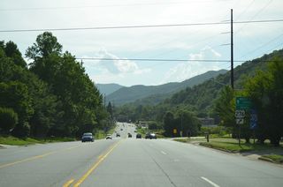
| U.S. 19/276 (Dellwood Road) overlap 2.29 miles west to Dellwod and the town of Maggie Valley. Beyond Maggie Valley, U.S. 19 navigates across a winding course to Cherokee. 07/02/14 |
|
| U.S. 19/276 (Dellwood Road) advance west from a commercial strip at Ivy Hills between Utah Mountain and Hard Ridge. 07/02/14 |
|
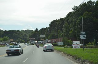
| Northbound U.S. 276 (Jonathan Creek Road) separates from U.S. 19 (Dellwood Road) south 6.26 miles to Interstate 40 at Cove Creek. 07/02/14 |
|
| U.S. 19 enters the town of Maggie Valley along Soco Road west from U.S. 276. 07/02/14 |
|
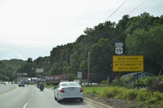
| Confirming marker posted west of the separation with U.S. 276 (Jonathan Creek Road) north at Dellwood. 07/03/14 |
|
| Moody Farm Road (SR 1307) branches north across parallel Jonathan Creek to Maggie Valley Country Club Estates. SR 1307 returns to U.S. 19, 1.89 miles to the west. 07/02/14 |
|
| U.S. 19 (Soco Road) proceeds west across the town of Maggie Valley. 07/03/14 |
|
| Reassurance marker posted west between Bradley Street and Scott Circle in Maggie Valley. 07/03/14 |
|
| Setzer Mountain rises ahead of U.S. 19 (Soco Road) southbound at Campbell Creek ahead and Memory Lane in Maggie Valley. 07/05/14 |
|
| U.S. 19 (Soco Road) straddles the north slopes of Setzer Mountain west from Maggie Valley to the grade separated intersection with the Blue Ridge Parkway. 07/05/14 |
|
| U.S. 19 enters Jackson County at Soco Gap and the access ramp to Blue Ridge Parkway. 07/05/14 |
|
| U.S. 19 advances west form Soco Gap along Thunderstruck Ridge. 07/05/14 |
|
| Traversing Lickstone Ridge, U.S. 19 navigates through numerous S-curves above Soco Creek. 07/05/14 |
|
| U.S. 19 continues into Cherokee and the signalized intersection with Casino Drive to Harrah's Cherokee Casino Resort parking garages. 07/05/14 |
|
| The succeeding traffic light along U.S. 19 southbound in Cherokee is also for the adjacent casino complex. 07/05/14 |
|
| U.S. 441 Business (Casino Trail) connects U.S. 19 with U.S. 441 heading south from Cherokee to Sylva. 07/05/14 |
|
| U.S. 441 Business runs 0.82 miles south to U.S. 441 and overlaps with U.S. 19 north 1.05 miles across Cherokee Gap into Swain County. 07/05/14 |
|
| U.S. 19 combines with U.S. 74 (Great Smoky Mountain Expressway) southwest of Bryson City. U.S. 19 joins Alarka Road for 0.11 miles between Lower Alarka Road (SR 1309) and the adjacent parclo interchange with U.S. 74. U.S. 19/74 overlap 49.2 miles southwest to Andrews and Murphy. 09/12/04 |
Page Updated 05-13-2021.

 South
South  North
North South
South


