|
| Confirming markers for U.S. 17-92-441 posted after their respective splits with U.S. 192 (Vine Street). The three routes follow Main Street through north Kissimmee. 08/26/07 |
|
| U.S. 17-92-441 (Orange Blossom Trail) north at Donegan Avenue. Donegan Avenue runs along portions of the Kissimmee city limits west to Thacker Avenue and east to Michigan Avenue. 08/26/07 |
|
| Osceola Parkway trailblazer preceding the Orange Blossom Trail (OBT) intersection with Carroll Street. Carroll Street forms a belt route west to Hoagland Boulevard south through newer subdivisions in northwest Kissimmee. 08/26/07 |
|
| Wetlands areas surround three of the four corners at the intersection joining U.S. 17-92-441 (OBT) and Osceola Parkway (CR 522). Osceola Parkway is a commercial arterial west to Dyer Boulevard and east to Florida's Turnpike by the Buenaventura Lakes community. 08/26/07 |
|
| Osceola Parkway (CR 522) extends west to I-4 and Walt Disney World as a tolled access arterial / expressway. Eastward, CR 522 continues to Simpson Road and Boggy Creek Road south of Orlando International Airport (MCO). 08/26/07 |
|
| U.S. 17-441-92 reassurance shield assembly posted between Osceola Parkway and Centerview Boulevard west. Centerview Boulevard connects OBT with the 2014-developed Crosslands Shopping Center. 05/03/08 |
|
| Centerview Boulevard ties into OBT across from the entrance for the Osceola County Performing Arts Center. 05/03/08 |
|
| Crossing into Orange County on U.S. 17-92-442 (OBT) northbound. 05/03/08 |
|
| U.S. 17-92-441 advances 1.75 miles north from the Osceola County line to meet SR 417 (Central Florida GreeneWay) by the Hunters Creek community. 05/03/08 |
|
| Hunter's Creek Boulevard loops west from OBT around Hunter's Creek to John Young Parkway and Town Center Boulevard. Falcon Trace Boulevard extends east from U.S. 17-92-441 to the Falcon Trace subdivision. 05/03/08 |
|
| Forthcoming Town Center Boulevard leads west from U.S. 17-92-441 to a commercialized intersection with parallel John Young Parkway (CR 423). 05/03/08 |
|
| A folded diamond interchange connects U.S. 17-92-441 (Orange Blossom Trail) with SR 417 (Central Florida GreeneWay) just beyond Town Center Boulevard. 05/03/08 |
|
| Town Center Boulevard constitutes an east-west arterial joining the Hunter's Creek communities to the west with Falcon Trace and the Meadow Woods east to Landstar Boulevard. 05/03/08 |
|
| SR 417 (Central Florida GreeneWay) travels west to Interstate 4 in northern Osceola and east to Orlando International Airport (MCO) and Lake Nona. 05/03/08 |
|
| Three connecting routes lead tourists into Walt Disney World from SR 417 southbound: World Center Drive to SR 536, Osceola Parkway and I-4 west to World Drive north. 05/03/08 |
|
| SR 417 continues west between subdivisions of Deerfield and Hunter's Creek 1.3 miles to John Young Parkway (CR 423). The toll road merges with I-4 west by Celebration. 02/27/16, 05/03/08 |
|
| Confirming markers for U.S. 17-92-441 posted north of the Central Florida GreeneWay on Orange Blossom Trail. 02/27/16 |
|
| Orange Blossom Trail transitions into a heavily developed commercial route from the GreeneWay north into the city of Orlando. Meeting the arterial next is Deerfield Boulevard, an east-west connector between Balcombe Road and John Young Parkway. 04/05/08 |
|
| Stable Drive intersects U.S. 17-92-441 (Orange Blossom Trail) from adjacent retail and an apartment complex. 02/27/16 |
|
| Gingermill Boulevard west and Wetherbee Road intersect U.S. 17-92-441 (OBT) at the succeeding northbound signal. Gingermill Boulevard spurs into the adjacent Ginger Mill subdivision. Wetherbee Road curves east through the Southchase development to the Meadow Woods community at Orange Avenue (CR 527). 02/27/16 |
|
| Pepper Mill Road stems west from U.S. 17-92-441 to the Pepper Mill subdivisions. 02/27/16 |
|
| Whisper Lakes Boulevard winds west through the Whisper Lakes community with four lanes to John Young Parkway. 02/27/16 |
|
| Water Bridge Boulevard threads between big box retail along the west side of OBT to the Sky Lake South subdivisions. 02/27/16 |
|
| Central Florida Parkway is an arterial connecting U.S. 17-92-441 with Central Florida Industrial Park to the east. The arterial west heads to Williamsburg, Sea World and I-4 westbound. 02/27/16 |
|
| Commercial frontage continues along both sides of Orange Blossom Trail to the Orlando Central Park industrial area and Florida's Turnpike. 02/27/16 |
|
| Taft Vineland Road winds northeast from Central Florida Parkway to intersect OBT at the subsequent northbound signal. East from U.S. 17-92-441, Taft Vineland Road reduces to two lanes and continues to industrial areas to Orange Avenue (CR 527) near Taft. 02/27/16 |
|
| Two sets of overheads for SR 528 and Florida's Turnpike precede the Orange Blossom Trail intersection with Consulate Drive. Consulate Drive links U.S. 17-92-441 with SR 528 (Beachline Expressway) west while a trumpet interchange connects OBT with an access road to Florida's Turnpike. 02/27/16 |
|
| A half diamond interchange joins Consulate Drive with SR 528 west to Sea World and I-4 by Turkey Lake. The eastbound on-ramp for SR 528 (Beachline Expressway) is located further north from Landstreet Road. 05/05/18 |
|
| Consulate Drive curves northwest from U.S. 17-92-441 to Orlando Central Park and Southbridge Commerce Park. 02/27/16 |
|
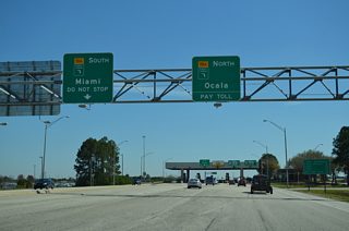
| U.S. 17-92-441 passes under the Turnpike mainline as traffic departs from OBT northbound for Florida's Turnpike north to Clermont, Wildwood and Ocala and south to Kissimmee, Fort Pierce and Miami. 03/31/18 |
|
| The access road to Florida's Turnpike from OBT also provides part of the connectivity with SR 528 (Beachline Expressway). Motorists from both routes combine through a toll plaza for northbound. 02/27/16 |
|
| An SR 528 trailblazer directs motorists northward along OBT to Landstreet Road (unsigned CR 527A) east. 10/20/18 |
|
| U.S. 17-92-441 (Orange Blossom Trail) progresses north below the Beachline Expressway to Landstreet Road. A traffic light was installed to improve safety at the merge with the Turnpike on-ramp here in 2018. 10/20/18 |
|
| A loop ramp takes motorists from Landstreet Road east onto SR 528 (Beachline Expressway) east to Orlando International Airport (MCO) and Cocoa. 03/31/18 |
|
| Landstreet Road (CR 527A) is an industrial boulevard extending east from SR 528 (Beachline Expressway) to Boggy Creek Road and the Villages of Southport near MCO Airport. 03/31/18 |
|
| Fast food franchises, motels and big box retail line Orange Blossom Trail north on the ensuing stretch from Landstreet Road. 03/31/18 |
|
| La Quinta Drive spurs east into Bee Line Industrial Park. Truss mast arms are used on succeeding signals along U.S. 17-92-441 to I-4 and the Orlando city limits. 10/20/18 |
|
| Florida Mall lies just east of OBT via Sunlife Path and August Lane. 03/31/18 |
|
| U.S. 17-92-441 (OBT) and SR 482 (Sand Lake Road) come together at a commercialized intersection northwest of Florida Mall. 03/31/18 |
|
| SR 482 follows Sand Lake Road west to I-4 near Universal Orlando and east to SR 527 (Orange Avenue) at Pine Castle. 03/31/18 |
|
| Totaling 7.6 miles, SR 482 extends east along McCoy Road to end at the Beachline Expressway in southwest Belle Isle. 03/31/18 |
|
| U.S. 17-92-441 continues north from SR 482 with six overall lanes. 11/04/17 |
|
| Southland Boulevard loops west from OBT to Southland Executive Park. Skyview Drive ties into U.S. 17-92-441 from the Sky Lake neighborhood to the east. 08/25/18 |
|
| The subsequent traffic light northbound operates at Chancery Lane east to The Crossings retail plaza and Orlando Central Parkway west to Lake Ellenor. 08/25/18 |
|
| Lancaster Road stems east from Lake Ellenor Drive to cross U.S. 17-92-441 en route to SR 527 (Orange Avenue) in Pine Castle. 08/25/18 |
|
| Oak Ridge Road heads west from SR 527 and Pine Castle to Oak Ridge, the Artegon Marketplace retail center, and the Orlando International Premium Outlets alongside I-4 and Florida's Turnpike. Oak Ridge Road is unsigned CR 506 east from U.S. 17-92-441. 08/25/18 |
|
| Wakulla Way intersects OBT west from the Florida Shores subdivision and east from Orange Blossom Terrace. 05/05/18 |
|
| Americana Boulevard travels west from U.S. 17-92-441 to become Conroy Road at John Young Parkway (CR 423). Conroy Road continues the arterial to the Mall at Millenia and I-4 in the Orlando city limits. 05/05/18 |
|
| Orange Blossom Trail advances north between Lake Tyler and western reaches of the Edgewood city limits to Holden Avenue. Holden Avenue runs along north side of Edgewood to Cypress Grove Park and SR 527 (Orange Avenue). 08/25/18 |
|
| U.S. 17-92-441 pass just west of Lake Holden and enter the Angebilt street grid ahead of 39th Street. 08/25/18 |
|
| A directional cloverleaf interchange connects U.S. 17-92-441 with Interstate 4 between 34th and 30th Streets. 08/25/18 |
|
| The Ultimate I-4 project reconfigures the exchange with Orange Blossom Trail, by realigning both roadways for the freeway to run side by side, and shifting the left ramp from westbound to OBT southbound to the right. 09/01/18 |
|
| Interstate 4 generally travels north-south through Orlando, connecting the city with points north including Maitland, Altamonte Springs and Sanford. 09/01/18 |
|
| West from U.S. 17-92-441, I-4 travels south of Clear Lake before angling southwest by the Mall of Millenia and Universal Orlando. 04/05/08 |
|
| U.S. 17-92-441 (Orange Blossom Trail) continue north through the Angebuilt community street grid outside the Orlando city limits. 09/01/18 |
|
| Michigan Street stems east from Rio Grande Avenue and the Rio Grande Terrace community to a half diamond interchange with Interstate 4 at Lee Street and SODO in Orlando. 09/01/18 |
|
| OBT north at Kaley Avenue and the Clear Lakeviews neighborhood. Kaley Avenue east connects with I-4 west at a half diamond interchange at Westwood Gardens. 09/01/18 |
|
| U.S. 17-92-441 north reenter the Orlando city limits at Grand Street. 09/01/18 |
|
| Orange Blossom Trail intersects Gore Avenue at the Holden Heights community in Orlando. Gore Avenue leads west to Orange Center Boulevard and east to Delaney Avenue at Al Coith Park. 09/01/18 |
|
| Orange Blossom Trail advances a quarter mile north from Gore Street to the East-West Expressway (SR 408). 09/01/18 |
|
| A diamond interchange joins SR 408 (East-West Expressway) with U.S. 17-92-441 (Orange Blossom Trail) at Carter and Long Streets in the Parramore neighborhood. SR 408 east navigates south of Downtown Orlando, meeting I-4 nearby, en route to University Park and SR 50 (East Colonial Drive) east to Titusville. 09/01/18 |
|
| Westbound SR 408 heads nine miles to Florida's Turnpike at Ocoee. The East-West Expressway serves Pine Hills, Orlo Vista, and Winter Garden (via SR 50 west). 11/05/06, 09/01/18 |
|
| U.S. 17-92-441 shield assembly posted between SR 408 and Anderson Street. 09/01/18 |
|
| Anderson and South Street form a one way couplet joining Downtown Orlando and Amway Center (home of the NBA Orlando Magic) with Camping World Stadium (formerly the Citrus Bowl). 09/01/18 |
|
| Northbound Orange Blossom Trail at the intersection with Church Street. Church Street lines the north side of both Camping World Stadium and Amway Center. Orlando City Stadium, built between 2014 and 2017 for the MLS Orlando City SC, lies a short distance east of U.S. 17-92-441 on Church Street as well. 09/01/18 |
|
| Span wire signals at OBT and Central Boulevard. 09/01/18 |
|
| Approaching SR 526 east (Washington Street) on U.S. 17-92-441 (Orange Blossom Trail) north. SR 526 follows Washington Street east to Interstate 4 where it dog legs north one block to Robinson Street through Downtown. 09/01/18 |
|
| Orange Blossom Trail north at the eastbound beginning of SR 526 (Washington Street). SR 526 travels east along Robinson Street through Downtown Orlando to Crystal Lake Drive. Washington Street continues west of U.S. 17-92-441 to Rock Lake and Old Winter Garden Road at Tampa Avenue. 09/01/18 |
|
| U.S. 17-92-441 reassurance shields posted northbound between SR 526 (Washington Street) and Jefferson Street. 09/01/18 |
|
| Robinson Street continues west from SR 526 (Hughey Avenue) to U.S. 17-92-441 (Orange Blossom Trail). 09/01/18 |
|
| Northbound Orange Blossom Trail at Amelia Street. Amelia Street east linked U.S. 17-92-441 with the former Orlando Centroplex, site of Amway Arena (demolished in 2011-12) and the Bob Carr Theater. The Centroplex was replaced with the Creative Village Development. 09/01/18 |
|
| Orange Blossom Trail takes an S-curve northeast to meet SR 50 (West Colonial Drive). Colonial Drive constitutes the main east-west arterial throughout Orange County, linking Oakland, Winter Garden, Orlando, Union Park, Bithlo and Christmas. 09/01/18 |
|
| U.S. 17/92 split with U.S. 441 north to combine with SR 50 (West Colonial Drive) east to Mills Avenue. 0.75 miles to the east, a single point urban interchange (SPUI) connects Colonial Drive with I-4. 09/01/18 |
|
| U.S. 441 remains along Orange Blossom Trail north through Apopka and Lake Dora. SR 50 continues along West Colonial Drive to Pine Hills. Historically, U.S. 441 once ended at the intersection of Orange Blossom Trail and West Colonial Drive. The route was extended south to Miami in 1949. 09/01/18 |
Page Updated 10-24-2018.


