
U.S. 1 crosses the Palmetto State 170.54 miles northeast from the Savannah River at North Augusta to the North Carolina state line north of Cheraw. U.S. 1 overlaps with U.S. 78 east to Aiken, where it turns north across Interstate 20 to Batesburg-Leesville. Continuing east, U.S. 1 converges with U.S. 378 at Lexington and the western suburbs of Columbia.
U.S. 1/378 overlap for 0.68 miles along W Main Street in Lexington, and again for 2.58 miles from West Columbia across the Congaree River onto Gervais Street across Downtown Columbia. U.S. 1 shifts northeast onto Two Notch Road from Millwood Avenue at Waverly in Columbia to Arcadia Lakes, Dentsville, Pontiac and the eastern suburbs.
Through Kershaw County, U.S. 1 parallels a CSX Railroad line to the town of Elgin, unincorporated Lugoff and the city of Camden. U.S. 601 accompanies the route for 5.04 miles east to U.S. 521 in Downtown Camden. Northeast from the county seat heads to the Carolina Sandhills, traversing portions of Sandhills State Forest in Chesterfield County to U.S. 52 outside Cheraw.
U.S. 52 combines with U.S. 1 northeast for 5.50 miles through the town of Cheraw and across the Pee Dee River into Marlboro County. The final 6.61 miles of U.S. 1 in South Carolina stem north from U.S. 52 near Wallace into Richmond County, North Carolina en route to Rockingham.
U.S. 1 South Carolina Guides
 North
North 
 East
East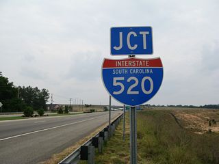
U.S. 1/78/278 (Jefferson Davis Highway) advance 0.73 miles east from the split with U.S. 25/S.C. 121 (Martintown Road) to a parclo interchange (Exit 17) with Interstate 520 (Palmetto Parkway).
06/01/07

Interstate 520 heads south from North Augusta across the Savannah River and west along a loop encircling Augusta, Georgia.
06/01/07

I-520 (Palmetto Parkway) north from U.S. 1/78/278 to Interstate 20 was completed in December 2009.
06/01/07
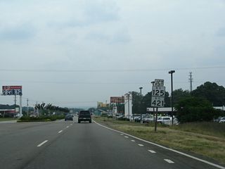
U.S. 278 splits with U.S. 1/78 (Jefferson Davis Highway) at forthcoming S.C. 421 (Augusta Road).
06/01/07
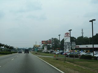
S.C. 421 (Augusta Road) branches east from U.S. 1/78 to Clearwater, Langley and Warrenville.
06/01/07
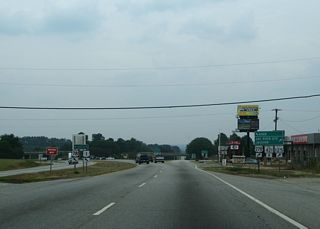
U.S. 1/78 shift northward from U.S. 278/S.C. 421 to a cloverleaf interchange with S.C. 125. S.C. 125 (Atomic Road) leads 3.19 miles west to U.S. 25 Business (Georgia Avenue) in North Augusta.
06/01/07
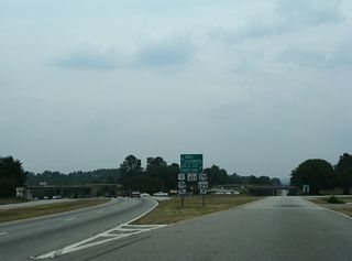
U.S. 278/S.C. 124 overlap southward to Beech Island. S.C. 215 continues from there to the Savannah River Site while U.S. 278 turns east to Williston.
06/01/07
Connect with:
Interstate 20
Interstate 26
Interstate 77
Interstate 520 - Palmetto Parkway
U.S. 15
U.S. 21
U.S. 25
U.S. 76
U.S. 78
U.S. 176
U.S. 178
U.S. 321
U.S. 378
U.S. 601
Page Updated 03-10-2022.


