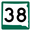
Traveling 65.3 miles, Highway 38 runs east from Business Loop I-90 in Mitchell to Interstate 29 at Sioux Falls. Generally a rural route, SD 38 connects the small cities of Salem, Montrose, Humbolt and Hartford while paralleling I-90. The eastern extend followed Russell Street, a major arterial route between I-29 and Business Spur I-90/SD 115 (Minnesota Avenue) in the city of Sioux Falls.
SD 38 was established in 1926 between U.S. 16, north of Alexandria, and the Iowa state line near Ben Claire.1 Per the 1941 Official South Dakota Highway Map, the original alignment took SD 38 two miles north along 421st Avenue from old U.S. 16 to 252nd Street in Hanson County. Paralleling the Chicago, St. Paul, Minneapolis and Omaha Railroad line a half mile to the north, the state highway traveled east to Farmer, Spencer and Salem. An overlap with U.S. 81 (Nebraska Street) directed SD 38 southward to Rutan Avenue, its current alignment through Salem.
The historical route of SD 38 followed a stair-stepped course southeast from Salem to Sioux Falls, eventually taking 471st Street (Marion Road) south to SD 42/former U.S. 16 along 12th Street. The eastern extent of SD 38 followed what is now SD 11 and SD 42 east from Sioux Falls to Rowena and the Iowa state line. Straightening of the route between Mitchell and Sioux Falls took place by 1950. SD 38 replaced U.S. 16 west into Mitchell by the late 1960s, when the US highway shifted southward onto newly built I-90.
Within Sioux Falls, SD 38 was eventually realigned east along 60th Street to I-29, which it joined southward to Russell Street. 60th Street east from I-29 to U.S. 77 along Cliff Avenue was designated as SD 38A. East from I-29, SD 38 followed Russell Street to U.S. 77 (Minnesota Avenue) between Downtown and Sioux Falls Regional Airport (FSD). The state highway was truncated westward to I-29 by 1995.1
|
| SD 38 follows 60th Street N into the city of Sioux Falls, where it expands into a four lane arterial by University Center North. East from there, SD 38 meets Interstate 29 at a parclo interchange. 08/06/16 |
|
| Interstate 29 heads south through western reaches of Sioux Falls between SD 38 and the city of Tea. 08/06/16 |
|
| Heading north from Sioux Falls, Interstate 29 travels to U.S. 14 at Brookings. 08/06/16 |
|
| SD 38 previously overlapped with I-29 south from 60th Street N to Russell Street east. The state highway extended east along Russell Street to SD 115 along Minnesota Avenue (old U.S. 77). 08/13/16 |
|
| Russell Street at SD 115 (Minnesota Avenue) and the former westbound beginning of SD 38 in Sioux Falls. 08/13/16 |
|
| SD 38 begins along 60th Street at the parclo interchange with Interstate 29 in northwest Sioux Falls. 08/06/16 |
|
| Interstate 29 and SD 38 previously overlapped south 1.75 miles to a wye interchange. 60th Street east to Cliff Avenue (old U.S. 77) was designated as SD 38A. 08/06/16 |
|
| The first confirming marker for SD 38 west stands along 60th Street at the entrance ramp for I-29 south to Beresford. 08/06/16 |
|
| SD 38 (60th Street) proceeds west from I-29 to University Center North and Annika Avenue. 08/06/16 |
Sources:
- The South Dakota Highways Page: Highways 31 to 60.
http://www.northernplainshighways.org/sdakota/sd31-60.html
08/06/16, 08/13/16 by AARoads
Connect with:
Interstate 29
Interstate 90
Page Updated 02-18-2020.


