South Carolina Highway 12 stretches 28.25 miles east from U.S. 1 (Augusta Road) in West Columbia to U.S. 601 at I-20 south of Lugoff. Through West Columbia, S.C. 12 follows Jarvis Klapman Boulevard, a controlled access arterial separating north from U.S. 1, 1.38 miles east to S.C. 35 (N 12th Street). Jarvis Klapman Boulevard continues 1.63 miles east along a limited access expressway across the Congree River to Williams Street in Columbia.
Through Columbia, S.C. 12 initially partitions into a couplet along Hampton Street east and Taylor Street west for six blocks between Williams and Park Streets. The two directions consolidate along Taylor Street east ahead of S.C. 48 (Assembly Street) and the Main Street District in Downtown. Taylor Street becomes Forest Drive along S.C. 12 east of U.S. 1 (Two Notch Road) and the Waverly neighborhood.
Forest Drive leads S.C. 12 east into the city of Forest Acres ahead of Richland Mall and S.C. 16 (Beltline Boulevard). S.C. 12 passes south of Forest Lake and turns northward onto Percival Road. Forest Drive east to I-77 at Exit 12 is part of S.C. 12 Spur, a 0.47 mile unsigned route which extends along Strom Thurmond Boulevard to Fort Jackson at Gate 2.
S.C. 12 (Percival Road) parallels Interstate 77 northeast to Exit 15 at Woodfield. The succeeding 6.60 miles east line along the northern boundary of Fort Jackson. Leaving the outer suburbs of Columbia, S.C. 12 enters Kershaw County along Fort Jackson Road. Running laterally with I-20 to the north, S.C. 12 proceeds 7.22 miles east to the parclo B2 interchange (Exit 92) joining I-20 with U.S. 601.

S.C. 12 (Jarvis Klapman Boulevard) separates from U.S. 1 (Augusta Road) northbound at a wye intersection.
12/31/12
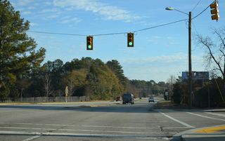
S.C. 12 (Jarvis Klapman Boulevard) intersects Hook Avenue (Road 285) just 0.17 miles beyond U.S. 1.
12/31/12
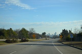
S.C. 35 stems 0.52 miles south from U.S. 378 (Sunset Boulevard) at Seminole Drive to a signalized intersection with S.C. 12.
12/31/12
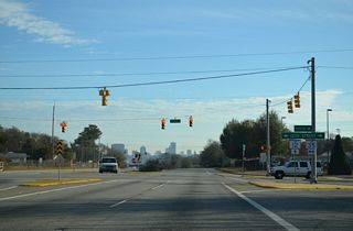
S.C. 35 (12th Street) continues 5.09 miles south from Jarvis Chapman Boulevard to Interstate 77 in the city of Caycee.
12/31/12
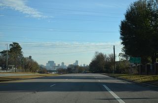
S.C. 12 upgrades to a freeway east from 12th Street and ahead of a diamond interchange with 9th Street (Road 12).
12/31/12
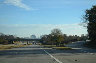
The Downtown Columbia skyline comes into view at the exchange with 9th Street. 9th Street links S.C. 12 with U.S. 378 (Sunset Boulevard) and U.S. 1 (Meeting Street) nearby.
12/31/12
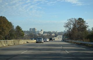
A loop ramp joins U.S. 378 (Sunset Boulevard) east with S.C. 12 (Jarvis Chapman Boulevard) ahead of the Congaree River.
12/31/12
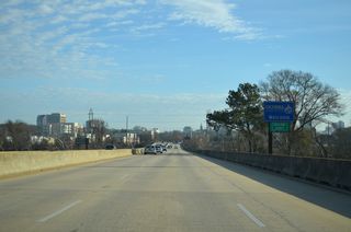
S.C. 12 east enters the city of Columbia and Richland County midway across the Congaree River.
12/31/12
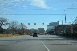
U.S. 21/176/321 overlap 0.94 miles south along Huger Street to Blossom Street (U.S. 21 Connector) near the University of South Carolina (USC) campus.
12/31/12

Hampton Street continues east with one way traffic five blocks from U.S. 21/176/321 (Huger Street) as part of S.C. 12 to Fort Jackson.
12/31/12
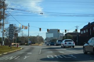
U.S. 21/176/321 (Huger Street) continue 0.77 miles north to Interstate 126 and U.S. 76 at Elmwood Avenue.
12/31/12
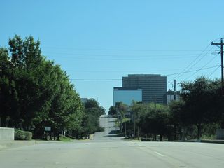
Hampton Street spans a CSX Railroad line between Pulaski Street and Wayne Street ahead of Downtown Columbia.
10/03/10
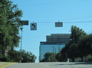
The eastbound direction of S.C. 12 turns north onto Park Street to rejoin westbound along Taylor Street.
10/03/10
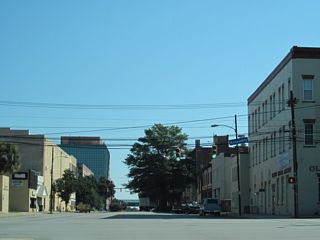
Unmarked on S.C. 12 (Taylor Street), S.C. 48 originates 0.49 miles to the north at U.S. 21/76/176/321 (Elmwood Avenue) and leads south to USC, Williams Brice Stadium and Gadsden.
10/03/10
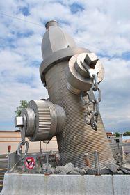
The World's Largest Hydrant is a 40 feet tall concrete, steel and aluminum sculpture along the south side of Taylor Street east of Marion Street.1
04/15/12
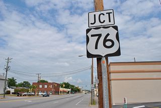
U.S. 76 follows Bull Street for nine blocks between parallel U.S. 1/378 (Gervais Street) and S.C. 277 at Elmwood Avenue.
04/15/12
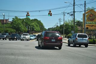
U.S. 1 turns north from U.S. 76/378 (Gervais Street) onto Millwood Avenue to S.C. 12. The route continues northeast along Two Notch Road to Dentsville and Pontiac.
04/14/12
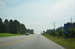
Clemson Road (Road 52) links S.C. 12 (Pervical Road) with Interstate 20 at a diamond interchange (Exit 80) just 0.23 miles to the north.
07/28/13
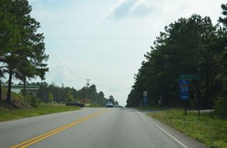
Spears Creek Church Road (Road 53) heads 2.54 miles north from S.C. 12 (Percival Road) to adjacent I-20 and U.S. 1 (Two Notch Road) at Pontiac.
07/28/13
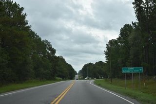
Screaming Eagle Road (Road 268) runs along the eastern boundary of Fort Jackson 7.74 miles from S.C. 12 to U.S. 601,
09/20/21
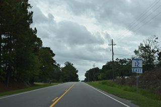
Reassurance marker posted east of the wye intersection with Screaming Eagle Road (Road 268).
09/20/21
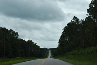
S.C. 12 (Fort Jackson Road) lowers to cross Spears Creek beyond Tower Road (Road 906) south.
09/20/21
| S.C. 12 (Taylor Street) west at Lincoln Street, the Vista Gateway and Finlay Park. 11/21/21 |
| Taylor Street intersects Gadsden Street at the southwest corner of Finlay Park. 11/21/21 |
| S.C. 12 (Taylor Street) spans CSX and Norfolk Southern Railroad lines west of Pulaski Street. 11/21/21 |
| U.S. 21/176/321 head 0.38 miles north from S.C. 12 (Taylor Street) along Huger Street to Interstate 126 west and U.S. 76 at Elmwood Avenue. 11/21/21 |
| Continuing west from Huger Street, S.C. 12 shifts south from Taylor Street onto Williams Street. 10/03/10 |
| S.C. 12 west turns south with three onto Williams Street one block from Taylor Street to S.C. 12 east along Hampton Street. 10/03/10 |
| Hampton Street flows east with one way traffic along S.C. 12 to Park Street. S.C. 12 west joins Jarvis Klapman Boulevard west to West Columbia. 10/03/10 |
| S.C. 12 spans the Congaree River west along a freeway to S.C. 35 (12th Street). 10/03/10 |
| S.C. 12 crosses the Jefferson Davis McMahan Bridge west to U.S. 378 (Sunset Boulevard). 10/03/10 |
| The Congaree River flows south from the adjacent confluence of the Saluda and Broad Rivers. 10/03/10 |
| A lane drop occurs at the exit for U.S. 378 (Sunset Boulevard) from S.C. 12 westbound. U.S. 378 separates from U.S. 1 (Meeting Street) just to the south. 10/03/10 |
| Entering Lexington County and the city of West Columbia. 10/03/10 |
| U.S. 378 (Sunset Boulevard) heads from West Columbia to Lexington, meeting both I-20 and I-26. 10/03/10 |
| A diamond interchange links Jarvis Klapman Boulevard with 9th Street a half mile west of U.S. 378 (Sunset Boulevard). 10/03/10 |
| 9th Street north to U.S. 378 and south to U.S. 1 (Meeting Street) is S.C. 12 Connector, an unsigned route measuring 0.45 miles. 10/03/10 |
| 9th Street extend south from U.S. 1 into the city of Cayce. 10/03/10 |
| The freeway along S.C. 12 (Jarvis Klapman Boulevard) ends at S.C. 35 (12th Street). 10/03/10 |
| S.C. 35 is a 5.63 mile long route north from Cayce to U.S. 378 (Sunset Boulevard) at Seminole Drive (Road 69). 10/03/10 |
| S.C. 35 (12th Street) connects Cayce with Interstate 77 along 12th Street Extension. 10/03/10 |
| Alpine Road (Road 63) runs south from I-20 by I-77 to S.C. 12 (Percival Road) at Woodfield northeast of Columbia. 07/28/13 |
| S.C. 12 (Percival Road) travels southwest from Alpine Road (Road 63) to Forest Drive between Forest Acres and Fort Jackson Gate 2. 07/28/13 |
| Spears Creek Church Road (Road 53) links Interstate 20 with S.C. 12 (Percival Road), 0.22 miles to the south. 09/20/21 |
Photo Credits:
07/28/13, 09/20/21 by AARoads
Connect with:
Interstate 20
Interstate 77
U.S. 1
U.S. 21
U.S. 176
U.S. 321
U.S. 378
U.S. 601
Highway 35
Highway 48
Page Updated 12-30-2021.


