

Joining Lawrence and Douglas County with Lenexa and the Johnson County suburbs of Kansas City, Kansas Highway 10 is 36.87 miles in length. K-10 encircles Lawrence south from the Kansas Turnpike along a two lane expressway with a lone signalized intersection at W 27th Street. U.S. 40 overlaps with K-10 (S Lawrence Trafficway) for 6.56 miles along the loop between W 6th Street and U.S. 59.
The South Lawrence Trafficway completed from I-70 (Kansas Turnpike) to U.S. 59 (Iowa Street) in 2003.
Continuing east from U.S. 40/59, K-10 upgrades to a four lane freeway. The 5.57 mile segment of the S Lawrence Trafficway east to the directional T interchange with E 23rd Street opened to traffic on November 9, 2016. Prior to that time, K-10 followed U.S. 40/59 north along Iowa Street to 23rd Street east.
The remainder of K-10 leading east from Lawrence constitutes a limited access highway. The freeway bypasses Eudora to the south and enters Johnson County northwest of the Sunflower Ammunition Plant. K-10 runs across the De Soto city limits and then shifts southward into suburban areas along the Lenexa and Olathe city line.
The east end of K-10 ties into Interstate 435 just west of I-35/U.S. 56-169. Built as part of the Johnson County Gateway Project, collector distributor roadway link K-10 with the cloverstack interchange at I-35.
Kansas Highway 10 Guides
- East - Lawrence to Eudora
- East - De Soto to Lenexa
- West - Lenexa to De Soto
- West - Eudora to Lawrence
Historically K-10 followed Midland Drive east onto 63rd Street into the city of Shawnee. The state highway continued northeast along Merriam Drive at Merriam, paralleling Interstate 35 onto Merriam Lane in Kansas City. Merriam Drive was formerly also U.S. 169 until the adjacent Turkey Creek Expressway was completed along I-35. K-10 shifted onto Southwest Boulevard (U.S. 169 Alternate) at Shawnee Heights in Kansas City and concluded at the Missouri state line in north Rosedale.
The freeway along K-10 was completed east to K-7 by November 8, 1976. K-10 was previously realigned from Midland Drive onto K-7 north to Shawnee Mission Parkway in 1971. The controlled access arterial east to 63rd Street beyond Pflumm Road was initially constructed with just two lanes. The proposed freeway link between K-7/10 and Interstate 435 along 103rd Street was designated K-12. Construction on the freeway commenced in 1980 and it opened on December 18, 1984 as an extension of K-10.1 K-12 was subsequently applied to what was K-10 on Shawnee Mission Parkway, Merriam Drive/Lane and Southwest Boulevard until 1987, when the route was decommissioned.2

K-10 through Shawnee, Merriam and Kansas City in 1968.
| 23rd Street / Old |
 | High speed ramps from K-10 combine westbound along E 23rd Street ahead of the intersection with E Hills Drive to East Hills Business Park. 10/31/16 |
 | E 23rd Street continues west with a grass median to the traffic light with O'Connell Road. 10/31/16 |
 | A truck restriction sign was formerly posted west of O'Connell Road. 10/31/16 |
 | The Lawrence city limit sign posted ahead of Anderson Road on E 23rd Street was removed in 2017. 10/31/16 |
 | E 23rd Street west at the commercialized intersection with Harper Street. 10/31/16 |
 | E 23rd Street (old K-10) west at Barker Avenue, which leads south to Haskell Indian Nations University. 10/31/16 |
 | E 23rd Street becomes W 23rd Street at Massachusetts Street. 10/31/16 |
 | W 23rd Street intersects Louisiana Street by the The Malls shopping center. 10/31/16 |
 | The succeeding traffic light on W 23rd Street (old K-10) west is with Alabama Street. 10/31/16 |
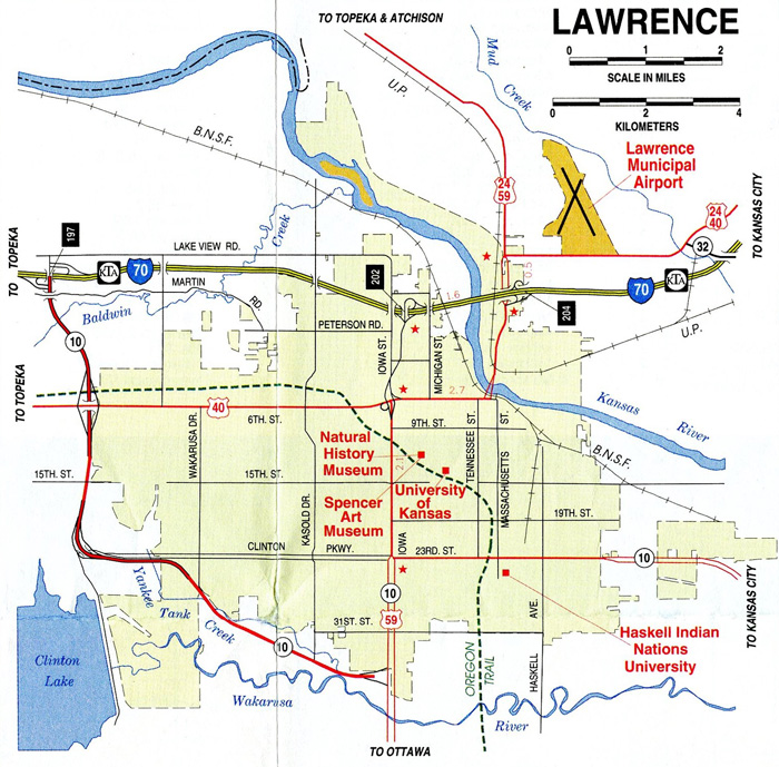
 | K-10 turned south onto U.S. 59 (Iowa Street) for 1.57 miles to the S Lawrence Trafficway. 10/31/16 |
 | U.S. 40 was realigned onto U.S. 59 north from K-10 (S Lawrence Trafficway) to N 1800 Road in north Lawrence. 10/31/16 |
| Merriam Lane / Old |
 | Merriam Lane (old K-10) west at S 24th Street in the Argentine community of Kansas Ciy. 10/30/16 |
 | Merriam Lane west at S 34th Street in Argentine, Kansas City. 10/30/16 |
 | Crossing into northern reaches of the Overland Park city limits, Merriam Lane becomes Merriam Drive ahead of a folded diamond interchange with Interstate 635. 10/30/16 |
 | Interstate 635 extends north from the adjacent exchange joining U.S. 69 (Metcalf Avenue) with I-35 across Kansas City. 10/30/16 |
 | A loop ramp joins Merriam Drive with I-635 south to I-35/U.S. 69. 10/30/16 |
 | Merriam Drive continues west from I-635 paralleling I-35 into the city of Merriam. 10/30/16 |
- Kansas Highway 10. Richie Kennedy, route56.com.
- Kansas Highways: Numbers 1-13. Richie Kennedy, route56.com.
Photo Credits:
- 10/30/16 by AARoads and Richie Kennedy. 10/31/16 by AARoads and JP Nasiatka.
Connect with:
Interstate 35
Interstate 70
Interstate 435
U.S. 40
U.S. 59
Highway 7
Page Updated 10-27-2021.