|
| SR 63 begins its 60 mile journey as a four lane expressway outside the community of Carbondale in Warren County (population 8,508) where U.S. 41 diverts from the expressway to form a two lane highway that goes through Attica, Veedersburg and Rockville on its own route toward Terre Haute. Long distance traffic heading toward Terre Haute and Evansville are advised to stay on SR 63 to avoid the slower U.S. 41. 03/05/12 |
|
| A view of the first SR 63 shield for southbound traffic past the U.S. 41 split. 03/05/12 |
|
| West Lebanon is the first community that can be reached from SR 63, it lies six miles away via SR 63 and SR 263. Danville, Illinois follows next at a distance of 25 miles via SR 63 and Interstate 74 (or U.S. 136). Evansville is still a long way from here at a distance of 171 miles. 03/05/12 |
|
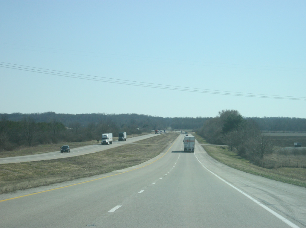
| Quiet and desolate is the main story for SR 63's trek across Warren County. It is not an understatement to say that there is little of anything along this stretch of highway. 03/05/12 |
|
| The junction with SR 236 appears with a link to West Lebanon. SR 263 represents the original routing of SR 63 through Warren County and stretches for 13 miles through West Lebanon before returning to SR 63. Locally, the route is sometimes referred to as "Old 63" with the current SR 63 called "New 63." 03/05/12 |
|
| SR 63 at the junction of SR 263. SR 263 will head south for its five mile trip to West Lebanon. From there it will follow the Wabash River, roughly, back to SR 63 near the interchange with U.S. 136. 03/05/12 |
|
| South of SR 263's junction, Interstate 74 lies 14 miles ahead. Terre Haute returns as the primary control city with a distance of 61 miles. 03/05/12 |
|
| Now west of West Lebanon, SR 63 approaches the junction with SR 28, a 153 mile highway that crosses the state from west to east. The highway starts only a few miles to the west and goes through Attica, Frankfort, Tipton, Elwood, and Alexandria before ending in Union City. 03/05/12 |
|
| The Warren County seat of Williamsport is a few miles away along SR 28. The town is home to St. Vincent Williamsport Hospital, the only one in the region. Across the Wabash River from Williamsport is the larger city of Attica. 03/05/12 |
|
| SR 63 at the junction with SR 28. West Lebanon is only a mile to the east of this highway. 03/05/12 |
|
| South of the SR 28 intersection, a distance sign announces the next two communities, both off of SR 63: Danville, Illinois (13 miles) and Covington (20 miles). Because of the lack of communities along this route, towns located off the highway appear on the distance signs along this highway. 03/05/12 |
|
| A view of SR 63 to the south of the SR 28 intersection. 03/05/12 |
|
| Now at the intersection with County Road 450 South, which lies just south of Redwood Creek. West along this road you'll reach the small communities of Marshfield (2 miles away), Johnsonville (six miles away) and State Line City (ten miles away). 03/05/12 |
|
| SR 63 goes through some hilly terrain as it heads through the Opossum Run valley. Slowly the expressway enters the Wabash River valley which will feature some more diverse landscapes besides the typical prairies that had dominated the view in the northern part of the highway. 03/05/12 |
|
| A guide sign announces the upcoming junction with U.S. 136, one mile away. 03/05/12 |
|
| SR 63 is now 1/2 mile away from the interchange with U.S. 136. U.S. 136 goes for 804 miles from Edison, Nebraska to Indianapolis, following the route of Interstate 74 through its routing in Indiana. 03/05/12 |
|
| Prior to the U.S. 136 interchange, SR 263 returns to SR 63 after its 13 mile stint along the former routing of SR 63. 03/05/12 |
|
| Despite having already passed West Lebanon, it is again the main control city for SR 263 north traffic. Just ahead lies the U.S. 136 interchange. 03/05/12 |
|
| A diamond interchange facilitates the movements between SR 63 and U.S. 136. Covington, the county seat of nearby Warren County, is only a couple of miles to the east across the Wabash River. Danville, Illinois, the county seat and largest city of Vermilion County, Illinois is just less than 10 miles to the west. 03/05/12 |
|
| SR 63 leaves a diamond interchange with U.S. 136, west of Covington, and approaches a parclo interchange with Interstate 74 in one mile. 11/04/11 |
|
| Reassurance marker posted for SR 63 south ahead of the Vermillion County line. 11/04/11 |
|
| Interstate 74 crosses paths with SR 63 midway between Peoria, Illinois and Indianapolis. The freeway connects with Danville and Champaign-Urbana over the next 40 miles to the west and Crawfordsville 30 miles to the east. 11/04/11 |
|
| Crossing the Vermillion County line along SR 63 south. The county is home to 16,212 and represents the longest and thinnest county in the state. SR 63 travels the height of the Vermillion County for 36 miles. The county is just 10 miles at its widest point. 11/04/11 |
|
| Lowering to the ramps with Interstate 74 on SR 63 south. A set of flashers hang above the intersection with County Road 1650 North, cautioning motorists of traffic to and from an adjacent truck stop. 11/04/11 |
|
| Drivers bound for Interstate 74 west depart SR 63 south. Interstate 74 crosses the state line on the 4.3 mile drive to the state line. Peoria is 135 miles to the west. 11/04/11 |
|
| A loop ramp drops down to Interstate 74 east from SR 63. Interstate 74 continues east 65 miles to merge with Interstate 465, the Indianapolis Beltway. 11/04/11 |
|
| SR 63 reassurance shield and distance sign south of the Interstate 74 interchange. The Vermillion County seat of Newport lies 17 miles away while Terre Haute is 47 miles away. 03/05/12 |
|
| The stretch of SR 63 from Interstate 74 south to SR 32 is named for Gary E. Dudley and Gary L. Martin, two police officers from Lake County who were killed along this stretch of highway while participating in a charity motorcycle ride in 2006. 03/05/12 |
|
| SR 63 is flat and desolate as it heads south from the interchange with Interstate 74. 03/05/12 |
|
| The small community of Gessie is 3 miles to the left off SR 63 along County Road 1350 North. 03/05/12 |
|
| SR 32 is a 157 mile highway that crosses the state from the Illinois border to Ohio, going through Perrysville, Crawfordsville, Lebanon, Noblesville, Anderson, Muncie, Winchester and Union City. 03/05/12 |
|
| Perrysville is one mile to the east along SR 32. Further down the road is the city of Crawfordsville in Montgomery County. 03/05/12 |
|
| Now at the intersection with SR 32. To the west, the highway crosses into Illinois and becomes Perrysville Road which leads to Interstate 74 and Danville, Illinois. 03/05/12 |
|
| The Cayuga Generating Station comes into view as SR 63 heads south from the SR 32 intersection, approaching the junction with Depot Street/County Road 1125 North. 03/05/12 |
|
| South of the Depot Street/County Road 1125 North intersection, the Vermillion County communities of Cayuga and Newport are 8 and 13 miles away respectively. 03/05/12 |
|
| The stretch of SR 63 from SR 32 to SR 234 is flat with little terrain change as the river follows the Wabash River. 03/05/12 |
|
| County Road 600 North leads west from SR 63 to the town of Eugene. 03/05/12 |
|
| Coming up to the intersection with SR 234 and the town of Cayuga (population 1,162). SR 234 exists in two segments with the western one stretching for 54 miles from the Illinois state line to Jamestown in southwestern Boone County, along with a 23 mile stretch in Hancock and Henry counties. 03/05/12 |
|
| SR 234 is the best route for traffic heading to Shades State Park, about 22 miles to the east. The Fountain County community of Kingman is ten miles to the east while Cayuga is less than a mile to the west. 03/05/12 |
|
| SR 234 follows Ferry Street through the north side of Cayuga as it continues west to the Illinois state line and onto the town of Georgetown, Illinois. The small towns of Waterman and Silverwood are 2.5 and 3 miles away to the east. 03/05/12 |
|
| SR 63 passes by the entrance to the Vermillion County Fairgrounds, which utilizes SR 63 for its location. Throughout the county, the SR 63 expressway does serve as the "main street" of the county. 03/05/12 |
|
| Leaving the Cayuga area, the Vermillion County seat of Newport is six miles away while the community of Dana is 13 miles away via SR 63 and SR 71. 03/05/12 |
|
| SR 63 passes by the Cayuga Generating Station as it continues south toward the Newport area. 03/05/12 |
|
| SR 63 now approaches the northern terminus of the southern segment of SR 71. The northern segment goes for 17.5 miles in Benton and Newton Counties. 03/05/12 |
|
| SR 71 goes for 20 miles from SR 63 south through Dana and Blanford before ending at SR 163. 03/05/12 |
|
| SR 71 turns off to the south off of SR 63 to the north of the Newport Chemical Depot. 03/05/12 |
|
| South of the junction with SR 71, the distance to the Parke County communities of Montezuma (ten miles) and Rockville (18 miles) is given. Both communities are reached via SR 63 and U.S. 36. 03/05/12 |
|
| SR 63 begins climbing up a hill as it approaches the intersection with Market Street. The expressway spans the Little Vermilion River along this stretch. 03/05/12 |
|
| A flasher lies at the intersection with SR 63 and Market Street, the main road into Newport. Newport (population 515) is the county seat of Vermillion County. This small community is best known for the Antique Auto Hill Climb that takes place each fall and is considered the second largest automobile event in the state after the races at the Indianapolis Motor Speedway. The event brings in thousands of people into its small community. 03/05/12 |
|
| The next few miles of SR 63 from Newport to U.S. 36 pass by the Newport Chemical Depot. Until 2010, the Newport Chemical Depot was a bulk chemical storage and destruction facility and was one of several places that stored the deadly VX nerve agent gas. The VX gas has since been destroyed and the facility closed. This stretch of SR 63 consequently is quite desolate. 03/05/12 |
|
| Now a mile away from the folded diamond interchange with U.S. 36 on SR 63 south. U.S. 36 goes for 1,414 miles from the Rocky Mountain National Park to Uhrichsville, Ohio and for 139 miles across Indiana from the Illinois line, through Rockville, Danville, Indianapolis, and Pendleton before leaving into Ohio. The Raccoon Lake State Recreational Area is located to the east in Parke County via U.S. 36. 03/05/12 |
|
| Now a half mile away from the U.S. 36 interchange with SR 63. There is mention of Hillsdale and Montezuma, two smaller communities along the highway within the general area of the interchange. The Ernie Pyle State Memorial in Dana is also accessed via the interchange. 03/05/12 |
|
| Travelers bound for U.S. 36 depart SR 63 south. The controls for U.S. 36 are Rockville and Decatur, Illinois. Rockville, the county seat of Parke County (the Covered Bridge Capital of the World) is 11 miles away and Decatur, Illinois is 85 miles away. 03/05/12 |
|
| South of the U.S. 36 interchange, the Vermillion County city of Clinton is ten miles away. Vincennes and Evansville, both located along U.S. 41 in Southwest Indiana are 79 and 130 miles away respectively. 03/05/12 |
|
| SR 63 continues to follow the path of the Wabash River in a southerly direction toward Clinton. Slowly traffic has been building up along the expressway as it gets closer to Clinton and Terre Haute, both areas of commerce for those in northern and central Vermillion County. 03/05/12 |
|
| Main Street turns off to the south from SR 63 toward the Vermillion County city of Clinton (population 4,893), which is the largest community in Vermillion County and contains about a third of the county's population. It is the business center of Vermillion and parts of Parke Counties. Clinton is best known for its Italian-American population and its Little Italy Festival which brings 75,000 visitors every Labor Day Weekend. 03/05/12 |
|
| Washington Street connects SR 63 with 9th Street in Clinton, a major north-south road through that city. To the north of the expressway is South Vermillion Middle School. 03/05/12 |
|
| SR 63 enters the community of Fairview Park (population 1,386). Fairview Park is an adjacent town to Clinton that abuts the northern boundary of the city. SR 63 cuts across the grid of Fairview Park but goes through the community with light traffic. 03/05/12 |
|
| SR 63 now approaches the junction with SR 163. SR 163 is a short, nine mile highway across the southern tier of Vermillion County. The highway begins at the Illinois state line, goes through Blanford and then intersects with SR 63 before going into Clinton. East of the Wabash River, the highway continues east for one more mile before it connects with U.S. 41 in southwestern Parke County. 10/16/12 |
|
| The control cities for SR 163 represent the only two communities along the highway, Blanford and Clinton. The stoplight with Clinton approaches as SR 163 passes through a commercial strip adjacent to the expressway. East of there, the highway descends into the Wabash River valley as Western Avenue. The road then follows 9th Street, Elm Street and Main Street before following Walnut Street across the Wabash River. 10/16/12 |
|
| SR 63 at the stoplight intersection with SR 163. This is the first stoplight for southbound travelers along SR 63 and U.S. 41 since the Newton County community of Kentland. There are only two stoplights along SR 63 and both are around Clinton. 10/16/12 |
|
| South of the SR 163 intersection, SR 63 is 13 miles from Terre Haute and 16 miles from Interstate 70. 03/05/12 |
|
| SR 63 approaches the intersection with Hazel Bluff Road, which is a minor county road that nevertheless provides a more direct route to Clinton from the south. Hazel Bluff Road merges with SR 163, the main highway into Clinton, a mile to the east. Since most of the traffic from Clinton is bound for the larger city of Terre Haute, Hazel Bluff Road gets plenty of use by those in Clinton who do not want to take SR 163. 03/05/12 |
|
| SR 63 transitions into a commuter route as it heads south from Clinton toward the Vigo County line and Terre Haute. 03/05/12 |
|
| County Road 1780 South leads to the town of Universal one mile to the west of SR 63. 03/05/12 |
|
| A view of SR 63 to the south of County Road 1780 South and Brouilletts Creek as it approaches the Vigo County line. 03/05/12 |
|
| SR 63 enters Vigo County (population 107,848). Vigo County is the heart of the larger Wabash River Valley region that includes counties in Western Indiana and Eastern Illinois. 03/05/12 |
|
| SR 63 crosses 111th / Trinity Avenue, which leads to the town of Shepardsville one mile to the east. 03/05/12 |
|
| It is a straight shot down SR 63 as the expressway heads toward Terre Haute to the south of the intersection with 111th Avenue. The landscape becomes hillier as SR 63 returns into the valley of the Wabash River. 03/05/12 |
|
| New Goshen Avenue connects SR 63 with New Goshen and Fayette Elementary School to the west. 03/05/12 |
|
| Durkees Ferry Road heads east from SR 63 to the town of Tecumseh one mile away. 03/05/12 |
|
| SR 63 continues south into the valley of Coal Creek south of Durkees Ferry Road. 03/05/12 |
|
| Sandford Road heads west from SR 63 to the town of Sandford, which is located on the Illinois state line. 03/05/12 |
|
| Bolton Road leads west from SR 63 to the town of St. Mary of the Woods and the St. Mary-of-the-Woods College, home to Indiana's first Catholic saint, Saint Mother Theodore Guerin. 03/05/12 |
|
| SR 63 begins its final turn to the southeast as it enters the community of Terre Haute. In the second picture one can see the top of the Vigo County Courthouse as the highway approaches town. 03/05/12 |
|
| SR 63 prepares for its return to U.S. 41, which continues the major highway south toward the cities of Vincennes (60 miles away) and Evansville (111 miles away). 03/05/12 |
|
| Prior to the U.S. 41 interchange, SR 63 crosses the Wabash River, which at 503 miles is the longest river in Indiana. The SR 63 bridge is the only crossing of the Wabash from between Downtown Terre Haute and Clinton. Traffic heading north on U.S. 41 is directed to stay in the right lane. 03/05/12 |
|
| Beyond the Wabash River bridge, SR 63 enters Terre Haute (population 60,785). Terre Haute is the largest city in the Wabash Valley region and is home to Indiana State University. 03/05/12 |
|
| Until 2008, SR 63 had followed U.S. 41 down 3rd Street through Terre Haute before breaking off to the southwest along Prairieton Road. Now, SR 63 restarts in the community of Prairie Creek in southwest Vigo County and continues south toward the town of Merom in Sullivan County. In any case, most traffic will continue south along U.S. 41 through Terre Haute and on toward Vincennes and Evansville. Traffic wanting to head north on U.S. 41 toward North Terre Haute and Rockville will turn off to the right onto Maple Avenue and then use Maple Avenue to turn left back on U.S. 41 (3rd Street) at the south end of the U.S. 41/SR 63 interchange. 03/05/12 |
|
| SR 63 ends just prior to the Maple Avenue intersection as U.S. 41 picks up the six lane highway along 3rd Street toward the center of Terre Haute. 03/05/12 |
Page Updated 10-03-2013.