Interstate 464 connects I-64, U.S. 17 (Dominion Boulevard) and SR 168 (Oak Ridge Connector) in Chesapeake with I-264 between the Downtown Tunnel west to Portsmouth and the Berkley Bridge north to Downtown Norfolk. The urban freeway parallels industrial areas along the Southern Branch of the Elizabeth River along a 5.83 mile long course.
The original Interstate system submitted to the American Association of State Highway Officials (AASHO) on April 7, 1958 identified the eventual I-464 as Interstate U5, for urban connection. The Virginia Department of Highways eventually assigned Route 364 for the connector between I-64 and I-264. Following correspondence with AASHO on September 3, 1958, which suggested Route 464 instead of Route 364 since both ends connected with the Interstate System, I-464 was formally approved at the Fall 1958 Route Numbering Committee meeting.

 North
North
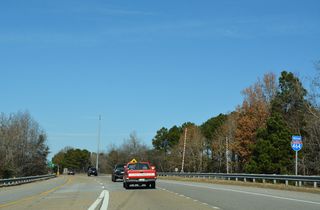
Interstate 464 begins north at the point where U.S. 17 (Dominion Boulevard) and SR 168 (Oak Ridge Connector) combine leading into the cloverleaf interchange (Exit 1) with I-64.
12/14/17
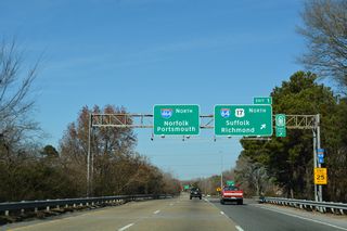
U.S. 17 north combines with I-64 (Hampton Roads Beltway) west from I-464/SR 168, 4.3 miles to George Washington Highway.
12/14/17
 North
North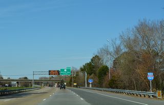
The first confirming marker stands along I-464 where the freeway passes between the Keats Landing and Doracs Acres subdivisions.
12/14/17

Paralleling I-64 (Hampton Roads Beltway), U.S. 13 (Military Highway) constitutes an arterial loop west to Bowers Hill in Chesapeake and northeast to Lansdale in Norfolk.
12/14/17
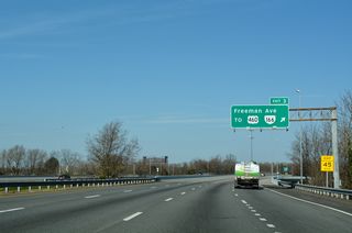
Freeman Avenue links I-464 with adjacent U.S. 460/SR 166 (Bainbridge Boulevard) to South Norfolk.
12/14/17

The interchange sequence sign preceding the viaduct across Gilligan Creek, a Norfolk Southern Railroad and Jones Creek, was removed by 2016.
07/28/13

SR 337 (Poindexter Street) connects I-464 with the South Norfolk Jordan Bridge spanning the Elizabeth River Southern Branch to the west and U.S. 460/SR 166 at the Quincy and Elmsley neighborhoods to the east.
12/14/17

Leading west onto Elm Avenue in Portsmouth, the South Norfolk Jordan Bridge (SR 337) comes into view.
07/28/13

East from the cloverleaf interchange at Exit 4, SR 337 connects with U.S. 460/SR 166 at Bainbridge Boulevard. U.S. 460/SR 166 overtake Poindexter Street east while SR 337 parallels I-464 north to S Main Street.
12/14/17

I-464 advances north to a half diamond interchange (Exit 5) with S Main Street. Adjacent SR 337 follows S Main Street 0.21 miles north to Liberty Street at the Berkley community.
12/14/17

An inspection station precedes Exit 6A for Interstate 264 west through the tolled Downtown Tunnel into Portsmouth.
12/14/17

Eastbound SR 337 combines with I-464 from W Berkley Avenue leading into the exchange with Interstate 264.
12/14/17

Exit 6A joins I-464 with parallel State Street north of Berkley Avenue at SR 337 (Liberty Street).
12/14/17

Exit 6A loops onto I-264 west leading into the Downtown Tunnel. The I-464 mainline defaults onto I-264 east across the Berkley Bridge to Downtown Norfolk.
12/14/17
 South
South

I-464 advances south into the city of Chesapeake beyond the entrance ramp from S Main Street.
07/28/13
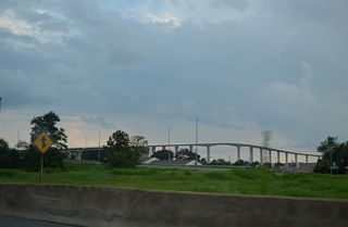
The tolled South Norfolk Jordan Bridge joining SR 337 (Poindexter Street) in Chesapeake with Elm Street in Portsmouth comes into view.
07/28/13
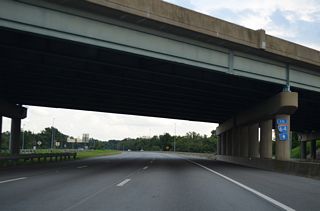
An I-64 trailblazer stands where a loop ramp formerly connected I-464 south with SR 337 (Poindexter Street) east.
07/28/13


An end shield precedes the directional T interchange joining SR 168 (Oak Grove Connector) with U.S. 17 (Dominion Boulevard) south.
12/30/17
 scenes scenes |
| Berkley Avenue east meets Interstate 464 and SR 337 just south of I-264 at Berkley in Norfolk. 12/14/17 |
Photo Credits:
12/14/17 by AARoads
Connect with:
Interstate 64
Interstate 264
U.S. 13
U.S. 17
U.S. 460
State Route 168 - Chesapeake Expressway
State Route 337
Page Updated 04-09-2021.


