|
| This view looks westbound along Port Road towards the beginning of SR 265. Port Road is a two lane road that connects the eastern end of the freeway with the Clark Maritime Center, one of Indiana's three maritime ports. 06/05/08 |
|
| The East End Bridge project will connect the eastern end of I-265 with the western end of I-265 in Kentucky, with a bridge over the Ohio River. Construction will extend this freeway north and east from here, with a wye-interchange allowing Port traffic to enter onto the freeway headed west. 06/05/08 |
|
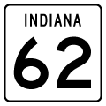
| The first interchange encountered by SR 265 westbound is at SR 62, which runs north along the Ohio River towards Cincinnati. This interchange was formerly a three-quarter cloverleaf, with no northwestern loop ramp. It was redesigned as a dumbbell interchange. 06/05/08 |
|
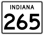
| Begin SR 265 shield posted at the Port Road transitions into the SR 265 freeway. 11/04/09 |
|
| Sunset as seen from SR 265's westbound beginning. Unlike in the eastbound direction, no ramp stub exists on this stretch. 11/04/09 |
|
| SR 265 was built as an eastern extension of the interstate to better serve the Maritime Center, now Port of Indiana Jeffersonville, when it opened in 1995. 06/05/08 |
|
| SR 265 runs over US 31 here and nears the southern end of the Clark County airport. 06/05/08, 11/04/09 |
|
| The first indication of I-65 is here just east of the junction. 06/05/08 |
|
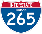
| I-265 in Indiana was named after legislator Lee H. Hamilton soon after his retirement in 1999, another example of a state naming a freeway after a still-living politician. 06/05/08 |
|
| SR 265 becomes I-265 here at I-65. The interchange is a parclo with a direct connect ramp from eastbound I-265 to northbound I-65. This interchange opened in 1977, and was extended in 1995 to the new freeway. 06/05/08 |
|
| SR 265 at I-65, or the beginning of I-265. 06/05/08 |
|
| I-65 south runs through Jeffersonville and into downtown Louisville, Kentucky just a few miles south. I-65 through Clark County was completely rebuilt from 1999-2003 as part of a project known as "Revive 65" which saw lanes added and interchanges realigned. Papa John's Pizza and the Rally's restaurant chain both started in Jeffersonville. 06/05/08 |
|
| The older I-265 here west of its part is paved with asphalt. 06/05/08 |
|
| I-265 enters the town of New Albany. New Albany is the county seat of Floyd Co., and has about 20,000 residents. It's a very historic city with a great old downtown right along the Ohio River. The town was founded by three brothers from Albany, New York in 1813.
The westbound shield for Interstate 265 pictured here was replaced by November 4, 2009. 11/07/11 |
|
| Floyd County is the second smallest county in Indiana. It was formed in 1819 after New Albany became sufficiently large to be the county seat of its own county. It was likely named for John Floyd, an early pioneer. Other theories hold that the county was named for Davis Floyd, John's uncle. Davis was convicted of aiding the treasonous Aaron Burr in 1809, but later became a county judge. 06/05/08 |
|
| Charlestown Road (SR 311 until January 20132) is the first Floyd County exit and comes up next. 06/05/08 |
|
| This view looks west towards SR 311, a state road turned back to Clark and Floyd Counties by January 2013.2 06/05/08 |
|
| SR 311 was a short 7 mile route that ran north of Clarksville to Sellersburg, and is locally known as Charlestown Road. It formed one of the older routes to Charlestown and was constructed before SR 62, which is now the main road and is further east. 06/05/08 |
|
| Spanning Jacobs Creek along I-265/SR 62 westbound ahead of the Exit 4 diamond interchange with Charlestown Road. SR 311 represented part of the former routing of U.S. 31W between New Albany and Sellersburg, a designation decommissioned after 19801. SR 311 was previously truncated south of I-265/SR 62 after 2002. 06/05/08 |
|
| I-265/SR 62 west at the Exit 4 ramp departure to Charlestown Road (former SR 311). Charlestown Road leads northeast from the freeway to SR 60 and its end at U.S. 31 in Sellersburg. Former SR 311 continued along Charlestown Road southward to what was SR 111 (Beachwood Avenue). 11/07/11 |
|
| SR 111 ran 35 miles north from the Ohio River to SR 60 originally, but was truncated north of I-64 by January 2013.2 South of here, the former state road passed through downtown New Albany and under I-64 to meander directly along the riverbank for some time. The road is very scenic, and is capped with the Caesar's Indiana casino in Harrison County. 06/05/08 |
|
| I-265 is entirely multiplexed with SR 62, as seen here on these reassurance markers. 11/07/11 |
|
| Grant Line Road is the main north/south route through New Albany, and the fairly suburban Indiana University Southeast is located just north of the exit here. The University was originally located in downtown New Albany but moved up here in 1973 to be closer to the future interstate's right-of-way. 11/07/11 |
|
| Floyds Knobs are always visible along the western horizon while on I-265 in Indiana. The knobs, named after the aforementioned Davis Floyd, are the visible erosions of the knobstone escarpment that sits along the west side of the Ohio River. 06/05/08 |
|
| Shields posted for I-265/SR 62 west at the Mt. Tabor Road underpass near St. Joseph. 11/07/11 |
|
| The Paoli Pike/State St is the last exit along I-265 in Indiana, and is a parclo interchange. The pike started as an Indian trail and eventually became an important pioneer path between the Ohio and Mississippi Valleys. In the 1800s, a turnpike was constructed between this spot at the Falls of the Ohio River and the territorial capital of Indiana at Vincennes. Later, US 150 would run down it. 11/07/11 |
|
| More signage for State St in New Albany.
Closure of the Sherman Minton Bridge between September 9, 2011 and February 17, 2012 gave double duty to Interstate 265 as the default Interstate 64 mainline (signed in the field as Interstate 64 Alternate), between Interstate 65 and the western terminus. Heavy morning traffic visible in these photos was a testament to the traffic shift. 11/07/11 |
|
| This exit used to be US 150, but that road was moved to be concurrent with the interstate some time ago. Downtown New Albany is just to the south and east of this junction, and sits along the Ohio River. The road is very windy and forested as it runs up the escarpment of Floyds Knobs. 11/07/11 |
|
| The western end of Indiana's I-265 approaches as it nears I-64. SR 62 joins I-64/U.S. 150 west briefly to Floyds Knobs and Edwardsville. U.S. 150 east follows Interstate 64 east to Exit 3 in Kentucky. 06/05/08 |
|
| The final I-265 westbound reassurance marker. 06/05/08 |
|
| I-265's westbound end here is at I-64. Going east here will almost immediately put the driver at the Ohio River and into Kentucky. 06/05/08 |
Page Updated 01-12-2012.