|
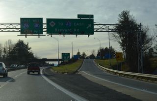
| A begin shield for Interstate 240 precedes the intersection joining U.S. 74A with Gashes Creek Road (SR 2834). Gashes Creek Road connects U.S. 74A with the entrance ramp for I-40 east to Hickory and Statesville. 05/26/21 |
|
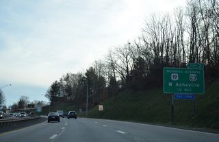
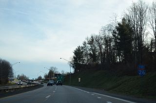
| A loop ramp follows for Interstate 40 west across the south side of Asheville to the Biltmore Estate, Canton, the Great Smoky Mountains and Knoxville, Tennessee. 10/24/15 |
|
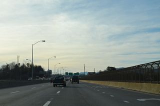
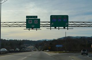
| A cloverleaf joins U.S. 74A and Interstate 40 adjacent to a wye interchange connecting I-40 west with I-240 west. 10/24/15 |
|
| U.S. 74A departs I-240 at Exit 8 for Fairview Road to NC 81 (Swannanoa River Road) at Beverly Hills in east Asheville. 10/25/15 |
|
| A begin shield for Interstate 240 stands at the separation with I-40 west at Exit 53 B. 05/26/21 |
|
| A separate ramp (Exit 8) departs from I-240 westbound for U.S. 74A (Fairview Road). 05/26/21 |
|
| U.S. 74A parallels I-240 along Fairview Road, an overlap with NC 81 (lSwannanoa River Road), and S Tunnel Road to U.S. 70 at Asheville Mall. 05/26/21 |
|
| A reassurance marker stands along the roadway for I-240 from U.S. 74A west at the parclo A2 interchange (Exit 8) with Fairview Road (SR 3238) east of Oakley. 10/24/15 |
|
| Interstate 240 proceeds north into the Swannanoa River valley by Sayles Village. 05/26/21 |
|
| Beaucatcher Mountain appears on the northern horizon as Interstate 240 advances north to a three-level interchange (Exit 7) with U.S. 70 (Tunnel Road). 05/26/21 |
|
| The I-240 bridges over the Swannanoa River were completed in 1977. The French Broad River tributary flows 22 miles from Flat Creek on Mount Mitchell to the French Broad at the Biltmore Estate in Asheville. 05/26/21 |
|
| U.S. 70 (Tunnel Road) winds west through the east Asheville communities of Oteen and Beverly Hills to meet Interstate 240 by Asheville Mall. 05/26/21 |
|
| Collector distributor roadways for I-240 and U.S. 70 (Tunnel Road) at Exit 7 intersect at-grade. U.S. 70 passes below uninterrupted. 12/31/13 |
|
| U.S. 70 (Tunnel Road) west combines with U.S. 74A nearby along a commercial boulevard paralleling I-240 northward to the Beaucatcher Tunnel. 04/22/17, 12/31/13 |
|
| A pair of wye interchanges (Exit 6) precede Beaucatcher Mountain. Left Exit 6 connects I-240 westbound with Chunns Cove Road (SR 2244) while the eastbound ramp links with adjacent Tunnel Road (U.S. 70/74A). 05/26/21 |
|
| Chunns Cove Road stems north from U.S. 70/74A (Tunnel Road) to Chunn Cove between Sunset and Piney Mountains. 05/26/21 |
|
| U.S. 70/74A emerge from the Beaucatcher Tunnel along College Street leading into Downtown Asheville. The pair turn north along Charlotte Street to combine with Interstate 240 at forthcoming Exit 5 B. 05/26/21 |
|
| A wide cut takes Interstate 240 across Beaucatcher Mountain ahead of the diamond interchange (Exit 5 B) with Charlotte Street. 05/26/21 |
|
| U.S. 70/74A lead back east to NC 694 (Town Mountain Road), a 6.32 mile route leading north to Elk Mountain and Blue Ridge Parkway at Craven Gap. 05/26/21 |
|
| The second of three Downtown Asheville exits along I-240 westbound joins the freeway with U.S. 25 (Merrimon Avenue) in one quarter mile. Exit 5 A serves interests to the Thomas Wolfe Memorial. 05/26/21 |
|
| Exit 5 A links with adjacent Elm Street ahead of U.S. 25 (Merrimon Avenue). U.S. 25 runs south through Downtown along Broadway Street and Biltmore Avenue. U.S. 25 (Merrimon Avenue) follows a commercial route north to Beaver Lake. 05/26/21 |
|
| Confirming markers for I-240/U.S. 70-74A west of the entrance ramp from U.S. 25 (Merrimon Avenue) and Broadway Street (SR 1781). 05/26/21 |
|
| Harrah's Cherokee Center Asheville appears along the south side of I-240 at Flint Street. 10/24/15 |
|
| Exit 4 C departs I-240 next for Montford Avenue via Cherry Street west. 05/26/21 |
|
| Exit 4 A for Future I-26 lies 0.75 miles beyond the Flint Street overpass. The freeway north along the French Broad River is substandard and will be upgraded during the I-26 Connector project. 05/26/21 |
|
| Montford Avenue stems north from parallel Haywood Street to the Montford Hills community. Haywood Street loops north from Patton Avenue near the Grove Arcade in Downtown to Clingman Avenue (SR 3602). 10/24/15 |
|
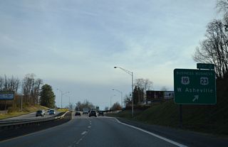
| U.S. 19/23 accompany Future I-26 and U.S. 70 north to Woodfin and Weaverville. 10/24/15 |
|
| Interstate 26 was extended north from I-40 in Asheville to I-81 north of Johnson City, Tennessee in August 2003. 10/24/15 |
|
| A pedestrian bridge spans Interstate 240 west leading into the directional T interchange (Exit 4A) with Future I-26 west, U.S. 19/23 north and the departing U.S. 70 west. 10/24/15 |
|
| Beyond UNC Asheville and Weaverville, U.S. 70 branches northwest from Future I-26 to Marshall and U.S. 19 east from Mars Hill to Burnsville. 10/24/15 |
|
| Construction starting in 2021 on the I-26 Connector realigns I-240 northward to a two-wye interchange to be built across the French Broad River. The bulk of the existing interchange at Patton Avenue (Exit 4A) will be demolished. 10/24/15 |
|
| Interstate 26 west and U.S. 23 run concurrent northward over Sams Gap into Tennessee. I-26 east combines with I-240 west across the French Broad River to West Asheville. 10/24/15 |
|
| I-240 west, I-26 east, U.S. 19/23 south and U.S. 74A west overlap for 0.45 miles. 12/31/13 |
|
| The Captain Jeff Brown Bridge carries four westbound lanes across the French Broad River, Riverside Drive (former NC 191/251) and a CSX Railroad line. The succeeding exit departs for Westgate Shopping Center and Resort Drive. 12/31/13 |
|
| The substandard bridge across the French Broad River will be bypassed by a new 2.6 mile long alignment for I-26/240 to the north. The I-26 Connector project will also reconstruct the western 4.3 miles of I-240. 12/31/13 |
|
| Exit 3 B leaves I-26 east / I-240 west for the Patton Avenue frontage road. Left Exit 3 A follows for U.S. 19/23/74A (Patron Avenue) to Sulphur Springs, Sand Hill and the western Asheville suburbs. 12/31/13 |
|
| Two lanes separate at Exit 3A as I-26/240 turn southward through West Asheville. U.S. 19-23-74A (Patton Avenue) quickly transition into a commercial arterial beyond the trumpet interchange. 12/31/13 |
|
| The adjacent Patton Avenue frontage road splits into ramps for U.S. 19/23 south and I-26 east / I-240 west. 07/16/05 |
|
| A loop ramp follows from the frontage road onto I-26/240 east toward Downtown Asheville. I-26/240 is four lanes wide south to I-40. 12/31/13 |
|
| U.S. 19/23 Business overlap with I-26 east / I-240 west to Exit 2 with Haywood Road. Haywood Road takes the pair west through West Asheville. 12/31/13 |
|
| Reassurance marker posted ahead of the modified diamond interchange (Exit 2) with Haywood Road. 12/31/13 |
|
| Haywood Road continues east of I-26/240 to cross the French Broad River toward Downtown via Clingman Avenue. Haywood Road was formerly a part of NC 191 west to Brevard Road and east to Riverside Drive. 12/31/13 |
|
| I-26-240 turn southwest at a forthcoming wye interchange (Exit 1C on eastbound) with Amboy Road. 12/31/13 |
|
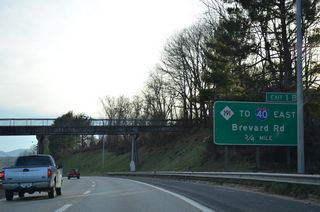
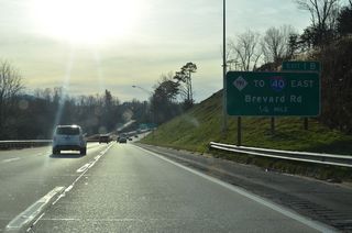
| NC 191 (Brevard Road) heads from U.S. 19/23 Business to a diamond interchange (Exit 1B) with I-26/240. The state route was formerly the designation for I-240 from Patton Avenue to I-40. 12/31/13 |
|
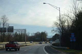
| NC 191 substitutes for the missing ramps at the nearby exchange of I-26/240 and I-40. The state route provides access to I-40 east from just south of Exit 1B. 12/31/13 |
|
| NC 191 (Brevard Road) winds southward from Exit 1B by an industrial park area to meet I-26 again at the subsequent exit south of I-40. The state route travels 24 miles overall between West Asheville and Hendersonville. 12/31/13 |
|
| Angling west I-26/240 lead into the three-wye interchange (Exit 31 B) with Interstate 40. 12/31/13 |
|
| Bear Creek Road spans I-26/240 ahead of Exit 31B for Interstate 40 and U.S. 74 west. 12/31/13 |
|
| Exit 31B separates at Hominey Creek for I-40/U.S. 74 west to Canton, the Great Smoky Mountains and Knoxville, Tennessee. 12/31/13 |
|
| Interstate 26 east continues southward toward Hendersonville and Spartanburg, South Carolina as I-240 ends. 12/31/13 |
Page Updated 01-27-2023.

 West
West

 East
East 

 South
South East
East 

 South
South East
East  West
West


