|
| Interstate 85 enters the city of Concord at the exchange with Bruton Smith Boulevard south and Concord Mills Boulevard (SR 2894) north. 05/31/21 |
|
| Speedway Boulevard was built in conjunction with the parclo interchange at Exit 49 to provide another access route between I-85 and U.S. 29 at Charlotte Motor Speedway. The exchange opened to traffic on October 1, 1996.1 05/31/21 |
|
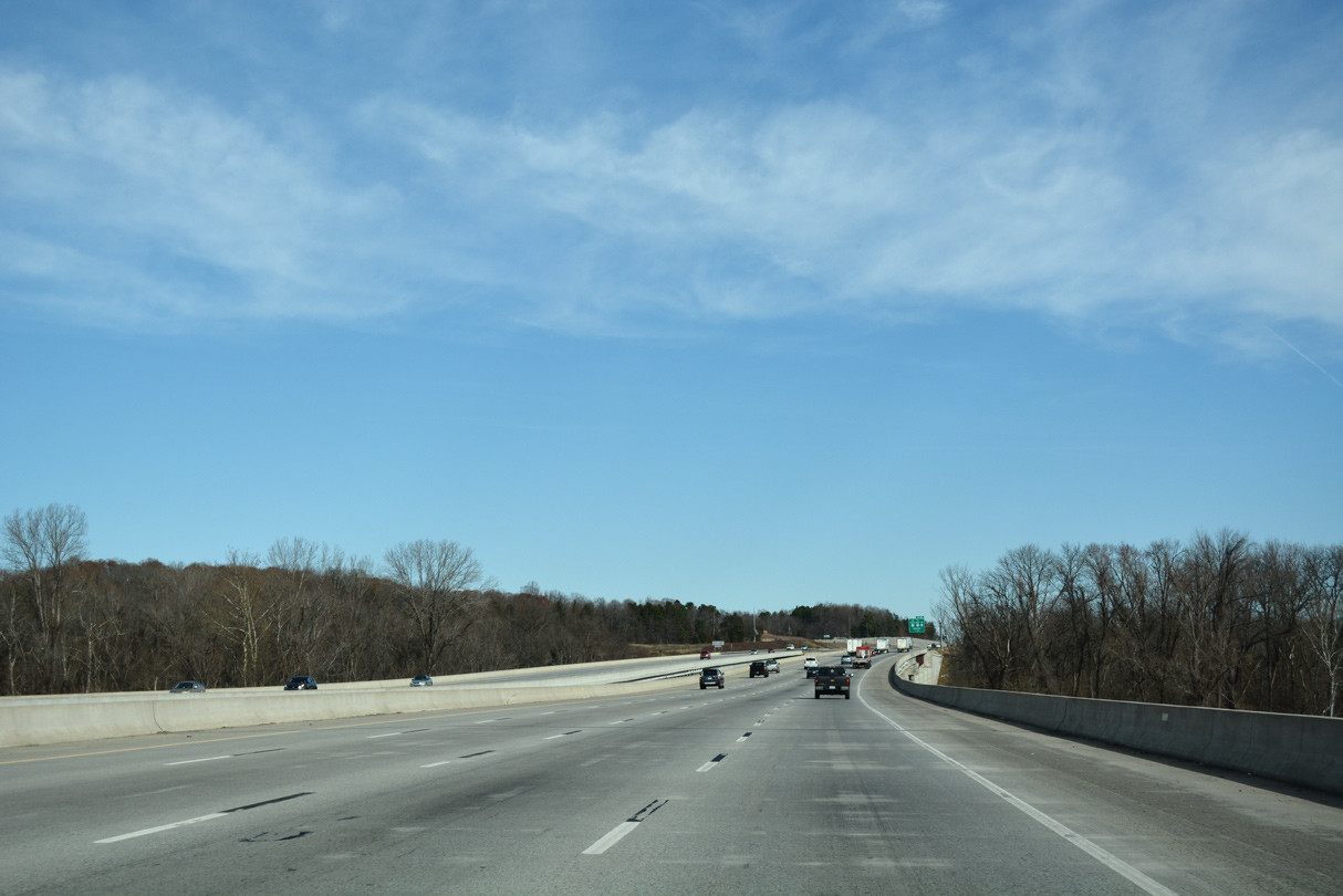
| Costing $138.7 million, work from September 2010 to June 2014 widened 7.3 miles of I-85 to eight lanes east from Exit 49 to a point ahead of Irish Buffalo Creek, north of NC 73 / Exit 55.2,3 05/31/21 |
|
| Lanes partition for Bruton Smith Boulevard west to Concord Mills Mall and east to U.S. 29 opposite Charlotte Motor Speedway. 09/17/21 |
|
| Costing $138.7 million, work from September 2010 to June 2014 widened 7.3 miles of I-85 to eight lanes east from Exit 49 to a point ahead of Irish Buffalo Creek, north of NC 73 / Exit 55.2,3 05/31/21 |
|
| Salisbury lies 27 miles to the northeast at U.S. 52. Greensboro follows in 76 miles. 05/31/21 |
|
| Poplar Tent Road (SR 1394) weaves between a number of subdivisions in northwest Concord southeast to meet Interstate 85 at Exit 52. 05/31/21 |
|
| Concord-Padgett Regional Airport (JQF) lies just west of Interstate 85 along the stretch preceding Exit 52 to Poplar Tent Road. 05/31/21 |
|
| East from Exit 52, Poplar Tent Road (SR 1394) passes by a number of subdivisions to U.S. 29/601 (Concord Parkway) and McGill Avenue east toward the Concord street grid. 05/31/21 |
|
| Construction widening Interstate 85 to eight lanes included converting Exit 52 into a diverging diamond interchange (DDI). The new exchange was slated for completion by June 2014. 05/31/21 |
|
| George W. Liles Parkway (SR 1430) leads south from upcoming Exit 54 to parallel Poplar Tent Road and Weddington Road (SR 1431) amid newer residential and commercial areas. 01/17/19 |
|
| Kannapolis Parkway (SR 1430) heads north from Exit 54 to NC 3 (Mooresville Road). Together with George W. Liles Parkway, the two arterials were known as the Westside Bypass when they opened between Poplar Tent Road (SR 1394) and NC 73 (Davidson Highway) on October 31, 2002.4 01/17/19 |
|
| Exit 54 leaves I-85 north for Kannapolis / George W. Liles Parkways to west Kannapolis and south Concord respectively. George W. Liles Parkway was extended to U.S. 29 and Stough Road (SR 1309) to NC 49. 12/15/16 |
|
| Widening of I-85 east to NC 73 included the conversion of Exit 52 into a diverging diamond interchange. 01/17/19 |
|
| NC 73 (Davidson Highway) heads east from Kannapolis Parkway to Rowan Cabarrus Community College and Interstate 85 at Exit 55. 01/17/19 |
|
| NC 73 (Davidson Highway) links Interstate 85 and Concord with the cities of Huntersville and Davidson to the west as part of a 118.5 mile course. 01/17/19 |
|
| Heading east from Exit 55, NC 73 (Davidson Highway) runs between a handful of subdivisions before combining with U.S. 29/601 (Concord Parkway) in North Concord. 01/17/19 |
|
| Costing $297.14 million, widening of I-85 northward to China Grove started in Spring 2015. Project #I-3802A extended from Exit 55 to Exit 63. Wrapping up in Summer 2020, Project #I-3802B extends the work north from Moose Road to Exit 68. 01/17/19 |
|
| A DDI (Exit 58) joins I-85 with U.S. 29 (Cannon Boulevard) north into Kannapolis and U.S. 29/601 (Concord Parkway) south. 01/17/19 |
|
| The first northbound rest area for I-85 since the North Carolina welcome center near Grover is located 1.75 miles ahead in north Concord. 01/17/19 |
|
| U.S. 601 links Concord with the Union County seat of Monroe by way of Midland, Fairview and Unionville. U.S. 29 links Kannapolis with the neighboring town of Landis. 01/17/19 |
|
| U.S. 29/601 (Concord Parkway) south pass by Carolina Mall and Atrium Health Cabarrus hospital to a short overlap with NC 73. U.S. 29/601 shift onto an arterial bypass of Concord for 3.5 miles while NC 73 follows Church Street south into Downtown. 01/17/19 |
|
| NC 3 (Concord Lake Road) passes overhead as I-85/U.S. 601 north reach the Cabarrus County Rest Area. 01/17/19 |
|
| Construction completed in 2019 modified the parclo interchange (Exit 60) with Dale Earnhardt Boulevard (SR 2126) west and Copperfield Boulevard south by replacing a loop ramp from SR 2126 north to I-85 south with a flyover adjacent to a realigned ramp from Exit 60A. 01/17/19 |
|
| U.S. 601 combines with I-85 north for 16.5 miles. The route previously continued alongside U.S. 29 north from a cloverleaf interchange with I-85 through Kannapolis, Landis, China Grove and Salisbury. 01/17/19 |
|
| Originally just Earnhardt Road, SR 2126 west from I-85 was renamed to honor the Kannapolis-native and seven-time NASCAR Winston Cup Champion on October 5, 1993.5 Dale Earnhardt Boulevard becomes a part of NC 3 west from Concord Lake Road to Mooresville Road. 01/17/19 |
|
| Exit 60 opened in 1992 and was quickly followed with heavy retail and office development on both sides of the freeway. Copperfield Boulevard continues the development southwest to NC 3 by Carolina Mall. 01/17/19 |
|
| Dale Earnhardt Boulevard arcs 1.15 miles northwest to become a part of NC 3 around central Kannapolis. NC 3 comprises a 27.82 mile route from Concord west to Mooresville. NC 136 was renumbered as NC 3 on October 23, 2002 to honor Dale Earnhardt, who died in a crash on the final lap of the 2001 Daytona 500.6 01/17/19 |
|
| I-85/U.S. 601 continue northeast by Lake Concord and Lake Fisher east of Kannapolis to a dumbbell interchange (Exit 63) with Lane Street (SR 2180). 01/17/19 |
|
| I-85 reenters the Kannapolis city limits beyond Cold Water Creek and the forthcoming Centergrove Road (SR 2114) overpass. 01/17/19 |
|
| Lane Street (SR 2180) travels miles east from U.S. 29 (Cannon Boulevard) in Kannapolis 2.62 miles to I-85/U.S. 601 at Exit 63. 01/17/19 |
|
| Lane Street extends 0.79 miles east from I-85/U.S. 601 to Old Salisbury-Concord Road (SR 1002) in rural Mount Mitchell. 01/17/19 |
|
| Crossing into Rowan County, I-85/U.S. 601 arcs westward, paralleling Cold Water Creek toward China Grove. 01/17/19 |
|
| Widening of I-85 in Rowan County started in early 2017 included constructing a parclo A2 interchange (Exit 65) with Old Beatty Ford Road (SR 1221) at an annexed area in the city of Kannapolis.7 01/17/19 |
|
| The exchange at Exit 65 opened following a ribbon cutting ceremony held on November 12, 2019. The exit spurs economic development, including the 318 acre Kannapolis Crossing along Old Beatty Ford Road (SR 1221) to the immediate east.7 01/17/19 |
|
| NC 152 crosses Interstate 85 at China Grove near adjacent U.S. 29. The state route heads west from the city to Mooresville and east to the town of Rockwell. 01/17/19 |
|
| Exit 68 was rebuilt into a dumbbell interchange during work completed in 2020. NC 152 dog legs southwest along side U.S. 29 to Church Street across China Grove. U.S. 29 shifts onto Main Street to parallel I-85 northward to Salisbury. Main Street southward to Landis and Kannapolis was originally U.S. 29A. 01/17/19 |
|
| A wye interchange formerly tied into I-85/U.S. 601 north from the U.S. 29 connector (SR 2664) one mile south of Exit 70. I-85 was constructed as an expressway for U.S. 29 from China Grove northeast to Greensboro in the 1950s. The connector represented the southern extent of that roadway. 01/17/19 |
|
| A pair of shields precede the Mt. Hope Church Road (SR 1505) overpass along I-85/U.S. 601 north. An $84.2 million project previously reconstructed 13 miles of I-85 from SR 2664 at China Grove north to East Spencer between June 1997 and Winter 2007.7 01/17/19 |
|
| Completed by Summer 2020, the four phase widening of Interstate 85 between mileposts 68 and 81 expanded the freeway to eight overall lanes from Exit 68 to Webb Road (Exit 70).8 01/17/19 |
|
| Webb Road (SR 1500) leads west to U.S. 29 (Main Street) at Roseman Road and east to Old Concord Road (SR 1002). Exit 70 is the first of three in a row linking I-85 with parallel U.S. 29 and SR 1002. 01/17/19 |
|
| Peeler Road (SR 2538) meets I-85 in a half mile by a pair of truck stops. The local road ties into U.S. 29 at southern reaches of the Salisbury city limit. 01/17/19 |
|
| Phase II of the I-85 widening upgraded 3.2 miles of freeway north from Webb Road to north of Julian Road. This work was completed on August 1, 2001.8 01/17/19 |
|
| I-85/U.S. 601 north at Exit 71 to Peeler Road. Exit 72 for Peach Orchard Road (SR 2539) follows in 0.75 miles. 01/17/19 |
|
| Auxiliary lanes in both directions of I-85/U.S. 601 expand the freeway to ten lanes overall. 01/17/19 |
|
| Exit 72 leaves I-85 north for Peach Orchard Road (SR 2539) east to Old Concord Road and west to U.S. 29 (Main Street) near Mid-Carolina Regional Airport (RUQ). 01/17/19 |
|
| The next three exits from I-85 north serve the city of Salisbury, seat of Rowan County. 01/17/19 |
|
| Julian Road meets I-85/U.S. 601 at a folded diamond interchange (Exit 74). Reduce weaving traffic conflicts with Exit 75 for the split of U.S. 601 north at Jake Alexander Boulevard, Exit 74 was converted from a diamond interchange during Phase II of the I-85 widening. 01/17/19 |
|
| Julian Road (SR 2528) forms an arc north from Heilig Road (SR 2528) and Old Concord Road (SR 1002) to U.S. 601 (Jake Alexander Boulevard) by a business park, apartment complex and Rowan Summit shopping center. Jake Alexander Boulevard is an arterial bypass of Salisbury west from U.S. 52 (Innes Street) to U.S. 29/70 at Rowan Mills and Innes Street near Franklin. 01/17/19 |
|
| Interstate 85 was reconstructed from north of Julian Road to the Bringle Ferry Road overpass between February 2001 and Summer 2006.10 01/17/19 |
|
| Combining with U.S. 70 between U.S. 29 (Main Street) and (Statesville Boulevard), U.S. 601 (Jake Alexander Boulevard) encircles the west side of Salisbury north from Exit 75. Beyond the city, U.S. 601 leads north to Mocksville. 01/17/19 |
|
| U.S. 52 was relocated onto I-85 at the succeeding exchange away from Innes Street north to Main Street (U.S. 29/70) in 1971.11 01/17/19 |
|
| Phase III of the I-85 widening between 1997-2007 reconfigured the cloverleaf interchange (Exit 76) with U.S. 52 south and Innes Street (SR 2200) into a single point urban interchange (SPUI). 01/17/19 |
|
| U.S. 52 follows Innes Street south from Salisbury toward Granite Quarry and Rockwell in southern Rowan County. U.S. 52 travels 29 miles from Exit 76 to the Stanly County seat of Ablemarle. 01/17/19 |
|
| U.S. 52 north combines with Interstate 85 north for 11 miles to Lexington. 01/17/19 |
|
| Bringle Ferry Road (SR 1002) crosses overhead as I-85/U.S. 52 enter the final project area of the 1997-2007 widening. Exit 79 (Andrews Street) and Exit 81 (Long Ferry Road) were rebuilt during the January 2005 to Winter 2007 construction. 01/17/19 |
|
| High Rock Lake was formed along the Yadkin River by the construction of High Rock Dam, a hydroelectric power facility, in 1927. The 15,180-acre lake offers recreation opportunities including boating and camping. 06/01/12 |
|
| The North Carolina Transportation Museum is located off U.S. 29 (Salisbury Avenue) in Spencer. The museum is host to an authentic train depot, antique automobiles, and a 37 stall roundhouse that includes 25 locomotives and other exhibit areas. 01/17/19 |
|
| A diamond interchange connects I-85/U.S. 52 with with Andrews Street (SR 1915) west and Old Union Church Road at Exit 79. 01/17/19 |
|
| I-85/U.S. 52 north enter eastern reaches of the East Spencer town limits at Exit 79. Andrews Street (SR 1915) links the freeway with U.S. 29/70 (Salisbury Avenue) east of Downtown Spencer. 01/17/19 |
|
| Old Union Church Road (SR 1915) heads southeast from Exit 79 to connect I-85/U.S. 52 with Bringle Ferry Road (SR 1002) east to Craven and High Rock Lake. 01/17/19 |
|
| Long Ferry Road (SR 2120) stems eastward from U.S. 29/70 (Salisbury Avenue) at the town of Spencer to meet I-85/U.S. 52 at Exit 81 in 0.75 miles. 12/15/16 |
|
| I-85/U.S. 52 curve northward across Town Creek through East Spencer. 12/15/16 |
|
| Long Ferry Road (SR 2120) winds east from Exit 81 to Trading Ford and a dead end on a peninsula off High Rock Lake. 12/15/16 |
|
| Long Ferry Road (SR 2120) heads 1.1 miles west from Exit 81 to Spencer and east to the Buck Combined Cycle Plant, a Duke Energy natural gas facility along the Yadkin River. 12/15/16 |
|
| I-85/U.S. 52 north rise over 700 feet above sea level before descending to the Yadkin River Veterans Memorial Bridge. The I-85 Corridor Improvement Project expanded the freeway northward from Exit 81 to 86 between September 29, 2010 and late September 2013. 12/15/16 |
|
| Continuing north from Spencer, U.S. 52 reaches Winston-Salem alongside Interstate 285 in 32 miles. I-85 travels northeast 45 miles to Greensboro. 01/17/19 |
|
| Part of the I-85 Corridor Improvement Project, a six-ramp parclo interchange (Exit 84) with U.S. 29/70 south, NC 150 and Seven Oaks Drive (SR 1285) south replaced succeeding wye interchanges along the previous alignment of I-85. 01/17/19 |
|
| With eight overall lanes, I-85 curves away from the original four lane alignment over the ensuing mile. The Yadkin River Veterans Memorial Bridge was named on June 12, 2012. 12/15/16 |
|
| Twin four lane spans were constructed along a new alignment for Interstate 85 across the Yadkin River in the Southern Segment of the I-85 Corridor Improvement Project. Dating from 1955, the former alignment curved more to the west, merging with U.S. 29/70 at a wye interchange. 12/15/16 |
|
| The northbound span was opened on May 5, 2012. It eventually supported two-way traffic until the southbound bridge opened on March 9, 2013. The 1955-built bridge was demolished by April 2013.12 12/15/16 |
Page Updated 11-22-2022.

 North
North


 North
North