|
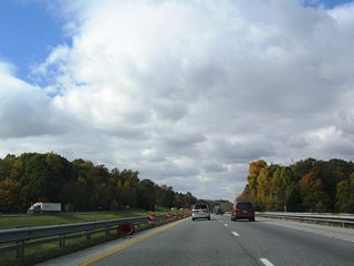
| Two lanes loop onto Ameriplex Parkway southbound as the Exit 68 c/d roadway reduces to one lane and concludes. One of many warehouse and distribution buildings between Ronald Reagan Parkway and SR 267 appears along the north side of the freeway. 11/05/09 |
|
| Continuing west from Exit 68 with Ronald Reagan and Ameriplex Parkways, drivers next meet SR 267 (Quaker Boulevard) south of Plainfield and north of Mooresville. 11/05/09 |
|
| The first westbound shield of Interstate 70 posted in Hendricks County follows. 11/05/09 |
|
| A pervasive area of warehouses occupies the land north of Interstate 70, east of SR 267 (Quaker Boulevard) and west of Ronald Reagan Parkway. SR 267 leads north from Exit 66 through the industrial area to its merge with U.S. 40 (Main Street) west to downtown Plainfield. 11/05/09 |
|
| Westbound Interstate 70 at the diamond interchange (Exit 66) with SR 267. The state road travels 28.7 miles between Mooresville (SR 42) and Interstate 65 south of Whitestown. 11/05/09 |
|
| One mile east of a rest area pair along Interstate 70 west at the White Lick Creek bridge. 10/16/04 |
|
| Interstate 70 nips the corner of Morgan County before returning to Hendricks County at Exit 59 north of Monrovia. The Putnam County seat of Greencastle lies 33 miles west via U.S. 231 north. 10/16/04 |
|
| Westbound at the Hendricks County rest area facility of Interstate 70. 10/16/04 |
|
| A reassurance marker follows the return ramp from the rest area at the South County Road 675 East overpass nearby. 10/16/04 |
|
| SR 39 crosses paths with Interstate 70 at a diamond interchange (Exit 59) near Center Valley. The state road connects the freeway with Monrovia 2.7 miles southward and Belleville (U.S. 40) 3.3 miles to the north. 10/16/04 |
|
| Consisting of two sections, SR 39 exists between Martinsville and the Michigan state line as a 179.2 mile route, meeting Interstate 70 at Exit 59. The southern portion travels just 15.5 miles between SR 56 and Burlington. 10/16/04 |
|
| SR 39 travels south from Exit 59 to Interstate 69, combining with SR 67 outside Martinsville. 10/16/04 |
|
| North from Interstate 70, SR 39 serves the county seat of Danville between U.S. 40 and U.S. 136. 10/16/04 |
|
| Interstate 70 reenters Morgan County ahead of Exit 51 with County Road 1100 West (North Little Point Road). 10/16/04 |
|
| A diamond interchange joins Interstate 70 with County Road 1100 West just north of Little Point and SR 42. North Little Point Road connects with County Road 550 West to Stilesville. SR 42 meanwhile follows a staggered route west from Monrovia to Cagles Mill Lake, paralleling the Interstate 70 corridor. 10/16/04 |
|
| U.S. 231 meets Interstate 70 at a diamond interchange (Exit 41) in southeast Putnam County. U.S. 231 joins the freeway with Cloverdale nearby and travels 297 miles in Indiana between St. John (U.S. 41) and the Kentucky state line. 10/16/04 |
|
| Exit 41 leaves I-70 west for U.S. 231 north to Greencastle and DePauw University and U.S. 231 south to Cloverdale and Cataract Falls State Recreation Area. McCoy Hill rises along the north side of the freeway. 10/16/04 |
|
| Continuing west, Interstate 70 slides south of Greencastle and Snyder Hill on the 36 mile drive to Terre Haute. SR 243 meets the freeway next, providing part of the nine mile route to Lieber State Recreation Area. 10/16/04 |
|
| One mile east of the diamond interchange (Exit 37) with SR 237 at the Poplar Grove Road overpass. 10/16/04 |
|
| Interstate 70 gains a wide forested median from Exit 37 west to Indian Ridge. SR 243 meanwhile meanders southward to its end at SR 42 at Cunot near Cagles Mill Lake. 10/16/04 |
|
| Continuing north from Exit 37, SR 243 concludes its five mile route at U.S. 40 at Putnmanville. 10/16/04 |
|
| Fall scenery along the hilly stretch of Interstate 70 between Exits 37 and 23. Westbound travelers enter Clay County on the drive. 10/16/04 |
|
| The diamond interchange (Exit 23) with SR 59 near Prairie City is the lone exit from I-70 in Clay County. 10/16/04 |
|
| Spanning Birch Creek a half mile east of Exit 23 to SR 59. SR 59 constitutes a 79.7 mile route between Sandborn and Waveland. 10/16/04 |
|
| Heading north, SR 59 ventures four miles to Billville and the Clay County seat of Brazil. Southward the state road immediately intersects SR 42 by Prairie City before continuing south to Clay City and Linton in Greene County.
In 1968, INDOT unsuccessfully lobbied for an Interstate 63 corridor leading south from the Brazil area to Evansville to provide a route between Indianapolis and southwest Indiana. Construction of Interstate 164 was a result of that original proposal.1 10/16/04 |
|
| Button copy guide sign posted for Linton and Brazil on the Exit 23 ramp to SR 59. A few truck stops surround the otherwise rural cross roads. 10/16/04 |
|
| Leaving the Prairie City and Exit 23 area, Interstate 70 sees this shield and bee lines west to the Chinook State Fishing Area. 10/16/04 |
|
| Two interchanges serve the city of Terre Haute from I-70 west. The first exits lies at SR 46, Future SR 641, and U.S. 40 east near Terre Haute International Airport / Hulman Field (HUF). U.S. 40 east overtook SR 46 from I-70 to the west end of SR 42 (Poplar Street) and its original alignment along Wabash Avenue near Rose Hulman Institute of Technology. The Terre Haute Bypass (SR 641) tied into Exit 11 by late 2014, which followed the January 30, 2011 truncation of SR 46 to I-70 and relocation of U.S. 40 away from Terre Haute.3 10/16/04 |
|
| Originally a folded diamond interchange, Exit 11 will be upgraded to incorporate the north end of the Terre Haute Bypass (SR 641). Redesign of the Exit incorporates a directional cloverleaf interchange with high-speed ramps connecting to the 6.2 mile long planned freeway. 10/16/04 |
|
| Westbound Interstate 70 at Exit 11 (SR 46). SR 46 totaled 153.7 miles (pre-truncation to Interstate 70) on its easterly trek to Bloomington, Columbus, Greensburg and U.S. 52 near Exit 169 of Interstate 74. Work on the $158 million project began in 2006 on the southern half of the freeway2, which opened between U.S. 41/150 and McDaniel Road on October 26, 2010.4 Two phases constituting the northern half of the bypass are slated for completion by late 2014. 10/16/04 |
|
| Replacement signage at Exit 11 including the addition of U.S. 40 east for former SR 46 north to Wabash Avenue. 11/12/11 |
|
| West of Exit 11, U.S. 41 (and U.S. 150) is four miles away. Marshall, Illinois is 20 miles away with St. Louis at 174 miles. 01/19/11 |
|
| Following the southern boundary of Terre Haute, I-70/U.S. 40 continue west to a diamond interchange with U.S. 41/150 (3rd Street). Comprising a busy divided arterial, U.S. 41/150 lead southward from Honey Creek Mall, the County Fairgrounds, and Ivy Tech Community College to suburban areas of Southwood, Allendale, and Woodgate, meeting SR 641 at Youngstown. 01/19/11 |
|
| Indiana State University, home of the Sycamores, is located in downtown Terre Haute along U.S. 41/150 (3rd Street) a couple of miles to the north of Exit 7 with I-70/U.S. 40 east. Until its realignment, U.S. 40 passed by the southern boundary of the university. 01/19/11 |
|
| U.S. 41/150 continue along 3rd Street into Terre Haute en route to downtown and Indiana State University. Once in Downtown, U.S. 150 splits with U.S. 41 (3rd Street) for U.S. 40 (Cherry Street) west to Taylorville and West Terre Haute. Continuing north, U.S. 41/SR 63 part ways at Maple Avenue on respective paths to Rockville and Clinton. SR 63 used to run concurrent with U.S. 41 southward to Huffman Street west. However that overlap was removed when SR 63 from Huffman Street to Lombardi Road in the Terre Haute area was decertified in 2008. 01/19/11 |
|
| I-70/U.S. 40 west at Exit 7 to U.S. 41/150 (3rd Street). U.S. 41/150 constitute a four lane corridor southward to Vincennes (U.S. 50). U.S. 41 continues from there to Evansville and overall to Miami, Florida. Northward U.S. 41 straddles the state line to Gary and Chicago, Illinois. 01/19/11 |
|
| Guide sign and U.S. 41 shield assembly posted at the Exit 7 ramp end. U.S. 41 travels 280 miles through the state, exiting into Kentucky south of Evansville and Illinois west of Hammond. U.S. 150 meanwhile travels a 176.3 mile route between Illinois at Libertyville and Kentucky at New Albany. 01/19/11, 10/16/04 |
|
| I-70/U.S. 40 veer northwest and pass over former SR 63 (Prairieton Avenue). SR 63 travels 16.3 miles south from Prairie Creek to Meron (SR 58). An unsigned stretch of SR 63 remains on the books from Lombardi Road south to SR 264. 10/16/04 |
|
| Continuing west, I-70/U.S. 40 meet Darwin Road (Exit 3) at Larimer Hill in two miles. Marshall, Illinois follows in 15 miles; St. Louis is now only 169 miles away. 10/16/04 |
|
| Crossing the Wabash River and exiting Terre Haute along I-70/U.S. 40 west. 10/16/04 |
|
| Darwin Road crosses paths with I-70/U.S. 40 at a parclo interchange one mile west of Sugar Creek. Darwin Road stems south from former U.S. 40 (National Avenue) near West Terre Haute to Larimer Hill and Exit 3. 10/16/04 |
|
| One half mile east of Exit 3 (Darwin Road) at the Lake Road underpass. Darwin Road continues southwest to Iron Bridge Road in a rural area of Clark County, Illinois. 10/16/04 |
|
| Marshall, Illinois is the next city of interest along Interstate 70 west at the cross roads of U.S. 40 and Illinois 1. Effingham (Interstate 57) follows at 65 miles away. 10/16/04 |
|
| U.S. 40 merged onto Interstate 70 west at the wye interchange (Exit 1) from National Avenue near State Line until the January 2011 relocation away from Terre Haute. 10/16/04 |
|
| A pavement change marked the Illinois state line along I-70/U.S. 40 west. An eastbound rest area / tourist information center lies just past the border. 10/16/04 |
|
| Crossing into Clark County, Illinois along I-70/U.S. 40. The two split at the first interchange (Exit 154) near Weaver. 10/16/04 |
Page Updated 10-25-2011.

 West
West
 West
West


