Interstate 70 shifts south through an S-curve alongside SH 36 and a Union Pacific Railroad line from Exit 292 to Exit 296 at Watkins in northeast Aurora. 07/04/12
|
| Traffic from I-225 north adds two lanes to I-70 east to succeeding lane drops for Chambers Road and Peña Boulevard. 08/11/16 |
|
| Peña Boulevard was built to service Denver International Airport (DEN), which lies 12 miles to the northeast from Exit 284. The airport opened on February 28, 1995. 08/11/16 |
|
| Chambers Road and Airport Boulevard serve an array of business and industrial parks south of I-70 over the next 1.25 miles. Lengthy ramps tie into the freeway between the two arterials with Peña Boulevard. 04/23/17 |
|
| Entering the diamond interchange (Exit 283) with Chambers Road on I-70/U.S. 36 east. Chambers Road heads north through Montbello to 56th Avenue. Southward, Chambers Road stretches across the city of Aurora to SH 83 (Parker Road) by Cherry Creek State Park. 04/23/17 |
|
| Exit 284 separates from the I-70 mainline below Chambers Road with two lanes for Peña Boulevard. Maintained by the city of Denver, the unnumbered freeway spurs north to Green Valley Ranch before curving east through the DIA area to E-470 and the passenger terminal of Denver International Airport (DEN). 08/11/16 |
|
| Interstate 70 bends southeast from Peña Boulevard to converge with the east end of Business Loop I-70 (Colfax Avenue) in four miles. Exit 285 leaves the freeway next for Airport Boulevard. 08/11/16 |
|
| Reassurance marker for I-70 east posted at the wye interchange (Exit 284) with Peña Boulevard north. 04/23/17 |
|
| Airport Boulevard heads south through Aurora toward Buckley Air Force Base and north to 40th Avenue and Peña Boulevard. 08/11/16 |
|
| A six-ramp parclo interchange provides separate ramps from Interstate 70 to both directions of Airport Boulevard at Exit 286. 04/23/17 |
|
| Tower Road, former SH 32 south to Business Loop I-70/U.S. 40-287 (Colfax Avenue), meets Interstate 70 at Exit 286 in one mile. 04/23/17 |
|
| 2015 traffic counts on Interstate 70 east reduce to 58,000 vehicles per day (vpd) after Airport Boulevard, and 34,000 vpd after Tower Road. 04/23/17 |
|
| I-70 advances 3.75 miles east to the diamond interchange (Exit 289) with Gun Club Road to the E-470 beltway. 04/23/17 |
|
| Tower Road parallels Peña Boulevard north from Exit 286 to the Gateway area and Green Valley Ranch community. An array of town homes, office parks, hotels and other businesses line the arterial. 04/23/17 |
|
| Continuing southeast, I-70/U.S. 36 span a Union Pacific Railroad line and Smith Road. 08/11/16 |
|
| Exit 288 provides return access to Colfax Avenue (U.S. 40/287) in 1.5 miles. U.S. 40/287 travel west by Aurora Sports Park and several subdivisions to Tower Road. 08/11/16 |
|
| Business Loop I-70 concludes a 27.47 mile route across the Denver metropolitan area at the wye interchange (Exit 288) with I-70/U.S. 36 east. U.S. 40 overlaps with the route for its entirety west to Golden. 04/23/17 |
|
| Looking south toward Buckley Air Force Base at undeveloped agricultural areas south across Colfax Avenue. The Front Range appears on the far horizon. 08/11/16, 04/23/17 |
|
| Exit 288 loops onto Business Loop I-70/U.S. 40-287 (Colfax Avenue) west through Aurora. U.S. 287 accompanies Colfax Avenue west to Federal Boulevard in central Denver.
A sign change made by 2017 updated the E-470 toll road shield. The blank space next to the U.S. 40 marker likely held a Business Loop I-70. 04/23/17 |
|
| Interstate 70 shifts eastward to overtake U.S. 40/287 through the eastern outskirts of Aurora. A south side frontage road represents Colfax Avenue east to Gun Club Road. 04/23/17 |
|
| Interstate 70 advances east one half mile to meet the E-470 beltway and Gun Club Road. Although mostly rural, the Aurora city limits stretch east to beyond Exit 295 / Watkins. 04/23/17 |
|
| Upcoming Gun Club Road parallels E-470 south from Smith Road to the Cross Creek development at 6th Parkway, and SH 30, which extends the road south to Quincy Avenue. 04/23/17 |
|
| E-470 provides a direct route north from the Douglas County suburbs and east Aurora to Denver International Airport (DEN). The beltway uses all electronic tolling (AET), requiring motorists to either use a transponder, or toll by plate billing. 04/23/17 |
|
| The high speed flyover directly linking E-470 north with Interstate 70 west opened to traffic on October 25, 2007.1 The remainder of movements between the two limited access highways requires a Breezewood connection at Gun Club Road. 04/23/17 |
|
| Exit 289 departs from Interstate 70 east for Gun Club Road. Wye interchanges tie into either direction of E-470, which leads north to I-25 at Broomfield and south to I-25 at Lone Tree. 04/23/17 |
|
| E-470 opened to traffic from Aurora north to DEN Airport in 1999. The beltway used Gun Club Road as a temporary mainline until new roadways were built across I-70. The southbound lanes opened on July 11, 2006, followed by the northbound direction on August 24, 2006.1 04/23/17 |
|
| Colfax Avenue remains along the south side of Interstate 70, acting as a frontage road east to the site of Aurora Airpark. 04/23/17 |
|
| Changeable speed limits are used along Interstate 70 east of Gun Club Road. Speed limits are set at 75 miles per hour during optimal driving conditions. 04/23/17 |
|
| Signed as SH 36, Route 036C represents U.S. 36 east from Exit 292 / Airpark Drive to the town of Bennett. 04/23/17 |
|
| Colfax Avenue switches sides with Interstate 70 and U.S. 36-40-287 at the diamond interchange at Exit 292. SH 36 extends the road east to Watkins, traveling 12.87 miles overall to SH 79 and U.S. 36 (Route 36D) in Bennett. 04/23/17 |
|
| Interstate 70 dips into Arapahoe County along an S-curve between mileposts 293 and 294. 04/23/17 |
|
| Confirming marker posted northeast of the Aurora Airpark site. 04/23/17 |
|
| SH 36 (Colfax Avenue) appears alongside as Interstate 70 curves northward to again run along the Adams and Arapahoe County line. 04/23/17 |
|
| Business Spur I-70 (Watkins Road) joins Interstate 70 with SH 36 (Colfax Avenue) from Exit 295 in one mile. 04/23/17 |
|
| Front Range Airport (FTG), a general aviation facility, lies six miles to the northeast of Exit 295 via SH 36, Imboden Road and 48th Avenue. 04/23/17 |
|
| Inventoried by CDOT as Route 070L, Business Spur I-70 measures 0.40 miles from the diamond interchange (Exit 295) with I-70 to SH 36 (U.S. 36-C) in Watkins. 04/23/17 |
|
| Shields direct motorists from each direction of I-70 to Business Spur I-70 (Watkins Road) north. The route is otherwise unposted. CR 97 extends Watkins Road south to Quincy Avenue (CR 30), east of the Arapahoe County Fairgrounds. 04/23/17 |
|
| Continuing east from Watkins, Interstate 70 crosses Box Elder Creek after milepost 296. 04/23/17 |
|
| A rural diamond interchange (Exit 299) follows with Manila Road. 04/23/17 |
|
| Manila Road runs south toward rural homesteads east of Box Elder Creek and north to SH 36 (Colfax Avenue) and Front Range Airport (FTG) at annexed areas of east Aurora. 04/23/17 |
|
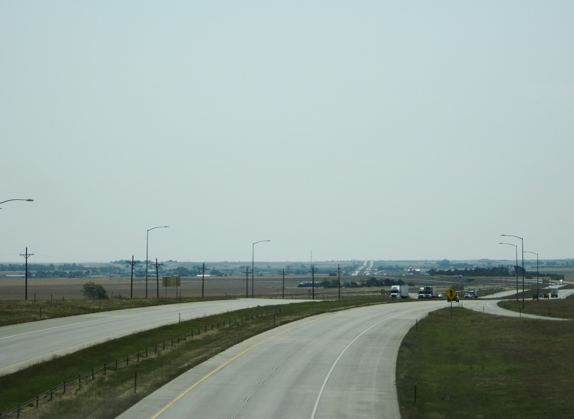
| A long straight away along Interstate 70/U.S. 40-287 ahead of Lost Creek. 04/23/17 |
|
| Eastbound travelers along I-70 reach the town of Bennett in four miles. The town of Limon is 61 miles to the southeast. 04/23/17 |
|
| SH 79 commences a 23.89 mile route north to SH 52 at Prospect Valley from Interstate 70 at forthcoming Exit 304. 04/23/17 |
|
| SH 79 follows 1st Street north 1.24 miles from the diamond interchange at Exit 304) to a short overlap with SH 36 (Colfax Avenue) in Bennett. 04/23/17 |
|
| Interstate 70 spans Kiowa Creek on the short stretch between SH 79 and Exit 305 to Kiowa-Bennett Road. 04/23/17 |
|
| Arapahoe County Road 137 (Kiowa-Bennett Road) stems south from Exit 305 to Kiowa Creek North Open Space Park and the Antelope Hills golf course community in south Bennett. 04/23/17 |
|
| Exit 306 departs at a wye interchange just east of the Kiowa-Bennett Road overpass, representing a section of Colfax Avenue linking Interstate 70 with SH 36 (Route 036D). 04/23/17 |
|
| Interstate 70 and SH 36 (Colfax Avenue) parallel one another east to Strasburg. 04/23/17 |
|
| Limon, the regional service center between Aurora and Burlington, is 55 miles away. 04/23/17 |
|
| A Union Pacific Railroad line accompanies the north side of Interstate 70 to the unincorporated community of Strasburg. 04/23/17 |
|
| The first in a series of unsigned Business Spurs for Interstate 70 through the high plains of eastern Colorado connects the freeway with Strasburg in one mile. 04/23/17 |
|
| Business Spur I-70 (Route 070M) lines Wagner Street north 0.348 miles from the south Frontage Road (CR 157) and Arrowhead Street at Exit 310 to SH 36 (Colfax Avenue) at the Strasburg business district. 04/23/17 |
|
| Reassurance marker for Interstate 70 east posted ahead of Comanche Creek and milepost 311. 04/23/17 |
|
| Byers, an unincorporated community of over 1,000, lies four miles ahead along I-70/U.S. 36-40-287 at Exit 316. 04/23/17 |
|
| SH 36 and the UP Railroad switch sides with Interstate 70 on their respective courses to Byers. 04/23/17 |
|
| U.S. 36 splits with I-70/U.S. 40-287 to overtake Route 036D from SH 36 at Main Street in Byers. The route west back to Watkins is signed as SH 36 instead of U.S. 36 in an effort to keep through traffic bound for Kansas on the freeway to Exit 316. 04/23/17 |
|
| Interstate 70 drops nearly 200 feet in elevation from Strasburg to Byers. The freeway crosses West Bijou Creek just ahead of the diamond interchange (Exit 316) with Main Street. 04/23/17 |
|
| U.S. 36 curves northeast from Main Street in Byers to straddle the Adams and Arapahoe County line east toward Last Chance. The 135.51 mile route of Route 036D concludes at the Kansas state line east of Idalia and U.S. 385. I-70 and U.S. 36 come together again at Indianapolis, Indiana. 04/23/17 |
|
| Although U.S. 40/287 are still considered overlapped with Interstate 70, a 1.81 mile long portion of their old route (Highway 40) through Byers remains state maintained and inventoried as Route 040D. 04/23/17 |
|
| Interstate 70 turns more southerly from Byers to Limon. The small town of Deer Trail is 11 miles ahead. 04/23/17 |
|
| Motorists along I-70/U.S. 40-287 next reach the diamond interchange (Exit 322) with County Road 201 (Peoria Crossing Road) south. 04/23/17 |
|
| Highway 40 forms the south side frontage road of I-70 to the UP Railroad siding of Peoria nearby. CR 201 (Peoria Crossing Road) is unpaved south of Highway 40. 04/23/17 |
|
| Crossing Middle Bijou Creek along Interstate 70 east of Peoria. 04/23/17 |
|
| East Bijou Creek flows under Interstate 70 ahead of milepost 325. The freeway passes through Richmill Ranch Open Space Park on the ensuing stretch. 04/23/17 |
|
| Unsigned Business Spur 70 (Cedar Street) links Interstate 70 with a state maintained section of Highway 40 (Route 040E) at Deer Trail. 04/23/17 |
|
| Deer Trail, a town of around 500, lies at 5,183 feet above sea level. 04/23/17 |
|
| Entering the diamond interchange (Exit 328) with Business Spur I-70 (Route 070N) on Interstate 70 east. The Deer Trail Business Spur is just 0.396 miles from Exit 328 to 1st Avenue (Route 040E). Route 040E is unmarked along its 5.955 mile course between the I-70 frontage road at milepost 325 and CR 42 (Wall Road). 04/23/17 |
|
| Interstate 70 and Highway 40 converge at the south end of the Deer Trail town limits, where County Road 42 branches east. 04/23/17 |
|
| An eight mile exit less along I-70/U.S. 40-287 precedes the settlement of Agate. Limon, in western Lincoln County, is 33 miles to the southeast. 04/23/17 |
|
| Although no longer state maintained, adjacent Highway 40 retains mile markers, with milepost 354 pictured here. The UP Railroad lines the frontage road just to the west. 04/23/17 |
|
| I-70/U.S. 40-287 cross into northeastern Elbert County at milepost 332. 04/23/17 |
Page Updated 05-09-2017.


 East
East


 East
East  South
South


