|
| The first Indiana exit runs right into downtown Jeffersonville. The city has about 30,000 people and is the county seat of Clark County. J-ville, as it is locally known, is the birthplace of restaurant chains Rally's and Papa John's pizza. 11/04/09 |
|
| Welcome to Indiana sign posted as Interstate 65 passes over Van Dyke Park and Market Street. 11/04/09 |
|
| The right lane defaults onto East Broadway northbound at Court Street, though the Exit 0 overhead is devoid of an exit only placard. Interests to Falls of the Ohio State Park should follow West 6th Street to South Clark Boulevard. The park includes naturally exposed fossil beds and a portion of the original series of rapids along the Ohio River where the river dropped 26 feet in 2.5 miles. 06/05/08 |
|
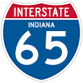
| An Interstate 65 reassurance shield, the first posted along the 257 mile stretch in Indiana, follows the Exit 0 gore point. 11/04/09 |
|
| The next exit, this time with a proper exit only sign, connects the three cities opposite Louisville in Indiana. This exit begins a long series of collector distributor lanes that run into old SR 62 and SR 111. SR 111 runs west to New Albany and I-64. 06/05/08 |
|
| Leaving the Exit 1 c/d roadway first is the ramp onto West 10th Street (Old SR 62) east into Jeffersonville. Old SR 62, which also doubles as old SR 3, follows 10th Street northeast to the SR 265 freeway at Watson. Charlestown is the destination of SR 62 leading north from SR 265.
The c/d roadway drops to grade level and intersects Stansifer Avenue west to Clarksville and West 14th Street into Jeffersonville. 11/04/09 |
|
| I-65's next exit in Jeffersonville is for Eastern Blvd, not related to the Eastern Parkway exit just a few miles south in Kentucky. I-65 through Clark County was rebuilt in a $250 million project from 2001 to 2005. The project added lanes, rebuilt all of the roadway, and put many exits into one long collector distributor system. 06/05/08 |
|
| The Exit 1 c/d roadway emerges at a wye interchange with Brown's Station Way, a controlled access parkway spurring northwest to New Albany. This stretch of roadway was also originally signed as SR 62. 11/04/09 |
|
| Eastern Blvd runs east to US 31 and west through Clarksville. 06/05/08 |
|
| The c/d roadway carries U.S. 31 northbound from the Rogers Clark Memorial Bridge and Exit 1 to an at-grade intersection with Eastern Boulevard. U.S. 31 southbound follows the adjacent southbound side service road 11/04/09 |
|
| Motorists continuing north from there split into a mainline I-65 ramp and the continuation of U.S. 31 north to Lewis & Clark Parkway (Exit 4 from the freeway mainline). 11/04/09 |
|
| A slip ramp departs Interstate 65 northbound in one half mile for U.S. 31 north to Lewis & Clark Parkway. Lewis & Clark Parkway was formerly signed as SR 131. The 1.9 mile state road was decommissioned in 2002. 11/04/09 |
|
| I-65 maintains eight lanes of concrete through Jeffersonville. Traffic counts range between 129,420 at the JFK Bridge to 88,610 ahead of Interstate 265 per 2009 INDOT traffic counts. 11/04/09 |
|
| U.S. 31 branches away from Interstate 65 frontage at Lewis & Clark Parkway and Exit 4. The US Route follows I-65 throughout southern Indiana. Lewis and Clark Parkway, former SR 131, has much of Clarksville's sprawly retail and the regional shopping mall. 06/05/08 |
|
| The next exit is for Veterans Parkway, which was a new road constructed along with the I-65 rebuilding in 2003. 06/05/08 |
|
| I-65 northbound at Veterans Parkway in Clarksville. Local leaders, not wanting another sprawl ridden SR 131, carefully planned growth along the new Parkway route. 06/05/08 |
|
| I-65 keeps 8 lanes with frontage roads through here, the view comes complete with a lot of concrete. 11/04/09 |
|
| The first mention of I-265 comes immediately at the Veterans Parkway overpass. 06/05/08 |
|
| I-265's eastern end in Indiana is at I-65. East of the interstate, the road is signed as SR 265. A new bridge is planned to connect both sides of I-265 at the Ohio River bridges project; the two sides will be connected and SR 265 will become I-265. 06/05/08 |
|
| Northbound reassurance shield posted for Interstate 65 near Progress Way. U.S. 31 parallels the freeway to the east. 11/04/09 |
|
| I-65 northbound at SR 265 north of Jeffersonville. SR 265 is signed with SR 62, which continues northeast along the Ohio River to US 50 near Cincinnati. The Clark Maritime Center, at the end of the route, is one of three ports in Indiana and sees a lot of farm and industrial exports floated down the river. 06/05/08 |
|
| I-65 northbound at I-265's eastern Indiana end. The interchange here is an underpowered cloverleaf, and was not upgraded along with the interstate here. The high number of trucks coming from the port can make for an annoying trip through here. New Albany, the county seat of Floyd County, is just to the west at I-64. 06/05/08 |
|
| I-65 sees two merge lanes enter from the cloverleaf at I-265. Clark County Airport and Deam Lake Recreation Area are served by nearby Exit 7 with SR 60. 06/05/08 |
|
| Salem is the county seat of Washington County and is west of the interstate here. Salem is the home of famous Civil War politician John Hay and to the first 2% milk. 06/05/08 |
|
| I-65 carries six lanes here, with a northbound reassurance marker south of SR 60. 06/05/08 |
|
| SR 60 is 62 miles long and ends immediately east of the interstate at US 31. It runs west to US 50 and the town of Huron. I-65 continues north and maintains three lanes to the SR 311 exit. 06/05/08 |
|
| Charlestown Road, SR 311 until January 2013, travels northeast from I-265/SR 62 at New Albany to Hamburg and U.S. 31 (Indiana Avenue). A six-ramp parclo interchange (Exit 9) joins I-65 with Charlestown Road. 11/12/04 |
|
| Interstate 65 reduces from six to four lanes with the loss of the right lane to SR 311 (Exit 9). SR 311 was a 7.3 mile route in its final alignment, but was originally a longer route southward into New Albany. The state road represented the original U.S. 31W alignment in Indiana. 11/12/04 |
|
| Exit 9 leaves Interstate 65 north for Charlestown Road. SR 311 ended at U.S. 31 just east of the off-ramp in Sellersburg. U.S. 31 parallels the freeway closely from Clarksville to Indianapolis. 11/12/04 |
|
| Button copy guide sign posted along the northbound off-ramp to Charlestown Road (old SR 311). Speed lies just north along U.S. 31 after its intersection with SR 403. SR 403 connects Sellersburg with Charlestown. 11/12/04 |
|
| North of Exit 9, the first distance sign in Indiana appears, announcing distances to the next interchange at Memphis (7 miles), Scottsburg (21 miles), and Indianapolis (103 miles). 06/07/12 |
|
| Interstate 65 remains a busy road in between Exit 9 (SR 311) and Exit 16 (Memphis Road). The interstate winds up and down the small hills of central Clark County as it approaches Exit 16. The interstate, according to long-term plans will be widened between Exits 9 and 16. 06/07/12 |
|
| One mile out from Exit 16 with Memphis Road, which serves the nearby town of Memphis at the junction with U.S. 31. 06/07/12 |
|
| To the east, Memphis Road turns to the southeast toward Memphis and ultimately Charlestown. To the west, the road turns to the northwest to SR 160. 06/07/12 |
|
| Exit 16 is a diamond interchange with Interstate 65 and Memphis Road. A grouping of truck stops serves long-distance traffic along Interstate 65 heading north from Louisville. 06/07/12 |
|
| The northern Clark County of Henryville is next up at four miles. Scottsburg and Indy follow at 14 and 96 miles respectively. 06/07/12 |
|
| The next interchange along Interstate 65 is Exit 19 for SR 160. SR 160 is a windy 23 mile road that begins at SR 430 in Charlestown and travels northwest through the Clark State Forest en route to Salem. 06/07/12 |
|
| Henryville is just east of the interchange at the junction of SR 160 with U.S. 31. Trucks are not advised to use this highway to the west due to its windy nature. Clark State Forest, the oldest state forest in Indiana, can be reached via SR 160 east to U.S. 31 north of Henryville. 06/07/12 |
|
| Henryville, best known as the birthplace of Colonel Sanders of KFC fame, was devastated by an EF-4 tornado in March 2, 2012 that traveled over 50 miles from southern Washington County eastward across Clark, Scott and Jefferson Counties before ending in Kentucky. The tornado traveled across the Exit 19 diamond interchange and destroyed the signage at the gore point of the exit, which at the time of this picture had not yet been replaced. The sign though was replaced later in the summer of 2012. 12/26/09, 06/07/12 |
|
| North of Exit 19, the Henryville Rest Area serves as the Indiana Welcome Center for northbound Interstate 65 in two miles. 06/07/12 |
|
| Scottsburg, the county seat of Scott County, is now 10 miles away with Indianapolis at 92 miles. 06/07/12 |
|
| Now one mile away from the Henryville Rest Area. The next of the five pairs of rest areas that serve Indiana's current longest interstate is in 51 miles. 06/07/12 |
|
| The Henryville rest area now turns off of Interstate 65 north. 06/07/12 |
|
| North of the rest area, Interstate 65 crosses underneath County Line Road and enters Scott County. 06/07/12 |
|
| A view of Interstate 65 in southern Scott County. The highway serves commuters who head from Scottsburg and Austin south to Louisville daily. 06/07/12 |
|
| Interstate 65 now nears the Scottsburg area at the one mile approach to Exit 29 with SR 56. SR 56 connects Interstate 65 with the Washington County seat of Salem, 20 miles to the west, and Scottsburg, a town of 6,700, a few blocks to the east. 06/07/12 |
|
| SR 56 travels for about 194 miles starting at U.S. 41 in Hazelton and continuing through Petersburg, Jasper, Paoli, Salem, Scottsburg, Madison and Rising Sun before ending at U.S. 50 in Aurora. Exit 29 connects SR 56 with Interstate 65 via a six-ramp interchange with loop ramps in the northwest and southwest quadrants. 06/07/12 |
|
| SR 56 to the east of Scottsburg provides the best route to the historic Ohio River town of Madison (23 miles away) and to Hanover College in the town of Hanover (23 miles away). 06/07/12 |
|
| Exit 29 leaves Interstate 65 north for SR 56 (McClain Avenue) which heads east to a junction with U.S. 31 (Gardner Street) a few blocks away in the heart of Scottsburg. Several restaurants, hotels and stores serve motorists around the vicinity of Exit 29. 06/07/12 |
|
| North of Exit 29, Austin is the next community at five miles. Seymour becomes the secondary control point at a distance of 23 miles and Indianapolis follows at 82 miles. 06/07/12 |
|
| At the one mile approach to Interstate 65's interchange with SR 256 at Austin. 06/07/12 |
|
| SR 256 travels for 26.7 miles from its western terminus with SR 39 in Washington County to the Jefferson County seat of Madison where the highway ends at SR 56. Austin is the only major community the highway travels through. 06/07/12 |
|
| SR 256 to the east of Austin links up with the Hardy Lake area and with Clifty Falls State Park just west of Madison. 06/07/12 |
|
| Exit 34 turns off for SR 256 (Main Street) to the immediate west of the town of Austin. SR 256 (Main Street) intersects with U.S. 31 in Downtown Austin a half mile away. Exit 34 has the same six ramp configuration as Exit 29 does with loop ramps in the northwest and southwest quadrants. 06/07/12 |
|
| Seymour is 20 miles away with Indy at 79 miles. 06/07/12 |
|
| North of Exit 34, Interstate 65 north crosses Vernon River to enter Jackson County. 06/07/12 |
Page Updated 02-25-2013.

 North
North


