|
| The Paducah Bridge is a tied arch bridge with two spans across the Ohio River. 12/27/09 |
|
| The Paducah Bridge opened to traffic in October 1974. 12/27/09 |
|
| The Paducah Bridge leads Interstate 24 southward into McCracken County near the settlement of High Point. 12/27/09 |
|
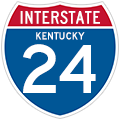
| Interstate 24 in western Kentucky is the Henry Ward Highway. 12/27/09 |
|
| The first of four exits for the city of Paducah joins Interstate 24 east with KY 305 (Cairo Road). 12/27/09 |
|
| KY 305 form a 12.95 mile long arc east from U.S. 62 at Camelia to Business Loop I-24/U.S. 60 Business in Paducah. 12/27/09 |
|
| The diamond interchange at Exit 3 falls within western reaches of the Paducah city limits. KY 305 (Cairo Road) west leads to unincorporated West Paducah. 12/27/09 |
|
| Advancing south, Interstate 24 spans a pair of Paducah and Louisville Railroad lines ahead of Exit 4 for U.S. 60 (Hinkleville Road) and Business Loop I-24 east into Paducah. 12/27/09 |
|
| Retail and Kentucky Oaks Mall line the west side of Interstate 24 on the ensuing stretch. 12/27/09 |
|
| Barkley Regional Airport (PAH) lies 5.3 miles west of I-24 via U.S. 60 and KY 305 (Fisher Road). 12/27/09 |
|
| Business Loop I-24 overlaps with U.S. 60 east and then U.S. 60 Business to Downtown Paducah. The 11.2 mile long loop returns to I-24 at Exit 11. 12/27/09 |
|
| Construction in 2019 converted the diamond interchange at Exit 4 into a DDI. Business Loop I-24 is no longer posted along the off-ramp. 12/27/09 |
|
| U.S. 45 returns to Interstate 24 south from Brookport, Illinois and Paducah at Exit 7. U.S. 62 parallels I-24 east from Paducah to Reidland and Calvert City. 12/27/09 |
|
| Confirming marker posted east after Perkins Creek. 12/27/09 |
|
| U.S. 45/62 combine along Jackson Street 0.65 miles west from U.S. 60 (S 28th Street) before partioning onto Alben Barkley Drive and Lone Oak Road to the split diamond interchange at Exit 7. 12/27/09 |
|
| The Whitehaven Welcome Center lines the service road linking the ramps at Exit 7 with U.S. 62 (Alben Barkley Drive) and U.S. 45 (Lone Oak Road). 12/27/09 |
|
| U.S. 45 heads south from Paducah to the unincorporated community of Lone Oak en route to Mayfield. 12/27/09 |
|
| The rest area at the Kentucky Welcome Center is also accessible from I-24 westbound via U.S. 45 (Lone Oak Road) south. 12/27/09 |
|
| U.S. 62 travels 26 miles west to the Carlisle County seat of Bardwell. Mayfield is 21 miles to the south of I-24 along U.S. 45 at I-69. 12/27/09 |
|
| Interstate 24 curves more to the east ahead of the Elmdale Road overpass and unincorporated community of Hendron. 12/27/09 |
|
| Nashville is 134 miles to the southeast. Kentucky Dam is 22 miles away off U.S. 62/441. Only Husband Road is correct on this distance sign. 12/27/09 |
|
| Business Loop I-24 overlaps with KY 1954 (John L. Puryear Drive) 2.98 miles southwest from U.S. 60/62 to the diamond interchange at Exit 11. 12/27/09 |
|
| Business Loop I-24 combines with U.S. 60 Business west to Downtown Paducah. Points of interest along the Ohio Riverfront include The Carson Center for the Performing Arts and the Inland Waterways Museum. 12/27/09 |
|
| KY 1954 shifts onto Husband Road from John L. Puryear Drive 0.42 miles south of Exit 11 at KY 3075 (Lydon Road). KY 3075 east 1.93 miles to KY 450 south leads to Paducah International Raceway. 12/27/09 |
|
| Interstate 24 continues east from Paducah to the census designated place of Reidland. 12/27/09 |
|
| Nashville is 130 miles to the southeast. 12/27/09 |
|
| U.S. 68 stems 1.10 miles south from parallel U.S. 62 in Reidland to meet Interstate 24 at Exit 16. 12/27/09 |
|
| U.S. 68 heads 11 miles southeast from Exit 16 to I-69 by the unincorporated community of Draffenville. 12/27/09 |
|
| U.S. 68 nationally travels northeast to Interstate 75 at Findlay, Ohio. U.S. 68 connects Hopkinsville, Bowling Green and Lexington across Kentucky. 12/27/09 |
Page Updated 12-14-2023.

 East
East


