
 West
West
06/12/08

06/12/08

06/12/08

06/12/08

06/12/08

06/12/08

06/12/08

06/12/08

06/12/08

06/12/08

06/12/08

06/12/08

06/12/08

06/12/08

06/12/08

06/12/08

06/12/08

06/12/08

06/12/08

06/12/08

Exit 46 separates from I-20 west for a distributor roadway leading north onto Interstate 55 for northern reaches of the Jackson area.
06/12/08
West  South
South  North
North
Northbound U.S. 49 combines with I-20 west and I-55 south one mile ahead of Exit 45B for State Street (U.S. 51).
05/03/12

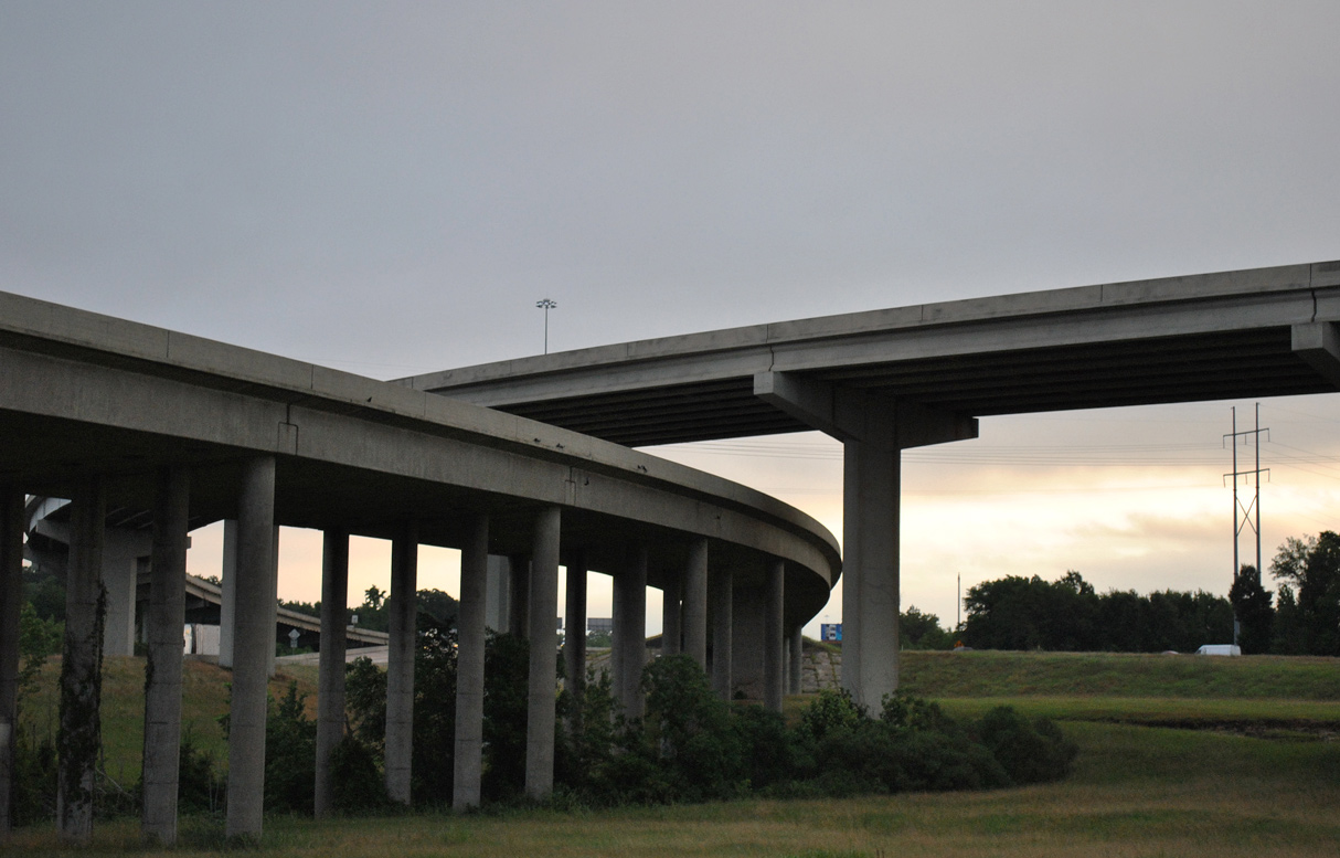
The directional T interchange joining I-20/U.S. 49 with Interstate 55 is named "The Stack".
05/03/12

05/03/12

U.S. 51 spurs 2.15 miles northeast from I-55 along an expressway leading to State Street at U.S. 80.
05/03/12
05/03/12

Guide signs for Exit 45A formerly referenced U.S. 51 north. State Street enters a folded diamond interchange with U.S. 80 to the immediate north en route to Downtown Jackson.
05/03/12

Spanning the Pearl River, I-20/55 and U.S. 49 enter Hinds County and the Jackson city limits.
05/03/12

The Jackson skyline appears to the northwest beyond the parallel U.S. 80 bridge over the Pearl River.
05/03/12

Exit 45A departs next for Gallatin Street, which leads north to the west side of Downtown Jackson.
05/03/12

Joining Jackson with New Orleans, Louisiana, I-55 overlaps with I-20 west for 1.94 miles.
05/03/12

U.S. 51 south combines with I-55 from State Street to Crystal Springs in Copiah County. The two parallel routes continue south to Brookhaven and McComb.
05/03/12

The separation with I-55/U.S. 51 south was previously assigned Exit 44.
05/03/12
West North
05/03/12

The six-ramp parclo interchange (Exit 43) with Terry Road lies just beyond the west split of I-20/55.
05/03/12

Terry Road represents the historic alignment of U.S. 51 through south Jackson.
05/03/12

Curving west, I-20/U.S. 49 span Raymond Road and Lynch Creek ahead of Exit 42 for Ellis Avenue.
05/03/12

A cloverleaf interchange joins I-20/U.S. 49 with Ellis Avenue at Exit 42.
05/03/12

I-220/U.S. 49 overlap north from the ensuing exit to Exit 5B. Yazoo City lies 36 miles northwest from there.
05/03/12

A lane drop occurs at Exit 41 for I-220/U.S. 49 toward north Jackson.
05/03/12

Interstate 220 comprises a 10.91 mile long loop north to I-55 at Ridgeland.
05/03/12
West
MS 18 (Robinson Road) angles 0.82 miles southwest from U.S. 80 and MS 476 to a six-ramp parclo interchange with I-20 at Exit 40.
06/12/08

The western segment of MS 18 runs 62.13 miles from U.S. 80 in Jackson to U.S. 61 at Port Gibson.
06/12/08

Robinson Road extends 0.75 miles east from U.S. 80/MS 18 as unsigned MS 476 to Royal Oak Drive in Jackson.
06/12/08

MS 18 west constitutes a four lane highway to the city of Raymond.
06/12/08


Photo Credits:
06/12/08, 05/03/12 by AARoads
Connect with:
Interstate 55
Interstate 220
U.S. 49
Page Updated 09-27-2021.