|
| East of Exit 368, IH 10 crosses an open mesa before straightening out on the remaining 12.2 miles in Crockett County. 01/14/06 |
|
| Sonora, seat of Sutton County, is the next population center referenced on IH 10 eastbound distance signs. 01/14/06 |
|
| Taylor Box Road north and Bailey Road south converge with IH 10 at a diamond interchange (Exit 372) in one mile. 01/14/06 |
|
| Taylor Box Road and Bailey Road venture into adjacent ranch areas from IH 10 and old U.S. 290 at Exit 372. 01/14/06 |
|
| IH 10 advances 28 miles east to Sonora and 204 miles to San Antonio. 01/14/06 |
|
| Forthcoming RM 1312 represents another section of old U.S. 290 still within the state highway system. 01/14/06 |
|
| IH 10 crosses the Sutton County line ahead of the half diamond interchange (Exit 381) with the connector to RM 1312. 01/14/06 |
|
| RM 1312 winds northward from IH 10 to connect the freeway with FM 2129 northeast to U.S. 277 outside Eldorado. 01/14/06 |
|
| Return access to IH 10 east from RM 1312 lies six miles ahead at a succeeding half diamond interchange (Exit 388 from westbound). 01/14/06 |
|
| IH 10 lowers from mile marker 386 to a pair of 1969-built bridges spanning Granger Draw and its relief channel. 01/14/06 |
|
| Distance sign posted beyond the entrance ramp from the connector linking RM 2129 and RM 1312 with IH 10 east. 01/14/06 |
|
| The next exit along eastbound IH 10 is with RM 1989 (Caverns of Sonora Road), a 9.73 mile route south to CR 410, and the east end of RM 1312. 01/14/06 |
|
| RM 1989 was designated in 1959 with the discovery and opening of Caverns of Sonora. The state highway was extended slightly south of the caverns in 1964. 01/14/06 |
|
| Rest areas operate along both directions of IH 10 at mile marker 394. 01/14/06 |
|
| SL 467 (Crockett Avenue) branches south from IH 10 at the first of two exits for the Sutton County seat of Sonora in one mile. 01/14/06 |
|
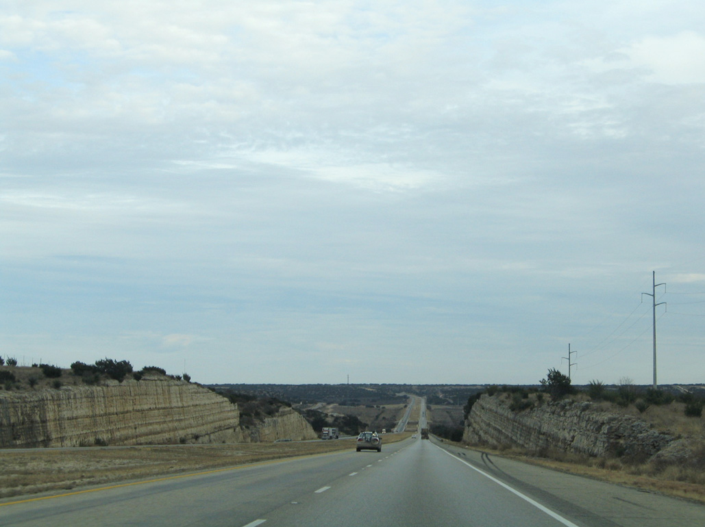
| Limestone road cuts become more prevalent along IH 10 as it traverses the Texas Hill County east for the next 130 miles. 01/14/06 |
|
| Entering the half diamond interchange (Exit 399) with SL 467 (Crockett Avenue) east on IH 10. SL 467 comprises a 5.68 mile loop along old U.S. 290. 01/14/06 |
|
| U.S. 277 meets IH 10 at the ensuing exit north of SL 467 and Downtown Sonora, adjacent to Sonora Municipal Airport (SOA). 01/14/06 |
|
| Exit 400 leaves IH 10 for U.S. 277 at Sonora. U.S. 277 travels south to Del Rio via Loma Alta, and north to San Angelo via Eldorado. 01/14/06 |
|
| A large US flag overlooks IH 10 at the Eaton Hill Nature Center & Preserve. 01/14/06 |
|
| Confirming marker posted ahead of the bridges across Poplar Street / CR 202 and Lowrey Draw. These spans were built in 1973. 01/14/06 |
|
| Exit 404 marks the east end of Loop 467 for Sonora. RM 3130 is the continuation of former U.S. 290 from Loop 467. 01/14/06 |
|
| RM 864 travels 41.95 miles northeast to Fort McKavett and U.S. 190, while RM 3130 parallels IH 10 along a 24.91 mile course. 01/14/06 |
|
| The Kimble County seat of Junction represents the next major population center along IH 10 east in 51 miles. 01/14/06 |
|
| Old U.S. 290 appears along the south side of IH 10 along the 7.6 mile exit less stretch east from RM 864. 01/14/06 |
|
| RM 3307 links IH 10 and CR 305 with parallel RM 3130 (old U.S. 290) via Exit 412. 01/14/06 |
|
| Sign changes made at Exit 412 both replaced RM 3130 with RM 3307 and added CR 305. RM 3307 constitutes a 0.727 mile connector between IH 10 and old U.S. 290. 01/14/06 |
|
| IH 10 progresses 44 miles southeast from Exit 414 to Junction and 163 miles to the Alamo City. 01/14/06 |
|
| RM 3130 meets IH 10 directly at Exit 420 and CR 306. RM 3130 shifts to the north side of IH 10 on the succeeding stretch. 01/14/06 |
|
| IH 10 crosses Live Oak Draw beyond this reassurance shield. 01/14/06 |
|
| Parking areas are found along both sides of IH 10 between mile marker 423 and 424. 01/14/06 |
|
| IH 10 travels through more roadcuts as it parallels RM 3130. 01/14/06 |
|
| County Road 313 connects IH 10 with RM 3130 just across the Dry Llano River at Exit 429. 01/14/06 |
|
| Sign changes made at Exit 429 replaced Harrell Road with CR 313. RM 3130 remains north of IH 10 by Fort Terrett Peak. 01/14/06 |
|
| Paralleling the North Llano River, IH 10 continues 27 miles east to Junction. 01/14/06 |
|
| Parallel RM 3130 ends just shy of the Kimble County line. The freeway runs just north of old U.S. 290 to Exit 437. 01/14/06 |
|
| SL 291 overlays the old alignment of U.S. 290 through Roosevelt from Exit 437 to Exit 442. U.S. 290 was bypassed here by the eventual IH 10 in 1955. 01/14/06 |
|
| Entering the split diamond interchange (Exit 437/438) with Old Highway 290 west and SL 291 east along IH 10 eastbound. The community of Roosevelt is known for the Marc-Key poinsettia nursery. 01/14/06 |
|
| IH 10 drops 200 feet in elevation through an impressive rock cut adjacent to Maynard Creek. 01/14/06 |
|
| The 800 foot long bridge taking IH 10 eastbound over the North Llano River was built in 1980.1 01/14/06 |
|
| Distance sign posted 18 miles out from Junction on IH 10 eastbound at Buck Hollow. San Antonio is 137 miles away. 01/14/06 |
|
| The 4.84 mile route of Loop 291 east from Roosevelt concludes at the ensuing exit with IH 10. 01/14/06 |
|
| RM 1674 begins in Fort McKavett at RM 864, travels south to meet IH 10 and SL 291, then travels east along former U.S. 290 to SL 481 in Junction. 01/14/06 |
|
| Copperas Creek separates the ramps at the split diamond interchange (Exit 442) with SL 291 west and FM 1674 east. 01/14/06 |
|
| Advancing to within 14 miles of Junction and 133 miles of San Antonio along IH 10 eastbound. 01/14/06 |
|
| RM 1674 switches sides with IH 10 at a half diamond interchange (Exit 445) following Stark Creek. 01/14/06 |
|
| Exit 445 departs IH 10 east for RM 1674. RM 1674 travels along old U.S. 290 east 13.45 miles into the city of Junction. 01/14/06 |
|
| IH 10 straddles the hills overlooking the North Llano River, spanning North Creek. 01/14/06 |
|
| Agricultural areas and ranch land spreads along both sides of IH 10 preceding the diamond interchange (Exit 451) with RM 2291. 01/14/06 |
|
| RM 2291 begins in Menard and travels 30.95 miles south via Cleo to reach IH 10 and RM 1674 (former U.S. 290). The highway parallels US 83 for its entire length. 01/14/06 |
|
| Travelers along IH 10 eastbound cross over Bear Creek beyond this shield assembly. 01/14/06 |
|
| Making a gradual southeastern turn, IH 10 runs five miles to the city of Junction. 01/14/06 |
|
| U.S. 83/377 combine south by Kimble County Airport (JCT) to a commercialized diamond interchange (Exit 456) with IH 10. RM 1674 ties into U.S. 377 along North Main Street nearby, while SL 461 continues along old U.S. 290 east from the city center. 01/14/06 |
|
| U.S. 377 joins Junction with South Llano River State Park and the Edwards County seat of Rocksprings to the southwest and the Mason County seat of Mason to the northeast. 01/14/06 |
|
| Exit 456 is the first of two interchanges along IH 10 east for Junction. Junction is named for the confluence of the North and South Llano Rivers. U.S. 83 enters the city south from Menard. 01/14/06 |
|
| U.S. 83 bypasses Junction along a 5.57 mile overlap with IH 10. 01/14/06 |
|
| The North and South Llano Rivers combine just south of IH 10 at Exit 457 with FM 2169 (Martinez Street). 01/14/06 |
|
| FM 2169 encircles the south side of Junction from Texas Tech University to SL 481 (Main Street) and IH 10 at Exit 457. The 16.49 mile long highway eventually follows old U.S. 290 at Segovia. 01/14/06 |
Page Updated 07-22-2019.


 East
East


 South
South