

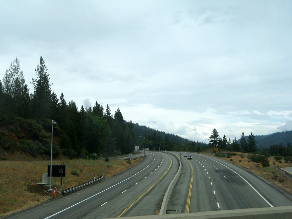
Between the Pit River Bridge and the Siskiyou County line south of Dunsmuir, Interstate 5 doubles as the Stone Turnpike Memorial Freeway. Originally built in 1860, then rebuilt in 1861, the Stone family commissioned a toll road that ran 44 miles along the Sacramento River Valley between the Pitt River Ferry and Upper Soda Springs near Dunsmuir. The route was established as a more direct road by the 1870s for mail and stage drivers, and by the 1880s, the Central Pacific railroad followed closely to the route, using some of the old roadbed. The Pacific Highway (U.S. 99) eventually overlaid the toll road, and during the 1960s, was rebuilt as I-5.1
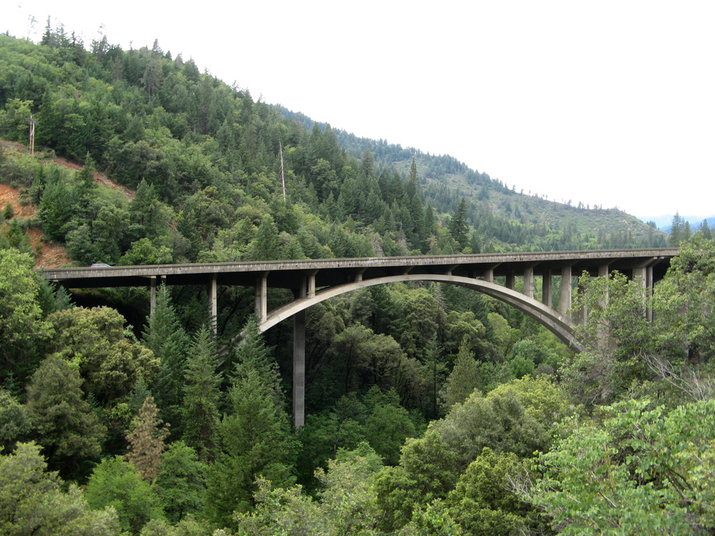


Near the community of Lakehead, Interstate 5 crosses the Sacramento River on the Antlers Bridge. Originally built in 1941 as a steel truss bridge for U.S. 99, the span was rehabilitated by 1967 to incorporate I-5 traffic. In 2009, work began on replacing the aging span with a cast-in-place, segmental concrete box-girder bridge.2 Initially with a 2014 completion date, the new 1,942 foot long span was completed September 2016, at a cost of $125 million.3 Part of the construction included realigning the southern approach to the bridge for increased safety. Demolition began January 2017 on the old span, taking two attempts to bring down the steel truss due to weather.4
 North
North
Interstate 5 between the Pit River Bridge over Shasta Lake to the Siskiyou County line is designated as the Stone Turnpike Memorial Freeway in addition to the Cascade Wonderland Highway.
08/02/11

Travel lanes separate north of Turntable Bay Road (Exit 692) with northbound I-5 following close to the McCloud River Arm of Shasta Lake.
08/02/11

03/31/05

08/02/11

The O'Brien Safety Rest Area lines I-5 north one mile ahead of a diamond interchange (Exit 695) with Shasta Caverns Road.
08/02/11

08/02/11

03/31/05

03/31/05

08/02/11

Northbound Interstate 5 is elevated nearly 60 higher than southbound on the ensuing stretch to Gilman Road (Exit 698).
08/02/11

03/31/05

08/02/11

08/02/11

08/02/11

Gregory Creek Road spans I-5 as the freeway crests at an elevation of 1,580 feet above sea level.
03/31/05

08/02/11

The Antler Bridge takes Interstate 5 across the Sacramento River near the northern end of Shasta Lake ahead of Lakeshore Drive / Antlers Road (Exit 702).
03/31/05

The 2016 opened Antlers Bridge includes two travel lanes for northbound and three for southbound, along with shoulders.
03/31/05

08/02/11

03/31/05

A diamond interchange (Exit 704) with Riverview Drive joins Interstate 5 with the community of Lakehead one mile ahead.
08/02/11

The Lakehead section of Interstate 5 was built in 1972.
08/02/11

08/02/11

The Lakehead Safety Rest Area lines southbound I-5 on the ensuing stretch to Exit 707 (Dog Creek Road).
08/02/11

03/31/05

08/02/11

Dog Creek Road, Delta Road, and Delta School Road all tie into I-5 at the upcoming interchange (Exit 707).
08/02/11

I-5 north crosses the Dog Creek (Harlan D. Miller) Bridge ahead of Exit 707. The span was built in 1956 and is 642.7 feet in length.5
08/02/11

08/02/11

Dog Creek Road winds westward from I-5 to McKinsey Ridge.
05/25/08

08/02/11

I-5 north meets Slate Creek Road at a trumpet interchange (Exit 710) one mile ahead. Slate Creek Road leads west along the northern edge of Mosquito Creek mountain ridge.
08/02/11

Interstate 5 narrows as the Stone Turnpike Memorial Freeway winds northward to Dog Creek Road (Exit 710).
03/31/05

The Lamoine Hole, one of many swimming holes along the upper Sacramento River, is accessed via Exit 710.
08/02/11

08/02/11

08/02/11

03/31/05

This section of I-5 was realigned by 1989 to cross the Sacramento River ahead of Exit 714 (Gibson Road).
08/02/11

The Stone Turnpike Memorial Freeway previously followed the route of historic U.S. 99 on a windy course west of the river and a Union Pacific railroad line between Pollard Flat and Fisher.
08/02/11

03/31/05

03/31/05

I-5 passes just to the south of an abandoned crossing over Shotgun Creek for former U.S. 99 in this vicinity.
03/31/05

08/02/11

08/02/11

03/31/05

I-5 advances north from Sims Road (Exit 718) to Flume Creek Road next.
08/02/11

08/02/11

08/02/11

The stretch of Interstate 5 between Exit 718 (Sims Road) and Exit 723 (Sweetbrier Avenue) was built by 1962.
08/02/11

08/02/11

The Conant Cemetery lines the west side of Interstate 5 at the diamond interchange (Exit 721) with Conant Road.
03/31/05

08/02/11

08/02/11

Interstate 5 rises to 2,000 feet above sea level for the first time since Tejon Pass in Los Angeles County.
08/02/11

08/02/11

A vista point follows Sweetbrier Avenue (Exit 723) in one half mile. The pull off offers a stopping point for scenic views of the surrounding area, including Mount Shasta.
03/31/05

03/31/05

08/02/11

Castle Creek Road joins I-5 with the community of Castella and Castle Crags State Park in one mile.
08/02/11

08/02/11

The section of I-5 leading away from Castella northward to the Siskiyou County line was constructed in 1960.
03/31/05

03/31/05

08/02/11

Representing the most expansive of all the Cascade Range volcanoes, and the fifth highest mountain in California, Mount Shasta rises to an elevation of 14,163 feet6 in adjoining Siskiyou County.
08/02/11

08/02/11

08/02/11

Crag View Drive branches from I-5 at Exit 727 to several residences. The local road represents a previous alignment of former U.S. 99.
03/31/05

03/31/05

Interstate 5 continues northward from Railroad Park Road (Exit 728) into Siskiyou County and Dunsmuir.
08/02/11


- "Stone Turnpike Memorial Freeway", The Historical Marker Database (hmdb.org), retrieved February 11, 2023.
- "I-5 Antlers Bridge Replacement - Shasta County, California", American Segmental Bridge Institute (asbi-assoc.org), retrieved February 11, 2023.
- "Caltrans celebrates completion of Antlers Bridge", Record Searchlight (redding.com) (newspaper), retrieved, February 11, 2023.
- "Most of old Antlers Bridge falls in demolition", Record Searchlight (redding.com) (newspaper), retrieved, February 11, 2023.
- I-5 - Dog Creek Bridge (bridgehunter.com), retrieved February 11, 2023.
- Mount Shasta (usgs.gov), retrieved February 11, 2023.
Photo Credits:
03/31/05, 05/25/08, 08/02/11 by AARoads
Page Updated 02-11-2023.