|
| Orange Avenue (CR 527) branches southwest from SR 426 (Fairbanks Avenue) at a five point intersection with Pennsylvania Avenue. 03/21/08 |
|
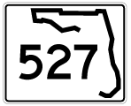
| What was the first southbound confirming marker for SR 527 along Orange Avenue in Winter Park. 03/21/08 |
|
| With maintenance of Orange Avenue transferred from FDOT to the city of Winter Park, the six-point intersection with Demming Drive and Minnesota Avenue was reconstructed with brick pavers. 03/21/08 |
|
| Orange Avenue continues southwest to a six-point intersection with U.S. 17/92 (Orlando Avenue) and Harmon Avenue. 12/13/07 |
|
| U.S. 17/92 (Orlando Avenue) travel south to become Mills Avenue through the Orwin Manor community of Orlando. The two routes continue to SR 50 (Colonial Drive) at Colonial Park, where they turn west along the north side of Downtown. 12/13/07 |
|
| SR 527 lines Orange Avenue southwest through the Orwin Manor community in Winter Park. 02/25/17 |
|
| SR 527 (Orange Avenue) enters the Orlando city limits at Westminster Street just ahead of the southward turn at Clay Avenue. 02/25/17 |
|
| Orange Avenue parallels Interstate 4 and a CSX Railroad line as it intersects King Street. 02/25/17 |
|
| Winter Park Street provides a route west below Interstate 4, connecting SR 527 (Orange Avenue) with the residential street grid beyond the freeway. 02/25/17 |
|
| Rollins Street connects SR 527 (Orange Avenue) with Florida Hospital Orlando, located to the east off Lake Estelle. 02/25/17 |
|
| Reassurance marker for SR 527 south at Orange Avenue and Smith Street. 02/25/17 |
|
| Princeton Street links Loch Haven Park and the Orlando Science Center with Interstate 4 just west of SR 527. 02/25/17 |
|
| New Hampshire Street stems west from SR 527 (Orange Avenue) to cross below I-4 into the Westwood Park and Shore Crest neighborhoods off Lake Ivanhoe. 02/25/17 |
|
| Orange Avenue runs between Gaston Edwards Park on Lake Ivanhoe and the CSX Railroad. The first of three signals along this stretch operates at Virginia Drive east. 02/25/17 |
|
| Highland Avenue branches south from SR 527 (Orange Avenue) toward Lake Eola. 02/25/17 |
|
| Turning southwest, SR 527 (Orange Avenue) partitions with Ivanhoe Boulevard west to adjacent ramps with Interstate 4. 02/25/17 |
|
| Magnolia Avenue flows north directly to the eastbound on-ramp for I-4 beyond Ivanhoe Boulevard. The three-lane street carries SR 527 north from U.S. 17-92 & SR 50 (Colonial Drive). 02/25/17 |
|
| Orange Avenue curves south at Legion Place and Garland Avenue to become a one way street southbound to Downtown Orlando. 02/25/17 |
|
| SR 527 (Orange Avenue) southbound next intersects Marks Street. 02/25/17 |
|
| Forthcoming Colonial Drive links the north side of Downtown Orlando with Interstate 4 at a single point urban interchange (SPUI) just west of Orange Avenue. 02/25/17 |
|
| Colonial Drive carries SR 50 through the Orlando metropolitan area. Omitted on signage here, U.S. 17/92 accompany the urban boulevard west to U.S. 441 (Orange Blossom Trail) and east to SR 15 (Mills Avenue). 02/25/17 |
|
| SR 527 is discontinuous south of SR 50 (Colonial Drive), with Orange Avenue entering Downtown as a locally maintained street. 02/25/17 |
|
| Orange Avenue forms a one way couplet with Magnolia Avenue north between U.S. 17-92 & SR 50 (Colonial Drive) and Livingston Street. Concord Street meets the former SR 527 south at the next in a series of traffic lights. 02/25/17 |
|
| Orange Avenue maintains three southbound lanes and intersects Amelia Street. Amelia Street passes below I-4 west to the Creative Village Development. The development replaced the Orlando Centroplex, where Amway Arena was located prior to demolition in 2011-12. 02/25/17 |
|
| Orange Avenue southbound at Livingston Street and the Orange County Courthouse. Livingston Street heads west just beyond I-4 to the Bob Carr Theater. 02/25/17 |
|
| An I-4 trailblazer precedes the intersection with SR 526 (Robinson Street) on Orange Avenue south. The assembly directs motorists to remain on Orange Avenue to South Street west. 02/25/17, 07/29/06 |
|
| SR 526 shields posted at Orange Avenue and Robinson Street. SR 526 takes Robinson Street west to Hughey Avenue, where it dog legs south alongside I-4 to Washington Street. The state road follows Robinson Street east to a truncated end at Crystal Lake Drive by Orlando Executive Airport (ORD). 02/25/17, 07/29/06 |
|
| Reassurance marker for SR 527 previously posted between Robinson and Jefferson Streets. 07/29/06 |
|
| Continuing one block south from SR 526, Orange Avenue (old SR 527) south intersects Jefferson Street. 02/25/17 |
|
| Washington Street ends two blocks to the east of Orange Avenue at Rosalind Avenue (old SR 527 northbound) and Lake Eola Park. West of I-4, Washington Street doubles as SR 526 through Paramore to U.S. 17-92-441 (Orange Blossom Trail). 02/25/17 |
|
| Advancing south through the Orlando financial district along Orange Avenue at Wall Street. 02/25/17 |
|
| Central Boulevard passes through Downtown west to Orlando City Stadium (home of the MLS Orlando City SC) and east along Lake Eola Park. 02/25/17 |
|
| Another I-4 trailblazer appears along Orange Avenue (old SR 527) south at Pine Street. 02/25/17 |
|
| The previous shield for I-4 at Orange Avenue and Pine Street with the state name. 07/29/06 |
|
| Connecting Orange Avenue with Amway Center (home of the NBA Orlando Magic), Church Street is the entertainment hub of Downtown Orlando. 02/25/17 |
|
| Southbound Orange Avenue (old SR 527) at Jackson Street east. 02/25/17 |
|
| Southbound Orange Avenue at South Street and Downtown Orlando City Hall. South Street switches from one way to two-way traffic west of Orange Avenue to ramps with I-4 and the nearby Amway Center (home of the Orlando Magic). 06/02/18 |
|
| Anderson Street runs along the south side of Downtown Orlando City Hall, connecting Orange Avenue to both eastbound I-4 and SR 408 (East-West Expressway). 06/02/18 |
|
| Lucerne Circle West encircles the west side of Lake Lucerne, from the westbound on-ramp to SR 408, to Orange Avenue after the merge with Rosalind Avenue. 11/05/06 |
|
| Vintage traffic lights operate along Orange Avenue south at Lucerne Circle North. A pair of viaducts carry the East-West Expressway above, while a flyover connects the toll road westbound with I-4 east. 05/22/20, 06/02/18 |
|
| Orange Avenue south combines with Rosalind Avenue across Lake Lucerne. With two-way traffic, the four lane boulevard proceeds to South Lucerne Circle. 09/08/18 |
|
| Interstate 4 trailblazer posted ahead of the intersection with Gore Street. Gore Street ventures a short distance west to Division Avenue and an on-ramp for the freeway westbound.
Construction underway through 2018 at the northwest corner of Gore Street and Orange Avenue is for the 375-unit Novel Lucerne mixed-use development.1 09/08/18 |
|
| Orange Avenue becomes a part of SR 527 again beyond Gore Street. Gore Street ends just east of the state road at Delaney Avenue and Al Coith Park.
Orange Avenue will be redesigned between Gore Street and Pineloch Avenue in 2019. The streetscaping project will enhance redevelopment of the area.1 06/02/18 |
|
| Continuing south from Gore Street on SR 527 (Orange Avenue) south. Southbound SR 527 is entirely unmarked along Orange Avenue between Gore Street in Orlando and SR 482 (Sand Lake Road) at Pine Castle. 06/02/18 |
|
| Orange Avenue south at Columbia Street west to Division Avenue. 06/02/18 |
|
| SR 527 advances south between Orlando Health Heart Institute and Lake Copeland to the signal with Copeland Drive southeast. 09/08/18 |
|
| The succeeding signal on SR 527 (Orange Avenue) south operates at Miller Street near Lake Beauty and the Copeland Park neighborhood. 06/02/18 |
|
| Kaley Street is an urban collector linking SR 527 (Orange Avenue) with Interstate 4 to the west and Boone High School and residential areas south of Lake Lancaster to the east. 06/02/18 |
|
| The former Pulse nightclub lies on the west side of Orange Avenue between Kaley and Esther Streets. Pulse was the site of a mass shooting on June 12, 2016. 49 lost their lives and another 58 were injured on that tragic night. 06/02/18 |
|
| Orange Avenue intersects Grant Street at the northeast corner of the 22-acre Sodo mixed-used development. 06/02/18 |
|
| An I-4 trailblazer precedes the intersection with Michigan Street on SR 527 south at SODO. Michigan Street heads 0.75 miles west to the freeway. 06/02/18 |
|
| Michigan Street connects SR 527 with U.S. 17-92-441 (OBT) at Angebilt to the west and Crystal Lake Drive at Conway to the east. The Orange County Property Appraiser (OCPA) Interactive Map references the urban collector as CR 428. 06/02/18 |
|
| Osceola Avenue arcs southwest from Michigan Street to become Pineloch Avenue ahead of SR 527 (Orange Avenue) at the Southside Shoppes development. 06/02/18 |
|
| Drennen Road stems west from Orange Avenue to South Orange Business Center and Holden Heights off Lake Holden. 06/02/18 |
|
| Continuing into the city of Edgewood, SR 527 south intersects Holden Avenue west to Cypress Grove Park and Texas Avenue by Park Central in Orlando. 06/02/18 |
|
| The succeeding signal on Orange Avenue southbound is with Gatlin Avenue east to Bumby Avenue and Conway. 06/02/18 |
|
| SR 527 separates into a one way couplet, with southbound traffic remaining along Orange Avenue and northbound using Hansel Avenue. 06/02/18 |
|
| Orange Avenue south at Mary Jess Road, a two lane collector west to the Rockwood Estates and Jessamine Beach communities outside the Edgewood city limits. 06/02/18 |
|
| Leaving Edgewood, SR 527 (Orange Avenue) enters the unincorporated community of Pine Castle. 06/02/18 |
|
| Hoffner Avenue (unsigned CR 506) ties into SR 527 from northern reaches of Belle Isle along an isthmus across Lake Conway. 06/02/18 |
|
| The western branch of unsigned County Road 506 lines Oak Ridge Road between SR 527 and U.S. 17-92-441 (Orange Blossom Trail). Oak Ridge Road extends west to the Premium Outlets in Orlando by the crossroads of I-4 and Florida's Turnpike. 06/02/18 |
|
| Advancing south from Oak Ridge Road (CR 506) west, SR 527 (Orange Avenue) south next intersects Lancaster Road. Lancaster Road heads west from Pine Castle to the Sky Lake community, U.S. 17-92-441 (Orange Blossom Trail) and Orlando Central Park. 03/31/18 |
|
| Orange Avenue travels just west of the Belle Isle city limits to SR 482 (McCoy Road). City Hall lies just east of SR 527 along Nela Avenue at Conway Circle. 03/31/18 |
|
| Nela Avenue is a residential through route spanning an inlet across Lake Conway in the Nela Isle neighborhood of Belle Isle. 03/31/18 |
|
| Traffic lights installed at Office Court in 2017 serve an adjacent commerce park and the Sand Lake Road Sunrail transit station. 03/31/18 |
|
| SR 527 south concludes 0.3 miles beyond Office Court at SR 482. SR 482 is a four to six lane arterial following Sand Lake Road west to Dr. Phillips and McCoy Road east to south Belle Isle. 03/31/18 |
|
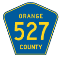
| Orange Avenue continues south from SR 482 at CR 527 (signed here incorrectly as CR 527A). CR 527 is mostly unmarked between Pine Castle and Kissimmee. 03/31/18 |
|
| Orange Avenue passes under the Beachline Expressway (SR 528) and intersects Jetport Drive. Jetport Drive stems east as the south side frontage road to SR 528 toward MCO Airport. 05/05/18 |
|
| Landstreet Road intersects Orange Avenue (CR 527) at the succeeding traffic light southbound ahead of Taft. West from CR 527 to U.S. 17-92-441 (Orange Blossom Trail), Landstreet Road is unsigned CR 528A. 05/05/18 |
|
| Orange Avenue south at 4th Street. Orange Avenue winds south through the unincorporated community of Taft between Landstreet Road and Taft-Vineland Road. 05/05/18 |
|
| Entering the Orlando city limits, Orange Avenue south intersects Taft-Vineland Road west to U.S. 17-92-441 (OBT) at Orlando Central Park and Tradeport Drive east through Airport Industrial Park. 05/05/18 |
|
| The northern segment of Wetherbee Road branches east from Orange Avenue and parallels CR 527 south from Airport Industrial Park to the Meadow Woods community. Orange Avenue elevates across the CSX and SunRail lines ahead. 05/05/18 |
|
| Navigating through an S-curve above the aforementioned railroads, Orange Avenue lowers to intersect Zell Drive west to Regency Industrial Park. 05/05/18 |
|
| Orange Avenue continues beyond the South Orange Sports Complex to meet West Wetherbee Road to the Southchase community and East Wetherbee Road to the Meadow Woods community. 05/05/18 |
|
| Fairway Woods Boulevard links South Orange Avenue with SunRail's Meadow Woods Station and Landstar Boulevard at the Meadow Woods community. 08/25/18 |
|
| Town Center Boulevard is a the main arterial route connecting the Meadow Woods community with Hunter's Creek, located west of Florida's Turnpike and the Falcon Trace development to the west. 08/25/18 |
|
| Heading south from Town Center Boulevard on unsigned CR 527 (Orange Avenue). 05/03/08 |
|
| County Road 527 ascends and crosses Florida's Turnpike east of the Falcon Trace community. The two lane bridge along Orange Avenue was closed for replacement during a Turnpike widening project underway in 2017. 05/03/08 |
|
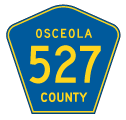
| County Road 527 crosses into Osceola County at Mary Louis Lane. The county road remains unmarked leading into Kissimmee. 05/03/08 |
|
| Orange Avenue ends at Osceola Parkway (CR 522). With a new SunRail station planned nearby, $150 million in development got underway in 2017 along CR 527 south to CR 522. Included is an Orlando Health medical facility, a 128-room hotel and the Eastwind apartment complex.2 05/03/08 |
|
| Osceola Parkway links Kissimmee with Florida's Turnpike (Exit 249) to the east and U.S. 17-92-441 (Orange Blossom Trail) to the west. CR 522 extends west as a toll arterial to Interstate 4 and Walt Disney World. 05/03/08 |
Page Updated 10-19-2018.