
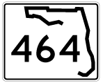
Comprising a five lane boulevard or four lane, divided arterial, State Road 464 runs across the south side of Ocala to suburban areas south of Huntington. The 7.3 mile route branches east from SR 200 (College Road) and connects with U.S. 27/301/441 (Pine Avenue) to the south of Downtown Ocala. SE 17th Street leads SR 464 east to SE 25th Avenue, where it arcs southeast along Maricamp Road. SR 464 concludes at SR 35 (SE 58th Avenue) at the Majorie Harris Carr Cross Florida Greenway opposite CR 464 southeast to Lake Weir.

04/17/19

04/17/19

04/17/19

04/17/19

04/17/19

04/17/19

04/17/19

04/17/19

11/14/16

11/14/16

11/14/16

Formerly was CR 464A, Magnolia Avenue is unsigned CR 4183.
11/14/16

11/14/16

11/14/16

11/14/16

11/14/16

11/14/16

11/14/16

SE 36th Avenue is unsigned CR 4176 south to SE 38th Street and unsigned CR 4175 north from SR 464.
11/14/16

11/14/16

11/14/16

11/14/16

11/14/16

SR 464 (Maricamp Road) concludes at SR 35 (SE 58th Avenue) south of Huntington and across from CR 464.
11/14/16

This branch of SR 35 (SE 58th Avenue) runs 10.84 miles north from SR 25/CR 25 at Belleview to SR 40/CR 35 at Silver Springs.
11/14/16

CR 484 (Maricamp Road) extends 10.19 miles southeast to Silver Springs Shores and Candler en route to CR 25 near Ocklawaha.
11/14/16
Photo Credits:
- 11/14/16 by AARoads. 04/17/19 by AARoads and JP Nasiatka.
Connect with:
U.S. 27
U.S. 301
U.S. 441
State Road 35
State Road 200
Page Updated 03-22-2021.