|
| The southern terminus of SR 281 coincides with an entrance to a shopping center on U.S. 98 (Gulf Breeze Parkway). Drivers can exit the shopping center parking lot and enter SR 281 northbound directly. U.S. 98 (Gulf Breeze Parkway) otherwise travels west to Gulf Breeze and east to Navarre. 05/09/04 |
|
| The first shield assembly for SR 281 accompanies an Interstate 10 trailblazer as the state road curves northwest toward Redfish Point. 08/28/12 |
|
| Spanning Redfish Point Road, SR 281 maintains controlled access standards to the Garcon Point Bridge. 08/28/12 |
|
| Northbound motorists reach the Garcon Point Bridge, which travels 18,425 feet across the waters between Pensacola and East Bays. 08/28/12 |
|
| A box girder bridge with 127 spans, the Garcon Point Bridge carries two travels lanes with partial shoulders at a width of 40 feet. 08/28/12 |
|
| Cresting at a height of 65.6 feet, the Garcon Point Bridge lowers toward Hernandez Point and the peninsula between Escambia and East Bays. 08/28/12 |
|
| During times of clear weather, the Three Mile Bridge of U.S. 98 comes into view across Pensacola Bay to the west of the Garcon Point Bridge. 11/23/08 |
|
| Nearing the coast west of Garcon Point, SR 281 curves northerly to touch land by Hernandez Point and parallel Katie Street. 08/28/12 |
|
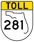
| The Garcon Point Bridge toll plaza lies one mile north of the bridge end on SR 281. 08/28/12 |
|
| One half mile south of the toll plaza. South Garcon Point Road (former County Road 191) and SR 281 come together just beyond the toll collection point. 08/28/12 |
|
| A toll schedule sign displays the rates for two-axle vehicles ($3.75 as of 2013) and for each additional axle (also $3.75 as of 2013). A 2010 proposal sought to increase the toll to $4.00, but that never came to fruition. 08/28/12 |
|
| During times of hurricanes, tolls are sometimes suspended on the Garcon Point Bridge to speed evacuations. The afternoon of August 28, 2012 was one such time when Hurricane Isaac threatened with tropical storm force winds over the Panhandle of Florida. 08/28/12 |
|
| Drivers encounter an access road to South Garcon Point Road (former CR 191) and the Garcon Point Trail parking area immediately north of the toll plaza. 08/28/12 |
|
| Continuing north, SR 281 splits with Garcon Point Road for Avalon Boulevard. Santa Rosa County Road 191 begins and veers northeast to Yellow River Marsh Preserve State Park, Bagdad and Milton. 11/23/08 |
|
| Following Avalon Boulevard north from Santa Rosa County Road 191, no additional shields for SR 281 are posted. 05/16/14 |
|
| SR 281 (Avalon Boulevard) curves northwest and crosses Trout Bayou. Trout Bayou dumps into Escambia Bay just to the west. 05/14/14 |
|
| Spanning Indian Bayou along SR 281 (Avalon Boulevard) north. The state road expands into a divided highway just ahead of Interstate 10. 05/14/14 |
|
| A number of traveler services appear alongside Avalon Boulevard as SR 281 meets Interstate 10. 05/14/14 |
|
| Interstate 10 joins Pensacola, 13 miles to the west, with Tallahassee, 180 miles to the east. 05/14/14 |
|
| A traffic light was added at the eastbound ramps to Interstate 10 due to the evening commute traffic that takes the freeway from Escambia County to SR 281 north toward Milton. 11/23/08 |
|
| Passing through the diamond interchange with Interstate 10 on SR 281 north. The overpasses for the freeway above Avalon Boulevard were rebuilt in 1996-97. 05/14/14 |
|
| Interstate 10 leads west across Escambia Bay to northern reaches of Pensacola, Baldwin County and Mobile, Alabama. 11/23/08 |
|
| SR 281 (Avalon Boulevard) travels through a rural street grid east of Avalon Beach between Interstate 10 and Mulatto Bayou. Four-laning of this stretch of Avalon Boulevard is underway until winter 2014. 07/24/11 |
|
| The Santa Rosa County seat of Milton lies seven miles northeast of Interstate 10 via SR 281 north to U.S. 90 east.
A park & ride lot was added to Avalon Boulevard by 2011. 01/19/13 |
|
| Del Monte Street doubles as Santa Rosa County Road 281 west from SR 281 (Avalon Boulevard) to 14th Avenue in Avalon Beach. 14th Avenue carries the unsigned route northward across Mulatto Boulevard onto Montecito Boulevard and the community of Harp. 01/19/13, 11/28/99 |
|
| North from Del Monte Street (CR-281), SR 281 spans Mulatto Bayou ahead of the former Moors Golf Club. 01/19/13 |
|
| SR 281 climbs from 30 to 100 feet above sea level northward from Highland Brae Boulevard across a CSX Railroad line to Cyanamid Road. 05/18/14 |
|
| Approaching the east end of Santa Rosa County Road 281B (Cyanamid Road) on SR 281 north. Avalon Boulevard northward from this point was expanded from a rural two lane roadway into a four lane urban arterial between August 2009 and May 2013. 07/17/04, 05/18/14 |
|
| Cyanamid Road leads west 0.6 miles to the intersection of Mulat Road (former County Road 191A) and Sterling Way (Santa Rosa County Road 191B). CR-191B continues the road west 0.9 miles to Bell Lane, which doubles as CR-197A north to U.S. 90 east of Pace. 05/18/14 |
|
| A frontage road was added during the 2009-13 widening of SR 281 from north of County Road 281B to just south of Mulat Drive. A number of residential streets tie into Avalon Boulevard along this stretch. 05/18/14 |
|
| Approaching the north end of Mulat Drive on SR 281 north. Mulat Drive was a part of County Road 191, but no longer is. Despite that, sign crews installed shields for the designation in 2011 as part of the four lane project of SR 281. 05/18/14 |
|
| Mulat Drive originally branched southwest from a curve in SR 281 at Kingery Road. That split was eliminated and Mulat Drive realigned to meet SR 281 directly across from Commerce Drive at a new signalized intersection. Mulat Drive otherwise spurs southwest to Harp and Mulat. 05/18/14 |
|
| SR 281 (Avalon Boulevard) curves northeast from Mulat Road toward Pea Ridge. 05/18/14 |
|
| A second reassurance marker for SR 281 was retained from after the former merge with Mulat Road (old) CR-191A). 05/18/14 |
|
| Carroll Road leads east from SR 281 (Avalon Boulevard) to Galt City Road. Roads leading north from the east-west highway connect with various Santa Rosa County offices. 05/18/14 |
|
| Nearing the north end of SR 281, Avalon Boulevard meets both County Road 191A (Old Bagdad Highway) east and U.S. 90. Originally separate signalized intersections existed on SR 281 with both routes. Sometime before 2004, the configuration was modified, leaving access to Old Bagdad Highway from SR 281 north as the only possible movement. Remaining connections are with U.S. 90 east nearby. 05/18/14 |
|
| 2009-13 widening of SR 281 greatly expanded the intersection with U.S. 90 to include two turn lanes for eastbound to Milton and two lanes for westbound to Pea Ridge and Pace. 05/18/14 |
|
| A right turn remains available for Old Bagdad Highway east to Forsyth Street (Santa Rosa County Road 191) in Bagdad. Officially Old Bagdad Highway is County Road 191A, though signs here display the route as another branch of CR-191. 05/18/14 |
|
| SR 281 ends opposite the entrance to Pensacola State College's Milton Campus. West from Milton, U.S. 90 constitutes a somewhat slow moving commercialized arterial to the north end of Escambia Bay. Pace lies just to the west as a growing bedroom community for both Pensacola and Naval Air Station Whiting Field. 05/18/14 |
11/28/99, 05/09/04, 07/17/04, 11/23/08, 07/24/11, 08/28/12, 01/19/13, 05/14/14, 05/16/14, 05/18/14 by AARoads
Page Updated 11-18-2014.