
 East
East
Bending northeast across a CSX Railroad line, State Road 70 expands into a divided highway. Forthcoming SR 710 branches southeast from Okeechobee to Florida's Turnpike at Palm Beach Gardens.
10/17/14

Known as the Bee Line Highway further south due to its linear course, SR 710 travels 56.82 miles overall from SR 70 to CR 811 (Old Dixie Highway) in the city of Riviera Beach.
10/17/14

SR 710 crosses paths with SR 76 midway between Okeechobee and Palm Beach Gardens at the village of Indiantown.
10/17/14

10/18/08

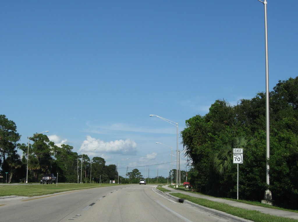
The sign for Fort Pierce posted beyond SR 710 references the former alignment of SR 70 along Okeechobee Road and Delaware Avenue to U.S. 1 in the city. The realignment of SR 70 ties into U.S. 1 further south, increasing the distance from 34.5 to 35.3 miles.
10/18/08
Reassurance marker formerly posted along SR 70 at NE 30th Avenue.
10/18/08

The four lane section of SR 70 previously concluded ahead of Mosquito Creek eastbound.
10/18/08

SR 70 makes an S-curve just east into St. Lucie County. The original two lane roadway was converted to the westbound lanes.
10/18/08

SR 70 crosses Cypress Creek north of Bluefield Road. The original roadway here follows the eastbound lanes.
10/18/08

A reassurance marker was formerly posted east of the driveway into Cow Creek Ranch.
10/18/08

SR 70 east at Wynne Ranch.
10/18/08

10/18/08

10/18/08

SR 70 navigates through an S-curve eastward to Summerlin Road.
10/18/08

SR 70 previously expanded to four lanes just east of Summerlin Road.
10/18/08

10/18/08

SR 70 crosses Rim Ditch Canal.
10/18/08

The southern branch of CR 613 (Carlton Road) connects SR 70 with CR 709 (Glades Cut Off Road), 9.05 miles to the south.
10/18/08

SR 70 links CR 613 south with CR 613 north along Sneed Road in 0.4 miles.
10/18/08

CR 613 bee lines 5.57 miles north from SR 70 to CR 68.
10/18/08

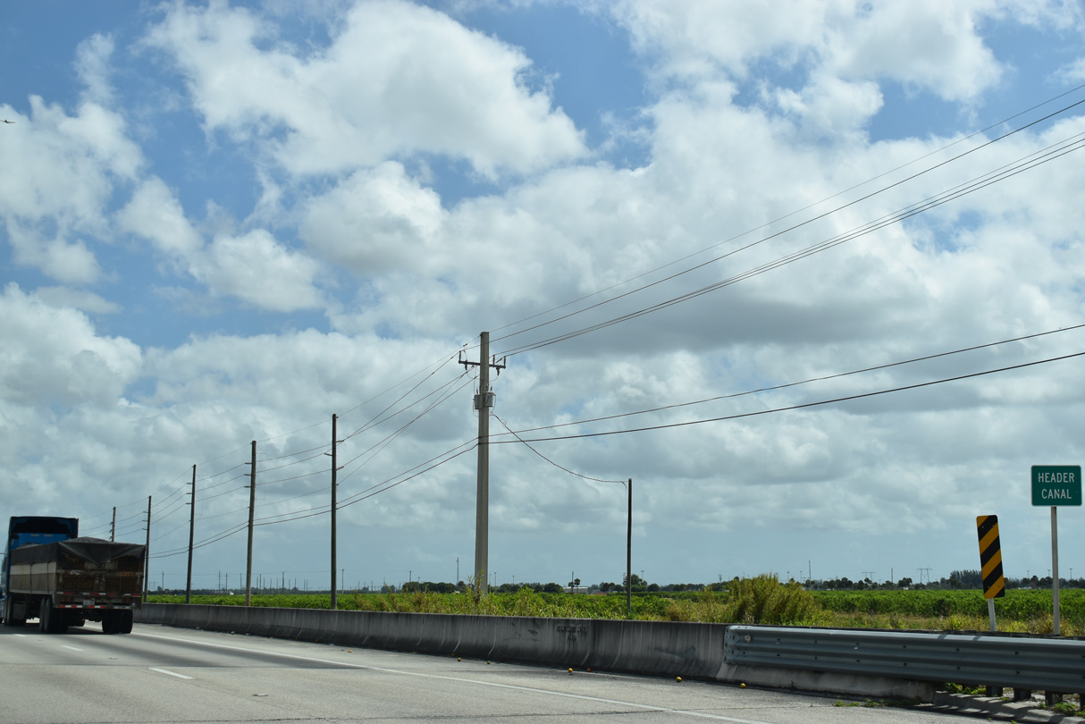
7.52 miles long, CR 609 spurs south across farmland toward the Diversion Canal and north along Header Canal Road to CR 68 (Orange Avenue).
10/18/08
03/20/20

03/20/20

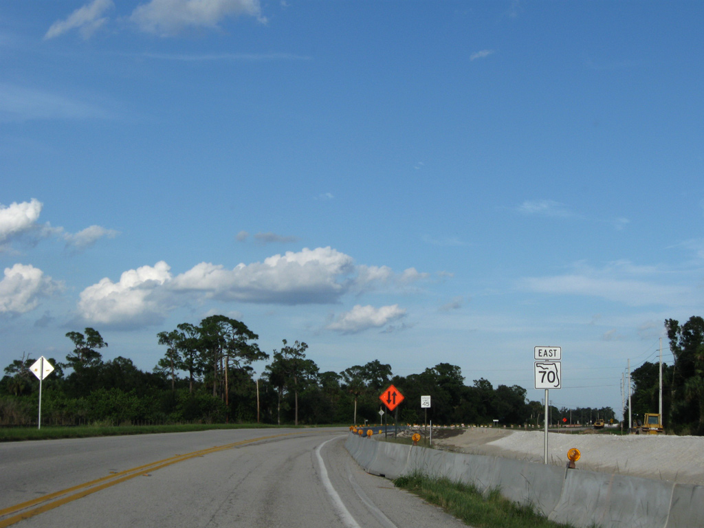
CR 712 (Midway Road) branches 11.94 miles east from SR 70 between Port St. Lucie and Fort Pierce to CR 707 (Indian River Drive) along the Indian River.
03/20/20

The St. Lucie County Fairgrounds is located just south of SR 70 along CR 712 (Midway Road). A pedestrian overpass was constructed for the facility in 2009.
03/20/20

CR 712 (Midway Road) follows a linear course east 4.7 miles along the St. Lucie County line to Interstate 95 at Exit 126.
03/20/20

10/18/08

CR 609A (Shinn Road) is a 7.57 mile long rural highway south to agricultural areas along Diversion Canal and north to CR 68 (Orange Avenue).
10/18/08

10/18/08

10/18/08
10/18/08

10/18/08

10/18/08

10/18/08

10/18/08

SR 70 passes under Florida's Turnpike between Gordy Road and the access road to the toll road at Exit 152.
10/18/08

07/27/16

The entrance ramps to Florida's Turnpike extend south from the intersection joining SR 70 and SR 713 (Kings Highway) north.
07/27/16

The guide sign referencing SR 713 north to Vero Beach and the continuation of SR 70 east to Fort Pierce is a replacement of a sign for U.S. 1.
07/27/16

SR 70 concludes at U.S. 1 in 4.7 miles. SR 713 runs 10.20 miles to U.S. 1 near the Indian River County line.
10/18/08

SR 713 (Kings Highway) heads north from west Fort Pierce to SR 613 near the community of Lakewood Park.
07/27/16

A trumpet interchange joins the access road linking SR 70/713 with Florida's Turnpike south to Miami and northwest to Orlando.
07/27/16

SR 70 (Okeechobee Road) expands to a six lane commercial arterial east from SR 713 (Kings Highway).
07/27/16

The remaining 4.7 miles of SR 70 east from SR 713 runs through the Fort Pierce city limits.
07/27/16

SR 70 (Okeechobee Road) enters a six-ramp parclo interchange (Exit 129) with Interstate 95 east of the signalized intersection with Crossroads Parkway and Peters Road.
07/27/16

07/27/16

07/27/16

07/27/16

07/27/16

CR 611B (Jenkins Road) parallels I-95 south to Edwards Road east and north to SR 68 (Orange Avenue) outside Fort Pierce.
07/27/16

07/27/16

07/27/16

07/27/16

07/27/16

SR 70 diverges from Okeechobee Road onto Virginia Avenue at a wye intersection adjacent to the Orange Blossom Business Center.
07/27/16

Okeechobee Road (unsigned CR 770) continues northeast into the Fort Pierce residential street grid to Delaware Avenue.
07/27/16

CR 770 along Okeechobee Road and Delaware Avenue is the former alignment of SR 70 northeast 3.02 miles to U.S. 1 outside Downtown Fort Pierce.
07/27/16

07/27/16

07/27/16

07/27/16

07/27/16

SR 615 lines 25th Street north from CR 611 (Edwards Roads) and CR 615 in Fort Pierce.
07/27/16

The 6.17 mile long route of SR 615 extends north to Paradise Park and U.S. 1 at St. Lucie Village.
07/27/16

07/27/16

07/27/16

07/27/16

07/27/16

07/27/16

07/27/16

Unmarked on SR 70 (Virginia Avenue), Oleander Avenue is CR 605 north onto Sunrise Boulevard and south to White City.
07/27/16

07/27/16

SR 70 (Virginia Avenue) concludes at U.S. 1 between Gateway Plaza and Sabal Palm Plaza.
07/27/16

U.S. 1 heads north to Downtown Fort Pierce and south to Port St. Lucie.
07/27/16


Photo Credits:
- 10/18/08 by AARoads.
- 10/17/14 by AARoads.
- 07/27/16 by AARoads and JP Nasiatka.
- 03/20/20 by AARoads.
Connect with:
Interstate 95
Florida's Turnpike
U.S. 1
U.S. 98
U.S. 441
State Road 615 / County Road 615
State Road 713
Page Updated 10-08-2022.