|
| Traveling southward along SR 399 at the transition to County Road 399 and Soundview Trail. Signage advises motorists of the forthcoming toll; two turn lanes provide u-turn opportunities before the Bob Sikes Bridge. 05/09/04, 05/29/10 |
|
| Santa Rosa County Road 399 (Pensacola Beach Boulevard) approaches the Bob Sikes Bridge across Santa Rosa Sound. The 1974-concrete span carries four lanes with shoulders dedicated for bicyclists. 05/09/04, 05/29/10 |
|
| Passing over the Intracoastal Waterway, County Road 399 enters Escambia County. 05/29/10, 02/09/06 |
|
| Entering the Bob Sikes Bridge toll plaza. Tolls, $1.00 per passenger vehicle, are collected in the southbound direction of County Road 399 only. Sunpass is not accepted. 05/29/10 |
|
| Continuing south, Pensacola Beach Boulevard travels alongside Sabine Inlet to Quietwater Beach and the intersection with Fort Pickens Road (unsigned County Road 399 west). 05/29/10 |
|
| Pensacola Beach Boulevard transitions to Via de Luna east to Gulf Islands National Seashore and Navarre. Fort Pickens Road spurs west to the Fort Pickens Area of the National Seashore. The intersection between the two segments of County Road 399 lies opposite the main public beach, Gulfside Pavilion, and Pensacola Beach Gulf Pier. 05/29/10 |
|
| Via de Luna Drive (County Road 399) expands from a four lane arterial into a four lane divided parkway ahead of Avenida 11. 05/29/10 |
|
| Eastbound scene along then-two lane Via de Luna Drive at Avenida 20. Expansion of County Road 399 into a four lane divided highway, between Avenida 10 and Bulevar Menor, was completed by December 2007. 02/09/06 |
|
| Nearing the end of the four lane section of Via de Luna Drive at Avenida 23. The remainder of county road carries two lanes to Navarre. 05/29/10 |
|
| Two lanes of Via de Luna Drive (unsigned County Road 399) exit the Pensacola Beach street grid for a coastal frontage by the Portofino complex. 02/09/06 |
|
| Continuing east from Portofino Drive, Via de Luna Drive becomes J. Earle Bowden Way. The county road enters county-maintained parkland to the Santa Rosa Area of Gulf Islands National Seashore.
The lack of traffic in this scene was a result of County Road 399 ending prematurely due to storm damage. Since reopening on March 6, 2009, a multi-use path was added to the north side of the road. 02/09/06 |
|
| J. Earle Bowden travels 7.1 miles through Gulf Islands National Seashore to emerge at Navarre Beach. Bike lanes alongside the road combine to form a multi-use path along the north side of Gulf Boulevard to Navarre Beach Causeway. 08/09/11 |
|
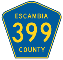
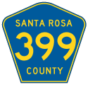
| An eastbound reassurance shield for County Road 399 appears a short distance beyond the National Seashore and Escambia County line. 08/09/11 |
|
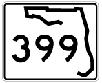
| Until July 1, 2004, Gulf Boulevard and Navarre Beach Causeway were a part of State Road 399. Santa Rosa County took control of the roadway when tolls were lifted from the Navarre Beach Bridge. This image looks at a former SR 399 shield posted near South Carolina Street on Gulf Boulevard eastbound. 06/23/01 |
|
| County Road 399 (Gulf Boulevard) and parallel White Sands Boulevard travel east from South Carolina Street to Arkansas Street. Gulf Boulevard kinks northward and travels alongside a series of condominium high rises to Navarre Beach county Park. 08/09/11 |
|
| Santa Rosa County Road 399 turns from Gulf Boulevard onto Navarre Beach Causeway northbound at the entrance to Navarre Beach Park and the Navarre Beach Fishing Pier parking area. Navarre Beach Causeway joins Santa Rosa Island with the mainland at Navarre. 08/09/11 |
|
| Historical look at a SR 399 shield posted at the Gulf Boulevard intersection with Navarre Beach Causeway. Damage from Hurricanes Ivan and Dennis closed the former state park at this time of this photo. Santa Rosa County took over maintenance responsibilities for the park on October 9, 2008. 02/09/06 |
|
| Heading north toward the Navarre Relief channel bridge on County Road 399 (Navarre Beach Causeway). 11/01/08 |
|
| Continuing north along Santa Rosa County Road 399 onto an artificial island. Gravel shoulders provide parking for anglers. Bike lanes, added in April 2010, line both directions of the causeway. 08/25/12, 11/01/08 |
|
| Motorists rise to pass over the Intracoastal Water on the Navarre Beach Bridge. The span opened to traffic in 1960 and carried a $1.00 toll until July 1, 2004.
A sign for Santa Rosa Sound, posted at the foot of the bridge in 2006, was not replaced. 03/10/09 |
|
| County Road 399 descends from the Navarre Beach Bridge crest directly to U.S. 98 (Navarre Parkway). Narrow bike lanes tie into gravel parking areas by Navarre Park. 11/01/08 |
|
| The Navarre Beach Bridge Toll Plaza stood at the north foot of the bridge. Tolls were collected in the southbound direction. 06/23/01 |
|
| U.S. 98 joins Navarre with Mary Esther and Fort Walton Beach to the east as a busy commuter route to Eglin Air Force Base and Hurlburt Field. 03/10/09 |
|
| U.S. 98 (Navarre Parkway) west connects with SR 87 north nearby. The state road ventures north through Holley and Eglin A.F.B. to Interstate 10. U.S. 98 meanwhile continues west to Holley By The Sea, Midway, the Garcon Point Bridge (SR 281) and Gulf Breeze. 03/10/09 |
06/23/01, 05/09/04, 02/09/06, 11/01/08, 03/10/09, 05/29/10, 08/09/11, 08/25/12 by AARoads
Page Updated 10-03-2012.


