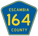
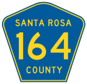
Six segments of County Road 164 are posted in the Florida Panhandle. All of the routes are rural.
|
| The first reassurance marker for County Road 164 east appears beyond SR 97 north of Walnut Hill. 02/07/06 |
|
| County Road 164 angles southeast and then east again on the drive to County Road 99. 02/07/06 |
|
| A rural highway, CR 99 leads north to Bratt and Escambia County, Alabama and south to SR 97. 05/12/16 |
|
| CR 164 continues east through the Oak Grove community after CR 99. 05/12/16 |
|
| Agricultural land spreads along both sides of CR 164 east at Walker Road. 05/12/16 |
|
| Navigating through a series of S-curves, CR 164 crosses Pine Barren Creek. 05/12/16 |
|
| Pine Barren Road intersects CR 164 ahead of this shield assembly eastbound. 05/12/16 |
|
| Hills in Santa Rosa County come into view as CR 164 descends into the unincorporated community of McDavid. 05/12/16 |
|
| Devoid of color, this was a red and white U.S. 29 shield. U.S. 29 constitutes a four lane divided highway with a 65 mile per hour speed limit north to Century and south to Cantonment. 02/07/06 |
|
| An erroneous State Road 29 shield was added for U.S. 29 at the east end of CR 164. 05/12/16 |
|
| The westbound beginning of Escambia County Road 164. 09/27/08 |
|
| Santa Rosa County Road 164 starts from the intersection of County Road 197 (Chumuckla Highway) and Little Rock Road at the settlement of Brownsdale. This stretch of road is only a mile or so off latitudinally from the Escambia County Road 164 east end. 02/07/06 |
|
| Harvest Road and County Road 164 end at an unmarked intersection with SR 89 in the distance. The Greenwood Road portion of Santa Rosa County Road 164 begins 1.1 miles to the north. 02/07/06 |
|
| Leading west from SR 89, County Road 164 (Harvest Road) traverses a number of agricultural fields to Moore Creek. 02/07/06 |
|
| County Road 164 (Harvest Road) straddles a section line due west from Moore Creek to end at County Road 197 and Brownsdale. 02/07/06 |
|
| Santa Rosa County Road 197 (Chumuckla Highway) forms a hook-shaped route 23.02 miles north from Pace to Wallace, Chumuckla, New York, Brownsdale and SR 89 south of Jay. 02/07/06 |
|
| County Road 164 (Greenwood Road) travels south from SR 4 to CR 399 before turning west. Pictured here is the first westbound shield. 02/07/06 |
|
| Greenwood Road approaches the stop sign with County Road 399 (Country Mill Road). Country Mill Road is one of four segments of CR 399 posted in Santa Rosa County. 02/07/06 |
|
| Santa Rosa County Road 399 (Country Mill Road) heads east to SR 87 at Whitfield and north to SR 4, east of Jay. 02/07/06 |
|
| The remainder of County Road 164 (Greenwood Road) beyond CR 399 travels west. The settlement of Cobbtown lies ahead. 02/07/06 |
|
| The Greenwood Road portion of CR 164 ends at SR 89 south of Jay. CR 164 resumes west along Harvest Road, 1.1 miles to the south. 02/07/06 |
Page Updated 04-02-2021.


