|
| The first SR 49 south reassurance shield stands just south of SR 70 (Feather River Highway) in Vinton. 09/04/10 |
|
| SR 49 initially heads south through the Sierra Valley, reaching the community of Loyalton in 11 miles. Sierraville lies 24 miles to the southwest beyond Tv Hill and the Antelope Valley. 09/04/10 |
|
| The Union Pacific (Western Pacific) Railroad crosses over SR 49 just south of Vinton on a 1928-built bridge. 09/04/10 |
|
| SR 49 arcs southwest after passing under the Union Pacific (Western Pacific) Railroad bridge. 09/04/10 |
|
| West of Downieville, SR 49 south intersects Sierra County Route 490, which connects to Forest Service Road 25 (Eureka Road) and Indian Valley. 01/19/01 |
|
| Exit 186 departs immediately south of the merge between SR 20 west / 49 south for Coyote Street (SR 20 Business/49 Business) to Downtown Nevada City. 07/11/18 |
|
| Constructed in the 1960s, the Golden Center Freeway leads SR 20 west / 49 south 5.1 miles to Empire Street in the city of Grass Valley. 07/11/18 |
|
| Back to back half diamond interchanges add traffic from Broad Street and Sacramento Streets to the Golden Center Freeway westbound in Nevada City. 07/11/18 |
|
| Heading through south Nevada City, SR 20/49 approach the unincorporated community of Gold Flat at Exit 185. 07/11/18 |
|
| The Grass Valley city center lies four miles further. Beyond their separation, SR 20 turns west to Marysville while SR 49 continues another 23 miles to Auburn. 07/11/18 |
|
| Entering the diamond interchange (Exit 185) with Gold Flat Road east and Ridge Road west on SR 20/49. 07/11/18 |
|
| Banner Lava Cap Road spans the Golden Center Freeway high above SR 20/49, a half mile ahead of Exit 183B for Brunswick Road. 07/11/18 |
|
| A six-ramp parclo interchange (Exit 183B) joins SR 20/49 with a sprawling retail corridor along Brunswick Road and parallel Main Street. 07/11/18 |
|
| Auxiliary lanes expand the Golden Center Freeway between Brunswick Road and Dorsey Drive (Exit 183A). The forthcoming diamond interchange opened to traffic on November 10, 2014.1 07/11/18 |
|
| Groundbreaking for the $15 million Dorsey Drive Interchange took place on April 29, 2013. The two-phase project widened Dorsey Drive to five lanes and improved 1.4 miles of SR 20/49. Aesthetic enhancements were added to concrete bridge walls, railings and street lighting. 1,272 linear feet of sound walls matching the project color scheme were installed as well.2 07/11/18 |
|
| The ensuing exit joins SR 20 west / 49 south with East Main Street in Grass Valley. 07/11/18 |
|
| An auxiliary lane opens westbound from Dorsey Drive to Exit 182B for East Main Street and Idaho Maryland Road east. 07/11/18 |
|
| Exit 182B ties into a roundabout with East Main Street and Idaho Maryland Road. The roundabout was completed in 2008. 07/11/18 |
|
| The north end of SR 174 ties into SR 20/49 (Golden Center Freeway) at Exit 182A. Truckers are not advised along the 13.3 mile long state route south to Colfax. 07/11/18 |
|
| A split diamond interchange (Exit 182A) joins SR 20 west / 49 south with Bennett Street, Bank Street and SR 174 (Colfax Avenue) east by Downtown Grass Valley. 07/11/18 |
|
| A service road (Tinloy Street) links the westbound off-ramp at Exit 182A with SR 174 (Colfax Avenue) east and Auburn Street (SR 20 Business/49 Business). The city of Colfax lies at the south end of SR 174 along Interstate 80. 07/11/18 |
|
| SR 20 west and SR 49 south part ways 0.75 miles southwest of the Bennett Street underpass in Grass Valley. 07/11/18 |
|
| SR 20 branches west from SR 49 (Golden Center Freeway) to Penn Valley midway between Grass Valley and the Yuba County line. 07/11/18 |
|
| Advancing south to Boston Ravine, a third lane opens from the SR 174 entrance ramp to the diamond interchange with Empire Street. 07/11/18 |
|
| SR 20 west and SR 49 south split at Empire Street. Empire Street ties in from Auburn Street (SR 49 Business) and Empire Mine State Historic Park to the east. 07/11/18 |
|
| SR 49 heads south from Auburn State Recreation Area to the unincorporated community of Cool. 12/28/04 |
|
| California State Route 193 (Georgetown Road) loops east from SR 49 at Cool to Georgetown and south back to SR 49 at Placerville. 12/28/04 |
|
| Continuing south from SR 193 (Georgetown Road), SR 49 travels four miles to unincorporated Pilot Hill and 20 miles to the El Dorado County seat of Placerville. 12/28/04 |
|
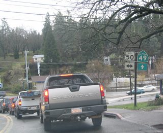
| Following Coloma Road, SR 49 lowers into Placerville, where it meets U.S. 50 at an at-grade intersection. 12/28/04 |
|
| U.S. 50 travels east from Placerville to South Lake Tahoe and west along a freeway to Folsom and Sacramento. 12/28/04 |
|
| Continuing beyond U.S. 50, SR 49 takes a stair stepped route along Spring, Main and Pacific Streets through Downtown Placerville. Pictured here is the turn onto Pacific Street, which leads the state route south to Sacramento Street. 12/28/04 |
|
| Southbound SR 49 (Main Street) approaches SR 4 in the city of Angels Camp. SR 4 travels west to Copperopolis, Farmington and Stockton in the Central Valley. 07/18/09 |
|
| SR 4 shifted north from an overlap with SR 49 in Summer 2009, when the Angels Camp Bypass opened to traffic. The state route ventures east from Angels Camp to Arnold, Big Trees State Park, Alpine Lake and Ebbetts Pass. 07/18/09 |
|
| A historical marker stands along SR 49 (Main Street) ahead of Stockton Road. Due to its historical role in the California Gold Rush of 1849, several buildings and structures in Angels Camp date to the 19th century. 07/18/09 |
|
| Murphys Grade Road intersects SR 49 (Main Street) at Demarest Street. While guide signs direct motorists to SR 4 east from Angels Camp to Murphys, Murphys Grade Road also leads to the community. 07/18/09 |
|
| SR 49 (Main Street) advances south toward Downtown Angels Camp. 07/18/09 |
|
| SR 49 runs alongside Utica Park between the intersections with Bret Harte Drive in Angels Camp. 07/18/09 |
|
| Southbound SR 49 (Main Street) at Downtown Angels Camp. Located at the corner of Raspberry Lane, is the Calaveras Visitor Center. Angels Camp is home of the Jumping Frog. 07/18/09 |
|
| Approaching Birds Way along Main Street south in Downtown Angels Camp. 07/18/09 |
|
| Prior to 2009, SR 4 and SR 49 overlapped 1.5 miles south through Angels Camp to Vallecito Road at Finnigan Lane. The intersection here includes an imprint of the jumping frog. 07/18/09 |
|
| Signage for SR 4 remains along South Main Street for Vallecito Road (old SR 4) east to SR 4 for Arnold and Bear Valley. 07/18/09 |
|
| Confirming markers formerly posted at the merge of SR 49 south and SR 120 east in Chinese Camp. This assembly was removed by 2007. 2002 |
|
| California State Route 49 concludes to the south at SR 41 in the unincorporated community of Oakhurst. SR 41 leads north from Fresno to Yosemite National Park. 05/13/05 |
Page Updated 03-19-2019.

 South
South West
West  South
South South
South


