
California 99 South - Sacramento County
| California 99 south | |
|---|---|
 |
Southbound California 99 meets Exit 306, Interstate 5 north of Sacramento. Although California 99 is signed on this overhead sign, it is poorly signed between here and downtown Sacramento. While some maps show California 70 following alongside California 99 all the way south to the Interstate 5 interchange, that is inaccurate. California 70 ends at the merge point with California 99. Photo taken by Pete Sison (05/02). |
 |
Leaving the Capital City Freeway (Business Loop I-80) interchange, this mileage sign provides the distance to the first four exits along newly independent California 99 in Sacramento. These exits are: Exit 297, 12th Avenue and Sutterville Road; Exit 296, Fruitridge Road; and Exits 294B-A, 47th Avenue. The left lane between here and Elk Grove serves as a commuter hour high occupancy vehicle (HOV) lane marked by painted diamonds. Photo taken 05/15/11. |
 |
The next exit along California 99 south is Exit 297, 12th Avenue and Sutterville Road. Twelfth Avenue travels east and Sutterville Road travels west from the interchange. Use Sutterville Road west to Sacramento City College and William Land Park. To the east, 12th Avenue swings a bit southeast and assumes the position of 14th Avenue in the street grid, so it gets a new name at that point. Fourteenth Avenue continues east to end at Power Inn Road. Photo taken 05/15/11. |
 |
An auxiliary roadside sign points the way to Exit 297 for Sutterville Road. Photo taken 05/15/11. |
 |
Southbound California 99 reaches Exit 297, 12th Avenue east to 14th Avenue and Power Inn Road and Sutterville Road west to William Land Park and Sacramento City College. Photo taken 05/15/11. |
 |
Storm clouds moved in as we see the gore point signage for Exit 297, 12th Avenue and Sutterville Road. Photo taken 05/15/11. |
 |
The next exit along California 99 south is Exit 296, Fruitridge Road (one mile). Photo taken 05/15/11. |
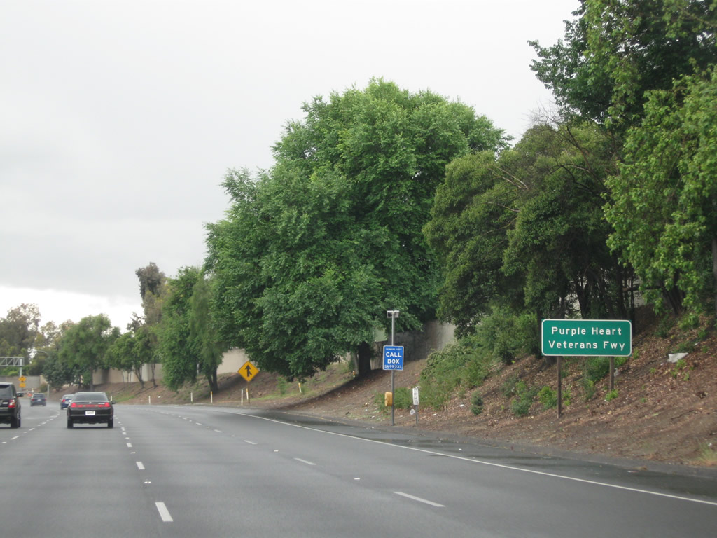 |
California 99 was constructed as the South Sacramento Freeway; signage today labels it as Purple Heart Veterans Freeway. Photo taken 05/15/11. |
 |
Southbound California 99 reaches Exit 296, Fruitridge Road. Upon exiting, the off-ramp divides, with the first right connecting to Fruitridge Road west, and the loop ramp connects to Fruitridge Road east. Photo taken 05/15/11. |
 |
This mileage sign provides the distance to the next six exits along California 99 south: Exits 294B-A, 47th Avenue; Exits 293B-A, Florin Road; and Exits 291B-A, Mack Road. Photo taken 05/15/11. |
 |
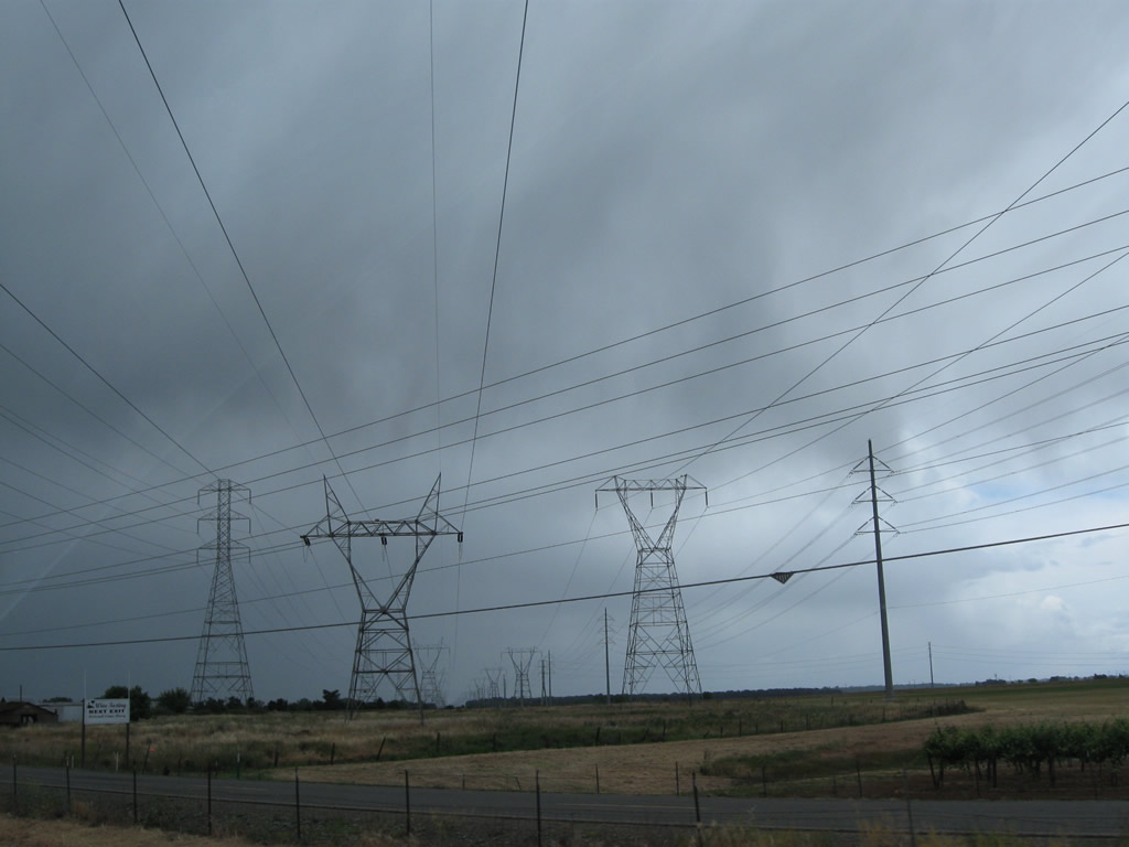
A set of Sacramento Municipal Utility District power lines cross over California 99 just south of the 47th Avenue cloverleaf interchange. Photo taken 05/15/11. |
 |
The next two exits along California 99 south are Exits 293B-A, Florin Road. Photo taken 05/15/11. |
 |
The first off-ramp connects California 99 south with Exit 293B, Florin Road west. The second ramp in this cloverleaf interchange connects to Exit 293A, Florin Road east to Florin and eventually Sacramento County E-2 (Sunrise Boulevard). Photo taken 05/15/11. |
 |
Southbound California 99 reaches Exit 293B, Florin Road west and next approaches Exit 293A, Florin Road east. Photo taken 05/15/11. |
 |
Due to inclement weather, we missed several signs along this stretch of California 99. Here, southbound California 99 meets Exit 291B, Mack Road west. The second exit is Exit 291, Mack Road east and Bruceville Road south. Photo taken 05/15/11. |
 |
Approaching the two-lane off-ramp (Exit 288) with Sheldon Road on California 99 south. Photo taken 05/15/11. |
 |
Southbound California 99 reaches Exit 288, Sheldon Road. Photo taken 05/15/11. |
 |
Upon departing the freeway at Exit 288, Sheldon Road, the middle lanes connect to West Stockton Boulevard northbound, which is a frontage road. Photo taken 05/15/11. |
 |
The next three exits along southbound California 99 (South Sacramento Freeway) are Exit 287, Bond Road east and Laguna Boulevard west; Exit 286, Elk Grove Boulevard; and Exit 284, Sacramento County E-2 (Grant Line Road) and Kammerer Road. Photo taken 05/15/11. |
 |
Use the right two lanes of southbound California 99 to connect to Exit 287, Bond Road east and Laguna Boulevard west. Photo taken 05/15/11. |
 |
Southbound California 99 reaches Exit 287, Bond Road east and Laguna Boulevard west. Photo taken 05/15/11. |
 |
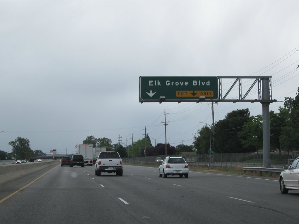
The next exit along California 99 south is Exit 286, Elk Grove Boulevard (one mile). Photo taken 05/15/11. |
 |
This mileage sign provides the distance to the next two exits along southbound California 99: Exit 286, Elk Grove Boulevard and Exit 284, Sacramento County E-2 (Grant Line Road) and Kammerer Road. Photo taken 05/15/11. |
 |
The right two lanes of California 99 south will connect to Exit 286, Elk Grove Boulevard. Use Elk Grove Boulevard east to the city of Elk Grove "Proud Heritage, Bright Future". Elk Grove had a population of 153,015 as of the 2010 Census and was incorporated on July 1, 2000. Photo taken 05/15/11. |
 |
The next exit along southbound California 99 is Exit 284, Sacramento County E-2 (Grant Line Road) and Kammerer Road. Photo taken 05/15/11. |
 |
At the time this picture was taken, the third left lane (high occupancy lane) ended. A median full of oleander comes into view thereafter. It is likely that will all the improvements underway along California 99 that the three-lane section will be extended further south. Photo taken 05/15/11. |
 |
The towering hedge of oleander in the median helps separate north/south traffic and creates a more rural feel to the freeway. Photo taken 05/15/11. |
 |
The right two lanes of California 99 south connect to Exit 284, Sacramento County E-2 (Grant Line Road) and Kammerer Road. CR E-2 begins at this interchange and travels northeast along Grant Line Road, then turns north along Sunrise Boulevard to meet U.S. 50 in Rancho Cordova and Interstate 80 in Roseville for a total of about 29 miles traveled. Photo taken 05/15/11. |
 |
Southbound California 99 reaches Exit 284, Sacramento County E-2 (Grant Line Road) and Kammerer Road. Photo taken 05/15/11. |
 |
This mileage sign along California 99 south provides the distance to Galt (eight miles), Stockton (31 miles), and Fresno (152 miles). California 99 passes under Grant Line Road at the upcoming overpass. Photo taken 05/15/11. |
 |
A California 99 south reassurance shield is posted after the on-ramp from Grant Line Road. Photo taken 03/15/15. |
 |
 |
 |
After the Grant Line Road interchange, a series of power lines cross over California 99. These lines travel north to a substation near Elder Creek Road. To the south, they travel toward the Interstate 5 and California 12 interchange. Photos taken 03/15/15 and 05/15/11. |
 |
 |
Southbound California 99 reaches Exit 283, Eschinger Road west. This interchange currently only serves southbound traffic; northbound traffic has no direct access to Eschinger Road. There is neither an overpass nor an underpass for Eschinger Road, which prevents access to it from the northbound side of the freeway. Photos taken 05/15/11. |
 |
A California 99 south reassurance shield is posted after the on-ramp from Eschinger Road. Photo taken 05/15/11. |
 |
Features such as this low-height-clearance railroad bridge and narrow roadway width preclude certain segments of older California 99 freeway from meeting Interstate standards. Work is necessary to realign the southbound lanes if this area is to meet those standards. Photo taken 05/15/11. |
 |
California 99 crosses over the Consumnes River and next approaches Exit 281, Dillard Road. Photo taken 03/15/15. |
 |
Southbound California 99 reaches Exit 281, Dillard Road. Photo taken 05/15/11. |
 |
The next exit along California 99 south is Exit 280, Arno Road. Photo taken 05/15/11. |
 |
More power lines cross over California 99 just before the Arno Road interchange. Photo taken 05/15/11. |
 |
Southbound California 99 reaches Exit 280, Arno Road. The succeeding exit is with West Stockton Boulevard, which serves as the western frontage road along this segment of California 99. Old U.S. 50-99 along this stretch followed Stockton Boulevard, but as the freeway was extended south from Sacramento, Stockton Boulevard was directly converted into the freeway, with frontage roads on both sides of the freeway to serve local and ranch access. Photo taken 05/15/11. |
 |
The next exit along California 99 south is Exit 277, California 104 east to Ione and Jackson and Sacramento County E-13 (Twin Cities Road) west to Walnut Grove. E-13 is an east-west county route that begins here, extends to Walnut Grove, and ends at Sacramento County J-11 in Walnut Grove not far from California 160 (River Road) in the California Delta. Photo taken by Joel Windmiller (01/22/04). |
 |
Use Exit 277 to Twin Cities Road, which carries Sacramento County E-13 west to Walnut Grove and California 104 east to Ione. California 104 is an east-west state route that follows Twin Cities Road from Galt east to Ione. California 104 merges onto California 88 east of Ione, and they separate again at Ridge Road. California 104 ultimately ends at its junction with California 49 south of Sutter Creek and north of Jackson. Photo taken 05/15/11. |
 |
Southbound California 99 meets Exit 277, California 104 (Twin Cities Road) east to Ione and Jackson and Sacramento County E-13 (Twin Cities Road) west to Walnut Grove. The interchange features roundabouts at the connection to California 104 and CR E-13. Photo taken by Joel Windmiller (01/22/04). |


Page Updated March 22, 2015.
|
About Contact Glossary |
In The News Testimonials Interstate Guide |
Social Media:
 |
|
© 2000-23 AARoads.com | All Rights Reserved | Privacy Policy / Terms of Use
|
||