
Spent the morning in west Minneapolis and then headed west to Fargo and south to Sisseton, South Dakota. Heavy rains washed out the majority of the afternoon as I returned east along state highways and U.S. 12. As usual, some highlights and photos are found below.
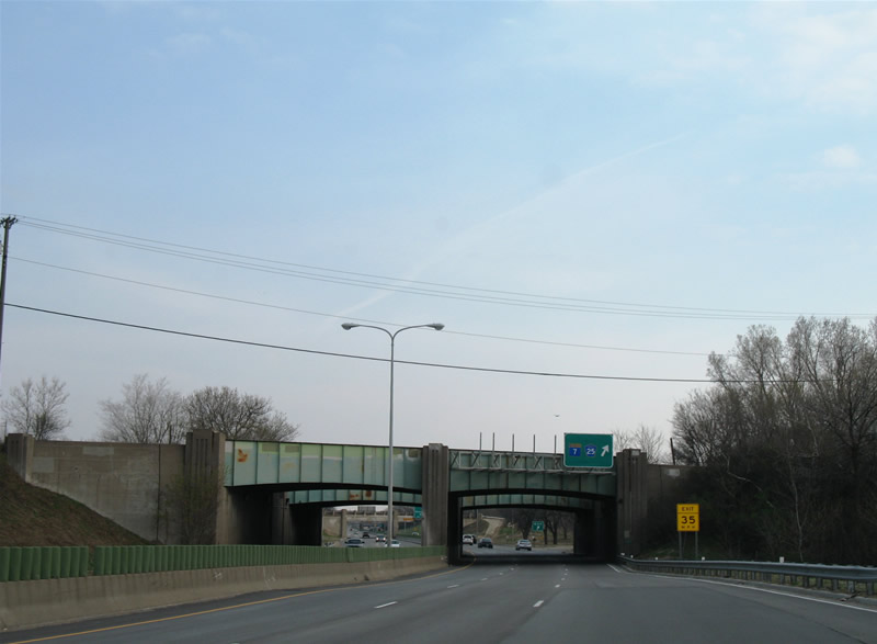
While Minnesota 100 is a full freeway now, elements of its past as a lesser route remain in the form of old overpasses with no shoulders. One such span remains in place at the Minnesota 7 & Hennepin County 25 full-cloverleaf interchange.
After a series of accidents, some fatal, Mn/DOT restriped the freeway mainline to provide limited acceleration lanes in place of a narrow shoulder at the overpasses, thus improving the situation from a safety standpoint. Before this improvement, drivers would come to a complete stop from the adjacent on-ramp, thus necessitating fast acceleration to freeway speeds while also dodging exiting traffic onto Minnesota 7 & Hennepin County 25.
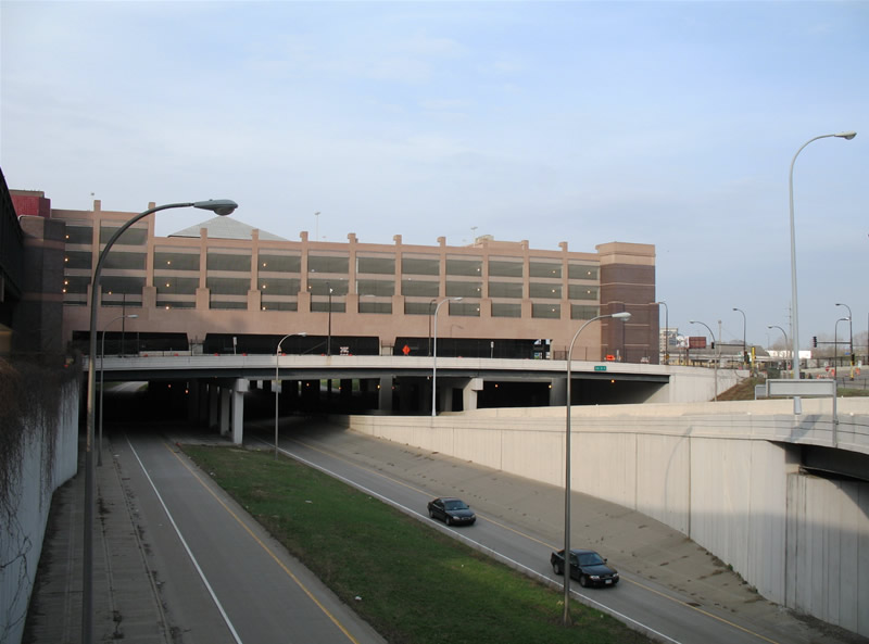
Interstate 394, similar to a handful of other urban freeways, includes tunnels underneath buildings and other structures at downtown Minneapolis. Pictured here is the east end/beginning and one such building tunnel.
Other freeways, such as the Cross-Bronx Expressway, Interstate 395 in Washington, D.C., Interstate 5 in Seattle, and the Georgia 400 Toll highway travel under such infrastructure.
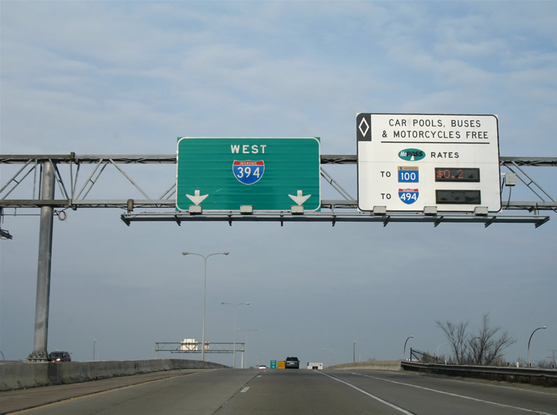
Interstate 394 includes managed or HOT (High Occupancy Toll) lanes through its median.
Tolled by MnPass, the lanes are reversible and feature variable toll rates based upon time of day and distance traveled. HOV (High Occupancy Vehicle) cars and trucks are not levied tolls to use the lanes between Interstate 94 and Interstate 494. The I-394 MnPASS Express Lanes travel along the center of the freeway, similar to those found on Interstate 95 in northern Virginia.
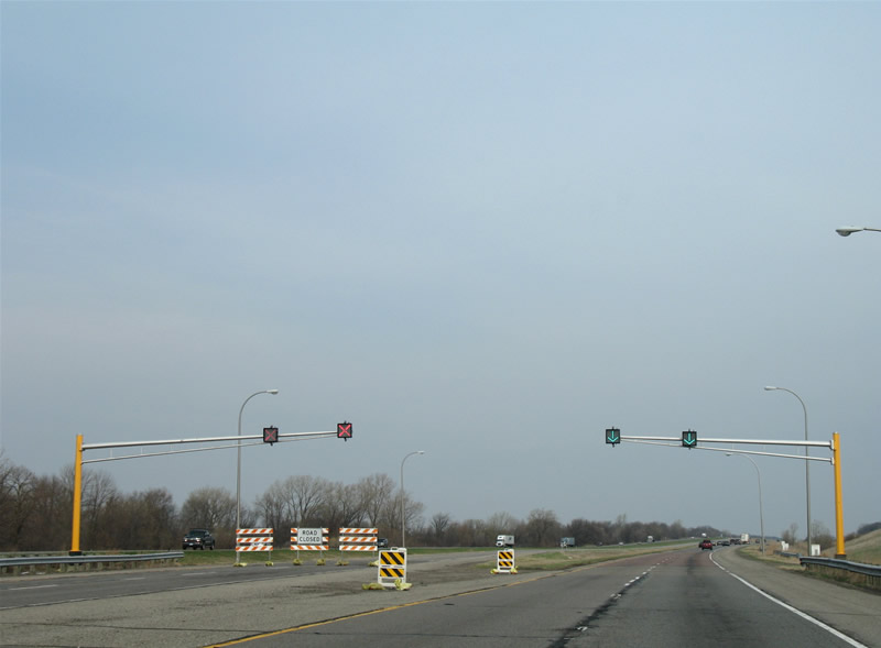
Westbound on Interstate 94 at the Minnesota Road Research Project, a 3.5-mile stretch of multi-carriageway freeway devoted to the study and experimentation of pavement types.
The site is the largest of its kind, providing an accurate portrayal of pavement types due to the ability to reroute Interstate 94 mainline traffic onto a carriageway with test pavement. Sensors embedded within the road measure the pavement performance and a 2004 average annual daily traffic count of 57,000 (according to Mn/Dot counts) provides plenty of opportunities for test results. The site is located between Exits 202 and 194.
Interstate 94 travels through majority farm land and open space between the Twin Cities and Fargo-Moorhead. Outside a few towns along the way, the freeway is devoid of services and substantial traffic. Moorhead provides a break in the monotony, and with it the only Business Loop for Interstate 94 in Minnesota.
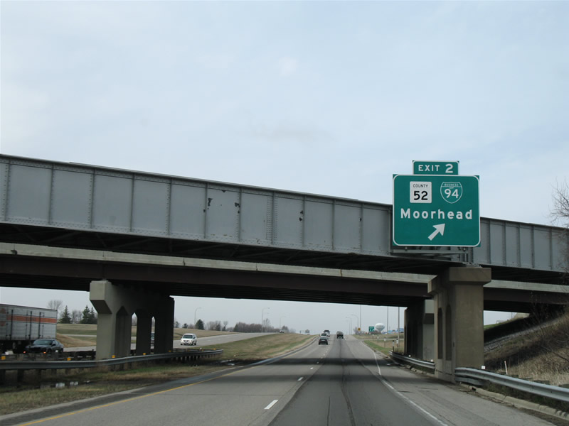
Business Loop I-94 ventures northwest of Exit 2 via Main Avenue (old U.S. 52) to junction U.S. 10 & 75 (8th Street). From there U.S. 10 joins Main Avenue and the Business Loop through downtown Moorhead into downtown Fargo, North Dakota.
U.S. 10 & Business Loop I-94 end at a wye interchange (Exit 343) with Interstate 94 at West Fargo. With that stated, the only signs for Business Loop I-94 in Minnesota are posted at the intersection of Main Avenue and 8th Street.
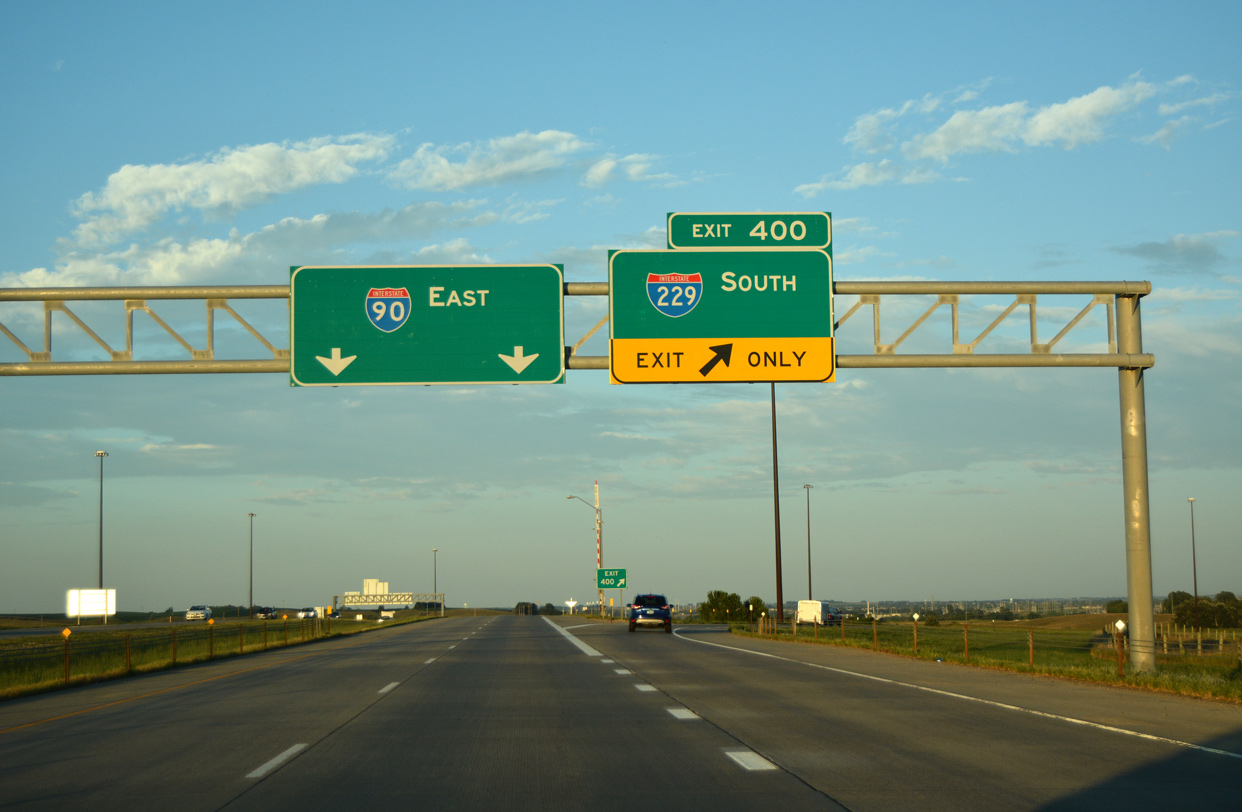
Interstate 94 meanwhile widens to six lanes for the first time since Minneapolis at the North Dakota State line (Red River). The six-lane section extends westward to just beyond the interchange with Interstate 29 (Exit 349), a distance of approximately three miles. Interstate 29 meanwhile also expands to six lanes between Exit 62 and 65, with construction to widen the freeway northward to Exit 69 ongoing. U.S. 52, silent since its merge with Interstate 94 in St. Paul, emerges from its cover once Interstate 94 crosses the North Dakota state line. U.S. 81, Interstate 29’s counterpart for most of South Dakota, is fully signed throughout the Fargo area. Business U.S. 81 provides access to downtown Fargo from Interstate 29 in lieu of Business Loop Interstate 29.
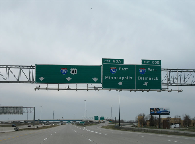
A high-flyover ramp carries traffic from Interstate 29 & U.S. 81 south onto Interstate 94 & U.S. 52 east. The interchange otherwise is that of a full cloverleaf interchange. Minneapolis represents the eastbound control city for Interstate 94 from Interstate 29 south; northbound travelers see Moorhead as the eastbound destination.
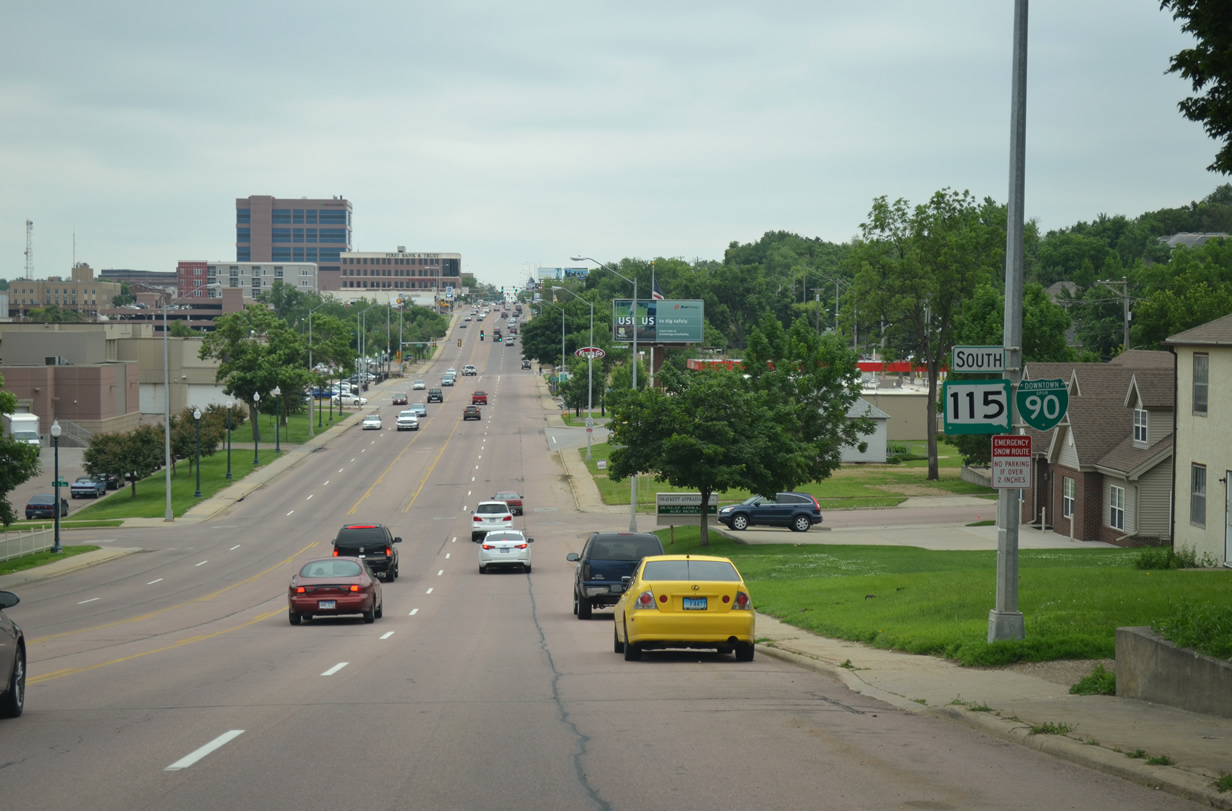
Back in Moorhead, U.S. 10 joins U.S. 75 for a short overlap along 8th Street and Center Avenue east of downtown Moorhead.

The first set of signs posted for the U.S. 10 and U.S. 75 overlap along Center Avenue, east of the intersection with 14th Avenue.
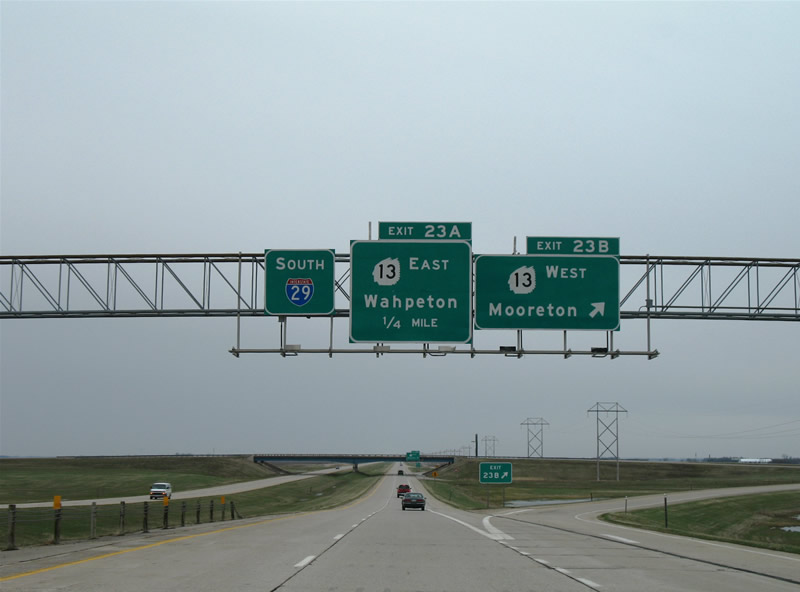
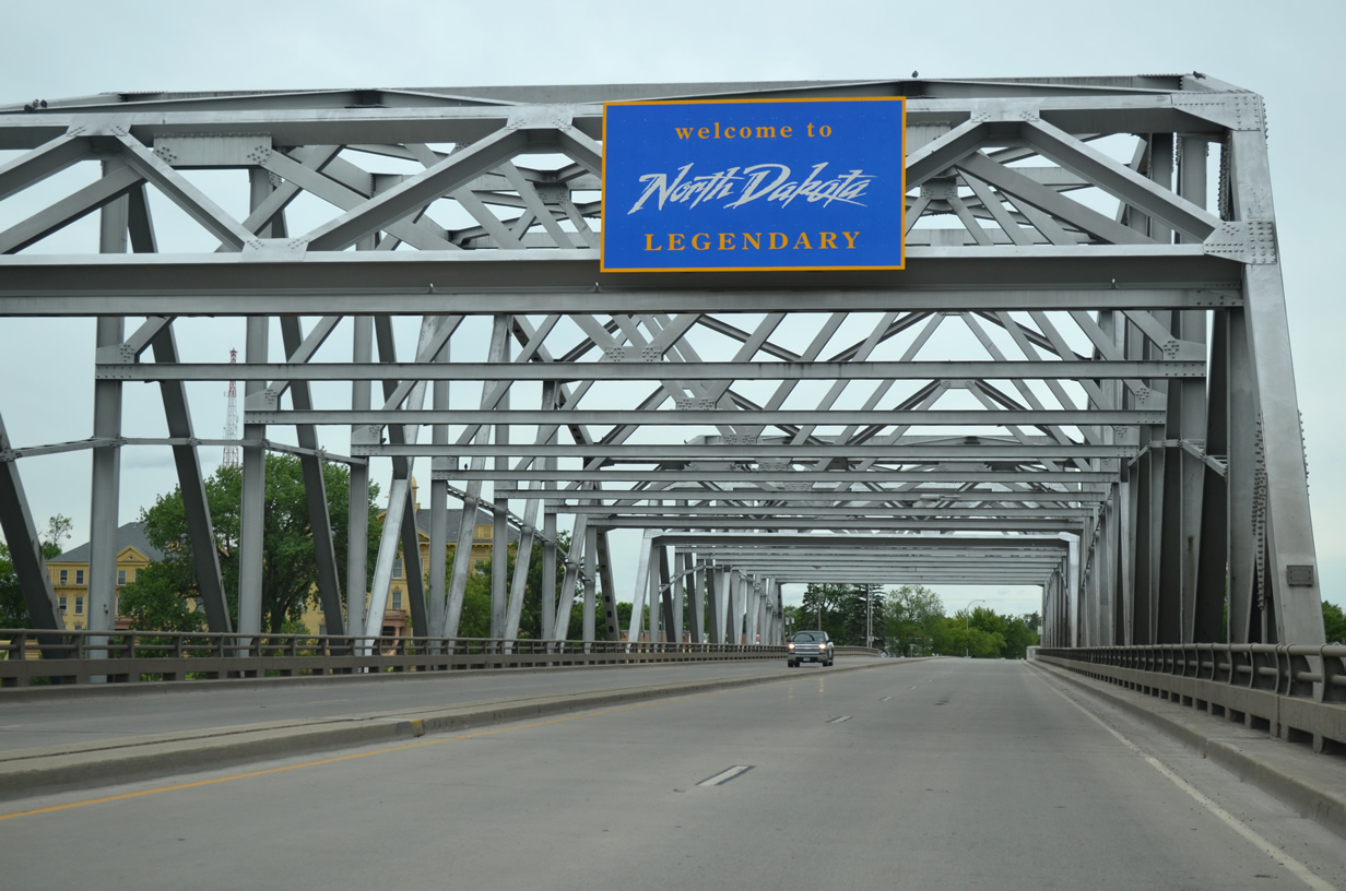
Interstate 29 & U.S. 81 quickly depart the Fargo area for wide open prairies and farm fields. The major town of significance in southeast North Dakota is Wahpeton, a community of 8,586.
North Dakota 13 constitutes a four-lane divided highway between Interstate 29 (Exit 23) and the North Dakota 210 & Minnesota 210 bypass of town. A trumpet interchange joins the two state highways there and a six-ramp partial-cloverleaf interchange facilitates the movements between the state highway and freeway.
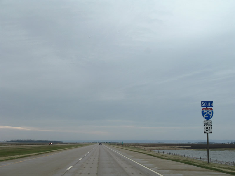
Continuing southward into South Dakota, U.S. 81 remains hinged with Interstate 29 through to Exit 180.
The drive is otherwise the same as North Dakota: lots of open prairie and farm land. One change occurs on the approach to Sisseton (junction South Dakota 10), as hills arise on the southeastern horizon. A paltry 4,680 vehicles per day traveled Interstate 29 between Exits 242 and 232 as of 2006 SDDOT traffic counts. The water depicted here is a misnomer as 2.5 inches of rain fell on the Dakotas the day before.

